You can now easily map 2010 Census demographic data from the Living Atlas of the World, the foremost collection of global geographic information, curated by Esri and available through ArcGIS Online.
These services can be used to create multigeography demographic stories that help us understand the human population regionally and locally. The services use demographic attributes from the 2010 Census Demographic Profile. They are broken into four services by demographic theme:
- Age and Gender
- Housing
- Race
- Households
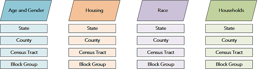
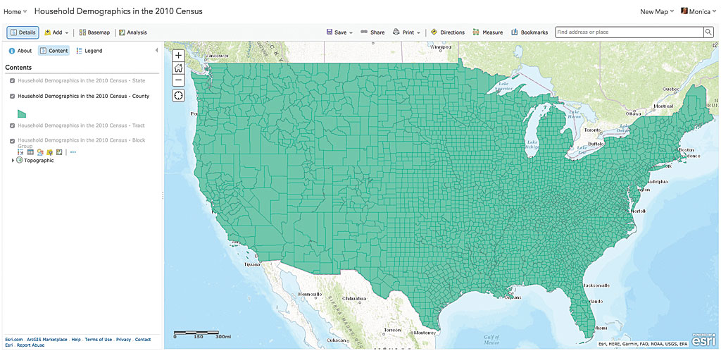
The services provide 2010 Census attributes for four different geographies: state, county, census tract, and census block group. The geography layers contain the same set of attributes in a single service.
Each service is configured so that as you zoom in to the map, you gain increasing geographic detail. When you are looking at the extent of the United States, you see states or counties. As you zoom closer to a city, the counties layer automatically turns off, and you will see a more detailed level of geography such as census tracts or block groups. If you want to customize the viewing scales, you can do so and save the service as a web map.
-
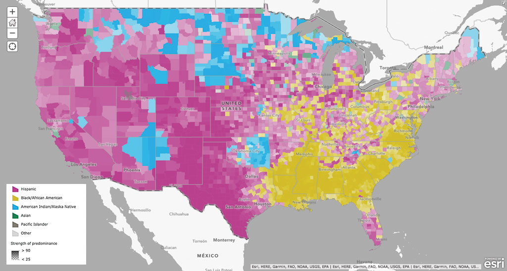
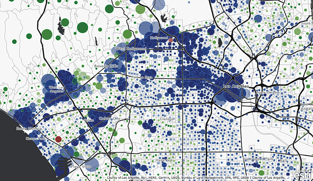
Non-White Predominant Population by Race.
It’s easy to make your own demographic map from these services. Once you have opened one of the services from the Living Atlas, you can save it to your My Content as a web map that calls the census service. Set the cartography and pop-ups for each layer and resave the finalized map. Now, this web map can be shared and used in your story maps and apps.
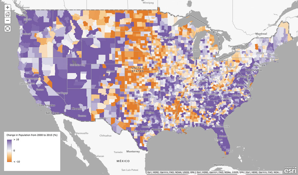
There is no limit to how many web maps you can create from these services. Find topics that interest you and create the maps you need using services from the Living Atlas of the World. The accompanying maps were made with these services.