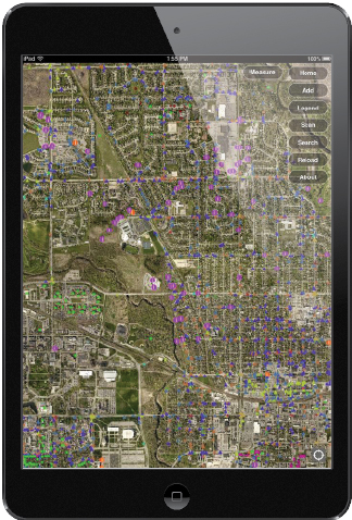
To effectively manage its more than 9,500 local traffic signs, the public works department for the city of Ames, Iowa, uses a new, custom, GIS-based sign management app called GISAssets.
Appropriate signage minimizes accidents and provides clear directions to anyone driving through the city with a population of more than 59,000. The city’s signs must conform to state and federal standards, as outlined in the Federal Highway Administration (FHWA) Manual on Uniform Traffic Control Devices (MUTCD).
Ames partnered with DGTex, Inc. to create the GISAssets app, which was built on ArcGIS Runtime SDK for iOS and runs on the Apple iPad. The app, available from the Apple App Store, is used to collect data, such as traffic sign inventories and asset information, from the field and integrate that information and other remotely collected data with the department’s geodatabase, which is managed using ArcGIS for Server.
Ben McConville, GIS manager in the city’s public works department, has been using ArcGIS for asset management for many years. “Street signs are a challenge to accurately manage,” said McConville. “You would think it is a fairly straightforward procedure; however, there are normally multiple assets at the same location.”
He said that in addition to the signpost, the department must manage the three or four signs that are attached to it. “So, at that location, your database will include maintenance histories, accident reports, and retroreflectivity records for each sign as well as the post,” McConville said. “In addition, there are replacement and maintenance schedules and vegetation management procedures related to the assets at that same location.”
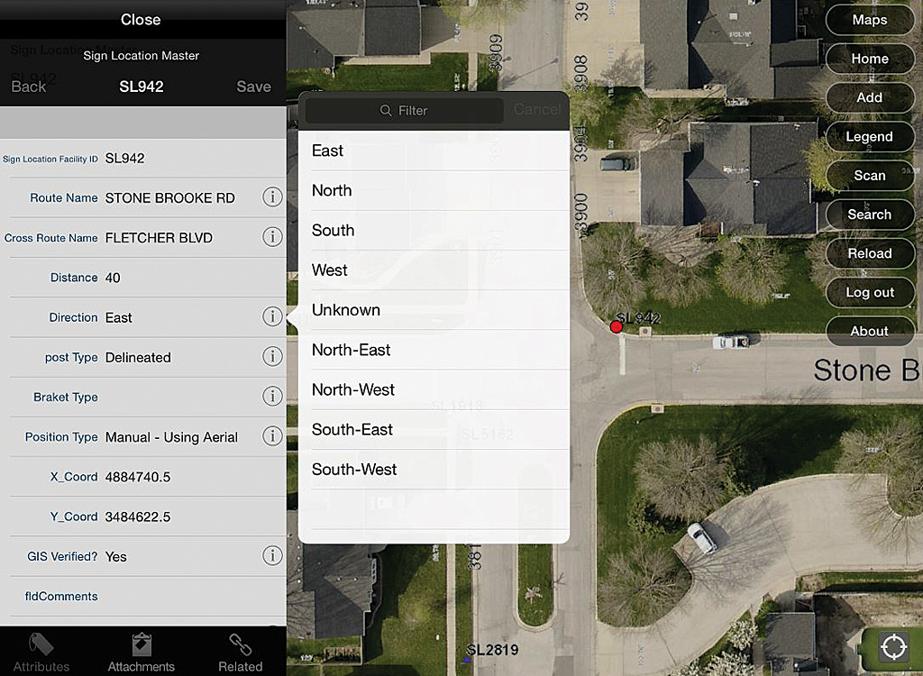
Dominic Roberge, GIS specialist for the city, worked hand in hand with traffic maintenance staff and developers at DGTex to design the application and database schema. “I spent a great deal of time identifying the needs of the crews and exactly what gaps the application needed to fill,” said Roberge. “Among them were the need for bar coding and the ability to handle complex relationships. I then designed the database schema to accommodate these needs and published the web services accordingly.”
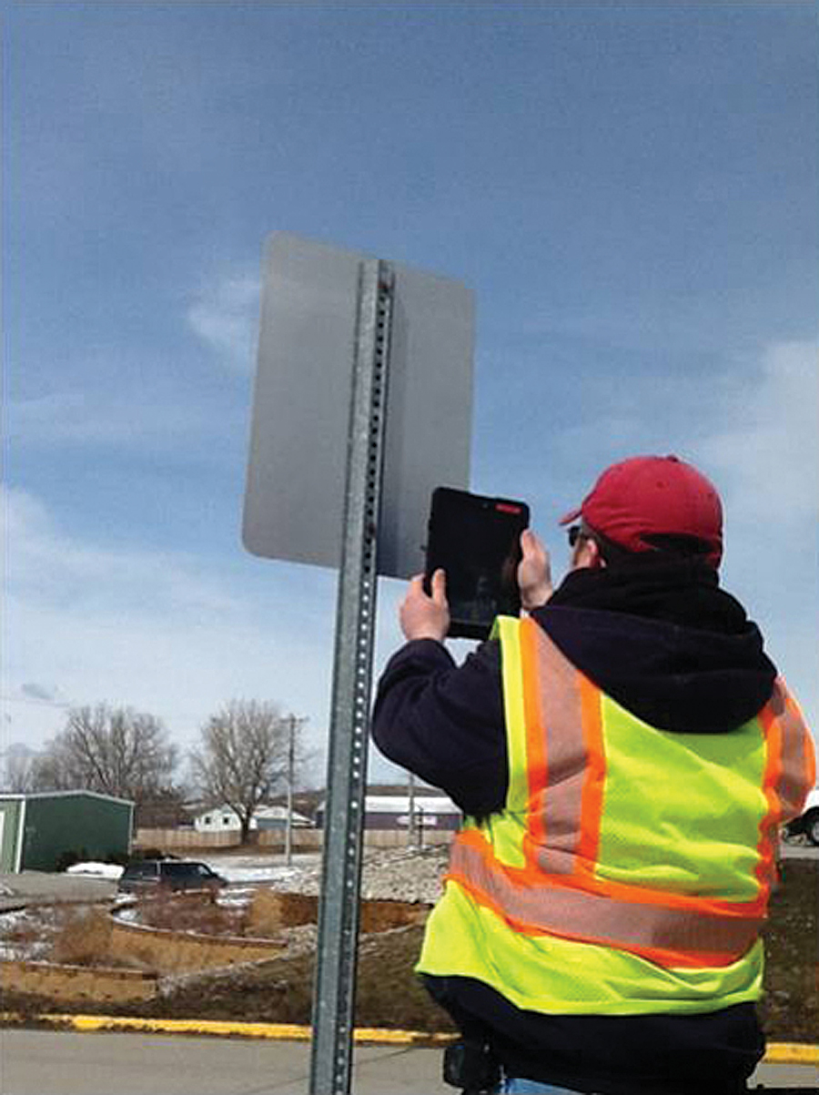
The city uses a RoadVista model 922 retroreflectometer to measure the reflectivity of each of its signs, required for the federally mandated retroreflectivity survey. In addition to measuring reflectivity, the device records a sign’s GPS coordinates and reads the bar-coded label attached to it for identification purposes.
Sign Management Challenges
Signs are frequently knocked down in vehicular accidents, vandalized, or hit by snowplows. “Often the signs are simply dropped at the maintenance shop by law enforcement or maintenance crews with no explanation of where they may have come from,” said Bill Latham, an Ames traffic maintenance worker. “By using bar coding, staff can easily see exactly which sign it is and where it came from, making it easy to reset.”
Back in the office, the data recorded by the retroreflectometer is downloaded to the GISAssets app, which uses the sign’s bar code for reference. The application then performs a join to the department’s geodatabase, and the field data is automatically added to it. This helps centralize all remotely collected data with the geodatabase.
Because each sign’s reflectivity data and history are now part of the database, the city’s traffic department can easily check to see if a specific sign is in compliance with the MUTCD. Public works staff can perform this verification process in the office or in the field, which saves both time and money.
“During city construction activities, GISAssets has proved to be extremely helpful,” said Terry J. Keigley, another Ames traffic maintenance worker. “Contractors often remove entire blocks of signs prior to construction. Sign crews are now able to easily reset the signs in the exact location with no measuring. The GPS typically gets us close enough to where we can find the existing hole or stem to place the sign on.”
Before using this app, the Ames public works department was faced with bulk replacement of its signs in a specified area every five years to comply with FHWA mandates. Field crews can now evaluate these assets sign by sign and then send this information to the geodatabase back in the office, where a determination is made to repair or replace a sign and a work order is issued.
Additional Functionality
The iPad provides additional functionality, such as messaging between workers and sending broadcast e-mails, that is improving the department’s workflow. Field-workers can also take a photograph or video of an emergency situation, such as a water main break, and send those images to the engineering department for evaluation.
Photos can be attached to the geodatabase. “The ability to easily attach pictures is a huge benefit,” said Brad Becker, traffic signal lead technician. “Pictures are a great tool to help us see what information may not be in the attributes. For example, not every MUTCD code indicates what the exact wording is on the sign. By looking at the picture, we can easily see.”
“Centralizing all our public works asset data has really been a big benefit to us,” said McConville. “Previously, there was a lack of integration and field connectivity, which made work tracking and inventorying difficult.”
The GISAssets app has sparked interest from other departments and is increasing the use of ArcGIS in Ames, particularly because the city has an Esri enterprise license agreement (ELA). “The ELA has opened up a ton of doors for us,” said McConville. “It’s given us the opportunity to really explore what we can do with GIS.”
The Next Phase
The Ames public works department is expanding its use of the GISAssets app by making greater use of its bar-coded reading capability. “Adding bar coding to all our public works assets makes it much easier for crews to immediately identify an asset in the field, determine its condition, and then send that information back to the geodatabase for further review,” said McConville. “It will really help streamline our field crews’ work and continue to keep our geodatabase up to date.”
For more information on the GISAssets app, contact Ben McConville, City of Ames at 515-239-5162.
About the author