In many cities, asset managers struggle to keep up with repairs such as fixing streetlights and potholes. Given the sheer number of required inspections and the precision and personnel needed to update records and paper maps, it’s easy to see why many maintenance projects are long overdue or altogether neglected.
However, in Fort Worth, Texas, maintenance jobs are promptly executed. For example, unsightly potholes are replaced by shiny black asphalt within 48 hours. The city makes smarter decisions based on known asset conditions and saves time and money. The city’s rapid response results from its extensive use of digital—rather than paper—processes for inspecting, maintaining, and managing its assets.
Updating GIS from the Field
Fort Worth covers 349 square miles. Ninety-three percent of its more than 874,000 residents commute to work. Repair and maintenance projects are constantly needed to keep the city operating smoothly. In a city of this size, staff must prioritize work orders based on factors that include traffic volume, public safety, and the efficiency of its crews. Forward-thinking cities like Fort Worth use GIS to ensure that prioritization is based on accurate data.
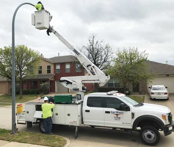
While the city has used GIS maps and data for some time, staff recently expanded its use of GIS. Fieldworkers now use GIS software on mobile devices to connect with the office. This move has improved communication and helps keep the city’s shared map up-to-date.
GIS-Based Asset Management
Elizabeth Young, Transportation and Public Works business process manager for Fort Worth and a GISP, is implementing GIS-based asset management to help improve the city—one pothole, streetlight, and storm drain at a time. In 2009, Young began developing an inventory of assets around the city.
Traditional systems track asset conditions with hand-written paper maps, fieldwork, and intuition, making it difficult for a city to keep asset data accurate. However, Young transitioned Fort Worth to a comprehensive asset management program using GIS.
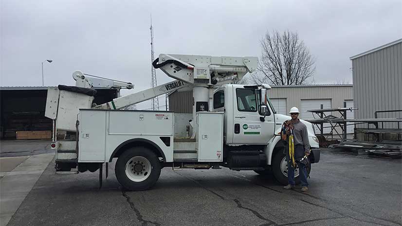
Having all assets tracked and managed in GIS helps improve real-time responses. For many businesses and cities with both fixed and mobile assets, this process can improve operational and predictive intelligence. Assets can be tagged with Internet of Things (IoT) sensors that feed their current status and send failure alerts directly to databases and fieldworkers’ mobile devices. This saves time, reduces errors, and allows managers to track the health of assets in real time.
The new processes save the city roughly $9,600 annually in the Stormwater Division in temporary employee costs and overhead.

In the decade since it switched to digital maps and gained up-to-date asset information, the City of Fort Worth has reduced its paper waste, according to Young. For example, storm water crews no longer need the more than 2,400 paper maps they previously used to locate storm drain inlet assets. Instead, they access maps and receive routing instructions to their next job on tablets. Teams discontinued paper daily crew reports that showed the breakdown of work accomplished for the day. This eliminated an estimated 1,000 sheets of paper annually. Storm water crews can now do markups directly on the map to show new or missing assets. Young said that backlogged data entry is no longer an issue. The new processes save the city roughly $9,600 annually in the Stormwater Division in temporary employee costs and overhead.
Proactive—Not Reactive—Planning
In Fort Worth, the shared awareness of modern GIS helps city managers make smarter decisions based on what they know about asset conditions. The system provides one access point for viewing, maintaining, and managing all assets.
Before GIS, paper maps bred inefficiencies. For example, storm drain inlets need to be cleaned out, but with paper maps and work orders, the city didn’t always know when the drains had last been cleaned.
According to Young, the city’s long-term goal is to “go from being reactive to proactive” and prioritize projects better by understanding the condition of the asset so that better decisions can be made based on available funds.
Recently, all Fort Worth schools adopted new start and end times. Young’s team had to update every School Zone sign in the city. Instead of sending several people to drive all over Fort Worth to find the signs, staff members used the data collected and managed in its GIS to identify in approximately 15 minutes the location of each of the 726 signs that needed to be changed. They then created work orders to spread the work across teams to accomplish this task efficiently.
Hands-On Leadership
Young immerses herself in almost every aspect of the city’s asset management project. She is a hands-on, walk-in-your-shoes kind of leader. Since all field crews and office staff must learn and adapt to various platforms, software implementations, and information inputs, Young is committed to doing the same. She wants to hear the issues users have and learn how the technology is helping or can be improved.
“I’ve cleaned inlets. I’ve put on the boots, and I’ve been down there,” she said. “I’ve been out there and built rapport with them already and gotten to know some of them—not all of them—but I’m a familiar face.”
Young said working directly with fieldworkers lets her better understand the job. “It helps build a relationship and trust that allows us to better work as a team. It helps me to understand their everyday problems, either with technology or trials they may face while out in the field.”
Preparing for Storms
The correct functioning of many assets managed in GIS, such as traffic signals and storm water collection assets, can be a matter of life or death. Texas weather can be extreme: drought one year, flooding the next. Because Fort Worth is prone to dangerous flooding, Young has focused much of her efforts on collecting asset data for storm water.
Fort Worth started its storm water inventory in 2009 with the goal of recording the location of all culverts, drains, headwalls, weirs, channels, and dams. The inventory—now complete—feeds daily reporting of all repairs and inspections. With this system, Young and her team can see labor reports, equipment usage, and materials used. They can track cleaned inlets and identify those that still need inspection or maintenance.
Cities, especially those with unpredictable weather events, must be ready to contend with nature. Keeping storm drains clear of debris is a key activity that can mitigate risk and possibly avert disaster. Before GIS gave an interactive glimpse of the city’s needs, asset management decisions were made based on intuition and experience. Now, decisions are data driven.
“We can go back and see where we’ve cleaned, how many times we’ve cleaned it,” Young said. “We’ve moved from cleaning storm water inlets in the entire city every eight years to every three years. We can report on it and prove it because we’ve got the data behind it.”