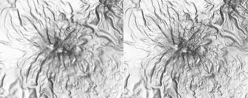
SRTM Data for South America and Western Europe Added to Esri World Elevation Services

Esri World Elevation Layers for South America, Western Europe, Central America, and the Caribbean Islands have been enhanced with detailed, void-free, 1 arc-second (~30 meters) Shuttle Radar Topography Mission (SRTM) data (version 3.0) from the National Aeronautics and Space Administration (NASA). This update provides three times the level of detail in these areas than was previously available.
Esri’s dynamic World Elevation image services—Terrain and TopoBathy—can not only be used for visualizations, such as multi-directional hillshade and tinted hillshade, but also provide access to raw elevation values and derivatives, such as slope and aspect, that can be used for analysis. Access to these global layers is free. An ArcGIS Online organizational account is required but using these layers does not consume any ArcGIS Online credits.
Previously released SRTM data for Africa has also been refreshed with void-free SRTM 30 m (version 3.0) data in this update. Updates for Asia and Australia are pending. For more information about the coverage of the World Elevation services, see the Elevation Coverage Map on ArcGIS Online.

