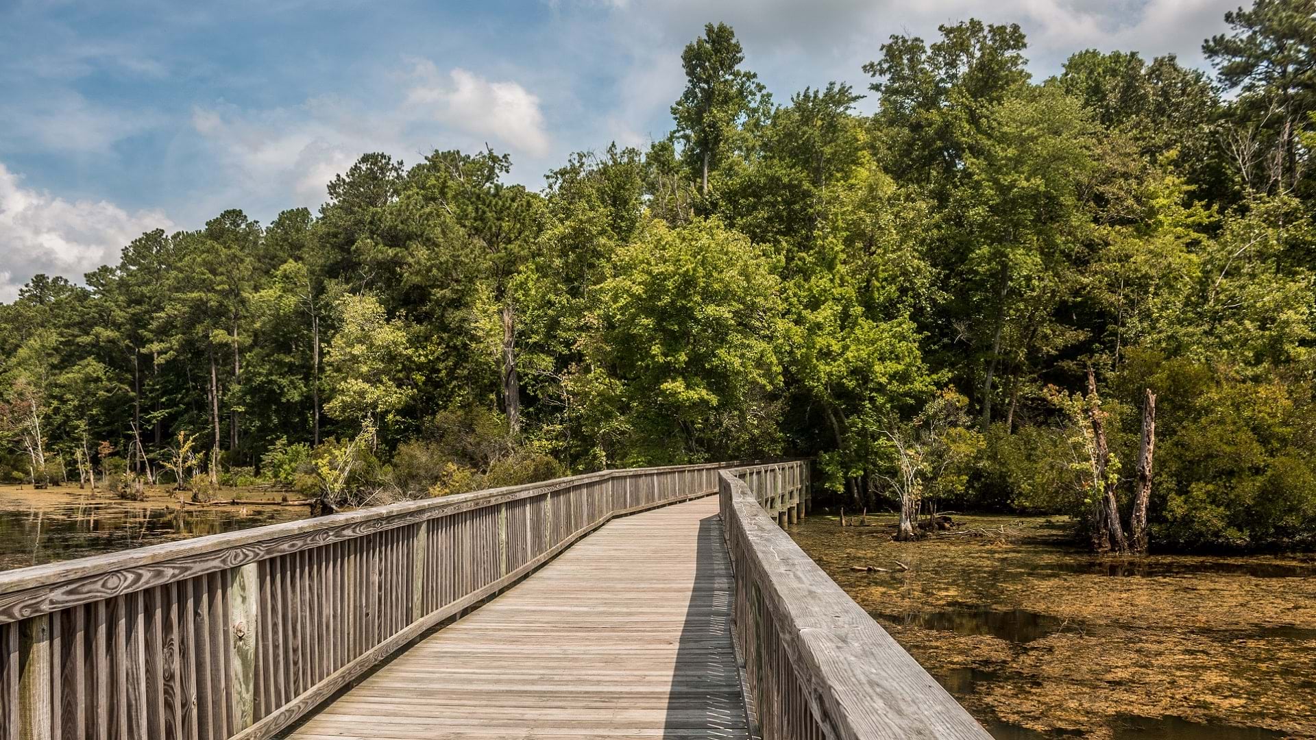
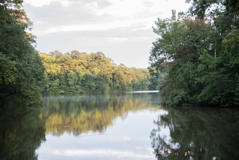
Located along the James River in the Chesapeake Bay watershed, the city of Newport News, Virginia, contains some of the state’s most stunning parks. Spanning a total of 8,767 acres, these 41 parks support multipurpose recreation and are chock-full of cycling, hiking, and mountain biking trails.
Until a few years ago, however, the city sported little digital content to showcase its park system—not to mention the many other amenities the city has to offer. City residents and visitors alike relied on word of mouth to explore Newport News, allowing many of its most vibrant features to fly under the radar. Therefore, the GIS team in the city’s IT department made it a priority to develop a public-facing application to advertise what the city has to offer and engage residents in new ways.
“We started with the launch of our GeoHub,” said Brian Pierce, GIS analyst for the Newport News IT department. “[The GeoHub] features a collection of apps and nearly 100 open data layers that we are constantly adding to.”
Built using ArcGIS Hub, the Newport News GeoHub has become the city’s public platform for exploring, visualizing, and downloading location-based open data. The city creates new geospatial content daily to provide unique perspectives, stories, and data to its staff and residents. In addition to city amenities, the GeoHub contains pages covering crime and budget data, as well as a gallery featuring maps of the city’s congressional districts, opportunity zones, and more. Visitors can find stories created with ArcGIS StoryMaps on topics from the city’s many sculptures to its stormwater infrastructure.
Home Is Where the Parks Are
Chief among the vital components of the expanding GeoHub collection is the Newport News Park Finder app, which the city views as a unique opportunity to promote Newport News’s vast park system, attracting new visitors to the area and giving residents an opportunity to better understand and explore their home.
Created with ArcGIS Experience Builder, the Park Finder app provides a way to engage residents and visitors with data in a way they may have never done otherwise. Not only can they find recreation opportunities more easily, but they can also reserve sports fields and courts, picnic shelters, and campsites from the app.
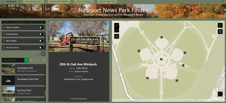
Before the creation of the Park Finder app, there was no easy way to search for a park based on its amenities and no interactive way to view parks prior to visiting them. However, the Park Finder app offers the public an easy way to quickly filter parks by amenities and discover new attractions in the city.
The tools included in ArcGIS Experience Builder allowed the GIS team to customize the look and feel of the Park Finder app to fit the city’s desired branding, setting up the app as a centerpiece of the city’s GeoHub resources. However, getting the aesthetic right was only the first step. The team soon realized that the basemap needed to be updated with additional local data in order to bring the app to life.
Maps by and for the Community
Enter Esri’s Community Maps Program, which allows places all over the world like Newport News to share local, authoritative geographic data about their communities.
“We discovered Esri’s Community Maps Program a few years ago while looking for a specific style to match the marketing materials from our tourism office,” said Tammie Organski, GIS project manager for the Newport News IT department. “[It] enables us to enhance our content while maintaining replicability in everything we develop for both internal and public apps.”
Members of the Newport News GIS team registered for and began contributing their local data to Esri’s Community Maps Program during the development of the Park Finder app. Initially, they submitted only a few layers; now they share 20 map layer services.
In the meantime, Newport News GIS team members developed a hybrid approach for keeping basemaps updated. After setting up routine service submission, team members began incorporating map changes through Esri’s Basemap and Geocoding Feedback service. They then added key features to the basemaps by way of the Community Maps Editor, allowing for increasingly large-scale detail. The addition of schools, parks, and recreation facility details brought these maps to life, creating a fully realized picture of what Newport News has to offer—including its immense parks system.
“Using [ArcGIS] Field Maps and the Community Maps Editor, I’ve helped collect and digitize over 4,000 parks and school amenities,” said Julianne Say, GIS intern in the Newport News IT department, emphasizing the scale and detail the project involved.
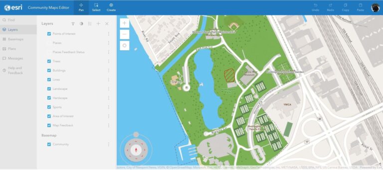
Once the team was satisfied with the basemap content, GIS staff were able to use the ArcGIS Vector Tile Editor to align the basemap style to their branding requirements.
Finally, the city began sharing address point data to ensure locals and visitors could find parks and other locations accurately. Address data shared through the Community Maps Program enhances the ArcGIS World Geocoding Service.
Seeing the success of the Park Finder app, the GIS team realized that other city departments, including the planning and public safety departments, could benefit from the greater level of detail and collaboration afforded by the Community Maps Editor.
Over time, the City of Newport News has continued to leverage GIS tools such as ArcGIS Hub, ArcGIS Experience Builder, and the Community Maps Program to bring together its geospatial resources—and its community—into one place, creating a stronger foundation to support the city’s growing digital GIS platform.