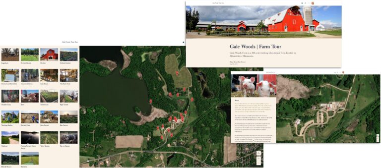
At Gale Woods Farm—a 410-acre working educational farm in the US city of Minnetrista, Minnesota—visitors of all ages learn about agriculture, food production, and land stewardship by immersing themselves into the farm’s daily doings.
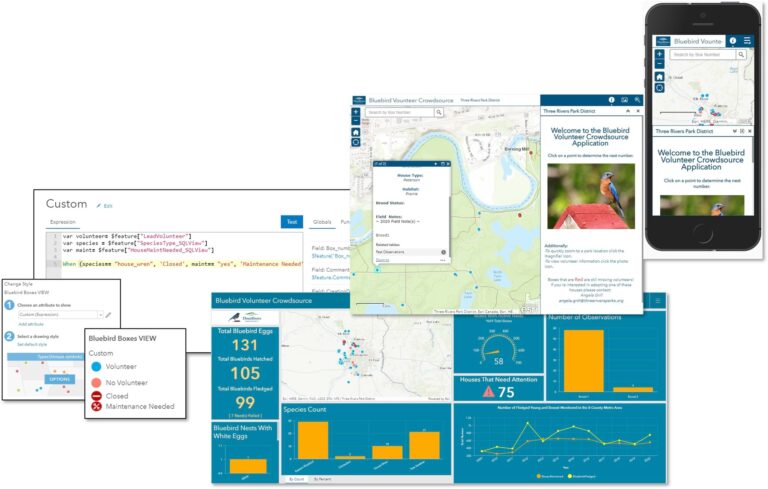
The farm is one of several areas overseen by the Three Rivers Park District, a Minnesota park system established in 1957 that promotes environmental stewardship via park-based recreation and education. The park system consists of more than 27,000 acres (109 square kilometers) of parks and trails in and around Hennepin County, Minnesota. With art parks, winter-sports hills, golf courses, nature centers, land restoration areas, and more, Three Rivers Park District manages a wide range of amenities that provide opportunities for deeper connections with nature and local communities.

As a GIS administrator for the district, Amanda Huber is part of a three-person team that assists various municipal departments—such as planning, engineering, maintenance, forestry, water resources, and wildlife—with their geospatial technology needs.
“We wear a lot of hats,” Huber said of the many complex tasks and responsibilities the GIS team takes on. These tasks include building and managing an interactive map of park trails as well as creating stories with ArcGIS StoryMaps about features such as Gale Woods Farm.
This variety of responsibilities is represented by the many GIS technologies Huber has learned for her job—ArcGIS Pro, ArcGIS StoryMaps, ArcGIS Monitor, and more.

Esri Community Resources
Given the scope and complexity of Huber’s work, it’s no surprise that she often turns to Esri Community, a global collaboration platform for ArcGIS users, with resources as well as answers to a variety of questions about GIS software.
This resource for information and collaboration is crucial to Huber’s work—partly because the GIS products that Huber creates and manages support the district’s many stakeholders, including local residents.
“I learned about [Esri Community] as being a place to ask questions and learn more information,” Huber said. “It’s a very rich and robust database of user contributions.”
Other contributors’ wide-ranging input has enabled Huber and the team to collect intelligence on new products they’re thinking about adding to their stack.
“If there’s a GIS tool that your organization could benefit from, Esri Community is a great way to see what questions people are asking about it or ideas that are being submitted,” Huber said. “It’s a really great place to learn about those products from another person’s perspective.”
ArcGIS Monitor 2023
In 2023, the GIS team members installed ArcGIS Monitor 2023 as part of the Esri product suite they use for the park system. ArcGIS Monitor—which provides the team with usage and performance information in the ArcGIS Enterprise environment, had recently undergone a significant update. Official documentation didn’t always include information she needed, so Huber turned to Esri Community.
Fortunately, other contributors had already published similar questions and answers about the updated software. Huber added perspective and data based on her own experience, and asked fresh questions such as whether there was a way to determine where alerts were coming from.
Esri team members who are active in Esri Community addressed Huber’s question and collected use-case details from Huber to add to the development backlog for future releases.
A Space to Connect and Learn
Given Huber’s embrace of the give-and-receive nature of Esri Community and her frequent participation in the platform, she was welcomed into the Esri Community MVP (most valuable participant) program in 2024. But the community-building aspect of Esri Community is what leads Huber to think of her participation in the group as vital to her GIS work.
“Sometimes students working on a school project don’t know how to do something in GIS,” Huber said. “Sometimes it’s a professional who’s in a position where they haven’t worked with a certain product before. I feel as though I can help.”
For example, Huber has encountered contributors who were migrating from ArcMap to ArcGIS Pro. Because the district has made this transition, Huber can provide an experienced perspective.
Huber also noted the welcoming character of Esri Community. Everyone is looking for answers, she said, and Esri Community is a place for GIS users to support one another.
“Anytime you have a question, obviously look it up and see if you can find it in the documentation first—do your due diligence,” Huber said. “But if you can’t find that answer, ask the question. It doesn’t hurt. You’re not going to embarrass yourself.”

