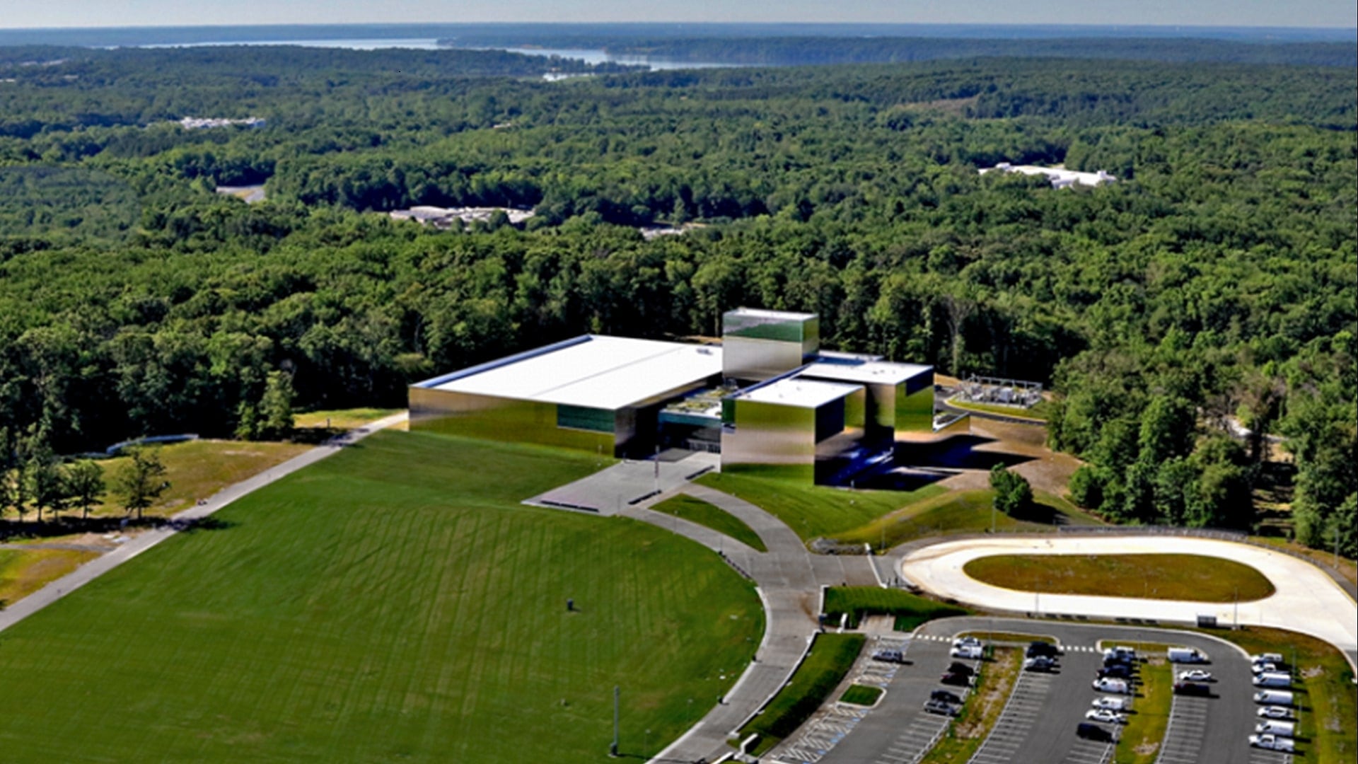
Nestled in the trees off the Fairfax County Parkway in Northern Virginia, the National Museum of the United States Army now stands as a monument to the history and legacy of the largest branch of service in the Department of Defense, as well as the individual stories of US Army soldiers. Composed of a 185,000-square-foot structure on an 84-acre campus, the museum was the result of a joint effort between the US Army and the Army Historical Foundation, which raised construction funds for the project, partially through the donation of commemorative bricks, trees, and benches that filled the first phases of the planned campus and provided an opportunity for civilians to honor U.S. Army soldiers.
The foundation’s efforts to raise funds for the museum’s construction began with an outreach campaign to soldier, veteran, retiree, resident, and industry communities—and these communities responded.
The lengthy process of planning, fundraising, and construction culminated in an opening on Veterans Day, November 11, 2020—a major achievement for all involved, despite a program dampened by COVID-19 social distancing protocols.
With the museum’s grand opening, however, came a need to easily display and highlight donors’ artifacts.
The Army Historical Foundation approached the Esri defense and national government team to help with this mapping challenge, which included not only a need to quantify donations, but also organize the data in an efficient and straightforward manner, without a heavy installation of IT equipment and software.
“Each of our commemorative bricks represents a soldier or army family member who contributed to the army legacy preserved by the National Army Museum,” said retired lieutenant general Roger Schultz, president of the Army Historical Foundation. “[The] virtual mapping of these bricks was not only a wonderful contribution to our foundation, but a service to every person eager to find their name, or the name of a loved one.”
Images and Words
The goal for this project was to find an effective method to deploy and share army museum data, layers, maps, and apps to the internal organization and the public. Using ArcGIS Online would eliminate the need for the team to install and maintain infrastructure and software, as well as provide a device-agnostic platform for staff, volunteers, and visitors to use from nearly anywhere.
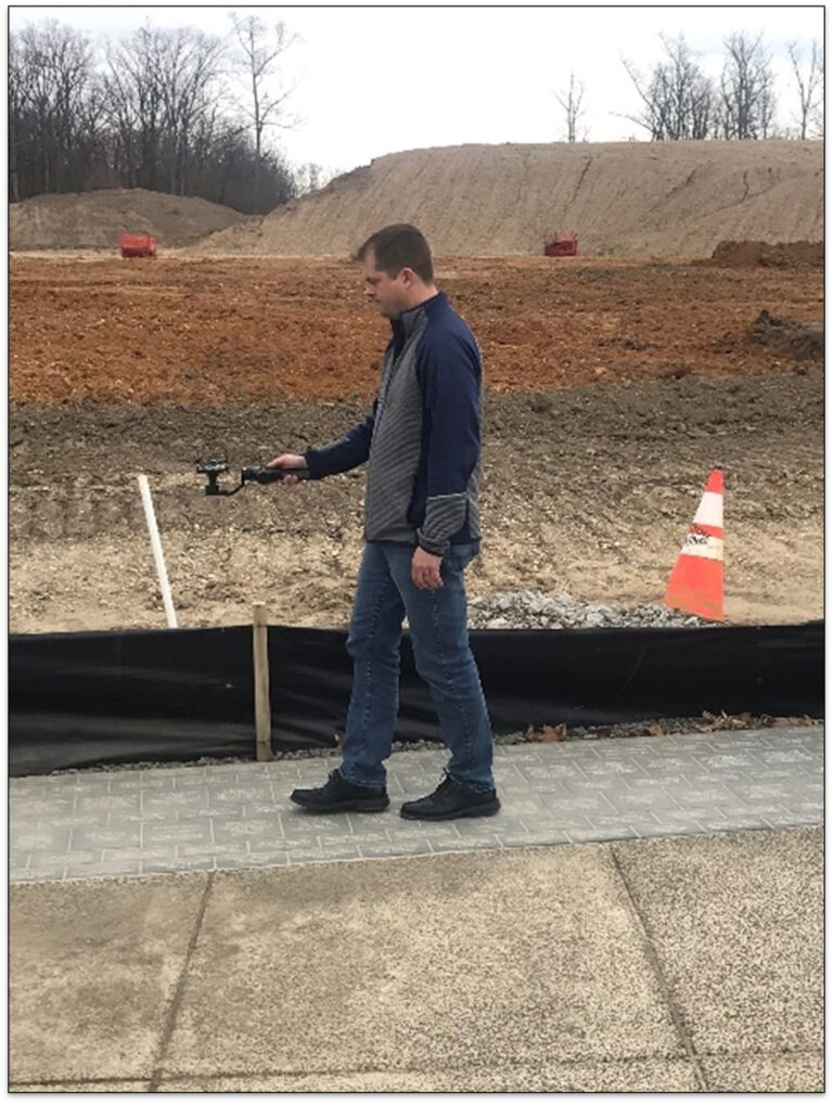
The effort was supported by resources from the US Army Geospatial Center, which stepped in to collect high-resolution images of recently installed bricks along the Path of Remembrance at the army museum.
Chris Kennedy, from the Army Geospatial Center’s mapping and geovisualization team, used a gimbal-mounted camera to collect images via a smartphone, then used survey equipment to obtain precise locations of the path on the campus. Finally, the Army Geospatial Center team created a georeferenced mosaic dataset to transmit this high-resolution layer to the Esri team.
Next, the Esri GeoAI team, which uses artificial intelligence and machine learning to support GIS projects, stepped in to support the “reading” of the thousands of brick images. The intent was to extract the text from the images to create the feature class, using the brick inscription for the feature pop-up. Running the dataset against optical character recognition and other services resulted in an accurate extraction of the text. Each brick was then delineated as a unique feature in ArcGIS Online to support location and search functionality.
A Searchable Application for Donors and Visitors
Andrew King and Max Ozenberger, solution engineers from the Esri defense team, created a campus basemap via the ArcGIS Pro style called Draft Sketch, derived from recent imagery posted by Fairfax County in ArcGIS Online. With this, they were able to style the basemap with a new entrance, roads, and forest outline.
The final step in the process was the creation of two user-facing applications. The first would be a web app with responsive web design, created with ArcGIS Web AppBuilder, that viewers could use on their computers, tablets, or phones. The second application was for the museum’s kiosks located around the campus. However, as these kiosks are not equipped with physical keyboards, Ozenberger used an open-source virtual keyboard from other kiosk app developers to create a JavaScript application that brings the virtual keyboard to the screen when the user touches the search bar.
Once they were up and running, the apps were deployed to the Amazon Web Services cloud and shared publicly for users at onsite kiosks, as well as those using their own devices at any location.

The final apps were configured with the Army Historical Foundation and National Museum of the United States Army branding guidelines—including logos, colors, and fonts—and released just prior to the grand opening in November 2020. The apps have received over 28,000 views since that time, even with the museum’s temporary closure due to the COVID-19 pandemic.
“We’ve been very pleased with the visitors’ response to the application,” said Schultz. “We look forward to working with Esri on additional items to be added as we continue receiving brick orders and build out new sections on the campus.”
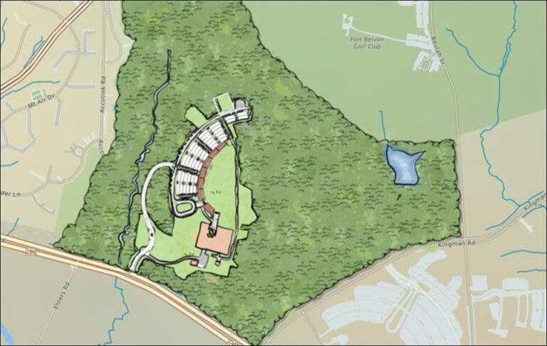
In May 2021, the team added mapping for the tribute trees and benches on the campus. This year, the Esri defense team is once again partnering with the Army Geospatial Center for the next round of brick paver installations on the Warriors’ Plaza and Field, to open in the summer of 2023.
Learn more about the Create My Brick application and donating to the Army Historical Foundation’s museum campaign.
