GIS Technology Drives Campus Asset Management
The facilities management team at a New York university uses GIS for outdoor and indoor asset management.
The facilities management team at a New York university uses GIS for outdoor and indoor asset management.
A new instructor-led course introduces key ArcGIS Indoors workflows with guided practice to integrate CAD, BIM, LAS, and GIS data.
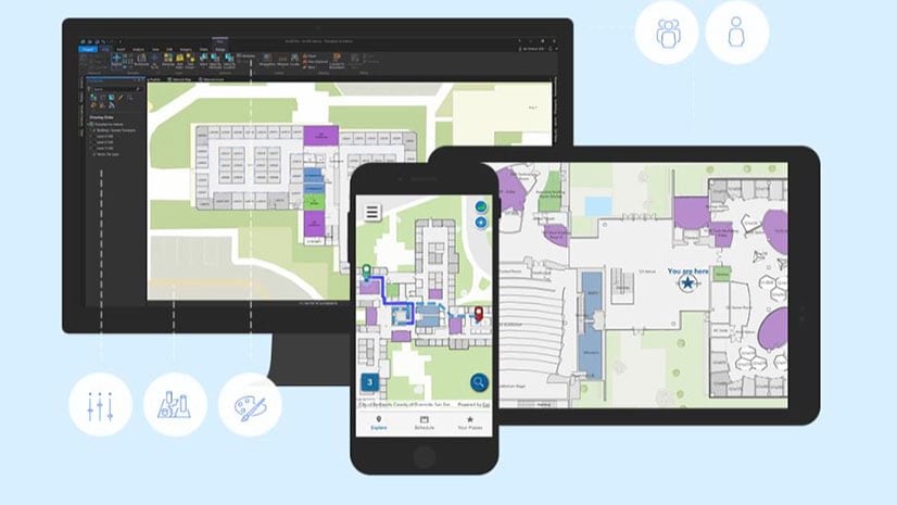
Esri product engineer Jason Hine explains the app development basics for ArcGIS Indoors, Esri’s indoors mapping system.
Learn about the indoor location technologies such as Bluetooth Low Energy (BLE) beacons are or soon will be supported by ArcGIS Indoors.
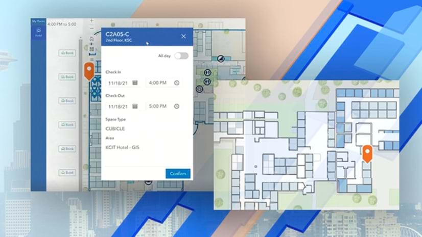
Use ArcGIS Indoors to navigate to offices, locate safety and security equipment, find events, and monitor security issues in the workplace.