Python Tips and Tricks for ArcGIS Administration
Learn to reduce common administrative pain points and leverage the latest visualization and automation capabilities in this no-cost seminar.
Learn to reduce common administrative pain points and leverage the latest visualization and automation capabilities in this no-cost seminar.
Discover the role of the Arcade expression language in ArcGIS and learn key concepts for writing and executing it.
Opening on February 18, 2026, Esri’s no-cost course explores how GIS is being used to prepare for a more resilient future.
Join this free course to learn how GIS and imagery work together to enhance workflows from visualization to analysis.
Join this seminar on October 23 to learn about a new capability that supports an easy-to-follow, dynamic to-do list for mobile workers.
In this instructor-led course, discover how analyzing data based on location can reveal previously unknown patterns and relationships.
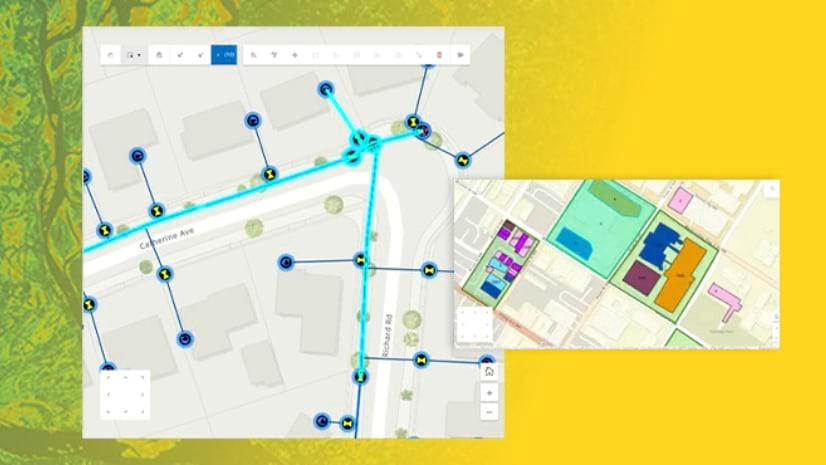
Explore the intuitive interface of ArcGIS Web Editor and watch live demonstrations of its popular editing tools in this September seminar.
Discover ArcGIS capabilities for acquiring and managing imagery through 2D and 3D visualizations in this new MOOC opening on October 22.
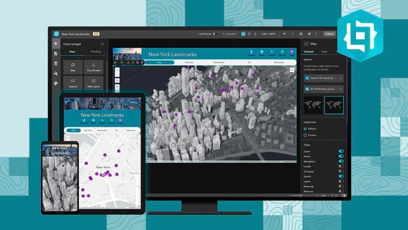
In this instructor-led course, learn advanced concepts and workflows to create web apps enriched with GIS content—all without writing code.
Learn how to structure a story, use maps to tell that story, and apply techniques to create an immersive experience in ArcGIS StoryMaps.
In this instructor-led course, learn design techniques and ArcGIS workflows to create and share professional-quality information products.
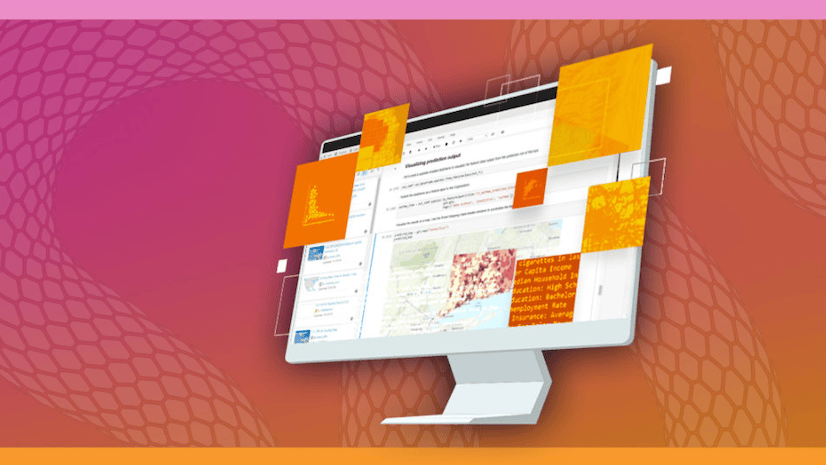
In this free course, learn how the application of spatial data science uncovers hidden patterns and improves predictive modeling.