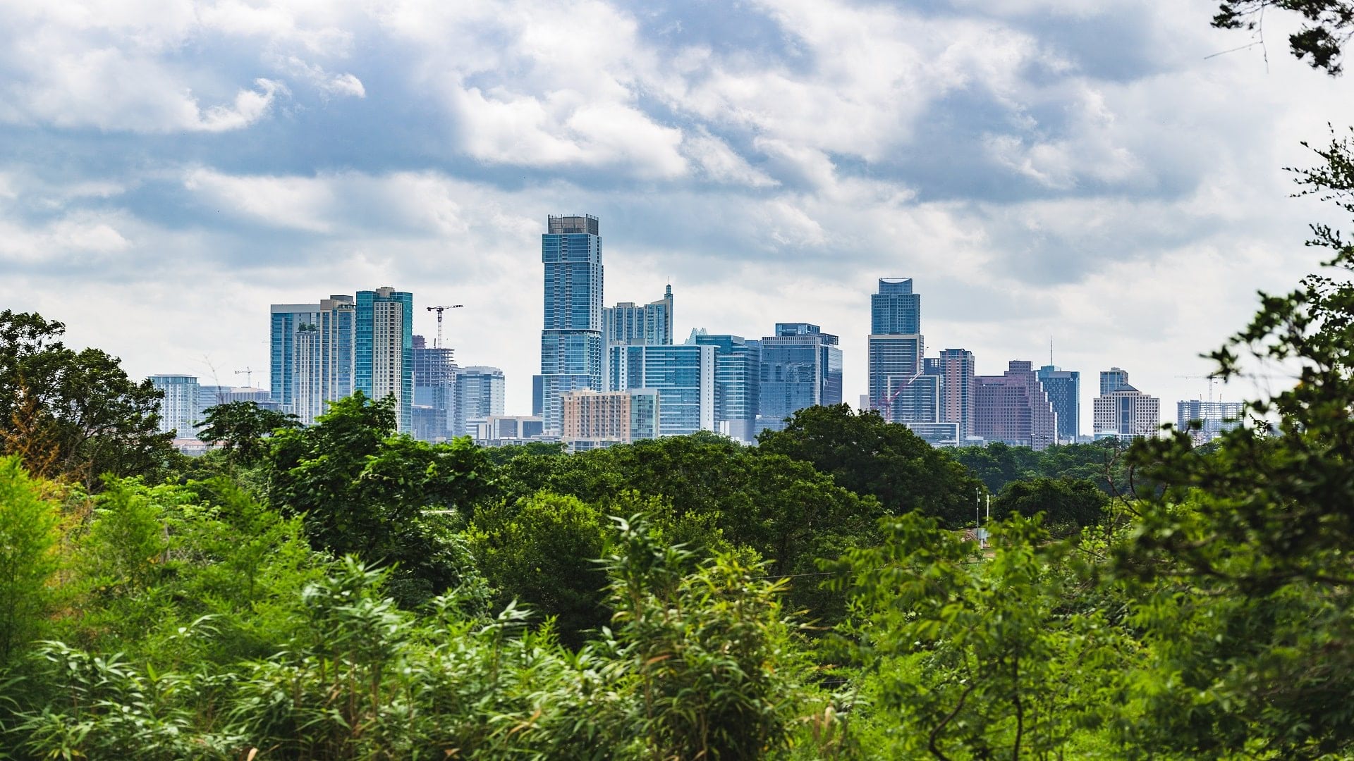
Urban forests can be of tremendous environmental and economic benefit to a city’s residents, from increasing shade coverage to conserving energy. Because of this, the City of Austin has long been dedicated to the protection of trees located on public lands and public right-of-way, acknowledging the need for a comprehensive urban forest strategy in the city code as far back as 1992.
In 2013, the city adopted a robust Urban Forest Plan, aiming to increase overall canopy coverage within the city limits in the face of rising population and expanding urban development. City staff have employed asset management practices for urban forestry the same way the city manages assets like constructed facilities and infrastructure.
The first step was obtaining comprehensive urban forestry data to better understand the character, composition, and condition of the trees within the public right-of-way. Public Works Urban Forestry staff set out to inventory and analyze these trees in a geospatial format as an asset management tool to visualize and improve decision-making.
Phase by Phase
The City of Austin hired engineering firm Halff Associates to incorporate traditional tree survey data into a geospatial format to collect, store, and dynamically visualize valuable information at exact geographic locations.
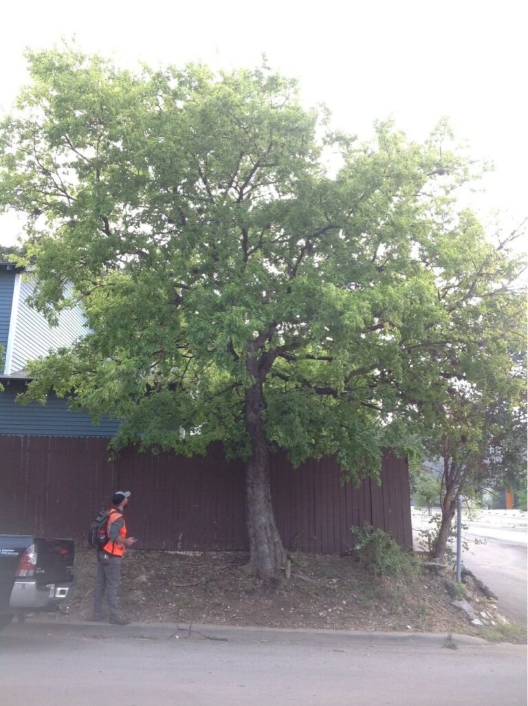
Halff created an ArcGIS Enterprise geodatabase configured with a city-provided schema to collect tree locations. The database included descriptive attribute information for each tree, such as species, dimensions, condition, and a minimum of one leaf or bark photo and one tree form photo. The photos were designed to assist with desktop quality control for the project and be used to develop a street tree identification guide for city staff to use to train new tree technicians and volunteers.
Lacking sufficient funding to inventory the entire public right-of-way, city staff opted instead to implement a phased pilot program to expand sampling efforts.
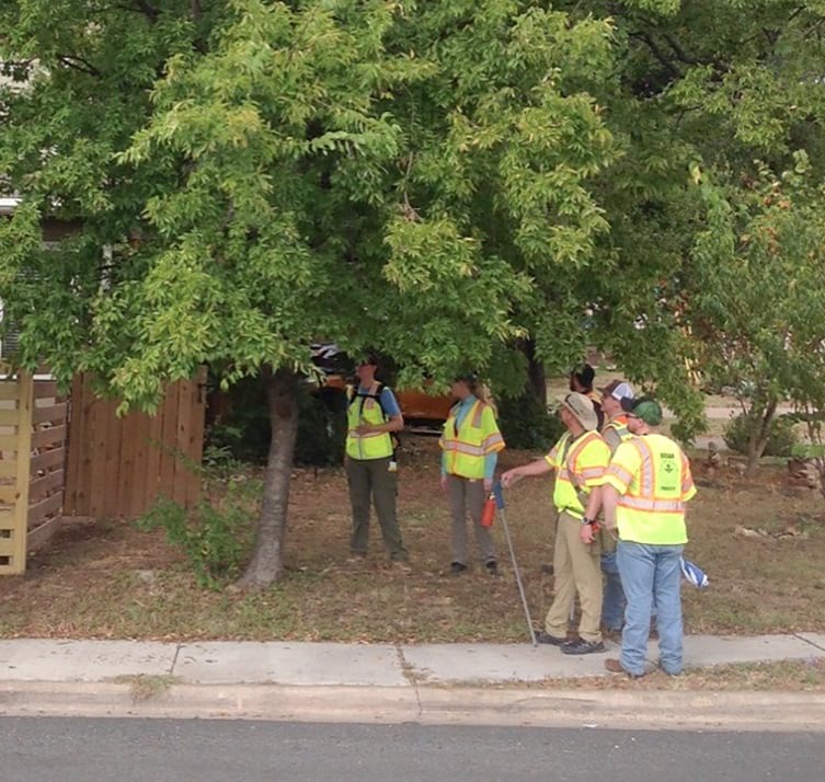
The first phase, in which two teams of two people spent roughly six weeks gathering data and taking more than 15,900 photos, began in the summer of 2019 by examining a single ZIP code in east Austin. The area was chosen because it was vital for city staff to understand how successful these tree plantings were and what further planting efforts were needed. The first phase ended in January 2020.
The project’s second phase extended over 20 weeks, from July to December 2020, with surveyors taking more than 30,000 photos. This phase included a larger area of four ZIP codes, including downtown Austin and neighborhoods near the University of Texas. These areas are known for high pedestrian activity and more mature trees.
A Wealth of Data
The teams used ArcGIS Field Maps paired with Eos Arrow 100 GPS units to pinpoint tree locations with a high degree of accuracy, employing both online and offline data collection modes.
The core of the project was a dashboard developed using ArcGIS Dashboards, which allowed Halff and city staff to review inventory data in real time. The dashboard tracked the location of the teams’ progress; aggregated attribute data from individual trees; and provided a mechanism for real-time independent quality control, which was conducted by the city’s and Halff’s certified arborists.
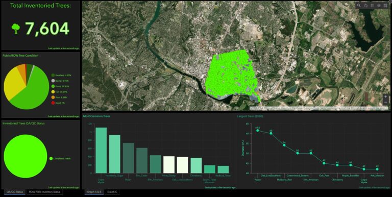
Visualizing the distribution of these characteristics with ArcGIS Dashboards helped communicate not only the progress of collection activities but also patterns for arborists to understand the complexity of Austin’s urban forest as data was being collected.
The Halff team inventoried more than 22,300 trees over the two phases of this project.
As part of the inventory, the team compiled and analyzed species composition data, with the first phase showing dense populations of crape myrtles, sugar hackberries, and pecan trees. The area included in the second phase was also home to crape myrtles, as well as elms and oaks, indicating opportunities for tree diversification in targeted areas.
Halff also collected data on health and tree dimension distribution. The data revealed multiple opportunities to replace stumps with living trees; issues like trees that had outgrown their space; and potential disease or pest threats including oak wilt, emerald ash borer, and Dutch elm disease. The team flagged areas where homogenous clusters of trees were susceptible to any of these threats, allowing the city to monitor and perform preventive maintenance.
The final piece of data needed to obtain a full picture of Austin’s urban forest was an analysis of vegetation structure, function, and value, including the environmental impact of the city’s trees. The analysis was performed using i-Tree Eco—a free ecosystem modeling application provided by the USDA Forest Service—and estimated the 22,300 trees inventoried over both phases of the project store more than 11,000 tons of carbon and produce 1,100 tons of oxygen each year.
Collecting inventory data about urban forests provides substantial groundwork for improving the beauty and environmental wellness of city spaces, a fact not lost on city officials. They were able to use the data compiled in the two-phase pilot project to justify hiring two urban forestry technicians, a step toward not only continuing the inventory effort but also expanding and maintaining the health of the city’s urban forest.
To date, the City of Austin has inventoried more than 35,000 trees and counting.