ArcGIS Living Atlas of the World contains great content for mapmaking, including constantly updated information on the weather, traffic, and the depth of streams and rivers. But did you know the content is useful when you want to explore geographic information that’s tied to current events such as natural disasters?
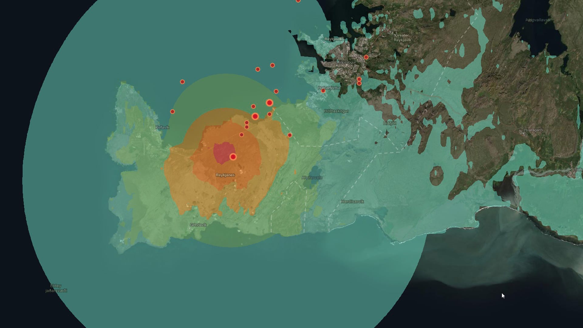
For example, you can use ArcGIS Living Atlas content to look more closely at geological events such as earthquakes, including the large swarm of temblors that occurred in Iceland in early 2021. More than 18,000 earthquakes were recorded in Iceland over a one-week period in February, possibly indicating a volcanic eruption is about to happen. Several quakes off the coast of New Zealand, including an 8.1 magnitude temblor, triggered tsunami warnings in March.
ArcGIS Living Atlas includes authoritative live feeds and other content that helps you learn more about earthquakes like the Iceland and New Zealand quakes and see where they’re happening. Note that current events are dynamic, time dependent, and change rapidly, so your maps may show different results.
USGS Global Earthquakes
The map below presents recent earthquake information from the United States Geological Survey (USGS) Prompt Assessment of Global Earthquakes for Response (PAGER) program. The PAGER system provides fatality and economic impact estimates following earthquake events worldwide. For more details, see the USGS PAGER website.
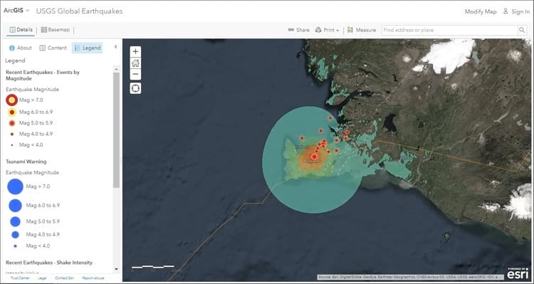
For more information, see the USGS Global Earthquakes map item details.
Latest Earthquake Monitoring Dashboard
The dashboard below monitors the latest earthquake events around the world. It automatically updates when new events happen to show you where they occurred, how significant they were, and if there were any resultant tsunamis.
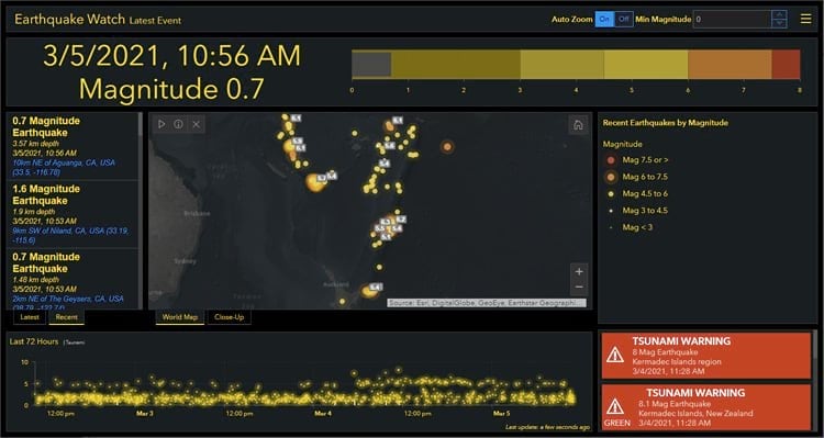
For more information on ArcGIS Dashboards, see the Dashboards overview and What is a dashboard. For more information on this dashboard, see the Latest Earthquake Monitoring Dashboard item details.
For more information, see the following resources:
- Latest Earthquake Monitoring Dashboard
- USGS Global Earthquakes
- ArcGIS Living Atlas earthquake content
About ArcGIS Living Atlas of the World
ArcGIS Living Atlas of the World is the foremost collection of authoritative, curated, geographic information from Esri and the GIS user community from around the globe. It includes maps, apps, and data layers to support your work. To learn more, visit the ArcGIS Living Atlas website.
