Does learning GIS improve spatial reasoning capabilities in high schoolers? A team from six universities is studying the students—and their brains—to find out.
A group of researchers from six American universities are studying what effect a classroom-based spatial education has on the development of the spatial thinking and reasoning skills of high school students. The research team wants to find out how the students, who use GIS technology for class projects, go about solving complex reasoning problems and whether their brains are physically changing in response to spatial learning.
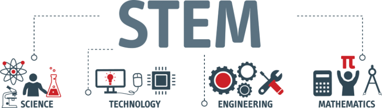
With more emphasis on science, technology, engineering, and mathematics (STEM) courses in the American secondary school curriculum, an increasing number of students want to pursue STEM degrees at universities and the well-paying careers available to them upon graduation.
Unfortunately, the anticipated success rate at university for most of these students is low. According to ACT, Inc., the developer of a major standardized achievement test for college admissions, about half of the more than two million high school seniors who annually take the ACT placement test express an interest in pursuing a STEM major. However, ACT test results indicate that only about 20 percent, or 200,000, of those students are academically prepared for the rigorous coursework required.
While spatial reasoning and analysis are frequently applied in careers that fall under the STEM umbrella, these important skill sets aren’t formally included in the secondary school curriculum. Instead, they are introduced incidentally in STEM-related classes when students encounter spatial concepts in the assignments.
Though many factors contribute to academic success, spatial reasoning is an overarching skill that could increase students’ comprehension of STEM subjects, if introduced during their secondary school years.
“Spatial thinking plays a very important role in the learning and practice of STEM-related disciplines,” said Bob Kolvoord, dean of the College of Integrated Science and Engineering at James Madison University (JMU) in Harrisonburg, Virginia. “Many of the most important discoveries in science involved a critical spatial insight, such as the structure of the Benzene ring or the DNA molecule.”

The Geospatial Semester
One way to teach high school students spatial reasoning and help them retain those skills is to add GIS coursework to the curriculum. Broadly speaking, spatial reasoning covers all thinking that has a spatial component. This includes geospatial reasoning, which is geographic in nature. Spatial analytics methodologies often include the examination of physical features such as the respective size, shape, and position of the objects or sites being studied and how they interact with nearby elements in their environment.
To help introduce students to spatial reasoning, Kolvoord in 2005 cofounded the Geospatial Semester (GSS) with his colleague Kathryn Keranen, an adjunct professor at JMU. Kolvoord and Keranen also are coauthors of several Esri Press books.
The GSS program offers high school juniors and seniors the opportunity to take GIS classes at their own schools while earning university credit at JMU. The program started at 4 high schools in Virginia but has expanded to include 30 high schools in Virginia, Oregon, and Illinois.
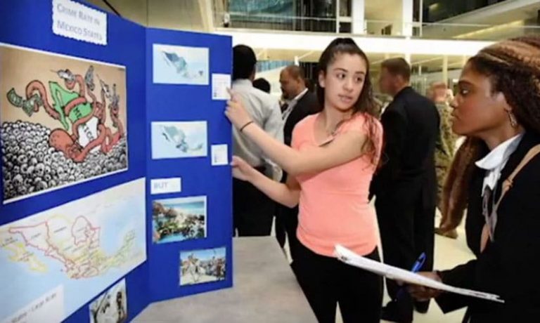
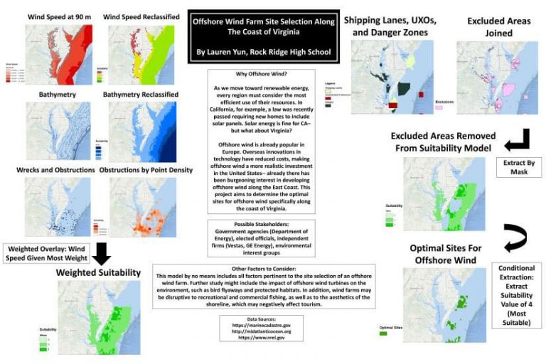
“We wanted to develop an educational program that exposed students to more problem-based learning through projects that require collaboration, and the use of GIS in their coursework was a good fit,” said Kolvoord. More than 4,000 students have participated in GSS thus far. Past student projects have explored a variety of issues related to the environment, renewable energy, wildlife, transportation, and public safety.
An Analytical Methodology for Spatial Cognition
Postulating that the students who participated in the Geospatial Semester had increased their spatial reasoning abilities, Kolvoord assembled a team to study whether exposure to GIS changes students’ high-level STEM spatial thinking ability. The team developed testing procedures to determine how these changes occur at both the cognitive and neurological levels.
Kolvoord’s chief collaborator on the team is David Uttal, professor of psychology and education at Northwestern University, where he works in the area of spatial thinking in STEM education. Other members include Adam E. Green, an associate professor of psychology at Georgetown University who specializes in cognitive neuroscience; David Kraemer, assistant professor of education in the Department of Psychological and Brain Sciences at Dartmouth College; and Emily Grossnickle Peterson, an assistant professor in the School of Education at American University, along with graduate students at all four institutions. Nora Newcombe, a professor of psychology at Temple University and the principal investigator at the school’s Center for Spatial Intelligence and Learning, advises the team.
Kolvoord said that his and Uttal’s approach to the research has evolved over the last 10 years. They started by interviewing students and assessed their final class projects. Students have used GIS to study a wide range of topics including elk habitats, hurricanes, air quality in relation to California wildfires, and even school locker usage. The students primarily use ArcGIS Desktop applications in their coursework, but they use ArcGIS Online, too, when needed.
“We initially found that the GIS students used more spatial language and exhibited stronger problem-solving skills than other students,” Kolvoord said. “We then added other collaborators to the team to more fully examine how the cognitive and behavioral aspects of the testing results connect.”
The researchers explored the students’ spatial thinking abilities, using standard psychometric measures. These include the mental rotation test (MRT), where a person—selecting from a series of options—matches the shape of one figure to another figure by mentally rotating them, and the embedded figures test (EFT), where the test taker recognizes geometric shapes from a bigger and more complex image.
Also, the students were interviewed and asked to answer questions such as these: Why do you think gas or milk prices differ from gallon to gallon or brand to brand? How would you predict what the price would be for each gallon or brand? If you were trying to increase recycling in your community or to run for a local political office, how would you go about running your campaign?
“There are both spatial and nonspatial ways to solve these problems. By analyzing their answers, we examined both their use of spatial language and their problem-solving abilities,” Kolvoord said. “We have ways to tease apart the interviews to look at how the students identify a problem, how they reason with the data, how they draw a conclusion, how they cite spatial data, and how they cite spatial representation. And the data we are collecting is really, really interesting. We have found that the open-ended problem-solving capabilities achieved by the GSS students seem to be making a difference in the development of their cognitive abilities that we can quantify.”
The research also includes performing neuroimaging of the brains of students in the study groups, using functional magnetic resonance imaging (fMRI) technology. These tests determine whether physical changes in the brain actually occur with spatial learning, according to Kolvoord. “This allows us to develop biological inferences about how these changes occur and explain the effects of spatial education on core spatial abilities as well as high-level spatial thinking,” he said.
Grants from the National Science Foundation and the Center for Spatial Intelligence and Learning support the team’s work.
Kolvoord said the research he and other team members are doing is bridging a critical gap between the analytical work being performed in the cognitive neuroscience laboratory and its real-world application in the classroom. Testing students provides the researchers with definitive, real-world data on what improves spatial cognition.
“More than two decades of research on how the brain performs spatial cognition has provided us with a reasonably clear understanding of the process,” he said. “Our longtime, active engagement with those schools that teach the Geospatial Semester gives us access to a group of students exposed to a unique form of STEM education that is deliberately designed around spatial thinking and reasoning. Because of our access to these students, we believe that this may be the first research that employs longitudinal data analysis to measure how learning in a real-world high school changes the brain.”
What Researchers Have Learned So Far
The study included a test group of 79 students who had experience in learning and using GIS technology, and a control group of 130 students who hadn’t enrolled in GSS. Pre- and posttest data was collected on all 209 students, who came from both urban and suburban school districts and were demographically diverse.
“What we are examining in the behavioral interviews is the transfer of learning results,” said Kolvoord. “This is the mental process in which past experiences affect learning and how it is used when we encounter a new situation. We’re finding that students in GSS improve to a greater degree in the transfer of learning than students in the comparison group, suggesting that the use of GIS results in more than just procedural knowledge about a piece of software.”
Analysis of the fMRI scans continues, as the process is time-consuming, according to Kolvoord.
The scan results have shown so far that there was a significant effect on the GSS students when they mentally processed the embedded figures task.
“Specifically, there were differences in activation in the parietal region of the brain, which is related to spatial reasoning,” Kolvoord said. “Students who took GSS had a greater blood flow in this region from pretest to posttest compared to the control group, implying greater activation.”
Since this analysis was done for all students participating in the tests, researchers feel optimistic about the results. They haven’t yet found out whether there is any increased white matter connectivity in the brains of the GSS students, but the researchers plan to continue work on that aspect of the project.
“While we have not completed the final analysis of all of our test results, we see differential improvement in the GIS students [compared to the control group] on STEM problem-solving skills, including problem definition and arguing from evidence,” Kolvoord said. “These abilities apply broadly across STEM and other disciplines, as they are the key skills in critical thinking.”
The research team will conduct a second series of experiments to determine the duration of GIS instruction that is needed to improve cognitive reasoning abilities.
To learn more about the GSS program, visit the Geospatial Semester website. This video from the National Science Foundation’s 2018 STEM for All Video Showcase, describes the GSS program and the neural impacts of spatial education.
