With warming temperatures, rising sea levels, and a multitude of other environmental issues visibly changing the world around us, viable solutions can seem out of reach. But Yishan Wong believes he is at the start of one. Wong, who founded the Hawaiian forest restoration startup Terraformation in 2017, maintains that the best solution lies in combining geospatial technology, accountability, and one of the earth’s most basic resources: trees.
“We believe that forest restoration is one of the most effective and immediately scalable solutions that we have for fighting climate change,” Wong said.
Out of countless proposed methods to mitigate carbon emissions, Wong argues that reforestation carries the lowest cost and risk since trees not only capture and store carbon but are also accessible worldwide.
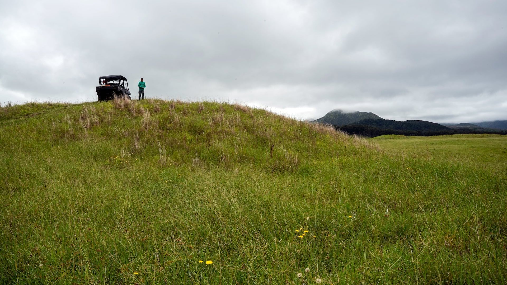
With the objective of scaling globally, Terraformation started launching proof-of-concept sites around Hawaii, where native ecosystems could not only be reforested but also tracked transparently through extremely accurate and near real-time digital maps and dashboards.
“One of the really important missing pieces to reforestation is accountability,” Wong said. “Ideally, you want full accountability because you can really track the data for science. You can know exactly how much carbon is being sequestered.”
In this case, accountability meant mapping each tree with a level of accuracy and transparency that would stand up to scrutiny when shared with possible partners worldwide. Using its knowledge and resources, Terraformation helps these partners establish successful forest restoration projects in their communities.
The Need for Highly Accurate Digital Maps
Terraformation is involved in every stage of reforestation. It starts by collecting and germinating native seeds, growing the plants at nurseries, and finally planting them at reforestation sites.
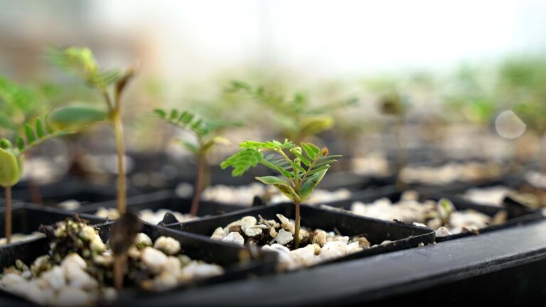
To mimic the growth of a native ecosystem, Terraformation plants in intentionally irregular formations. It might place a māmaki plant in one spot with a koa tree half a meter away, and so on until the entire parcel is reforested with plants native to the area. These plants will grow creating a healthy, diverse ecosystem that mimics a natural one.
“You’re trying to create a self-sustaining system,” said Jill Wagner, director of Hawaii Island Seed Bank and consultant to Terraformation.
But this strategy makes it harder to record, revisit, and report on each seedling over time. You can’t, for instance, revisit a single grid of all the māmaki that have been planted.
So, Terraformation turned to digital maps.
First, it sought a high-accuracy Global Navigation Satellite System (GNSS) receiver that could provide at least submeter-level accuracy in the field when mapping plants. This level of accuracy would ensure it was returning to and monitoring exact plants over time. Terraformation chose the Arrow 100+ GNSS receiver from Esri partner Eos Positioning Systems. The Arrow 100+ provides submeter accuracy using Wide Area Augmentation System (WAAS) differential corrections without any need for a paid subscription. The field technicians paired the Arrow 100 via Bluetooth to their iOS devices.
“High accuracy is really important to ensure the long-term tracking and monitoring of these plants,” said Brian Tucker, GIS specialist at Terraformation.
To record the plant locations, it used Esri’s ArcGIS Field Maps data collection app. Field Maps worked with both the iOS devices and Arrow 100 GNSS receiver.
“I can’t emphasize enough the ease of how [the Arrow 100+] pairs with Esri’s Field Maps app,” Tucker said. “You have the mapping interface combined with the ability to collect data. Having that dual functionality—that is really powerful.”
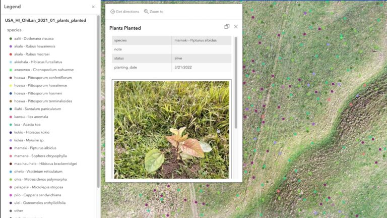
With ArcGIS Field Maps, the field crews collect not only exact plant locations but also specific information such as species, plant health, and even photos, which will help crews navigate back to that specific point in the future.
This information is submitted in real time to ArcGIS Online. Back in the office, team members can see the progress, sort species distribution by color, and gain insight into each plant by clicking on the individual points.
The data is also gathered in a dashboard created with ArcGIS Dashboards, where viewers can see a summary of the number of plants planted and species distribution, enabling high-level tracking of the overall progress of the restoration site.

“People love to just see the numbers [update] and the impact going on,” Tucker said. “And if they check in to the dashboard monthly and see the numbers rise—it’s pretty powerful.”
Watching Degraded Lands Come to Life
The ‘Ōhi’a Lani Project is perhaps one of the most stunning examples of Terraformation’s dashboards. This reforestation site was once barren hills covered in invasive grasses. Now, a dashboard created with ArcGIS Dashboards displays its transformation into a native wet forest.
In just nine months, the site went from having zero native plants to supporting over 10,000. By the end of 2023, Terraformation was on track to add a total of 30,000 plants to this once barren site.
As the plants grow, the restoration team members will visit each one to check on their health. They will then update the map, which captures both the granular data and the overall picture of how their restoration efforts are encouraging the forest to grow and thrive.
Because ArcGIS Online and ArcGIS Dashboards are grounded in extremely accurate, field-captured data, they serve a key purpose essential to Terraformation’s mission. With irrefutable data pointing to how many healthy plants Terraformation has restored, and, therefore, information about how much carbon can be sequestered, Terraformation can provide a compelling argument to organizations capable of providing financial support. This is critical to being able to sustain the project and, most importantly, scale it up.
Terraformation intends these proof-of-concept sites to show that this process is not only feasible but can also be replicated across the globe. In leading by example, Terraformation hopes to show others a simple path toward bettering the environment.
Wong recognizes that not everyone will participate in the ambitious goal of global reforestation. But he and the Terraformation team believe this goal is not only worth striving toward but also within reach.
“Local communities are the protectors of the forest,” said Wagner. “And we want to leave the next generation with a resource and with healthy forests. Everyone should be involved in this.”