Cork County Council Uses ArcGIS Online to Monitor Road Conditions during Extreme Weather
With storms such as Typhoon Magkhut in Asia and Hurricanes Michael and Florence in the United States recently wreaking havoc, more government organizations are turning to technology to better monitor public safety issues in communities that are experiencing strong winds and major flooding. In County Cork, Ireland, the Esri ArcGIS Online platform is being used to track the condition of roads in near real time during severe weather.
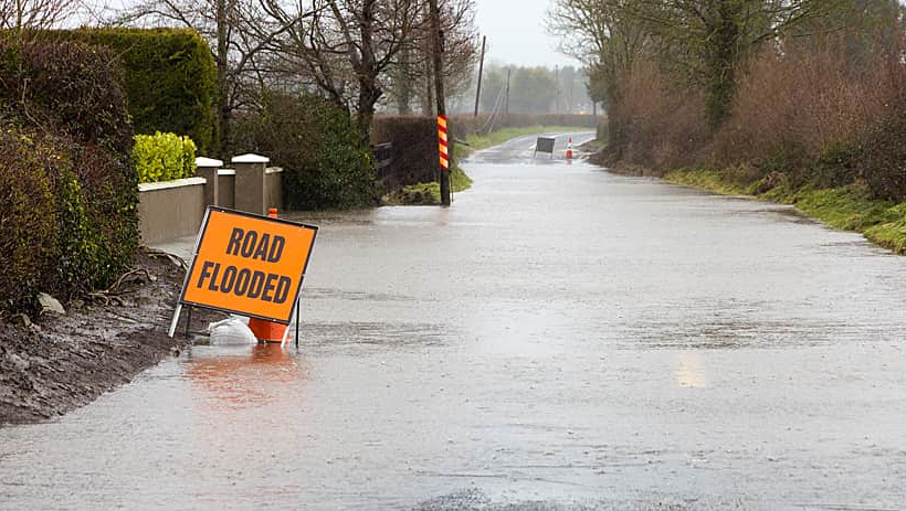
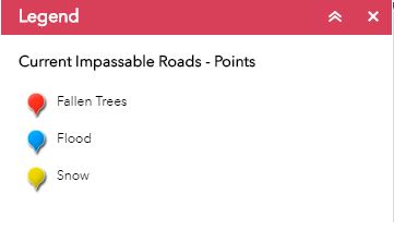
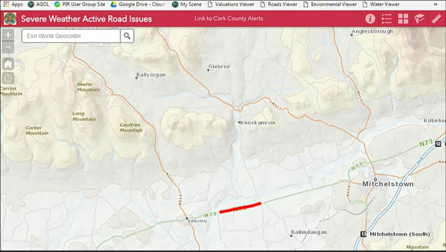
Maps in ArcGIS Online give Cork County Council near real-time information about where weather-related problems are occurring on the roadways in the county. Knowing what’s happening and where—whether it’s impassible roads in West Cork or trees blocking a highway in Coolatanavally—can help to improve the organization’s response to emergencies and better communicate information to the public.
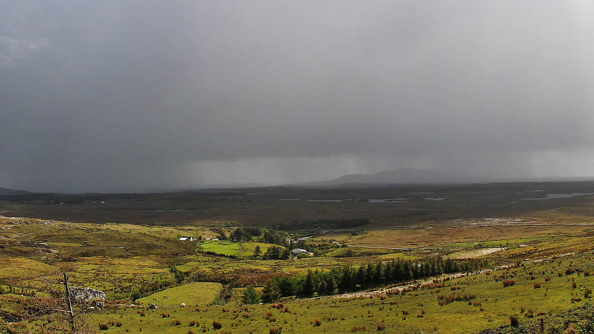
Storm Ophelia’s hurricane-strength winds pummeled Ireland in October 2017, taking the lives of three people and causing power outages and substantial damage to infrastructure. Yet extreme weather like Ophelia, an Atlantic hurricane, can no longer be assumed to be a rare event. According to some estimates, the frequency of storms and severe rainfall events in winter and autumn in Ireland could increase by up to 30 percent in the future.
Cork County Council, the local governing body in County Cork, Ireland, wanted to improve its ability to monitor the impact of extreme weather events on its road network and communicate that information to both county officials and the public. The council wanted to collate information about roads blocked by flooding, fallen trees, and heavy snowfall and provide this information in near real time to council teams in an easily understood format, so that they could respond more effectively to weather-related problems, learn from past events, and better communicate information to residents.
Technology Harnessed
The council already uses ArcGIS technology within its organization and has access to ArcGIS Online. It also subscribed to a geographic public alert service called MapAlerter, which it used to inform the public about severe weather and scheduled road closures via text messages to subscribers of the system. Weather information also is posted on the council’s Facebook and Twitter accounts.
Cork County Council leveraged its existing investment in both ArcGIS Online and MapAlerter to create a solution that assists with emergency management. Now, when council employees who are working in the field observe a problem during extreme weather, they report it to MapAlerter via text using road segment codes and message templates. This information is used to generate MapAlerter posts, and it’s also shared within the ArcGIS Online platform, where it’s displayed on an interactive map in near real time.
During storms, teams in the council’s emergency incident room, the roads department, and other service areas can all view a severe weather map to see a clear picture of the extent of problems with the roads throughout the county. The map refreshes automatically every minute, highlighting new issues as they are reported.
“With the frequency and severity of storms increasing, councils need to be prepared for dealing with them. This system has certainly assisted with this,” said Tim Lucey, chief executive of the Cork County Council.
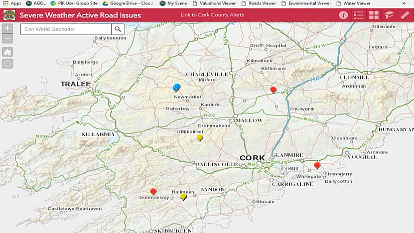
Cork County Council has two views of the weather information. The severe weather map on ArcGIS Online displays the current road situation. It can be shared with council employees, along with the public and emergency responders, via Twitter, Facebook, MapAlerter, and news channels. The second view leverages ArcGIS Enterprise for internal use only, where all the historical data from past events is displayed and can be viewed using the time slider function. That way, the council’s staff can look back in time to identify hot spots where the same issues have occurred during past extreme weather events.
This solution provides the following benefits:
- Emergency teams have a clearer understanding of unfolding events during severe weather.
- The council can look back over previous crises to see patterns and identify areas for improvement.
- Members of the public and emergency responders have up-to-date information about potential hazards.
Since ArcGIS Online is hosted in the cloud, it’s easy to access even in the worst of storms, which is a significant advantage for Cork County Council. “If our offices in Cork are flooded, and our in-house IT systems go down, or if senior managers cannot travel into work, we can view the ArcGIS Online map from a temporary emergency center or from home,” said Judith Vonhof, the information systems project leader at Cork County Council. “In crisis situations, it’s reassuring to know that Esri Ireland has the resources to keep our severe weather map available 24/7.”
Fast, Effective Response
ArcGIS Online provides a single point of reference during extreme weather, where all council employees can see the same, accurate, up-to-date view of an emergency, in a clear visual format, as incidents unfold.
As a result, council managers can make faster decisions about how best to allocate resources to clear fallen trees at the earliest opportunity following the storm. If, for example, managers can see that both major roads to West Cork are flooded, the council’s emergency team can quickly direct field-based teams to the area to erect signs to warn the public of the potential danger.
Improved Long-Term Emergency Planning
Cork County Council can use the historical maps and time slider functionality of ArcGIS Server to better understand the impacts of past events and use this insight to prioritize road improvements that could help minimize disruption in the future.
“You can never know for certain what the next storm will bring,” Lucey said. “But this historic information enables us to look back at previous severe weather events and learn from the past.”
During major storms, Cork County Council can now play an important role in helping to keep members of the public aware of potential road hazards and obstructions. By directing residents to the map with all the latest information, the council can help them make better choices about whether to make nonessential trips and which routes to take. Emergency responders, such as the members of the fire and ambulance service, can also refer to the map to see the latest status and make better decisions about the best routes to reach people in dire need.