Try Draft Sketch, a New Style in ArcGIS Pro
As a GIS analyst for the City of Waterloo, Ontario, Canada, I get to work with amazing teams doing GIS analysis, creating maps, and sharing technical and creative resources. You might notice from my work that I am especially fond of maps that have a hand-drawn, tactile charm. Why should maps be sterile? That’s why I created Draft Sketch, available via ArcGIS Online.
I love the maps of yesteryear and admire their cartography, drawn with ink, paint, and a steady hand. I’ve created maps and styles before that attempt to re-create those qualities digitally. Being a geographer for a municipality in the modern age, I find that ink and parchment are rarely, if ever, called for as a medium today. However, I often work with the renderings of landscape architects and architectural draftspeople and have noticed that they bring the same bespoke, hand-drawn artistic quality to their work.
They fluently render worlds that don’t quite exist yet—including plans and ideas—so a sketched and painted approach is totally appropriate. And beautiful. I have felt the draw myself and seen requests from GIS users for symbols that replicate typical landscape, site plan, and architectural drawings stylistically, while providing some cartographic flair and sketchy imprecision for their spatial data.
So I opened a project in ArcGIS Pro and began creating point, line, and polygon symbols that echo a hand-drafted aesthetic. When I was happy that the features I was symbolizing looked convincingly . . . landscaped, I applied a style that I had created.
A style, in ArcGIS Pro, is a collection of saved symbols that can be easily reused within all your projects and shared with your team or anyone in the ArcGIS Pro user community. The graphical capabilities in ArcGIS Pro enable some amazing—and even realistic-looking—symbology. Anyone can make styles; if you can apply symbology, you can create a style. I named this style Draft Sketch.
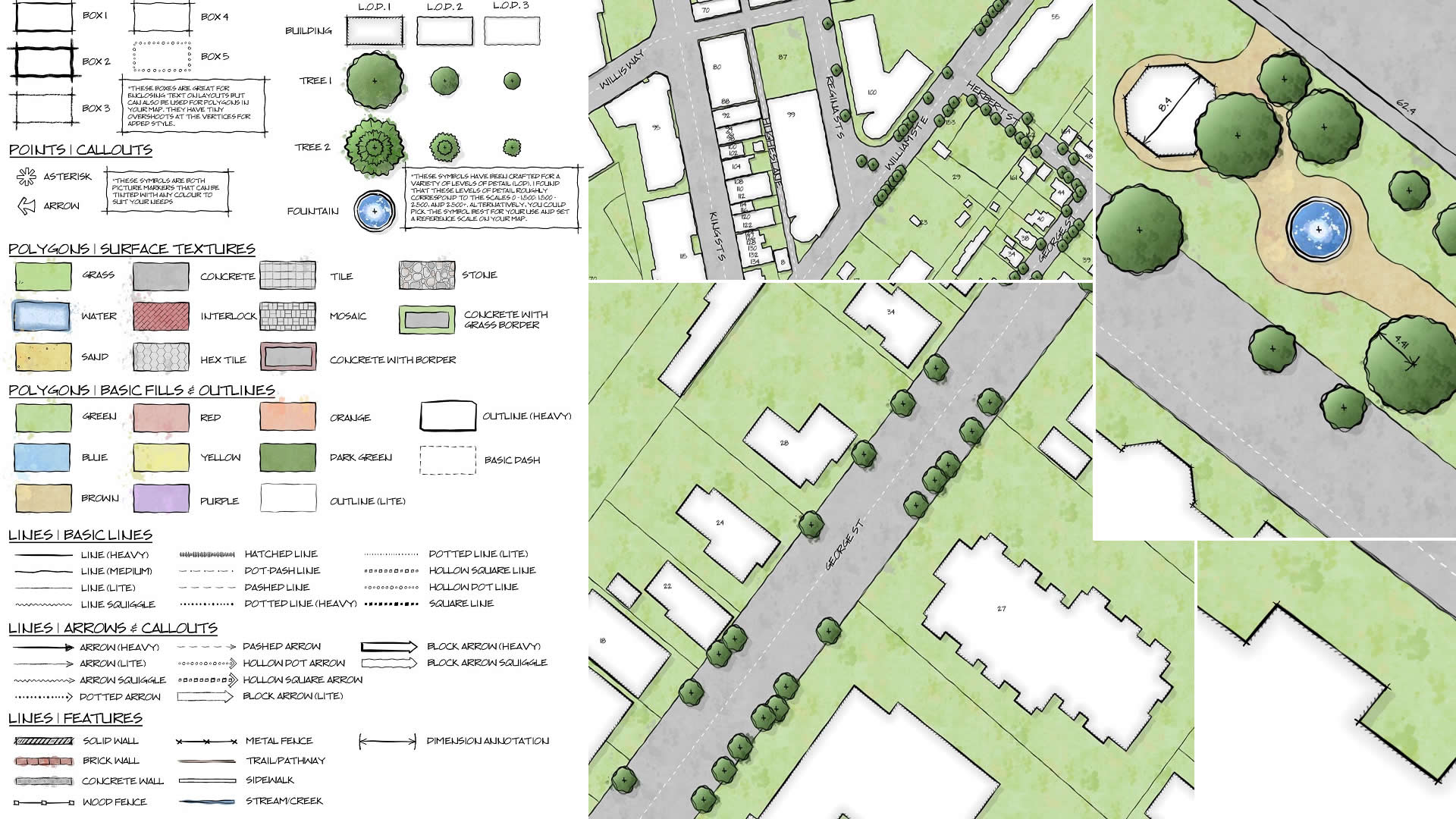
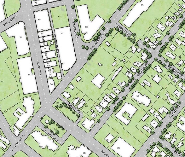
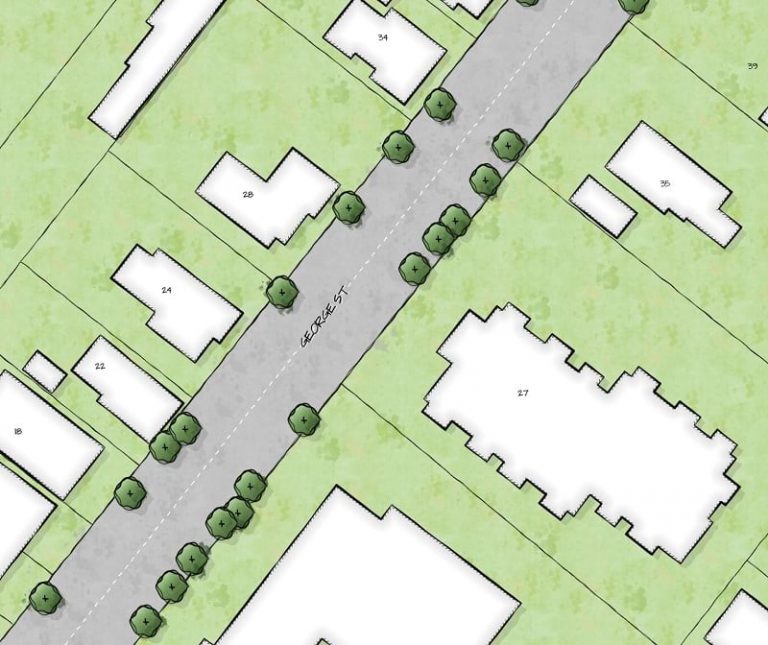
I am very excited to share the result, which I am constantly improving and adding to. You can download and install Draft Sketch. It consists of a collection of symbols that can be used to render your GIS data with the facade of a bespoke architectural drawing or landscaping sketch. Let’s take a closer look.
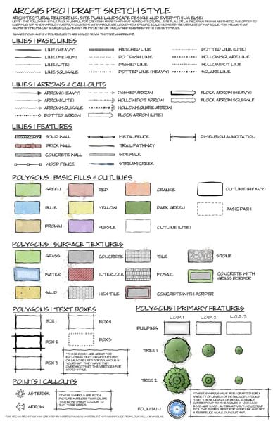
These symbols (click on the image above for a closer look) have been meticulously crafted using a mouse to give your spatial data some of the unique visual qualities of hand-drawn plans, right in ArcGIS:
– Line weight variation and “wobble”
– Inky watercolor splotches
– Paint bleed
– Subtle sketched overshoots at vertices
Draft Sketch provides symbols for features at various scales, so you can apply the right sort of symbology based on the extent of your map. If you have suggestions for future symbols, please leave a comment on the item in ArcGIS Online.
When used in conjunction with scale dependencies, you can tailor the symbology level of detail to your specific map scale.
Now the symbology becomes the most detailed.
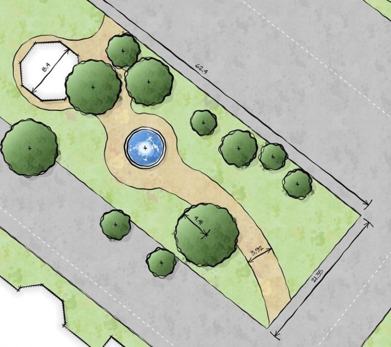
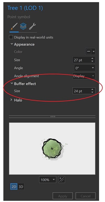
The style includes must-haves like a fountain polygon and tree point or polygon symbols at various sizes. Some symbols use a buffer effect, so you have full control over its dimensions.
If you are interested in adding, modifying, or crafting this style for your own purposes, dig into the graphical assets that I used for all the Draft Sketch symbols. (These graphical assets happen to be the same ones I used to build an earlier style, Field Notes, which I also encourage you to check out). If the culinary world can deconstruct dishes, I think you should be able to deconstruct your cartography. In fact, I encourage it!
These symbols are just the beginning, and this style is by no means complete, so I’d love to hear some feedback via the style’s comments section in ArcGIS Online. If there’s something you’d love to see in a future iteration of this style, submit it to the comments section and I’ll do my best to incorporate it!
In the meantime, I hope you enjoy this style and start inviting looks of envy from the planners and drafters in your organization!