In the last 50 years, the Earth’s biodiversity has declined at an alarming rate, driven by factors such as environmental changes, pollution, and invasive species. According to the World Wildlife Fund’s 2024 Living Planet Report, populations of more than 5,000 species fell an average of 73 percent from 1970 to 2020.
Human development, including deep-sea mining infrastructure and offshore wind farms, has impacted water bodies and their critical ecosystems around the world. The Mediterranean Sea, in particular, faces challenges such as increasingly frequent and intense marine heat waves. While governments and organizations in this region have been working to protect critical species in the Mediterranean Sea, research has been scattered, and it is often difficult to determine how antipollution and species protection measures are faring.
That’s why a group of independent scientists are using GIS to assess and evaluate research initiatives throughout the Mediterranean Sea and share results to increase awareness as well as promote conservation efforts and policy.
The Barcelona Convention
To help prevent and offset pollution in this marine environment, a group of 22 countries, United Nations agencies, and environmental organizations and research groups established the Convention for the Protection of the Mediterranean Sea against Pollution, known as the Barcelona Convention. Created in the 1970s, the Barcelona Convention’s main goal is to prevent and reduce pollution from various sources and protect the Mediterranean Sea’s marine environment and resources.
In the 1990s, Barcelona Convention participants updated the agreement to include a directive known as Annex II to conserve endangered and threatened species and ensure their protection and recovery. A group of independent marine scientists recently used ArcGIS Pro to evaluate Mediterranean marine research as it relates to Annex II and map the locations of invertebrate species, focusing on 52 critical species, to raise awareness of biodiversity challenges in the area.

The Mediterranean Sea and Annex II
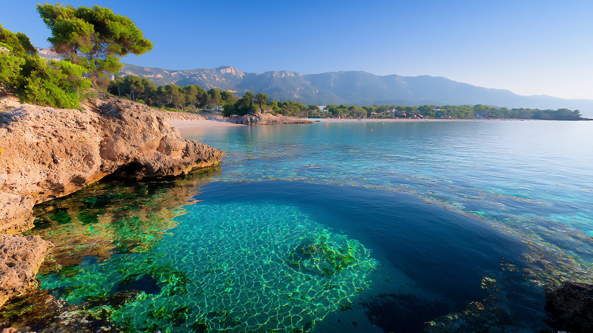
Linking Europe with the Middle East and Africa, the Mediterranean Sea affects culture, trade, local and regional economies, and more. This great inland sea is also home to a diverse assortment of marine life, including many species that are unique to this part of the world, such as Mediterranean monk seals, or species whose existence is threatened, like the hawksbill turtle.
The Annex II amendment included a list of marine species that need protection. These include vertebrate and invertebrate species such as the greater flamingo, the sperm whale, and Neptune grass. Most of the species on the Annex II list live in water depths of less than 200 meters (about 656 feet), which helps explain why so many studies take place in coastal areas.

This conservation directive presented several challenges. Protecting many species across a wide area requires extensive, geographically distributed research and planning, often with limited existing information. With data that covers the full Mediterranean basin, marine scientists can design more effective spatial management plans, anticipate environmental change impacts, and support coordinated conservation for genetic connectivity and population viability.
Turning Data into Insight with ArcGIS Pro
To begin the review of Mediterranean marine research as it relates to Annex II, the group of marine scientists first compiled a geodatabase with species location data from almost 1,300 scientific reports, with topics ranging from population assessments to habitat threats. Then they used the Kernel Density tool from the ArcGIS Pro Spatial Analyst toolbox to generate a raster surface representing the concentration of occurrence points. Following this, they applied the ArcGIS Pro Contour List tool to create contour lines corresponding to specific density thresholds. This approach allowed the scientists to create species location maps and species distribution maps for many listed aquatic invertebrates.
Maps show areas where particular species are most abundant and marine biodiversity is highest—as well as how closely marine protected areas (MPAs) align with where particular species live. The maps also show research gaps, such as species or geographic locations with little or no related research.
To make their findings dynamic and engaging to a wide audience, the marine biologists also created animated maps to show species distribution, or how these organisms are spatially arranged, across the Mediterranean Sea. This helps raise awareness of biodiversity challenges, including overfishing, seafloor-bottom trawling, strong currents, wave action, parasites, rising temperatures, pollution, and coastal development.
Improving Conservation with GIS Technology
Recent policies and agreements such as the European Union’s biodiversity strategy for 2030 and the Kunming-Montreal Global Biodiversity Framework have provided a road map for Mediterranean marine conservation by outlining shared strategies and commitments for nearly 200 countries. To be effective, these efforts must be guided by research and supported by GIS technology.
The research gathered during this project provides valuable insight into what strategic steps can be taken to protect these endangered species in the future. For example, a new network of MPAs has been established in Greece as a result of this research, as well as prior studies and collaborative efforts. The maps and analyses produced during this initiative help serve as essential tools to guide future actions and facilitate the development of effective and evidence-based solutions.
Conservationists can use ArcGIS Pro to assess environmental conditions and their connection to biodiversity, enhancing understanding of the threats endangered species face and supporting effective conservation laws and policies. By showing the need for knowledge in underresearched locations and identifying environmental threats, comprehensive scientific reporting can lead to more effective conservation management planning.