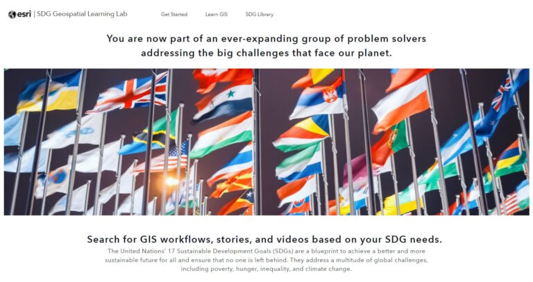
Esri has released the SDG Geospatial Learning Lab, a freely available ArcGIS Hub site dedicated to helping people address the United Nations’ Sustainable Development Goals (SDGs).
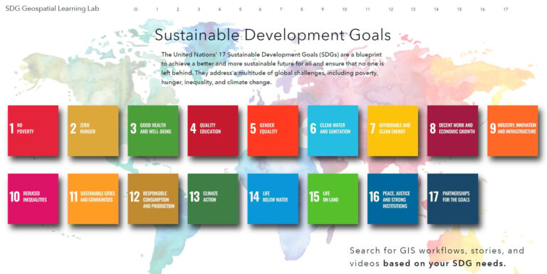
Established in 2015, the SDGs seek to promote global prosperity by meeting the basic needs of citizens and their communities by 2030. There are 17 SDGs that include eradicating poverty, establishing transparent governments, conserving natural environments, and more.
While there are many methods of achieving these SDGs, one excels beyond the rest—the geographic approach. Through the lens of geography and map-centric analytics, grasping the extent of global challenges and offering solutions at the local and international scales becomes simpler and more direct.
However, constantly evolving GIS technology can make it challenging for both new and experienced users to keep up with what is possible and what other organizations are doing in the SDG space. Regardless of technical geographic knowledge or scale, the SDG Geospatial Learning Lab has something for any GIS practitioner dedicated to tackling SDGs around the world.
Those new to ArcGIS and looking to unleash its potential can navigate to the “Get Started” tab to embark on the new user journey. Users need a Creator ArcGIS Online account and access to ArcGIS Pro to get started, but will learn the fundamentals of GIS and how it transforms SDG-related projects by conducting exercises in field data collection, mapping, app creation, analysis, and sharing results. More experienced users can browse the SDG Library, a curated set of tutorials, videos, and articles categorized by the 17 SDGs.
The New User Journey
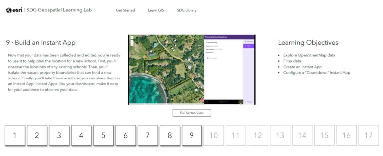
To assist those new to GIS, the new user journey guides users through a comprehensive, step-by-step video tutorial series. These 16 videos, containing three and a half hours of content, explore how GIS is used to inform decisions that support meeting SDGs through the example of an SDG analyst who needs to map and understand the population of a village on a small Caribbean island.
By following these videos’ workflows, a new user creates a head of household field survey using ArcGIS Survey123 to learn the basics of digital GIS data collection. This field data is placed on a web map and visualized in a dashboard created with ArcGIS Dashboards to better understand demographic and education information gathered in the field. Then, property boundaries are collected with ArcGIS Field Maps. These parcels help determine potential sites for a new school. These proposed sites are shared using an interactive web application created with ArcGIS Instant Apps. Additional analyses are performed with ArcGIS Pro to determine which roads are susceptible to landslides and to identify areas with poor cellular connectivity. Finally, the analytic results are shared as a report created with ArcGIS StoryMaps; this app represents how data and findings can be shared effectively across an entire organization.
Through these exercises, those undertaking this journey will learn the fundamentals of web and desktop GIS from scratch—no previous GIS knowledge necessary.
The SDG Library
For users who have already mastered GIS basics or just completed the new user journey, the SDG Library offers over 90 self-guided tutorials teaching new geospatial skills and contains over 200 user stories that demonstrate how other organizations have applied the geographic approach to the SDGs and achieved success. The library is divided into sections based on the 17 SDGs. Simply navigate to a goal of interest and explore.
The step-by-step written tutorials found within each SDG contain workflows based on real-world scenarios, such as determining the best location for a new hospital, assessing the extent of forest fire damage from satellite imagery, and estimating solar power potential in a residential neighborhood. These scenarios and the explanations provided with each step make it easier for users to not only use ArcGIS tools, but also understand how those tools work and how to apply them to their organization’s new or existing sustainable workflows.
To encourage a collaborative style of education, the SDG Library also includes curated user stories, blogs, and videos demonstrating how other organizations have applied GIS to their SDG-related work.
Seeing what organizations or communities, large or small, have accomplished with ArcGIS catalyzes and energizes other organizations to follow them in working toward SDGs. The SDG Library contains stories about Rwanda overhauling its land administration system using ArcGIS to give rural communities a voice in government; students in India mapping clean water access to prevent all too common illnesses; and people rallying together to map the devastating impacts of an oil spill on beaches. This library offers more than learning resources; it offers narratives to invigorate those seeking meet the expectations of the United Nations’ SDGs.
The SDG Library is also kept up-to-date to meet the challenges of a rapidly changing world. As new SDG-related articles and resources are released, fresh content will be added to this catalog. Any tutorials found here will also be updated, ensuring that the latest technology is applied to the SDGs.
There has never been a better time to dive deeper into ArcGIS and explore how mapping technology can transform new and existing SDG workflows. The SDG Geospatial Learning Lab offers a wealth of GIS knowledge for all users, from the new and curious to veteran analysts. But this site is not just for the individual seeking to expand their own GIS skillset. This page is for entire teams and organizations. Sharing these resources empowers others to adopt GIS for their unique SDG efforts. When everyone maps, everyone wins: organizations, those they serve, and the environment they want to save.