Mapping and Visualizing Data in ArcGIS
In this instructor-led course, learn design techniques and ArcGIS workflows to create and share professional-quality information products.
In this instructor-led course, learn design techniques and ArcGIS workflows to create and share professional-quality information products.
Discover how to use Scene Viewer Analysis tools to enhance 3D data.
Learn to deliver informative, eye-catching cartographic representations in 3D with this new title from Esri Press.
Opening April 3, Esri’s no-cost course explores the cartographer’s craft using the latest ArcGIS Pro 2D and 3D map design tools.
In this course, learn about the types of data that are used to model the world in 3D scenes, including functional surfaces and 3D feature types.
When working in 3D, you need to define a point or ‘camera’ in the 3D space from where you want people to view the scene. Learn how to do this.
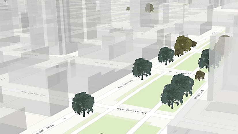
In this Learn ArcGIS lesson, you will learn to turn 2D tree data into 3D scenes of trees using Scene Viewer in ArcGIS Online.
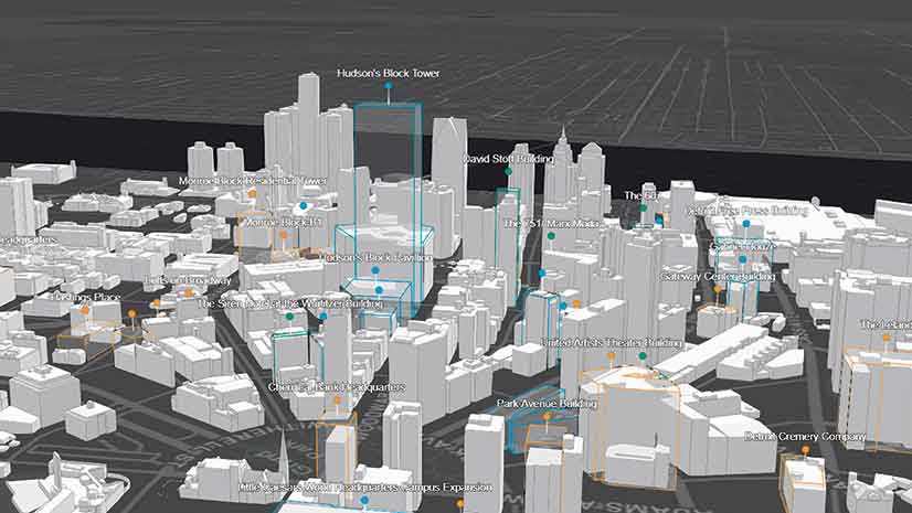
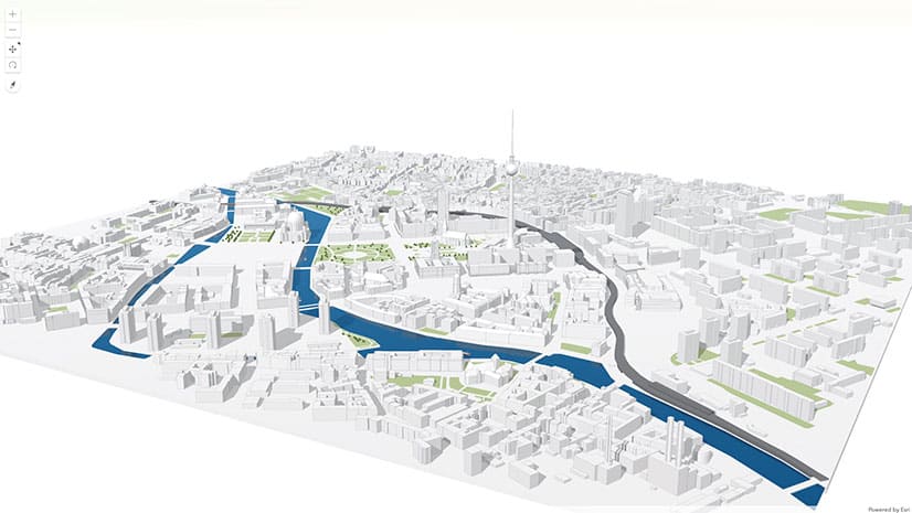
Changes to ArcGIS API for JavaScript means that you can now use 2D data to create a 3D view of your cities.
Conservation photographer Carlton Ward Jr., says geodesign and storytelling will play a critical role in conserving land for Florida wildlife.
Spatial statistics expert Noel Cressie will give the keynote address at the 2015 Geodesign Summit...
Get tips on how to make a winning Esri Story Map app from the experts: The winners of the 2014 Esri Storytelling with Maps Contest.
Planetary geologist Paul R. Byrne explains how mapping plays a pivotal role in unlocking the secrets of Mercury.