Over the past 25 years, the annual Esri Electric and Gas GIS Conference (EGGC) has become the largest annual geospatial event for utility professionals in the world. This year’s conference focuses on how utilities can employ the latest GIS technology to break barriers—from business and technical barriers, to communications and information barriers. And while attendees explore products and services with familiar faces on the expo floor, they’re also discovering a lineup of emerging businesses.
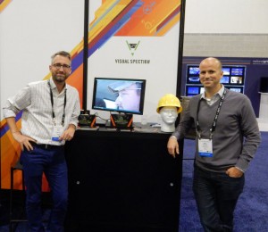
The Esri Startup Zone at EGGC features six Esri Startup Program members that introduce innovative GIS solutions to electric and gas utility challenges.
“Esri is committed to the startup community,” said Kurt Daradics, Esri’s Startup Program Director. “As a company that was once a startup, Esri understands the challenges that emerging businesses face to quickly bring products to market and developing customers. Startups do more than influence mainstream culture, they fundamentally change the way organizations operate. Esri utility startups are delivering powerful solutions with intuitive interfaces that extend the value of the ArcGIS platform.”
LIVE FROM THE FLOOR
DataCapable Inc.
For DataCapable, Inc, “Esri’s Startup program is all about collaboration” said Peter DiSalvo, DataCapable’s Co-Founder and CTO. “The modern utility needs to actively monitor and engage their customers at all levels. Being part of EGGC is an opportunity for us to announce our integration with ArcGIS Online and enable existing Esri utility customers to maximize the value of their current GIS investments.”

VisualSpection
VisualSpection developed the most efficient inspection solution through smart glasses for the utility sector. Not only is intelligent information through augmented reality brought to the field but all data collection activities such as field notes, photos, and videos from a first person perspective are GPS tagged and automatically integrated into existing Esri solutions.

Dispatchr
Dispatchr provides the world’s first and most sophisticated predictive workforce management system to proactively increase the resiliency of the grid. The system is deployed across North America in the largest utility grids. To learn more, visit www.dispatchr.com.
Remote GeoSystems, Inc.
Remote Geo provides Geospatial Video Recording Systems and Integrated GIS Software for Utilities, Oil & Gas and other Critical Infrastructure Inspection applications. Helicopter, UAV, fixed-wing, terrestrial vehicles and pedestrian – no matter your data collection platform or environment, it’s now easier than ever to capture, analyze and collaborate with informative high-definition geospatial Full Motion Video, photos and other documents. “By partnering with Esri, Remote Geo has been able to rapidly bring to market five new Esri-based solutions in less than 9 months, giving utility and pipeline operators and vendors unprecedented capabilities for capturing and integrating Geospatial Full Motion Video with existing enterprise GIS” says Managing Director Jeff Dahlke.
Paleon Solutions
Paleon Solutions was created to provide our customers with a common sense, cost-effective approach to solving complex utility business problems. Our product offerings are focused on providing utility customers with the necessary tools to test and manage their Smart Grid infrastructure.
InspecTools
InspecTools develops and deploys utility asset risk mitigation systems, using remote sensing, aerial systems, cloud-based and mobile software. Industry-leading solutions for Transmission & Distribution, wind and solar energy production.
About the Esri Startup Program
The Esri Startup Program is a free three-year program that gives emerging businesses the tools to build mapping and location analytics capabilities into their products. Qualifying startups receive cloud services, software, training and support, content, and other opportunities to help them succeed.
insider