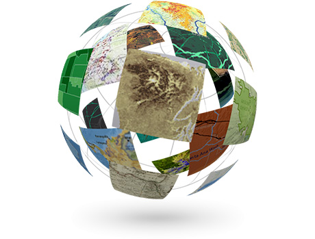
Esri is now curating an enormous and rapidly growing library of ready-to-use maps, imagery, and geo-referenced data for the entire world. This online collection of authoritative content, together with the new Web GIS pattern, is having a huge impact on the way people use GIS.
GIS has a long history of successfully adapting to new technologies, applications, customer types, and business models. From mainframes to minicomputers, UNIX workstations to PCs, desktops to the enterprise to the cloud, each round of technical innovation has led to countless advantages for users of the technology. Every one of these changes has extended the reach of GIS by making it more accessible and usable by more people and for more applications.
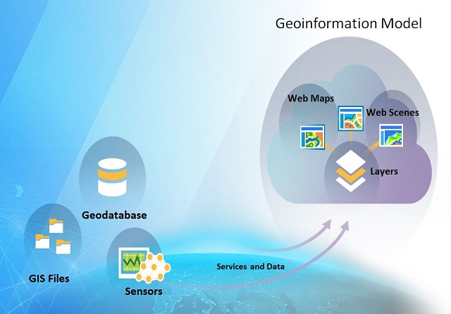
Web GIS and the Geo Information Model
Over the past several years Esri has been extending the ArcGIS information model to enable Web GIS. This technology lets users simplify the management and access of all types of geospatial content. This is done by abstracting these data into three new information types: web layers, web maps, and web scenes. The result is that GIS is not only dramatically simplified, but geographic information products (maps, 3d visualization, etc.) can be easily integrated and used in any app on any device.
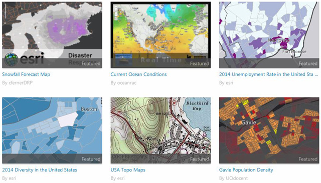
ArcGIS Online and Massive Global Content
ArcGIS Online is Esri’s cloud-based GIS solution. It provides users with everything they need to create interactive web maps and apps that can be shared with anyone. And it’s rapidly becoming the first place that GIS users should look for content.
ArcGIS Online lets you browse the world’s most extensive online geographic resource and discover maps and data about thousands of topics. You can combine the content any way you want, view it on a map, and use it for you own explorations and analyses.
Content that just a decade or two ago would have literally cost hundreds of millions of dollars, or simply didn’t even exist, is today freely available to GIS users through ArcGIS Online.
Community Maps
While Esri has organized and curates a very large volume of authoritative content, a significant part of the online content is made available by members of the GIS community themselves, who are sharing thousands of data sets and web maps daily.
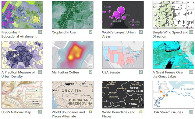
The Living Atlas of the World
The Living Atlas of the World is a collection of thousands of maps, intelligent map layers, imagery, tools, and apps built by ArcGIS users worldwide and by Esri and its partners. This rich catalog of geographic information is made available through ArcGIS Online, and reflects the collective power and reach of the entire ArcGIS community.
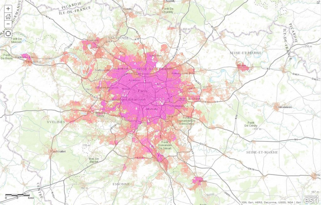
The Most Detailed Population Map in the World
Advances in technology are changing the type, quantity, quality, and timeliness of information available. The ideal human geography database would include uniform social and demographic information about all human populations on the globe. It would include population, household, housing unit, business, and economic information that would allow determination of societal characteristics at any scale from macro to micro. Esri has met this challenge by compiling a human geography database of demographics and statistics about all countries in the world and mapping this data using a new, innovative methodology.
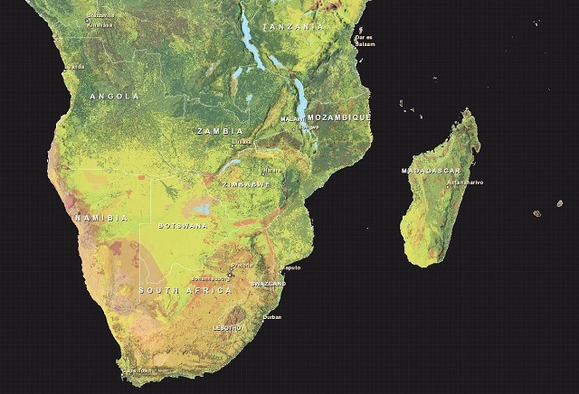
The First Detailed Map of Global Ecological Land Units
The US Geological Survey (USGS) and Esri recently announced the publication of the most detailed global ecological land units (ELUs) map in the world. This exciting new global content provides a science platform for better understanding and accounting of the world’s resources. Scientists, land managers, conservationists, developers, and the public will use this map to improve regional, national, and global resource management, planning, and decision making.
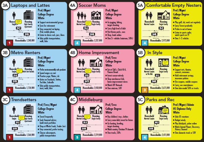
US Demographic and Lifestyle Data
Available at multiple geographies in maps, reports, online, and in software, Esri Demographics contains variables such as age, income, race, ethnicity, and much more. Whether you’re in economic development, health care, retail, or real estate, this data adds greater insight to your maps and more context to your analysis. Esri Demographics helps you understand the unique characteristics of a population based on a specific location. This data is accessible through ArcGIS Online as maps, reports, and data that you can use to enrich your maps and data.
Landsat Services
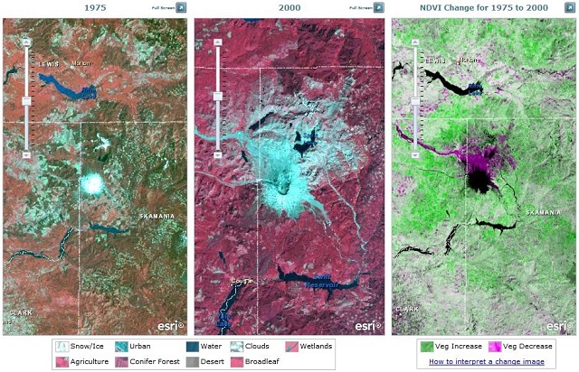
In 2008, the secretary of the US Department of the Interior (DOI), Dirk Kempthorne, announced that as part of a larger US government initiative to make its data more available, all Landsat scenes in its archives would be available for free. This includes the Landsat Global Land Survey (GLS) datasets, which provide the best worldwide imagery data for how our earth is changing.
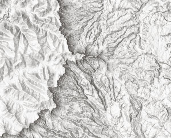
Enhanced SRTM Elevation Data
In February of 2000, the Space Shuttle Endeavour flew an 11-day mission called the Shuttle Radar Topography Mission (SRTM). With a specially modified radar system onboard, the mission obtained 30 meter elevation data on a near-global scale to generate the most complete high-resolution digital topographic database of Earth.
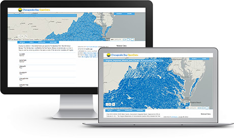
ArcGIS Open Data
In 2013 we announced ArcGIS Open Data as a free application for organizations using ArcGIS to publish their open data to the web. Our vision is to enable any organization to quickly and easily share data by using their existing data management infrastructure. This means organizations can focus on open data strategy, policy, and adoption rather than technical and operational concerns.
Unlocking a World of Content
GIS is a powerful tool that lets you visualize, question, analyze, and interpret data to understand relationships, patterns, and trends. Just as the world around us is constantly changing, GIS is constantly evolving to meet new challenges and leverage new opportunities. The latest step in this continuing evolution—the widespread availability of content, and the ability to share content with the world—is already having a huge impact on the way people use GIS.
insider
