displaying 5897 results
From voxel layers to trace networks and from graphic layers to link analysis, see what’s new in ArcGIS Pro 2.6.
Jim Aranguren, Butte County, California, GIS manager, details the biggest challenges his small GIS department confronted during the Camp Fire.
An animated map shows where the sweet potatoes; green beans; potatoes; pumpkins; and turkey that Americans eat on Thanksgiving are grown.
Join Stefan Arisona from the Zurich R & D Center for a fascinating introduction to building game engine experiences with ArcGIS CityEngine.
A map created using ArcGIS Pro, Cinema 4D, and other technologies shows an animation of the ten largest wildfires recorded over the last century.
The City of Escondido, California, used ArcGIS Hub to recruit volunteers to prepare a trail for a 50-kilometer run in Daley Ranch.
Learn how government organizations use ArcGIS Hub to share information about coronavirus disease 2019 (COVID-19) with communities.
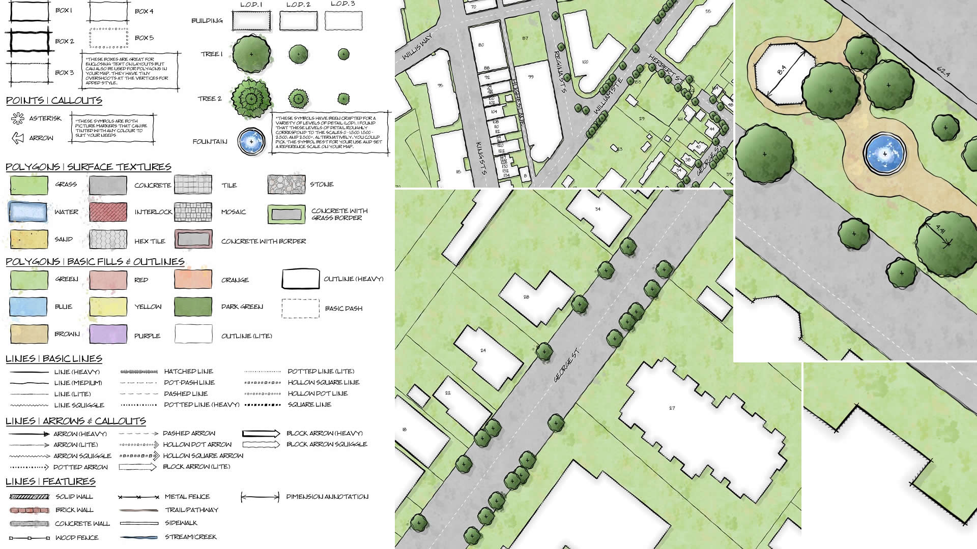
GIS analyst Warren Davison of Ontario, Canada, created Draft Sketch, a very artistic n ArcGIS Pro style for landscape design and site planning.
Cases of Lassa fever in Nigeria are being tracked using a dashboard created with ArcGIS Dashboards by Sambus Geospatial Nigeria Limited.
Learn to use the erase geoprocessing tool in ArcGIS Pro and data from ArcGIS Living Atlas of the World to make a map of your area of interest.
ArcGIS Pro now includes new data analysis capabilities, three new map projections, tools for making chart symbology, and more.
Tan Boon Khai, chief executive of the Singapore Land Authority, speaks about the democratization of geospatial information in the 21st century.