displaying 5939 results
The next Geodesign Summit in the United States is scheduled for January 29–30, 2014, in Redlands, California.
A tutorial clearly shows every step in the process of creating a project using ArcGIS Pro.
Orbital Insight's GO tool uses satellite imagery, artificial intelligence, geolocation data and ArcGIS Online basemaps to understand events.
If you want to learn how to outline a polygon with dots instead of dashes or add color to a black and white map, this story is for you.
Learn how spatial statistics in ArcGIS helps you answer questions confidently and make decisions that use more than simple visual analysis.
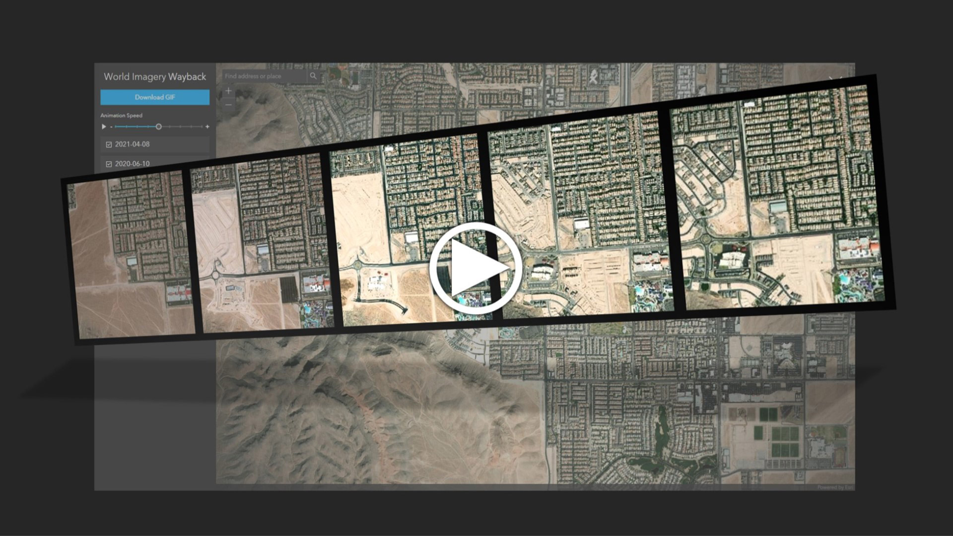
Learn to create and share animations of your images of interest using the World Imagery Wayback app.
This story visually explains the goals of the 30x30 movement to protect and preserve 30 percent of the Earth’s land and water by 2030.
Learn how your organization can use GIS technology in urban planning and to study trends such as the movement of more people from cities.
Using an ArcGIS StoryMaps app, you can learn more about the history and condition of bridges in the United States.
Explore architectural projects in virtual reality (VR) using ArcGIS 360 VR, edit terrain, and import scenarios into Unreal Engine.
This map shows which areas are a 10-minute walk or 10-minute drive from a grocery store in the United States and Puerto Rico.