ArcGIS Blog

Data Management

ArcGIS Enterprise

Take advantage of Living Atlas content in your ArcGIS Enterprise

By Julia Shi

While creating maps and conducting analysis in ArcGIS Enterprise, do you ever find yourself wishing you could enhance your work with great local or global content? Well now you can.

Starting at 10.5, ArcGIS Enterprise includes authoritative ready-to-use content from Living Atlas of the World. This content can help you create web maps and apps, and you can use it in analysis tools and Insights for ArcGIS.

A majority of Living Atlas content is available to consume at no additional cost. The remaining set of content consumes a nominal amount of ArcGIS Online credits.  The content you choose to enable is shared with any user in your ArcGIS Enterprise portal.

ArcGIS Enterprise includes two types of Living Atlas content:

  • Content that is hosted in ArcGIS Online
  • Content that you can download and host in your ArcGIS Enterprise portal

This post details how to enable and consume Living Atlas content from ArcGIS Online in your Enterprise portal. In my next post, I’ll talk about how to configure and use this content in the analysis tools. I’ll also describe how you can host your own Living Atlas content and perform analysis. Users without an internet connection or those seeking a greater performance benefit for analysis tools may choose to go this route.

Of the content available from ArcGIS Online, three levels are available in ArcGIS Enterprise:

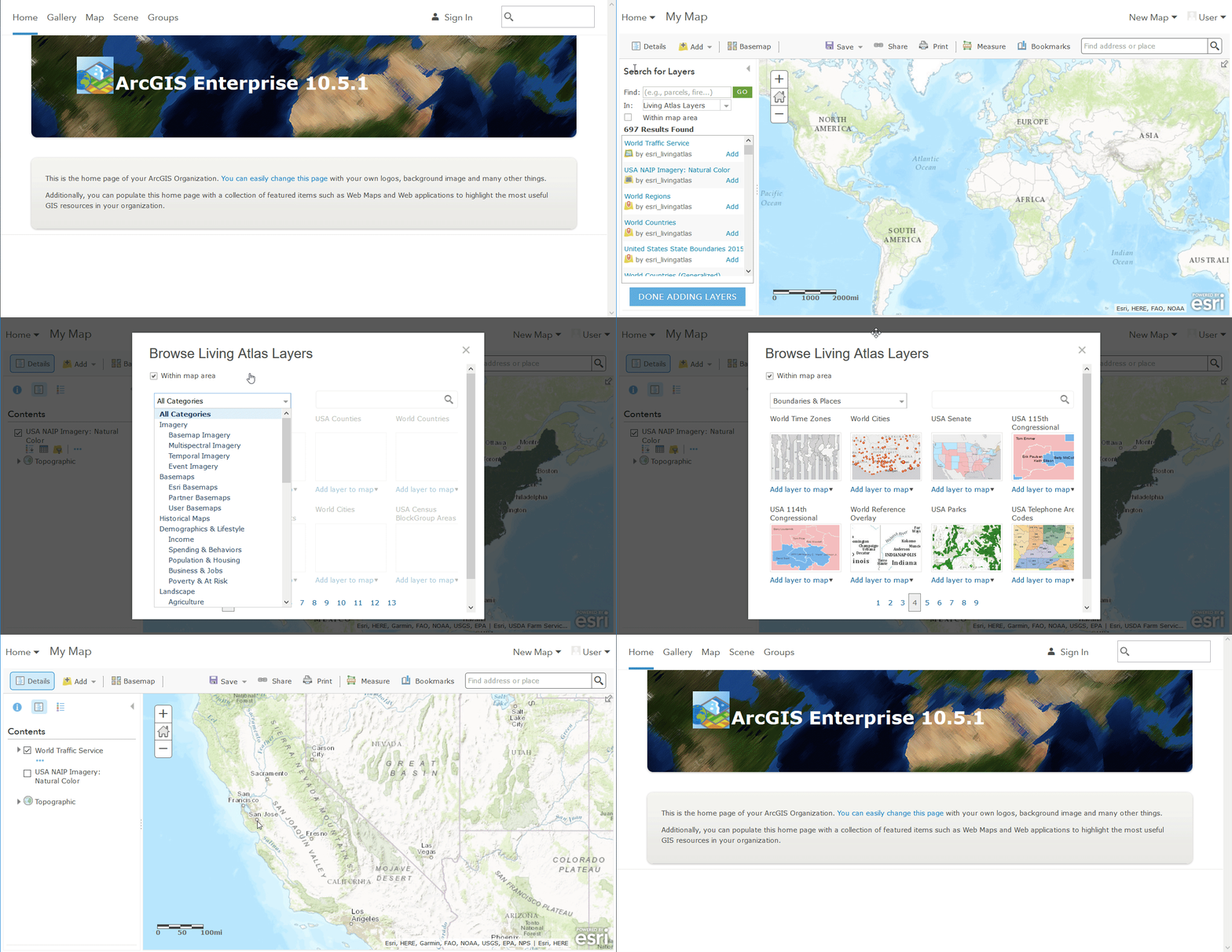
Default content is a collection of web maps, apps, scenes, and a sample set of layers published by Esri. It is available at no cost to all portal members by default.
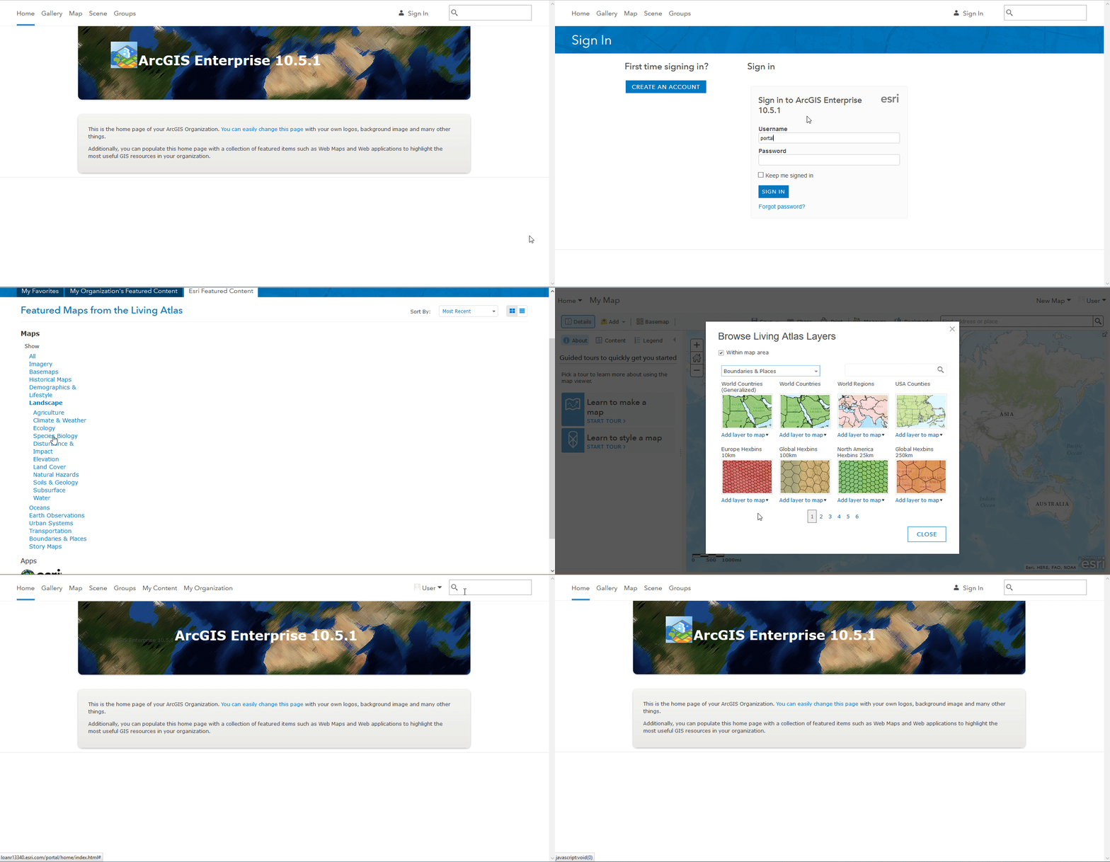
Browse or search default content in ArcGIS Enterprise

Subscriber content is a collection of layers published by Esri and requires an ArcGIS Online subscription account to access. These are layers such as NAIP imagery, boundaries, live traffic, and historical maps.  Your portal’s administrator must enable this content before users can consume it.  This content is available for use at no additional cost.
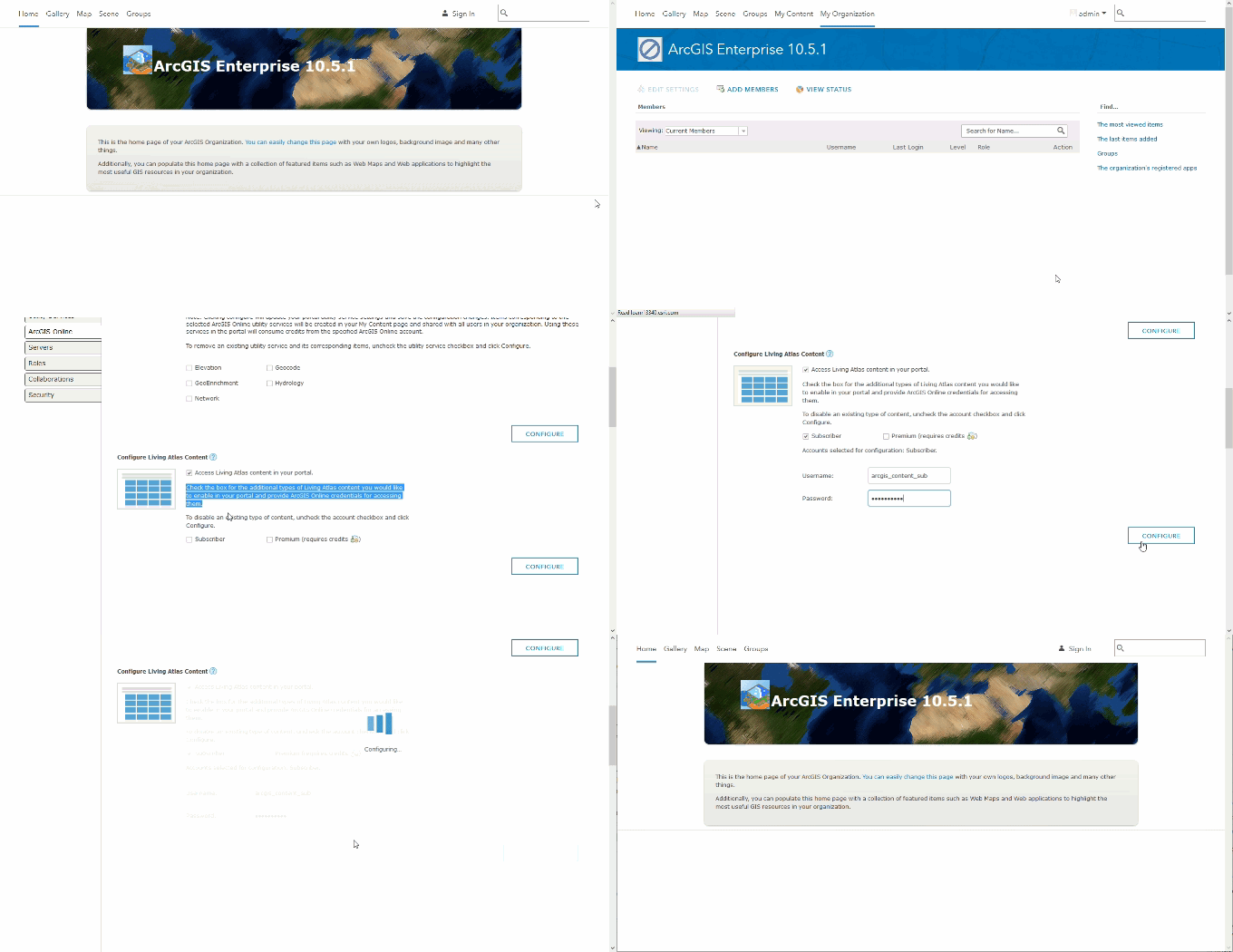
Enable subscriber content in ArcGIS Enterprise
After enabling subscriber content, browse or search the content in ArcGIS Enterprise

Premium content is a type of subscriber content. It’s a collection of layers published by Esri that requires an ArcGIS Online subscription account to access. These are layers such as demographic and lifestyle maps. Like subscriber content, it requires a portal administrator to enable the content before users can consume it. These layers consume a nominal amount of ArcGIS Online credits.
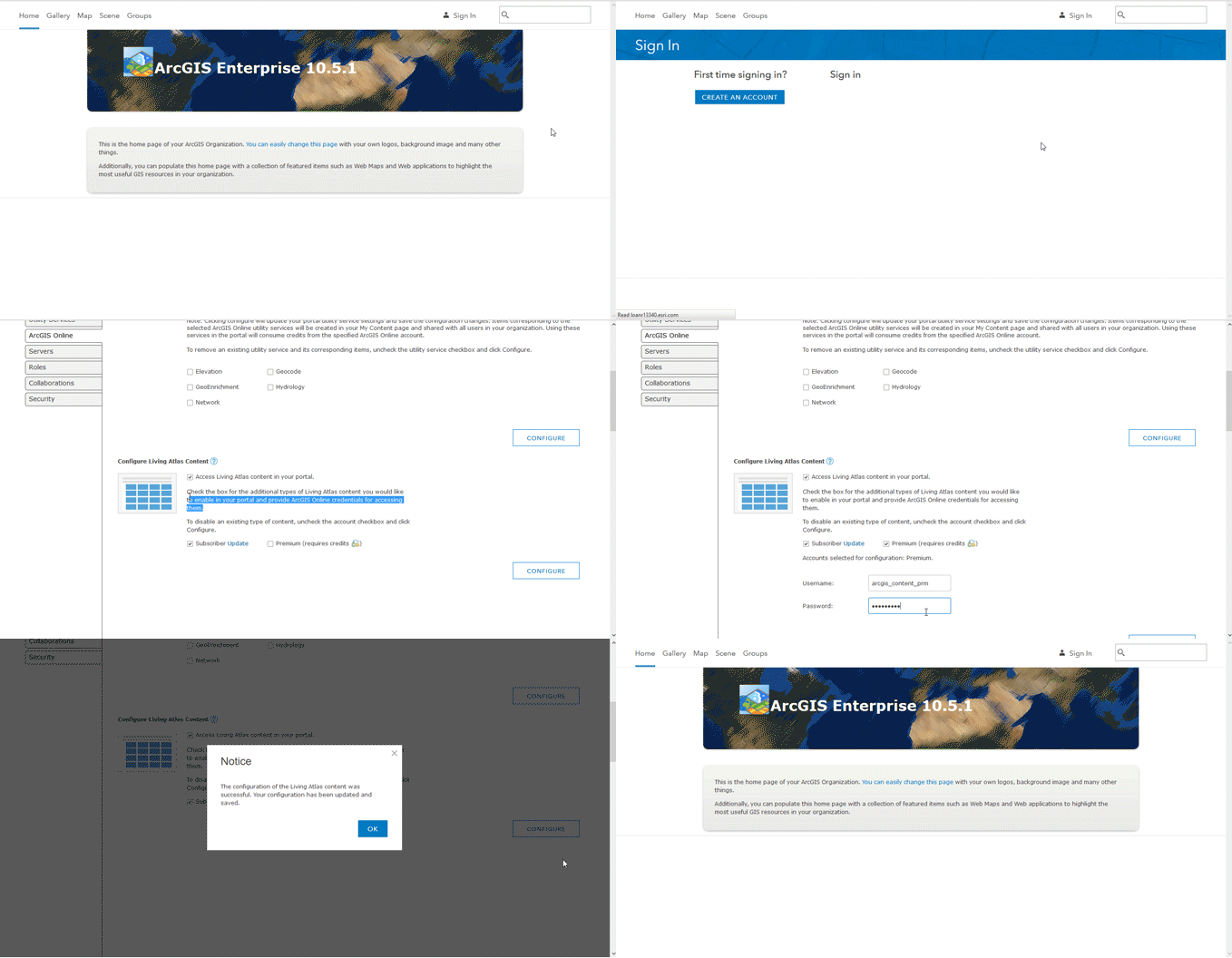
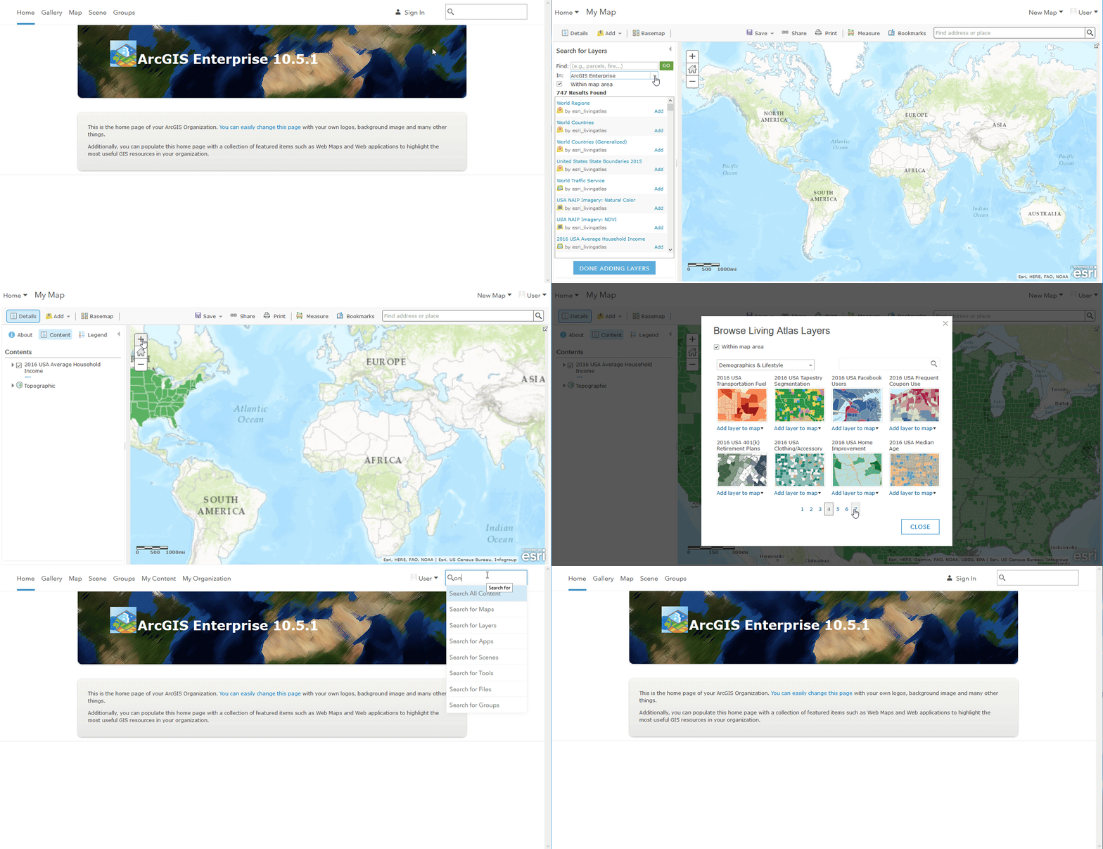
Enable premium content in ArcGIS Enterprise
After enabling premium content, browse or search the content in ArcGIS Enterprise

All content is updated frequently, in some cases every few minutes (e.g., live traffic and weather). The item details, however, are updated with each ArcGIS Enterprise release.

For those ArcGIS Enterprise users who don’t have internet and can’t access the content from ArcGIS Online, Living Atlas content can be easily disabled by their portal administrators.

Make this rich set of Living Atlas content accessible to the rest of your organization today!


Share this article

Subscribe
Notify of
0 Comments
Oldest
Newest
Inline Feedbacks
View all comments
Susan Carlson(@carlson1se)
March 26, 2020 10:35 am

This is great! How do I have these applications open directly to their own URLs and without the hub wrapper/banner? – Thanks

Susan Carlson(@carlson1se)
March 27, 2020 4:10 pm
Reply to  Susan Carlson

I added them as new items to AGO using friendly URLs. All good now.

Virginia Behm Chang(@virginia_sigtas-2)
April 22, 2022 11:33 am
Reply to  Susan Carlson

Hi, can you explain how do you do that?

Rebecca Lilja(@rlilja_usfs)
April 8, 2020 7:50 am

Hi! We tried to add a gallery of Storymaps (all created with the new story map builder) to our Hub Site and the “Explore” buttons will not launch the Storymap when we view the Hub page. Any tips or tricks?

Ariana Toth(@atothgwe)
July 2, 2020 1:04 pm

I really wish there was a way to make the gallery cards all be the same size. I’m displaying 6 cards on my site and two cards are much larger, like in the last image of your post. But the thumbnails I created are not meant to be displayed in those dimensions, so they get cut off and distorted.

Czapiga, Jason(@jason-czapigamaine-gov_maine)
July 22, 2020 12:56 pm
Reply to  Ariana Toth

I had the same issue. I was able to trick it by adding a blank text box element to the side of the cards and change the size of the text box until your thumbnails display properly…I found that this works well for many other sections as well to resize other elements.

Eddy Clark(@eddybaboy)
October 20, 2020 10:13 am

When a gallery has no content meeting display criteria, I’d like for the hub site to say so. Something like “No documents are available for review at this time.”

Pankaj Jamwal(@ago141866)
December 16, 2020 10:29 am

Hi,
I have created a survey using Collector for ArcGIS app. I was wondering how could I add/embed a link/path in ArcGIS Hub
so that our field staff can click that link which will take them directly to the Collector App.
Thanks

Virginia Behm Chang(@virginia_sigtas-2)
April 22, 2022 11:49 am

Just like Susan I want the aplications of the gallery open directly without the hub banner to the left side of the screen. How can I do that? Thanks

SMAS-Rio Adm.(@smds-adm)
May 2, 2022 8:03 pm

In the general settings of the Hub, in the “interactions” section, uncheck the “embedded apps” option. Hope this helps (sorry for the bad english – Google Translate).