Fresh start
There is something to be said about fresh starts and new beginnings. They offer us time for introspection and reflection while pursuing new goals. In this release, a goal for the ArcGIS AllSource team was to focus on creating a new start and imagery experience for our users. Upon opening the application, you are met with a new home page and solutions page. The home page focuses on getting to work by opening new projects, recent projects, and templates with reduced clutter. The solutions page is focused on implementing solutions that are installed with the application. Now, whether connected or disconnected, you can use solutions without leaving the application. Another goal for our team was to make observations with imagery feel more cohesive to our users with Observation Workbench. Lastly, help documentation has seen a robust update with the new ArcGIS Documentation Center application.
To learn more read What’s New in ArcGIS AllSource 1.6 help topic.
Check out around the application on the new start experience.
Home page
The Home page is where you’ll begin your work by opening new projects, templates, and recent projects you need to revisit. In the New section, you can open a new project based on a specific workflow you need to accomplish. Let’s open the application and take a look.
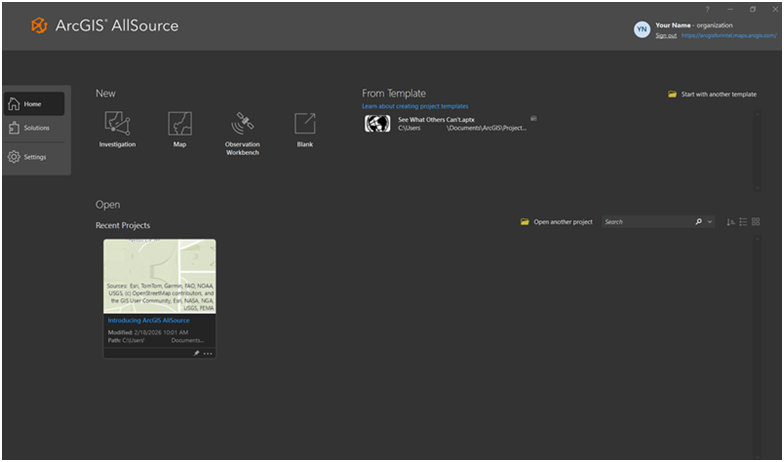
By allowing room to breathe on the Home page, it has never been easier to locate a desired template or recent project in their associated galleries.
Solutions page
Solutions are templated projects known as configurations that are focused on completing specific workflows. They use your data to improve operations across many industries. The ArcGIS Solutions page offers built-in solutions that allow you to begin a project right away.
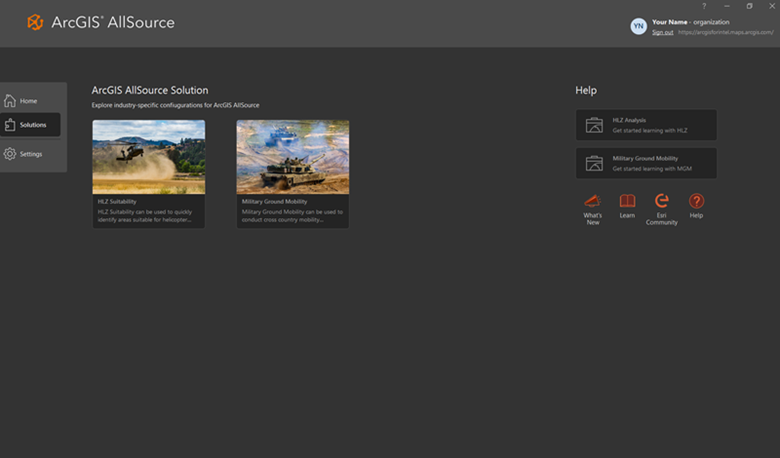
The two solutions currently installed with ArcGIS AllSource are Helicopter Landing Zone (HLZ) Suitability and Military Ground Mobility.
Observation Workbench
“Hearing a hundred times is not as good as seeing once”, a proverb from The Book of Han Volume 69. An idea that shows the importance of visualizing an issue over simple reporting. With the Observation Workbench option, we can investigate our imagery and begin to find out whether it’s true. By creating an observation workbench, a user can capture observations from orthorectified imagery. There are two ways to create an observation.
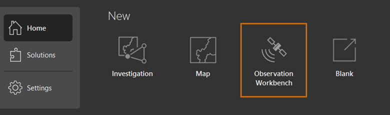
In the New section of the Home page, you can start a new project focused on your observation collection workflow. The Create Observation Workbench tool prompts you for your imagery, elevation, and observation feature class inputs. Orthorectification automatically applies to your imagery if elevation is included. Then the workbench opens as a map, ready for your collection.

Using the Imagery tab of an existing project, you can create a workbench within that project, allowing multiple workbenches to exist within the same project.
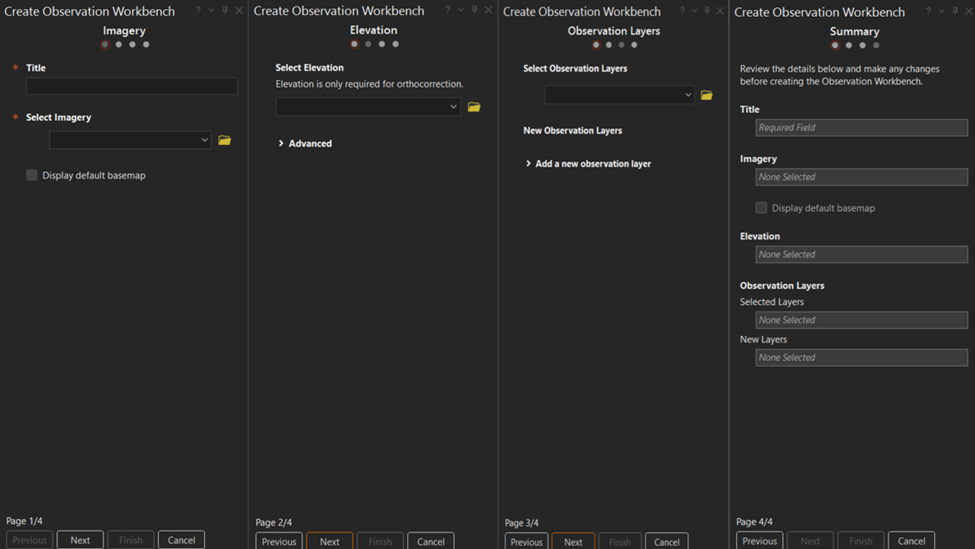
When the tool is run, the orthorectified image layers appear in a map along with the elevation and any existing or new feature class layers you chose to create. Ensure you check Display default map if you require a basemap.
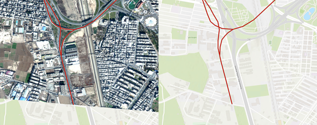
For best orthorectification results, ensure you have high quality elevation data to use with your imagery. Observations collected from uncorrected imagery may shift from their true geographic location, especially in areas with high relief in the terrain. Imaged without associated elevation display but are not orthorectified.
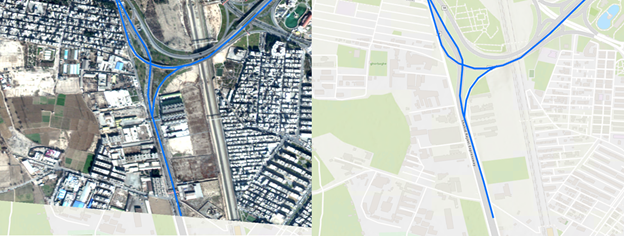
Using elevation data, the image will lie over the basemap with more accuracy, showing the shift is greatly reduced. Results will vary between images, terrain, and quality of the elevation dataset.
Imagery provided courtesy of Digital Globe.
ArcGIS Documentation Center
In this release, help documentation has seen a significant change. Instead of a separate installed help per application, there is a new application known as the ArcGIS Documentation Center. It is a unified application across Esri software to open and view installed help like a web browser.
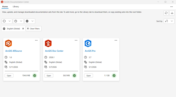
The documentation sets can be extended by importing additional document sets or by clicking the Library tab and downloading the help of additional applications.
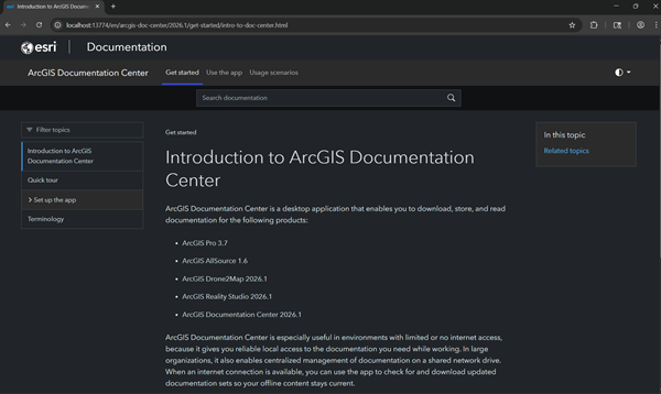
ArcGIS AllSource 1.6 includes new features from ArcGIS Pro 3.7 as well as the product-specific updates mentioned above. You can learn more about the new features in ArcGIS Pro in What’s new in ArcGIS Pro 3.7

Article Discussion: