The ArcGIS API for Python released version 2.4.2 on October 13, 2025. This was primarily a maintenance-focused release, but there are a few important updates to be aware of. You can also read the full release notes here, which includes a detailed list of bug fixes and deprecation announcements.
Python 3.13 support
In this release of the Python API, we have upgraded Python from version 3.11 to 3.13. Version 3.13 is a major release for the Python community, and includes important performance improvements, memory optimizations, and an enhanced developer experience. Read more about all the good things in Python 3.13.
GIS Administration
New administration endpoints
To simplify administrative tasks for ArcGIS Enterprise and ArcGIS Enterprise on Kubernetes deployments, we have added new functionality and upgrades to existing functionality in the arcgis.gis module and arcgis.gis.admin submodule.
The new AboutManager class provides usage and licensing information for the components in your ArcGIS Enterprise deployment. The “about” resource compiles information such as hardware details (CPU, RAM, disk usage, etc.) and licenses for each component that makes up an ArcGIS Enterprise deployment, including all servers federated with the deployment.

Newly added classes such as HealthCheckManager, SuitesManager and ReportManager empower users to evaluate the health of the organization in their Kubernetes deployments.
A vital upgrade was added to the ServerManager.validate() method. By setting the value of the new verbose property to True, administrators can inspect the state of their federated servers to get detailed information and messages, to help diagnose issues if any. Here is an example of the information returned for one of the federated servers.

Content Management
Notebook user workspace directory functions
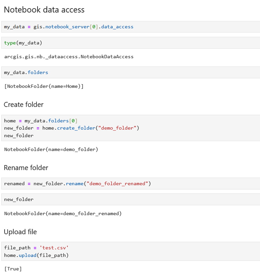
Previously, the NotebookDataAccess and NotebookFile classes—used to manage files in notebooks—supported only notebooks in the Notebook Server for ArcGIS Enterprise implementation. These classes have been updated to now also support notebook workspaces in ArcGIS Online and ArcGIS Enterprise on Kubernetes. A new class NotebookFolder allows users to manage their folders and subfolders in the notebook workspace directory. This provides users with expanded functionality to create, rename, and delete files and folders within their notebook workspace directory as well as the added capability for administrators to programmatically reassign contents of a workspace to another user within the organization.

Mapping / Visualization
Basemap tile service
To streamline Basemap styling, we have two new classes BasemapStyle and BasemapStylesService, which provide a vast number of basemap styles, styling options, server capabilities, and the best map visualization at all zoom levels. The data is provided as vector tiles and/or map tiles depending on the style used, including full support for satellite imagery and displaying custom styles.
Data Science / arcgis.learn
A new model Hyperspectral3DRCNet has been added to perform hyperspectral image classification. This is particularly useful for remote sensing applications, such as land cover mapping, crop type identification, and environmental monitoring. The model handles high-dimensional hyperspectral data efficiently and preserves fine spectral details critical for accurate discrimination of landscape features.
Additionally, support for new remote sensing backbones (Clay, DOFA, Satlas) across models that span object detection, classification, and pixel classification perform well on geospatial data and improve advanced geospatial analysis.
Supported platforms
1. Python version 3.13, with secondary support for 3.10, 3.11, and 3.12
- We will evaluate support for newer releases of Python in future versions of the ArcGIS API for Python
2. Esri products and their versions
- ArcGIS Pro 3.6 and later, default and cloned environments
- ArcGIS Enterprise 12.0 (included with ArcGIS Notebook runtime v13.0)
- ArcGIS Online February 2026 release
3. Stand-alone Python environments, available through Conda or PyPI
Deprecations and removals
The TensorFlow library is deprecated and is no longer supported in the ArcGIS API for Python. Please see this Esri Community post for more details. You can view the full list of deprecation announcements in the ArcGIS API for Python documentation.
Conclusion
We want to remind you that there are excellent resources available for getting help with the API and sharing your feedback. You can use the ArcGIS API for Python Esri Community page to ask specific questions, suggest ideas for enhancements and improvements, connect with other users, and read recent blogs. You can also use the ArcGIS API for Python public GitHub repo to submit bugs, enhancement requests, and other issues. The team actively monitors these pages and greatly appreciates your feedback and suggestions, which guide our priorities for future API development. We encourage you to share your thoughts!


Article Discussion: