Anyone using a mobile device and an app for fieldwork will have fallen into the trap of taking too much data, not enough data, ran out of battery, couldn’t see the screen well enough in bright sunlight, or struggled with connections to a GPS, at least once! You don’t need to repeat these mistakes, and new fieldworkers should be able to learn from our collective experiences and avoid many of these pitfalls.
The Fieldwork Handbook is intended to be a companion (for existing) or guide (for new) fieldworkers.
This book is part instruction, story, and activities. I hope that you can learn from the information sections, have a chuckle at some of the stories (or sigh when you recognise a familiar fail), and make notes on your own fieldwork experiences in the activities. For example, there’s is a place to keep a log of the GPS hardware you’ve trialed, and a place to plan out pilot projects. When you go out in the field regardless of what digital technology you use, I believe you should always carry a paper notebook. If you don’t do that already, maybe consider this book as your field work companion!
For those of you working in the field already – you can read how people in other industries do the same things that you do, your activities are not unique. You can learn from others experiences to do better.
For those of you about to start fieldwork for the first time – you can learn tips and tricks to prepare for what you will encounter. University students studying any course that involves fieldwork are covered here, and not just GIS students. Any of the sciences, engineering, business, and arts courses that include the need to go into the field and collect data can use this book. Consider this your ‘other textbook’ for any course that includes fieldwork.
For those of you who are building apps and maps and forms and projects for use by field workers – you can learn do’s and don’ts to make the data that is collected (or used out in the field) more useful for both those that are in the field, and those that will use the data after.
What to learn more?
If you want to learn more about how this came about book, head over to the Field Notes podcast and listen to my chat with Josh and D’maia.
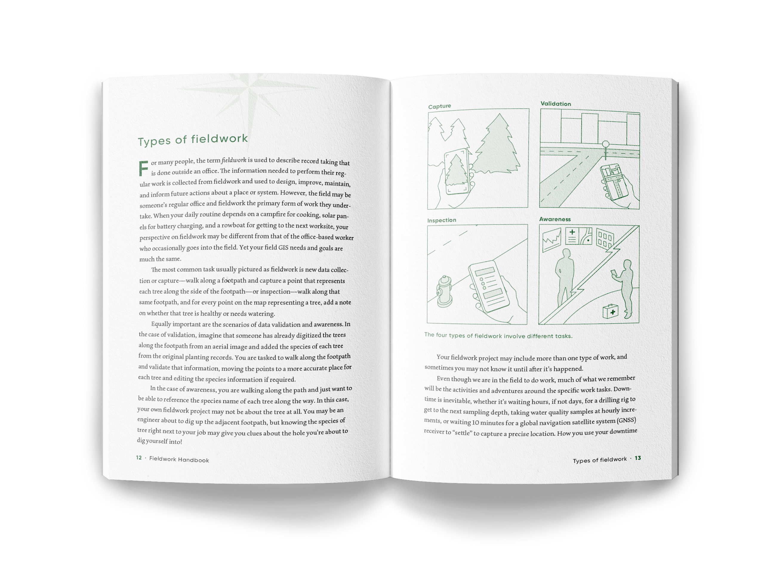
The Fieldwork Handbook: ArcGIS user stories storymap contains a collection of user stories that align with the different types of fieldwork projects described in the book: capture, inspection, validation, and awareness.
You can find more user stories and helpful information about field apps on each of the resources pages for our ArcGIS apps, in particular:

I would suggest anyone interested in Field Data Collection should pick this up! Marika is the BEST at this. She helped me years ago in the ArcPad days and has helped me with Survey123. Truly the consummate professional! Congratulations Marika!