We are pleased to announce the release of a new tool available in ArcGIS Online and ArcGIS Enterprise, the ArcGIS Vector Tile Style Editor. Whether you are a developer, designer, or a GIS professional, this tool gives you a fast and easy way to create a custom basemap style that matches your brand and the type of app that you are building.
How it works
Start by selecting an existing Esri vector basemap (e.g. World Street Map or Light Gray Canvas) and then begin customizing the layer colors and labels from there. You can edit everything from fill and text symbols to fonts, sprites, halos, patterns, transparency, and zoom level visibility. When you are finished, the styles are saved as an item in ArcGIS Online with a unique ID. The Map Viewer or any custom application can then reference the item to display your basemap.
Design Tools
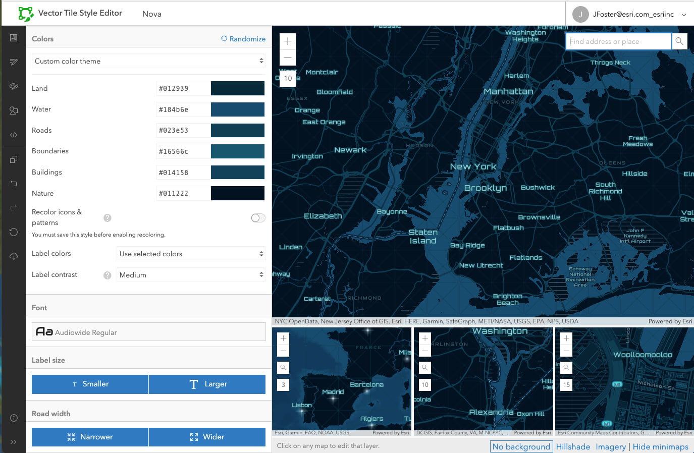
- Quick Edit – select all layers and style them at once
- Edit by Color – select and replace a color for one or more layers
- Edit icons and patterns – edit image, tint, and color of the sprites
- Edit Layer Styles – search for one or more layers to style
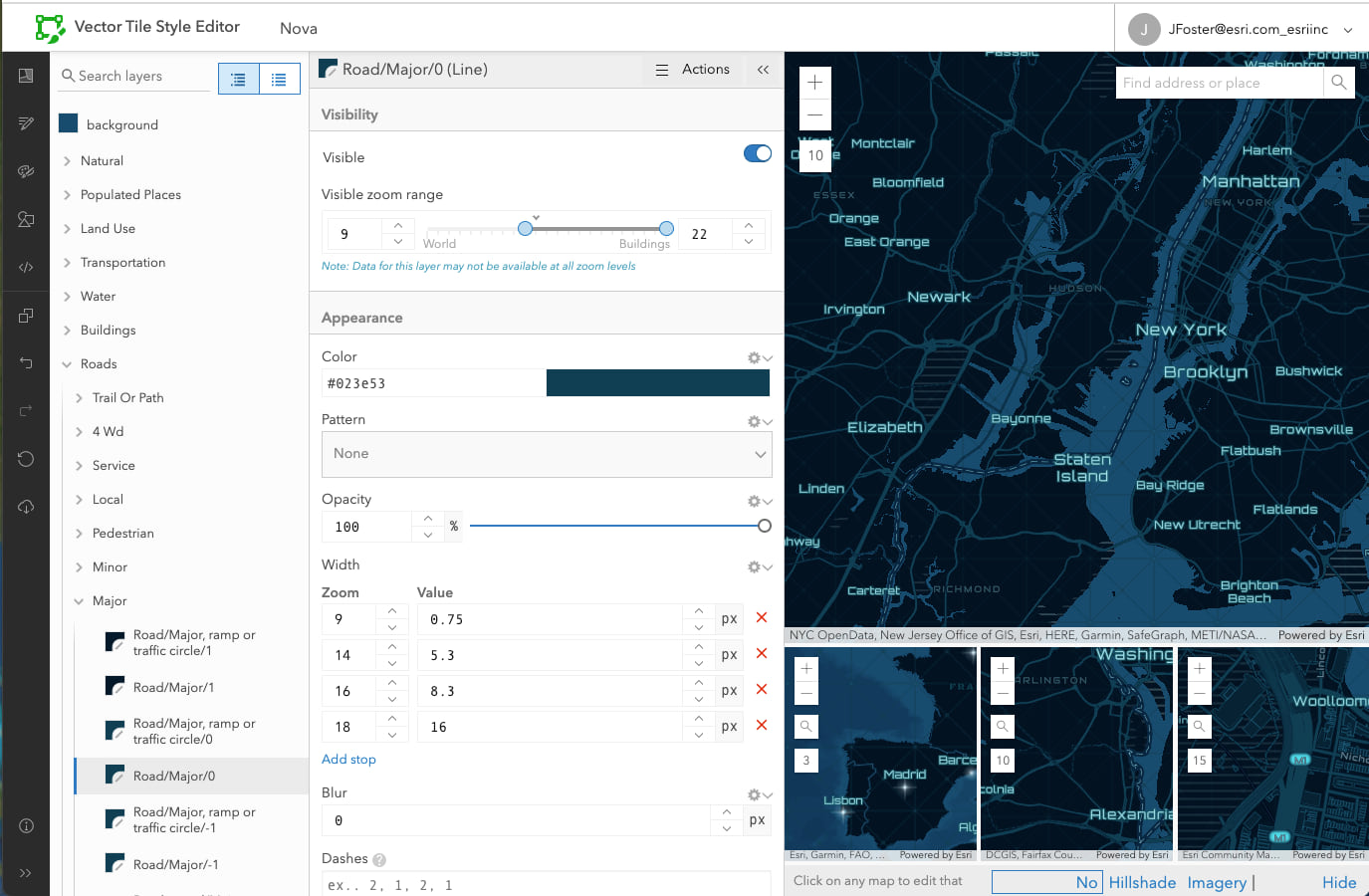
- Layer Editor – click the map or the layer list to perform detailed editing on a layer
Quick Edit

Layer Editor

Try it!
To start customizing a basemap, sign in with your ArcGIS account and click “New Style”. There are also ArcGIS developer tutorials for creating a custom basemap style and displaying a styled vector basemap in your application.
For more inspiration visit this showcase of some custom styles we have created.
Feel free to post questions or feedback on Esri Community.
Have fun making beautiful maps!
Commenting is not enabled for this article.