ArcGIS 10.5 Prerelease software is now available for qualified customers. The prerelease setups for ArcGIS Enterprise and ArcGIS Desktop can be found at My Esri.
Along with ArcGIS 10.5 Prerelease, you can sign up for ArcGIS Pro 1.4 Alpha.
Big News!
If you haven’t already heard the product family formerly known as ArcGIS for Server has been renamed to ArcGIS Enterprise. It’s a great time to be in GIS, organizations across the world are eagerly embracing mapping applications and geospatial business intelligence to drive decisions and keep stakeholders informed and up to date. Here at Esri we are keeping our commitment to deliver products that help you stay ahead of the curve. We recognized that you would need a server product that can do more and help provide a clear path forward for your organization in today’s web enabled world.
ArcGIS Enterprise is that solution.
Whether you are analyzing big data, streaming in real-time sensor data, making rapid raster analysis pervasive, or simply making GIS data available across your organization, there is an ArcGIS Enterprise deployment that can help get you there.
Tailor ArcGIS Server to fit your business needs with new licensing roles
The base ArcGIS Enterprise deployment provides foundational Web GIS capabilities such as the ability to publish map and feature services, web mapping capabilities, story map templates, Web AppBuilder, and lots of apps. In addition to this strong core set of functionality, you can expand ArcGIS Enterprise with even more capabilities through additional ArcGIS Server roles.
ArcGIS Server has always been the go to framework for your GIS server needs. Now the framework that you know and love can do even more. The server roles provide additional functionality such as real-time data processing, image and raster visualization and processing, and fast data processing that works seamlessly with your base ArcGIS Enterprise deployment. All of the new server roles are powered by ArcGIS Server 10.5 that comes as part of ArcGIS Enterprise.
New server roles include the highly anticipated ArcGIS GeoAnalytics Server that provides fast batch analysis of geospatial big data, ArcGIS GeoEvent Server (formerly GeoEvent Extension), ArcGIS Image Server (formerly Image Extension), and ArcGIS Business Analyst Server.
Making the Move from ArcGIS for Server to ArcGIS Enterprise
Current ArcGIS for Server users will find that transitioning to ArcGIS Enterprise is very straight-forward as it continues to offer flexible deployment options, including in local infrastructure and cloud platforms. ArcGIS Enterprise components and tools should be very familiar to existing ArcGIS for Server users, including Portal for ArcGIS and ArcGIS Server.
Expand the power of your Portal with Portal to Portal Collaboration
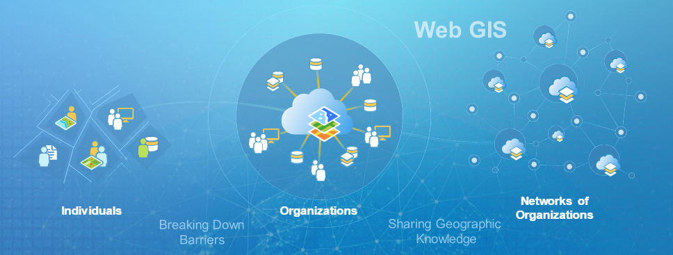
One of the new features of ArcGIS Enterprise is the ability to engage in portal to portal collaboration. Portal collaboration allows you to share your maps, apps, and content securely between multiple Portal for ArcGIS deployments. For example, if different departments or office locations each have their own ArcGIS Enterprise, they can collaborate and share content across departments and offices. Some organizations may want to use this new capability coordinate the distribution of enterprise maps and other geoinformation products with remote offices or across departments. It also allows those departments and offices to report up to corporate.
This distributed Web GIS capability will expand early next year by allowing collaboration between ArcGIS Enterprise and ArcGIS Online.
Learn more about portal collaboration.
ArcGIS Enterprise will also be offering new apps and specialized GIS servers that enhance spatial analytics capabilities of the ArcGIS platform.
Final release of ArcGIS 10.5 is scheduled for mid-December 2016.

Article Discussion: