What is changing?
Currently, Esri raster basemaps can be requested using HTTP or HTTPS protocols. Starting in April 2022, support for HTTP will be disabled, and tile requests will be HTTPS only. If an HTTP request is received, it will be redirected to HTTPS. While in many cases the redirect to HTTPS will work, it will not work for ArcMap .mxds containing raster basemaps added using HTTP. See Notification: HTTPS to be enforced for Esri Basemaps for more information about the reasoning behind the change. This change will not affect ArcGIS Pro.
The switch will be carried out incrementally throughout April while we monitor systems and is expected to begin on the 4th and be completed by the end of the month.
Who will be affected?
Customers with map documents (.mxds) containing a raster tile basemap added using HTTP will need to update the references to the layers.
- Raster tile basemaps added from the Add Basemap gallery have been using HTTPS for a number of years, so unless you have very old map documents, it is unlikely that these documents will be affected.
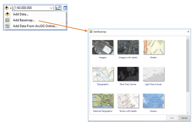
- Raster tile basemaps added as HTTP through the GIS Servers > Add ArcGIS Server connection at any time will need to be updated.
A list of affected basemaps is available in this ArcGIS Online group. Note that the street based raster basemaps are in mature support, and we recommend that you use equivalent vector basemaps as a best practice.
How can I tell if my map documents contain raster basemaps using HTTP?
If raster basemaps were added from a server connection as a layer (i.e. they were not added from the Basemap gallery), go to the Layer Properties and open the Source tab to determine if the connection is using HTTP or HTTPS.
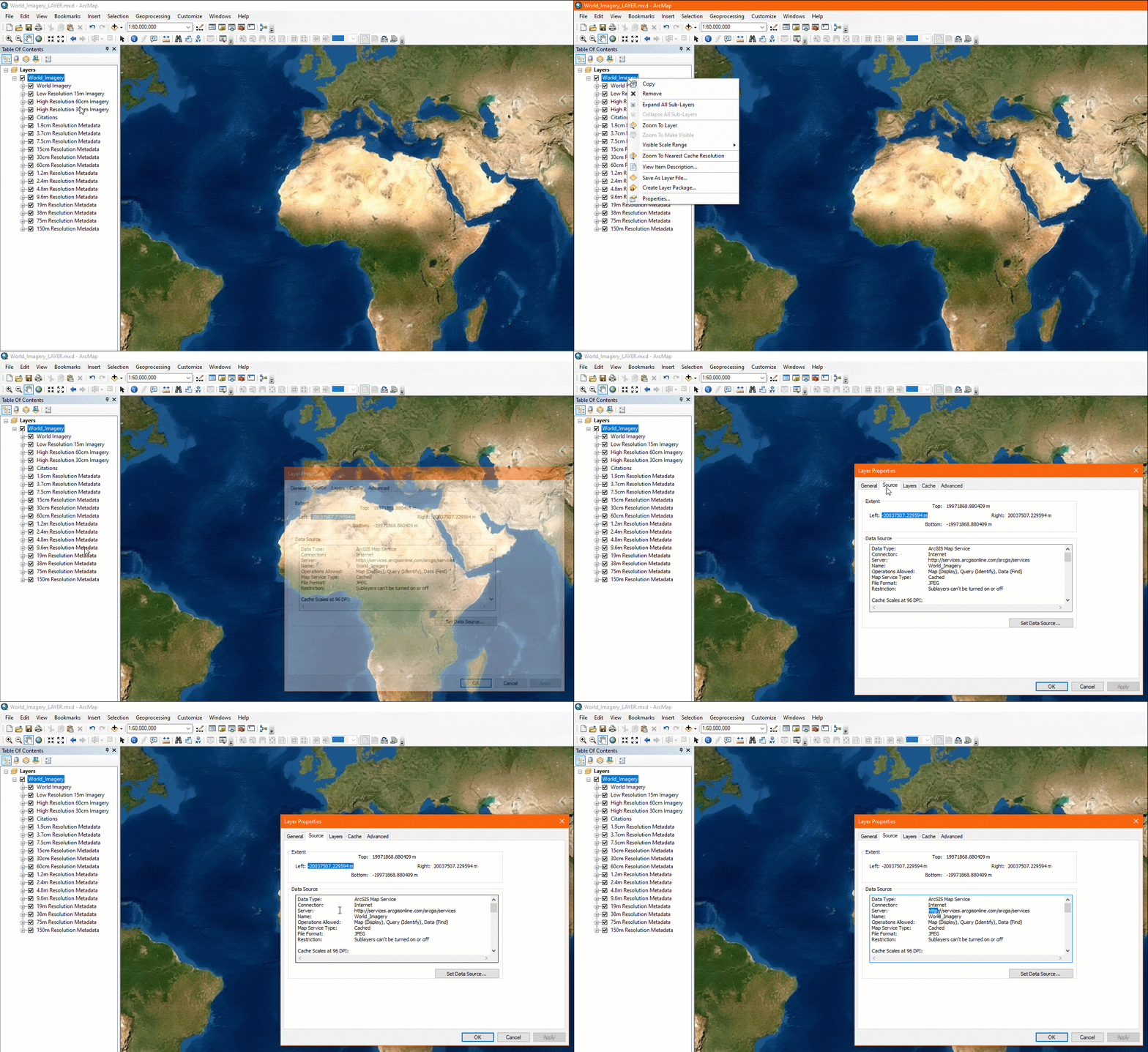
If the Server property is using HTTPS, no action is needed.
If added from the Basemap gallery, the layer will be part of a Basemap group and the source properties will not be exposed. Move it out of the basemap group in order to see its source properties.
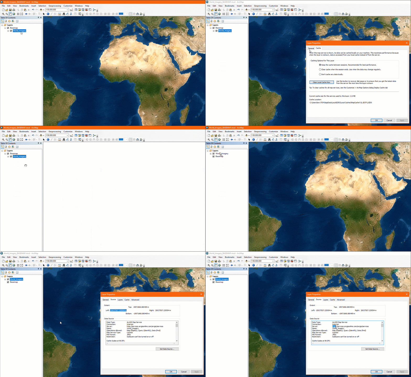
If the Server property is using HTTPS, no action is needed. You can move the layer back into the Basemap group to optimize performance.
We recommend checking your frequently used .mxds that contain raster tile basemaps before April to minimize the chance of disruption by this change.
What will happen if I don’t update my .mxds before support for HTTP ends in April?
When support for HTTP raster basemaps ends, when an .mxd containing an HTTP basemap is opened, the layer will be broken.
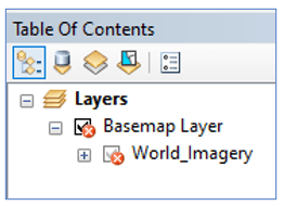
How can I fix broken basemap layers caused by the switch to HTTPS?
Added from Basemap Gallery
- Add a new basemap from the basemap gallery which will use the HTTPS protocol.
- Remove the broken layer.
- Save the .mxd.
Added from Server Connection
- Update the connection to HTTPS and re-add the layer.
- Remove the broken layer.
- Save the .mxd.
Automated check
If you have a large number of map documents that may contain Esri raster basemaps, it is understandable that you will not want to manually check each document. As demonstrated above, it is not possible to access the source properties for layers that are part of a basemap group, and this is also true when trying to check using a script. Therefore, running an automated check depends on checking for any broken layers in .mxds.
The disadvantage is that these cases cannot be caught before the switch happens in April because HTTP basemap layers will not be broken until after the switch occurs. The advantage of this check is that it will report back any .mxds with broken layers, so you may find infrequently used .mxds that need to be updated unrelated to this switch to HTTPS.
Steps
- Go to SampleArcPyMappingScriptTools_10_v1 and download the zipped files.
- Extract the files.
- Create a folder connection to the SampleArcPyMappingScriptTools_10_v1 folder.
- From the MXD and LYR Management Tools.tbx, open the Find Broken Data Sources (Report) tool.
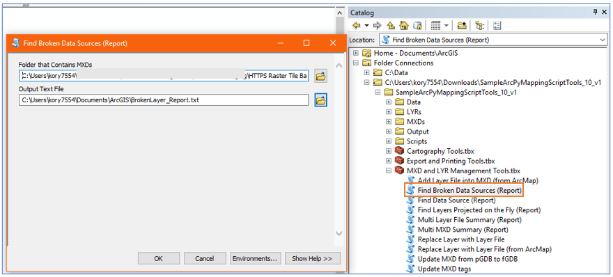
The tool will generate a report of .mxds containing broken layers that you can inspect further.

Because Find Broken Data Sources (Report) is a script tool, it can be used as a starting point and be modified to customize checks.
Disclaimer: The SampleArcPyMappingScriptTools_10_v1 tools are provided as samples only. Esri makes no guarantees or warranty related to the tools. The script tools are not supported by Esri Technical Support.

Article Discussion: