This blog is in response to a comment about how to create a layer stack in ArcGIS.
We try really hard at Esri to make imagery management as easy as possible. It’s often an overlooked aspect of image analysis, but if you’re waiting a long time for an image to load, or to put together a band composition, it takes the fun out of it.
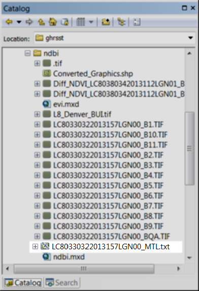
There are two ways that you can make a layer stack in ArcGIS. One is to use a raster product. From the Catalog pane, navigate to the folder where you have your imagery, and if you see this icon next to one of the items, you’re in luck.
A raster product in the Catalog window
Here’s what it looks like zoomed in. It’s a satellite over a generic raster.
![]()
Now, we don’t support raster products for every single sensor that’s out there. If you want to know if the type of imagery you are working with is supported as a raster product, check out this page.
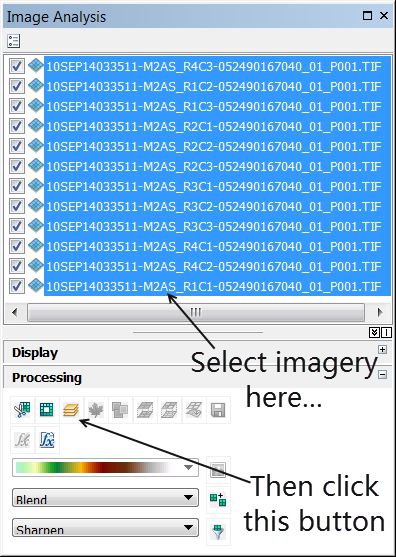
If you’re imagery is not supported, what you can do to create a layer stack is select all of the bands in the image analysis window. Then click on the band composition button. You won’t have all of the functionality that you get from a raster product (you won’t have a pansharpened image already set up for you, for example) but this will create the layer stack that you’re looking for.

Commenting is not enabled for this article.