In his demonstration, Shreyas shows how ArcGIS Enterprise can integrate into an organization’s business systems by using server object interceptors.
Integrating spatial data with business systems
For this demonstration, Shreyas set up an organization for a solar power installation company. Currently, the organization is lacking real-time information on the solar potential of businesses and their projected cost savings. Since this limitation impacts the company’s ability to pursue sale leads, they’re looking for ways to integrate the spatial data from their ArcGIS Enterprise deployment with their Salesforce accounts.
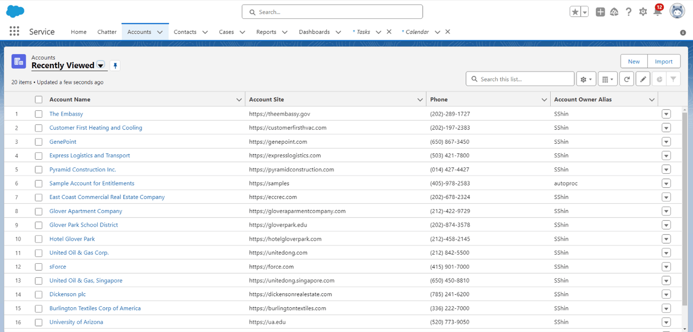
In order to achieve this goal, Shreyas created a feature service that shows the buildings, and their footprints, in the Glover Park neighborhood of Washington DC. The entities that own and operate these buildings are stored as an account in the organization’s Salesforce.
Shreyas plans to have edits made to the feature service be translated to the appropriate attributes for an account record in Salesforce. To do this, Shreyas extended his service to use a server object interceptor.
Server object interceptor (SOI) allows you to intercept requests for map or image services and apply custom logic to alter the behavior of the service. For Shreyas’s service, he’s using the Enterprise SDK to create a java project that implements an SOI class. It uses the handleRESTRequest method, which is called each time a request is made to the feature service.
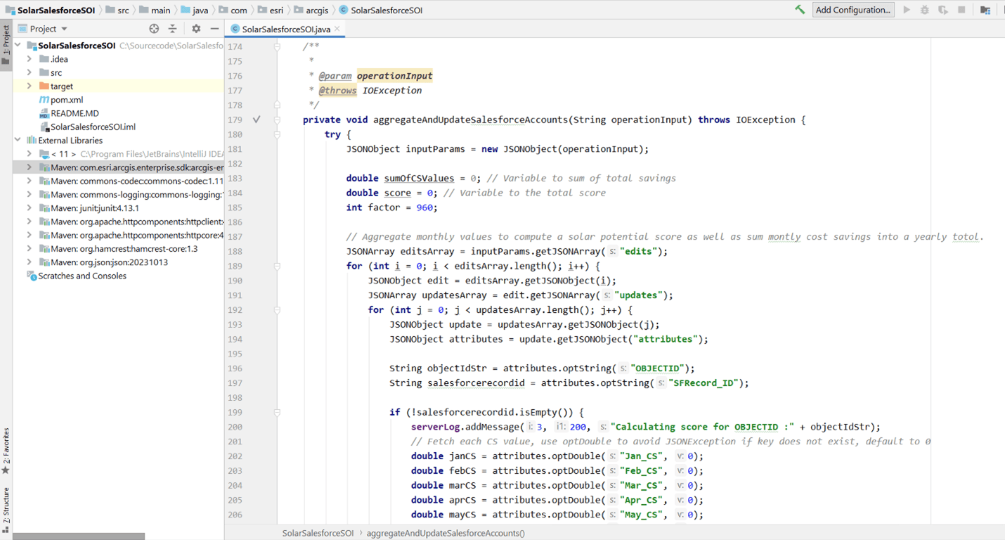
When someone in the organization makes edits to the service, the SOI applies the changes to the geodatabase first. If the edits are successful, the SOI aggregates the solar potential and cost savings values and updates them in the account record for that entity in Saleseforce.
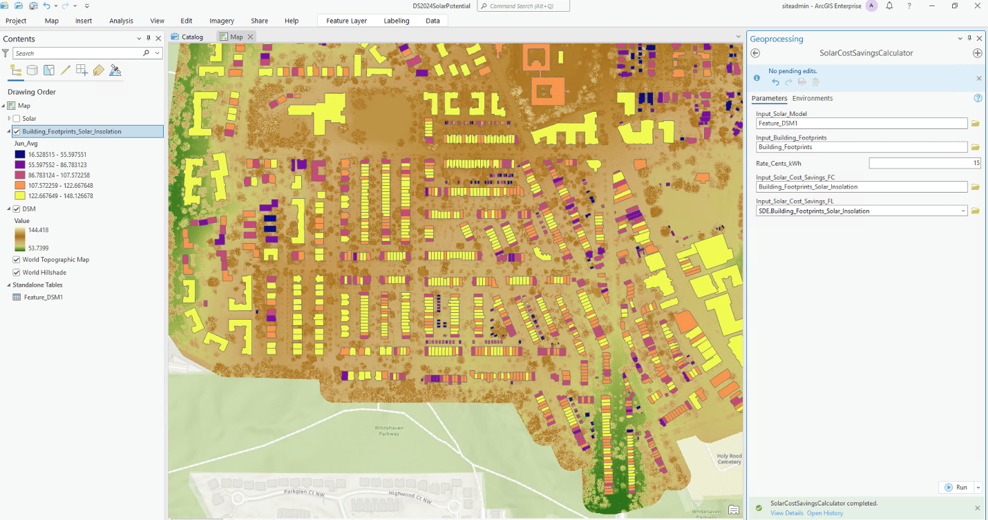
To demonstrate, Shreyas opens ArcGIS Pro to run a script that performs solar potential calculations and edits the feature service.
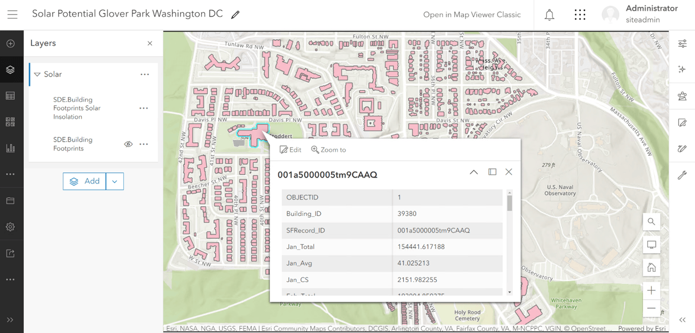
Shreyas then returns to his feature service to validate the edits. Clicking one of the buildings, the attributes now showing the cost savings values, populated by month.
Moving back to the Salesforce dashboard, Shreyas shows that the attributes are populated with real-time edits from the updates to the feature service. The organization’s sales team can now use this information to identify and pursue promising sales leads.

Conclusion
In his demonstration, Shreyas showcased how server object interceptors can extend services to allow organizations to seamlessly integrate their business systems with ArcGIS Enterprise. SOIs are powerful extensible patterns in ArcGIS Server to bring spatial data and decision-making to businesses.
For more information on using SOIs with your services, see the following documentation:


Commenting is not enabled for this article.