ArcGIS Enterprise

Harnessing distributed collaboration for forest restoration

Distributed collaboration empowers organizations to work together seamlessly, sharing data, web layers, and maps in pursuit of common goals. In this story map I’ve crafted a fictional scenario to demonstrate how to establish a distributed collaboration between two organizations and their workflow for sharing information and working together effectively.

Scenario

Northern California is recovering after wildfire damage to the region’s national forests. The United States Forest Service is proposing a restoration plan for the affected areas, but the agency needs accurate data to assess the level of damage. The Forest Service is relying on residents to act as data collectors and help organization members gather necessary information about tree conditions.

In the story I’ll set up a collaboration between the U.S. Forest Service and a nonprofit organization called the D&J Forestry Initiative.

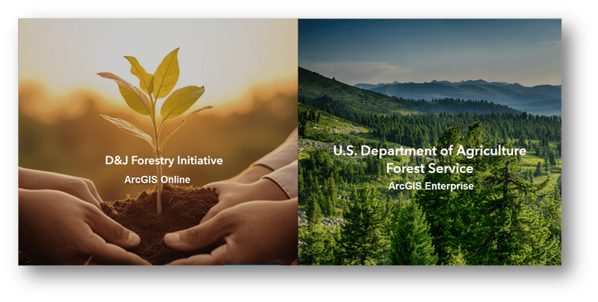
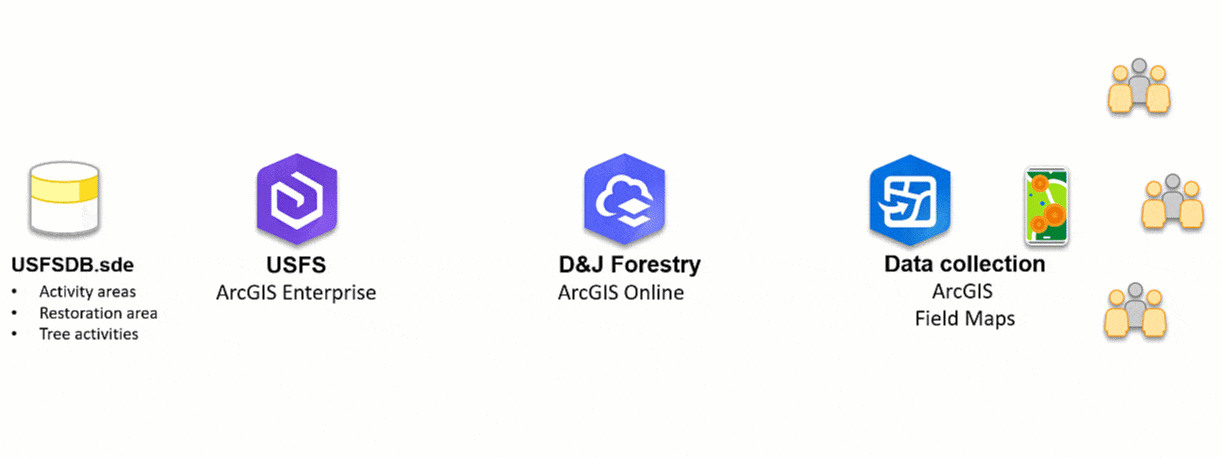
U.S. Forest Service — A governmental agency that maintains all forests in the United States. Their data is primarily stored in ArcGIS Enterprise, behind a firewall, to comply with governmental regulations.

D&J Forestry Initiative — A nonprofit organization dedicated to advancing ecological restoration by pairing volunteers with specific field activities. The organization hosts its data on ArcGIS Online.

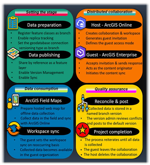
The Forest Service is storing its assets in an enterprise geodatabase. Agency officials have published web feature layers using ArcGIS Enterprise to take full advantage of geodatabase capabilities such as branch versioning to support multiuser editing across services.

To make the data available for volunteer data collection, the agency will distribute its tree data with the D&J Forestry Initiative. Because the nonprofit is using ArcGIS Online, the data will be shared using distributed collaboration.

Workflow overview

Here is a high-level overview of the workflow showing how the data is shared between the organizations.

Collaboration Setup

  • Project: Collective Forest Restoration. The tree data is shared by reference to ArcGIS Enterprise by the US Forest Service.
  • Host: D&J Forestry Initiative – creates the collaboration, the workspace, defines the access mode, and invites the guest.
  • Guest: US Forest Service – joins the collaboration and sets up the synchronization interval.


Steps

  • Initial workspace synchronization – Web feature layers shared with D&J Forestry Initiative.
  • Mobile app creation Design an ArcGIS Field Maps for offline data collection.
  • Data collection – Volunteers use ArcGIS Field Maps to record tree data (height, diameter, condition).
  • Offline sync – Offline data sent to ArcGIS Online when volunteers connect to the network.
  • Workspace sync  Collected data is available to US Forest Service in a named version.
  • QA/QC Portal admin reconciles the named version, reviews and resolves conflicts, and posts to the default version.
  • Iterative process  Repeated data collection, sync, and QA/QC throughout the project.


Completion

  • Guest (US Forest Service) leaves the collaboration and continues to use the named version for multiuser editing.
  • Host (D&J Forestry Initiative) deletes the collaboration and continues to use the hosted web layers in a public facing dashboard to showcase their initiative.

Check out the Geodatabase Resources Hub site for more content on applied GIS using real world examples.

About the author

Product Engineer on the Geodatabase team, passionate about making a difference in people's lives using GIS. Hiker and a true Éclair and Crêpe lover in her free time.

Next Article

Your Living Atlas Questions Answered

Read this article