For decades, you’ve seen imagery projected onto a 2D map in ArcGIS the same way – a way that works well for “directly above you” vertical imagery, but makes oblique imagery highly distorted and difficult for analysis.
New this year in ArcGIS is the ability to visualize imagery in Image Space – from the perspective of the sensor. Rather than projecting your imagery to the map, it projects the map and GIS data to your imagery. The result is a much more natural and intuitive view of the image, unlocking better mensuration and more accurate analysis capabilities.
Take a look at the workspace below. You can access this sample data here in ArcGIS Online.
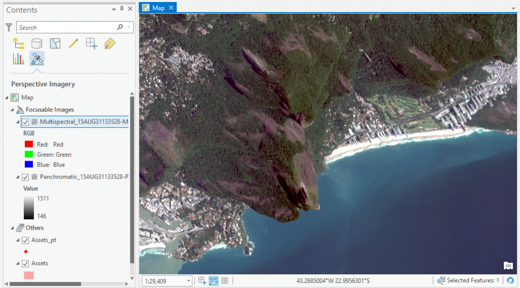
You’re seeing a pretty common image for imagery analysts – it’s a WorldView oblique image over Rio de Janeiro, Brazil, projected to a 2D map. Notice how the mountains are not oriented correctly, buildings are skewed and flattened – it’s near impossible to analyze or make measurements from this image. Projecting oblique images into map space using a map projection system results in maps like this – and the higher the angle of obliquity, the worse it gets.
In ArcGIS Pro 2.1, we’ve introduced Image Space Analysis, where you can view this kind of imagery from the perspective of the sensor. We do this using an image coordinate system, or ICS, which transforms the map without a need for orthorectification. Let’s take a look at that Rio map, now in Image Space.
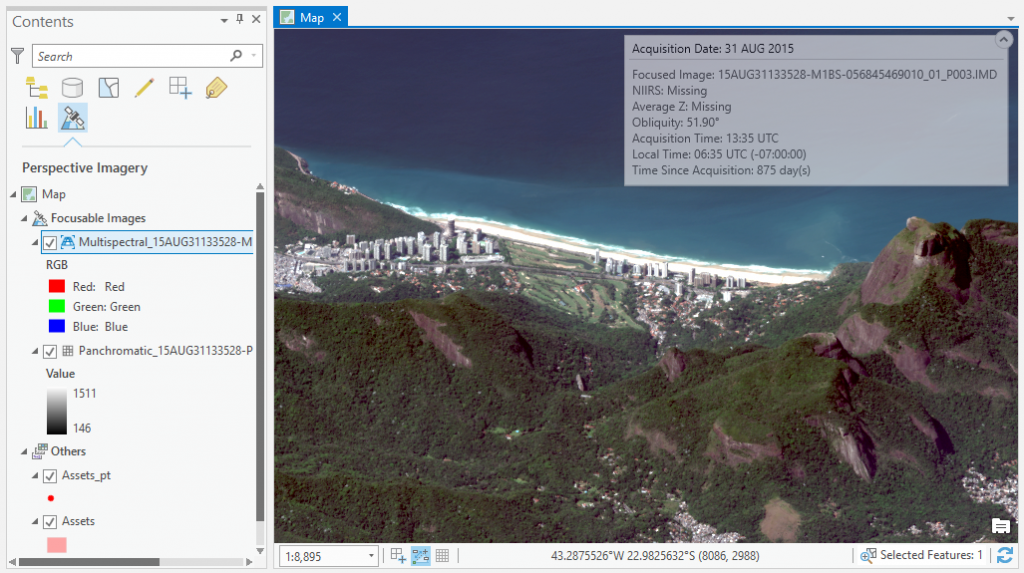
Much better. Buildings are oriented correctly, mountains look more natural – it’s a much better experience for the image analyst. And the Image Space Analysis gives you a heads-up dispay with metadata for the perspective image you’re working with.
The ICS is listed as a two-number coordinate (Columns, Rows) after the map coordinates in the bottom of your map view. Image Space Analysis uses a single focusable image at a time to make the perspective view, but you can cycle around multiple images from the same perspective. For even better accuracy, you can add a DEM to the raster function chain defining the ICS.
In Image Space mode, all of the ArcGIS editing tools work seamlessly with our GIS datasets projected to this view. We’ve added image mensuration to the perspective view; for example, looking at this image of the Rio airport, you can measure not just the length of the runway, but the heights of buildings and objects using the image sensor’s model and metadata.
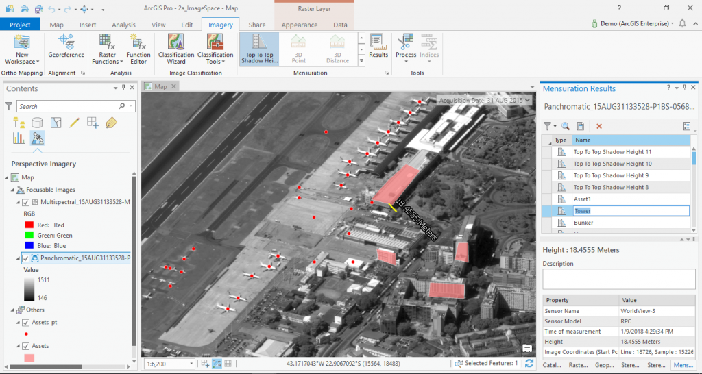
These measurements aren’t just graphics, either – you can export your measurements with metadata to a PDF report.
The Image Space Analysis capability makes the imagery experience in ArcGIS Pro even better, and we look forward to seeing the amazing things users will do with this. This tool significantly improves the visualization and mensuration of oblique imagery, and opens new possibilities for your remote sensing data.
To learn more about enriched visualization in ArcGIS, watch this video.
Article Discussion: