Engagement Matters – Part 4
This article is the fourth part of a four part series on collaboration and engagement.
Part 1A Hub for
|
Part 2Empowering
|
Part 3Sustaining
|
Part 4Building
|
Click on any of the articles above to jump forward or backward
When we think about disasters – environmental, human-caused, or a blend of the two – it’s easy to focus only on disaster response. Something bad happens and trained first responders arrive to handle that something. Firefighters, EMTs, and police officers all play a very important role but they can’t do their job effectively without a community first preparing for likely events and also having a long-term plan for recovery. Just like building muscles in the gym, communities that engage residents in all three of these phases of a disaster build resilience against disasters that help them recover faster and more equitably.
Prioritizing preparation
Community officials have a good idea of the types of problems that their community might encounter. Floods, earthquakes, certain types of crime, and more can all be anticipated or predicted to some extent based on topology, history, or by data analysis.

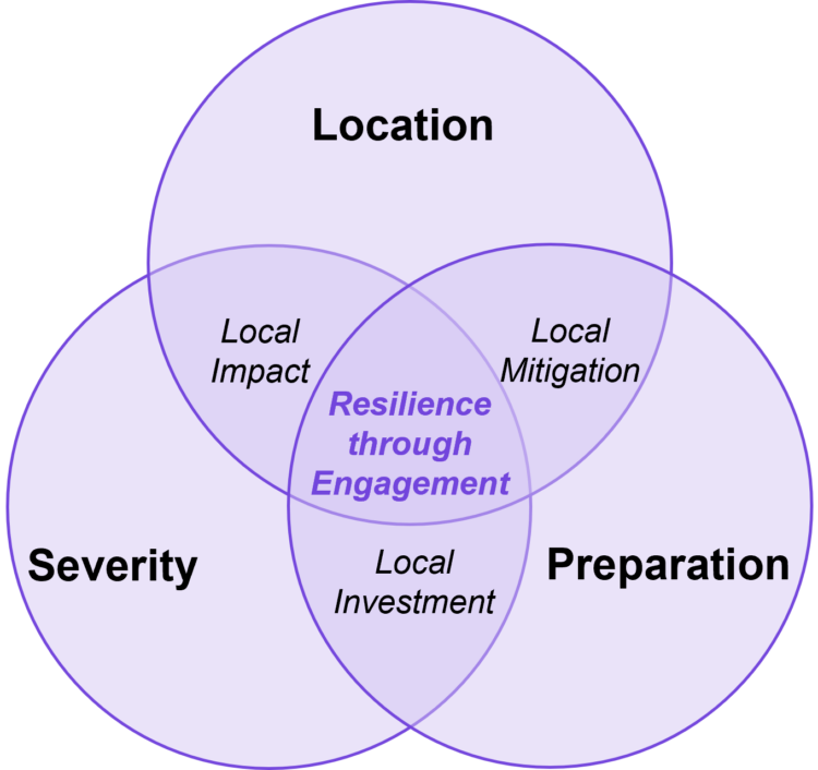
Residents need to know three important things:
- Location: What area will be impacted?
- Severity: How bad will I/my family be impacted?
- Preparation: What can I do to prepare?
If you live in an area that is prone to earthquakes or similar natural hazards, you’ll know that local officials repeatedly tell residents to have a plan. Radio and TV commercials urge us to take action now to prevent suffering in the future. Websites list the items needed in a preparedness kit that includes several days of food and water, a radio, batteries, and more. Some communities even organize events where residents learn how to prepare their homes so items don’t fall on people during an earthquake. Through clear and continual engagement, residents build their own resiliency against the risks an earthquake poses to them by focusing on the things they can do to prepare.
Communicating the response
When bad things happen, officials focus first on coordinating first responders. Just like in a hospital, areas are triaged to determine who gets help first. But officials can’t be on every street corner all at once. This is where residents can help. The most resilient communities are ones where the flow of information happens in both directions. Residents are told where emergency shelters are located, what services are still available, and which areas of town to avoid. They can also help inform officials of local conditions in different areas of the community.
When a flood looks likely, residents in low lying areas are urged to find a nearby shelter through interactive maps. Inundated or damaged roads are relayed to residents so that residents know where to avoid driving. Some communities ask residents to submit photos with descriptions of the issues they see locally through online surveys or apps.
Recovering with equity
Not every part of a community recovers at the same speed. Areas that have higher concentrations of households that struggle to recover after a flood or earthquake can include:
- Low income,
- Limited English proficiency,
- Minorities,
- Elderly,
- Disabled, and/or
- No personal vehicle

The most resilient communities know of these challenges and more ahead of time. They allocate resources specifically designed to help these households recover at rates closer to households that don’t face these challenges. Elderly households might receive printed guidance rather than only websites and online forms. People with low English proficiency might be offered specific phone numbers to call for assistance where staff speak a variety of languages. Bus routes might be altered or added temporarily to help households without other means to move around the community. The goal of any of these actions is to engage different groups in the community in the ways that best support them, rather than expect everyone in a community to respond in the same way.
Building resilience is a process
Becoming a resilient community takes time and effort but the rewards are well worth it. You can start to learn the uniqueness of your community – from its topology to its people – using GIS. It’s that same GIS that also forms the backbone of your two-way engagement. Helping residents know what hazards to prepare for, what to do when disaster strikes, and what resources are available is just the first part of the solution. Gathering community input and feedback helps refine a community’s response and supports a more equitable and fair long-term response.


Article Discussion: