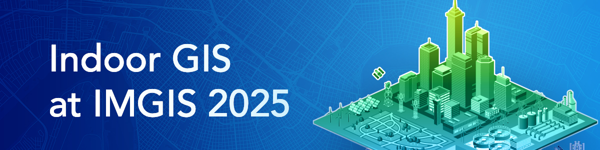
The 2025 Esri International Infrastructure Management & GIS (IMGIS) conference is scheduled to take place on October 28-30, in Palm Springs, California. This event brings together professionals from various industries, including architecture, engineering, and construction operations (AECO), electric, gas, telecommunications, and water utilities. Explore how ArcGIS helps you connect data, workflows, and people for lasting results.
Role of Indoor GIS
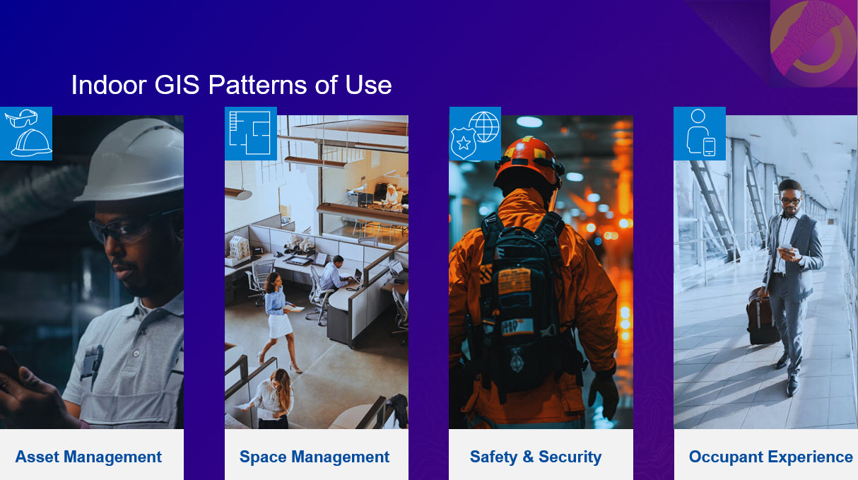
Indoor GIS is a unified floor-aware ArcGIS system for visualizing, analyzing, and managing indoor spaces and facilities. It enables organizations to make their operations and maintenance activities more efficient and ensures better experience for building occupants and visitors. Indoor GIS is powered by indoor maps created with ArcGIS Indoors with the ability to overlay indoor positioning through ArcGIS IPS. Indoor GIS supports:
Asset Management
Indoor GIS technology plays a vital role in asset management by providing the ability to map locations of indoor assets. This enables organizations to connect the location of assets to work/asset management systems, thereby efficiently manage service or work orders for inspections, maintenance, and repairs. It also facilitates real-time location awareness through indoor positioning, making it easier to locate and navigate to assets within facilities. Additionally, field crews can visualize local work environment conditions with the help of 360-degree photos in Indoors Mobile and Viewer before entering a facility.
Safety and Security
Indoor GIS capabilities enhance situational awareness for safety and security operations and planning. By quickly identifying the locations of personnel, evacuation routes, and exits, it can enable first responders to act more effectively in emergency situations. Emerging trends include using location intelligence to track security personnel and dispatch the nearest responders, as well as improving incident reporting.
Occupant and Visitor Experience
Indoor GIS improves the overall experience for both visitors and employees by offering wayfinding and turn-by-turn navigation in complex facilities. It also provides tools for reserving workspaces, making it easier to locate people, places, assets, events, and work orders. Additionally, occupants and visitors get enhanced visual understanding of their indoor spaces with 360-degree photos in Indoors Mobile and Viewer. For instance, they can preview if the conference room or office hotel meet their needs prior to reserving.
Space Management
With Indoor GIS, organizations can gain a comprehensive view of how their facilities are being used. This makes it easier to optimize space usage by consolidating unused areas or reassigning them to different business units as needed. By doing so, organizations can improve their overall space utilization and create a more efficient use of their facilities.
At IMGIS, attendees can expect to learn about the advancements in Indoor GIS, including extending the lifecycle of CAD, BIM, LiDAR, and other data to support facility operations, building your indoor GIS using reality capture technologies, live indoor positioning demos, and more. The conference will also provide opportunities for networking with industry professionals and exploring the latest tools.
Esri Presentations
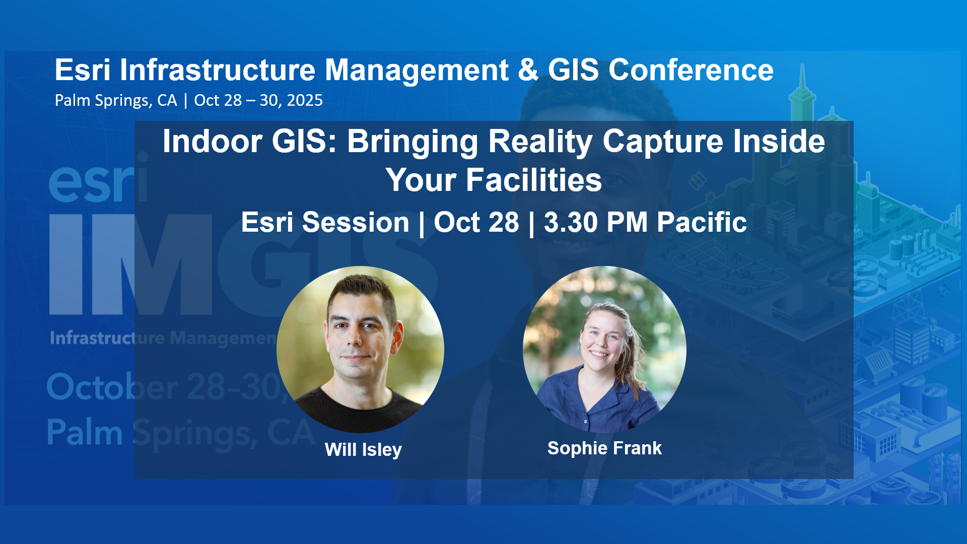
Indoor GIS: Bringing Reality Capture Inside Your Facilities
Tuesday, Oct 28 | 3:30 PM – 4:30 PM PDT | Primrose B | PSCC | In-person and live stream
Join us in this session to discover how to harness Lidar scans inside your facilities. You will learn how to create floor-aware indoor maps, and bring 360-degree photos as a layer to your indoor GIS using ArcGIS Indoors. We will share best practices for working with Lidar data to produce indoor floor plans. We will also demonstrate importing 360-degree photo series to build an oriented imagery data set. Modernize your facility operations with indoor GIS by leveraging indoor reality capture.
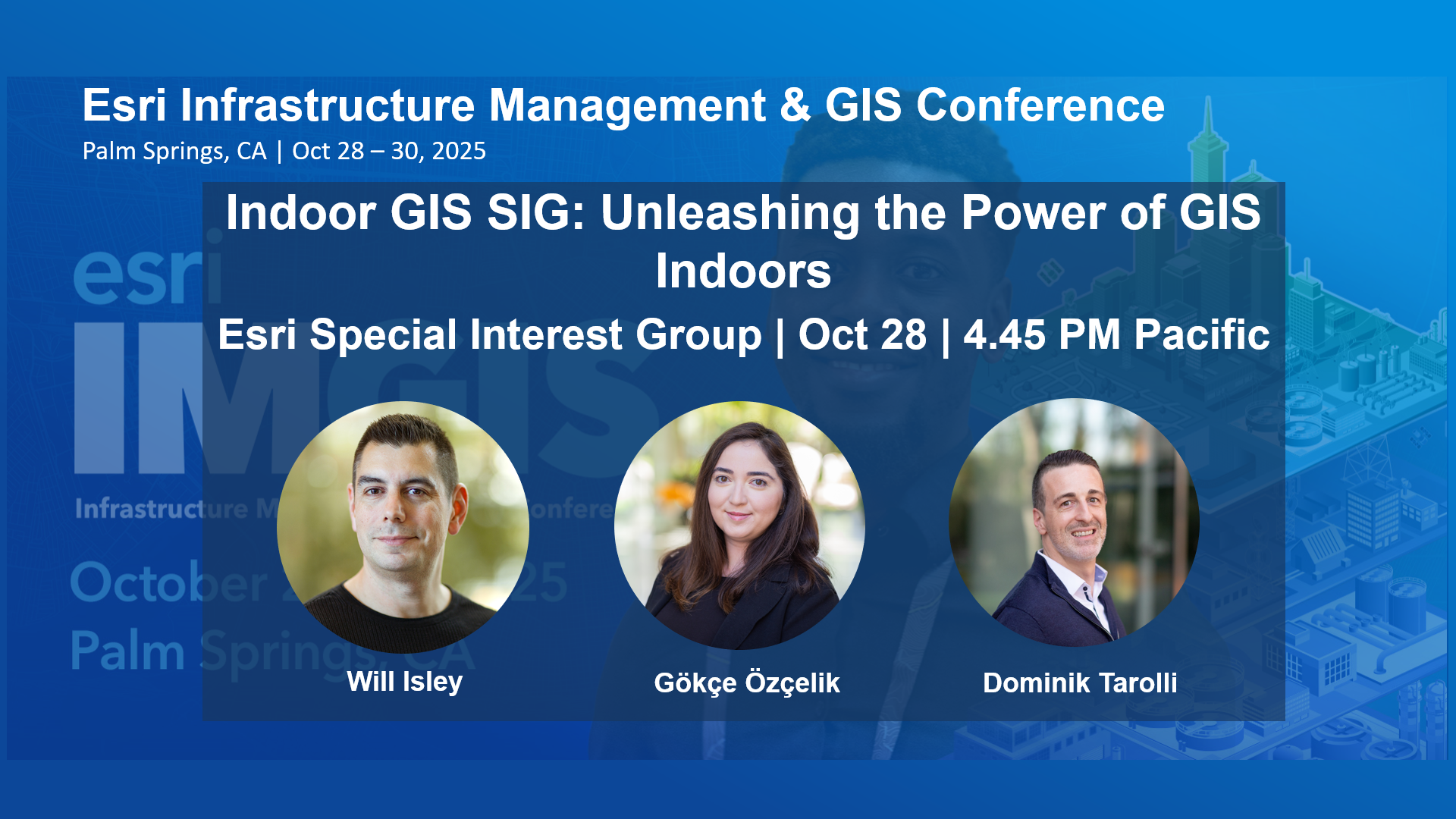
Indoor GIS SIG: Unleashing the Power of GIS Indoors
Tuesday, Oct 28 | 4:45 PM – 5:30 PM PDT | Sierra/Ventura | Renaissance | In-person
Reservation Required: This session requires a reservation to attend. Please use Add to Schedule to reserve your spot or Join Waitlist to be added to the queue.
The Indoor GIS SIG offers a platform to actively engage in discussions surrounding indoor GIS for operations of your facilities, connecting you with industry professionals who share your enthusiasm for this field. By joining us, you will have the chance to participate in face-to-face interactions, fostering high-quality discussions with like-minded peers. This SIG presents a valuable opportunity to network, exchange ideas, and collaborate with experts in the indoor GIS domain, enhancing your knowledge and expanding your professional connections.
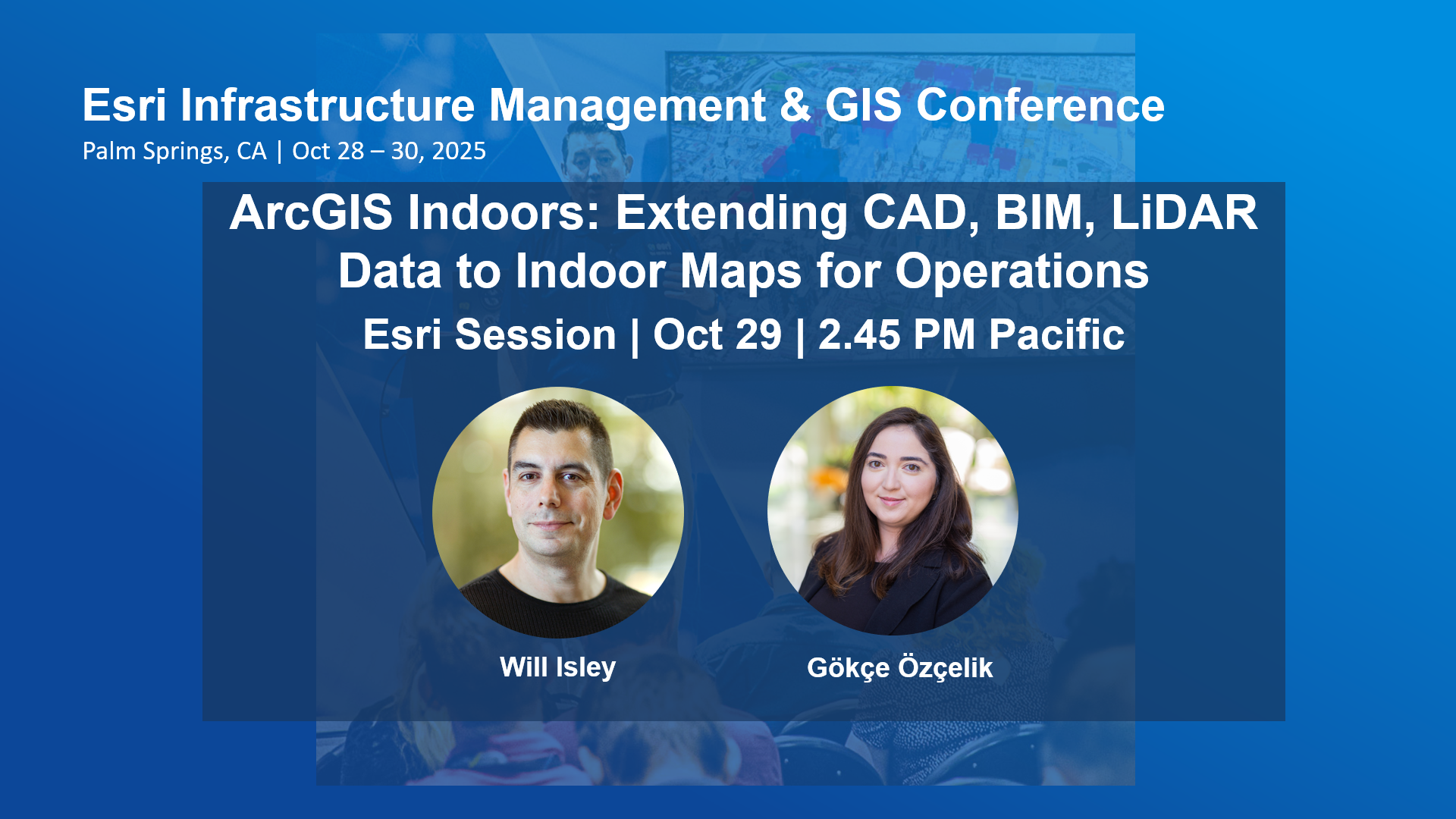
ArcGIS Indoors: Extending CAD, BIM, LiDAR Data to Indoor Maps for Operations
Wednesday, Oct 29 | 2:45 PM – 3:45 PM PDT | Primrose CD | PSCC | In-person and live stream
Join us to learn how you can extend the life of your CAD, BIM, LiDAR and other floor plan data into operations of your facilities. In this foundational session, you will get an overview of ArcGIS Indoors and learn how to create and share interactive floor aware maps of your facility. You’ll also learn how to leverage indoor maps to power indoor maps for: – Asset mapping for maintenance and Inspections -Space planning, workspace reservations -Indoor navigation and more.
User Presentations
Facility & Vertical Asset Management Using ArcGIS Indoors and 3D Modeling
Tuesday, Oct 28 | 2:15 PM – 3:15 PM PDT | Madera | Renaissance | In-person
Many water and wastewater facilities lack detailed, up-to-date asset records making effective infrastructure management difficult in today’s data-driven environment. To address this, American Water launched a pilot project with LandTech Consultants to explore how a COTS-based GIS solution, grounded in ArcGIS Indoors, can modernize vertical asset management and serve as a foundation of a long-term enterprise solution.
Neil Bolton, David Chaffins – American Water
Christopher Lorrain – LandTech Consultants, Inc.
Bridging the Gap: LiDAR & GIS for Smarter Project Planning and Deliverables
Tuesday, Oct 28 | 3:30 PM – 4:30 PM PDT | Madera | Renaissance | In-person
LiDAR is emerging as a key player in GIS as a data collection tool, enabling digital twins, 3D GIS, and indoor mapping (ArcGIS Indoors). This session explores how to align project goals with LiDAR by assessing accuracy needs, expected deliverable outcomes, and available technologies and solutions. We will review how to analyze project requirements and identify LiDAR solutions available to the GIS ecosystem. Real-world examples will highlight digital twins in water and wastewater, smart campus initiatives, and ArcGIS Indoors for K–12 and higher education – all GIS projects powered by LiDAR!
Zachary Jaffe, Map I.T.
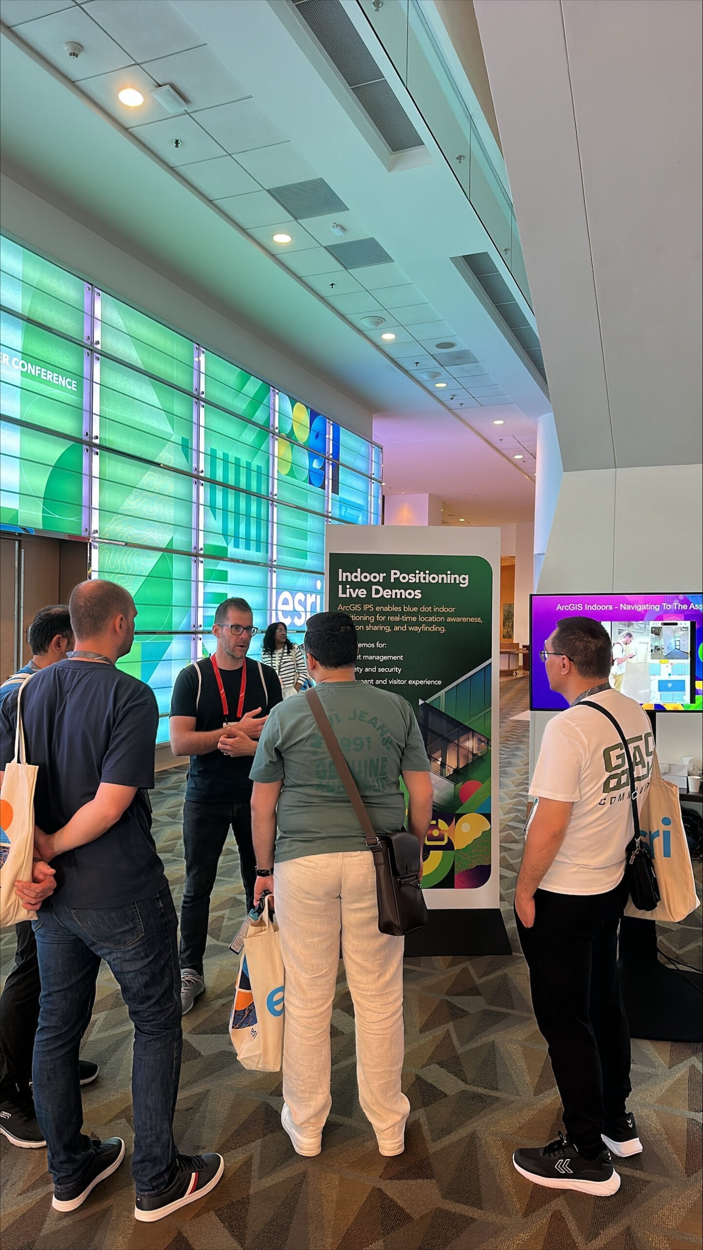
Indoor Positioning Live Demos
New this year, we will be showcasing live demonstrations on how ArcGIS IPS works with ArcGIS Indoors, ArcGIS IPS, ArcGIS Field Maps, and ArcGIS Mission to enhance asset inspections, safety, and occupant/visitor experiences. ArcGIS IPS brings the blue dot indoors to enable live location inside a building. Together with the ArcGIS Indoors mobile app, you will discover how to enable real-time asset location, streamline maintenance workflows, and improve workspace reservations. These demos are particularly relevant for AECO organizations and utilities through indoor mapping and positioning. Thereby enhancing operational efficiency, safety, and overall management of infrastructure.
This conference is a must-attend event for anyone looking to leverage Indoor GIS for infrastructure management. It offers a valuable platform for professionals to share knowledge, explore new trends, and network with peers. Don’t miss this opportunity to discover the latest about Indoor GIS to begin modernizing your infrastructure management. See you there!

Article Discussion: