Along with the ArcGIS Online June 2026 update, we are excited to announce that a new Mapillary global street-level imagery (beta) is available in ArcGIS Living Atlas, accessing more than 3 billion street-level view images from Mapillary’s crowdsourced datasets that are growing daily.
This publicly available imagery layer brings another valuable and accessible global dataset to the ArcGIS user community. You can easily integrate immersive, street-level oriented imagery views into your daily mapping workflows, and share with your audience via maps, 3D scenes, and web applications.
Street-level Imagery, a Primary Type of Oriented Imagery
Street-level images add valuable visual context to vector data representing on-the-ground assets and areas of interest and help better understand their relationship to the other geospatial data you manage. They use information like the location and orientation of the camera, the camera’s horizontal and vertical fields of view, and a digital elevation model (DEM) that defines the ground to relate each pixel in an image to a location on a map (and vice versa).
There are many applications for oriented imagery and below are just few examples
- Provide situational awareness for first responders or field workers before they visit a site or asset.
- Support inspection workflows by visualizing images of an asset from multiple directions.
- Manage the GIS assets with locations of infrastructure such as signs, fire hydrants, guard rails, and streetlights, and integrate them as a system of records.
How to View Street-level Images
Mapillary global street-level imagery (beta) is a group layer that consists of two layers. Mapillary Global Coverage is a vector tile layer that enables users to preview where images are available. Mapillary Global Oriented Imagery is an oriented imagery layer that enables users to query and view the images.
To view street-level images, open the group layer in supported ArcGIS applications, and open the Oriented Imagery widget from the oriented imagery layer. You can click on a map to view the best image of that location in the oriented imagery viewer, then see the image’s footprint dynamically updated on the map as you pan and zoom in the image.
There are two types of imagery formats available in this Mapillary street-level imagery, standard frame images and 360-degree panoramas (aka 360 images)
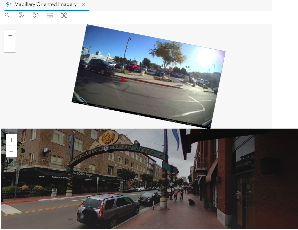
Supported ArcGIS applications include ArcGIS Pro, Map Viewer, Scene Viewer (ArcGIS Online only), ArcGIS Experience Builder and ArcGIS Instant Apps.
Popular Tools for Viewing Street-level Images
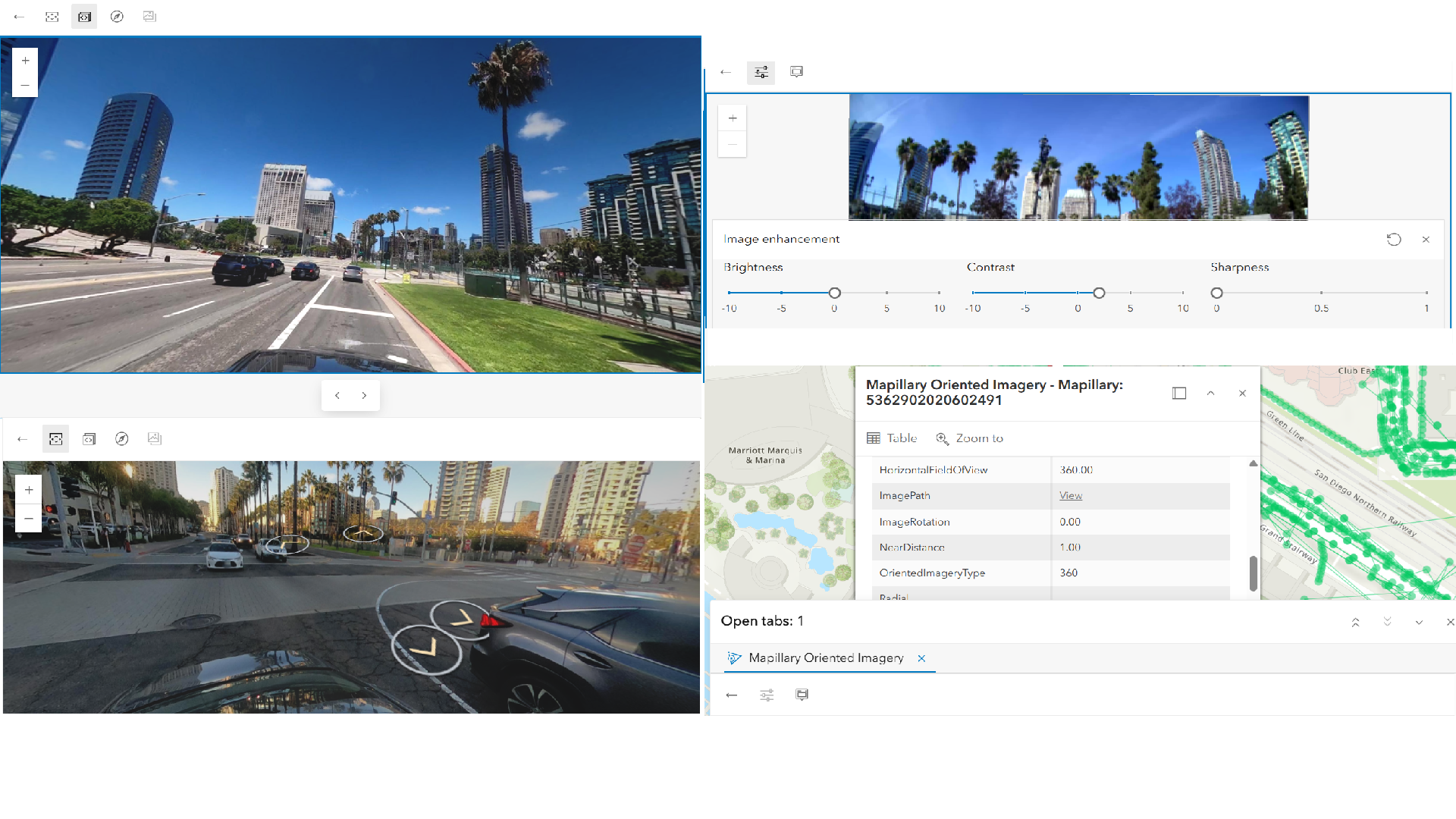
Let’s highlight several popular tools available in the oriented imagery viewer for working with Mapillary street-level imagery.
Use directional navigation tool (under Image Navigation) to explore a specific area in your map. Use arrows in the oriented imagery viewer to navigate to adjacent images in cardinal directions—north, south, east, or west.
Use sequential navigation tool (under Image Navigation) to step through an image collection in a predefined order. Once selected in the oriented imagery viewer, buttons in the viewer allow you to move forward or backward through the sequence.
Use image enhancement tool (under Utilities) to interactively adjust the brightness, contrast, and sharpness of street-level images. It’s only available for frame images
Use show pop-ups tool (under Utilities) to view the metadata of the images.
Integrate Mapillary Street-level Imagery Into Your ArcGIS Workflow
Integrated oriented imagery capability has been available in ArcGIS ecosystem for over two years. For more information, check out this blog article
ArcGIS Pro
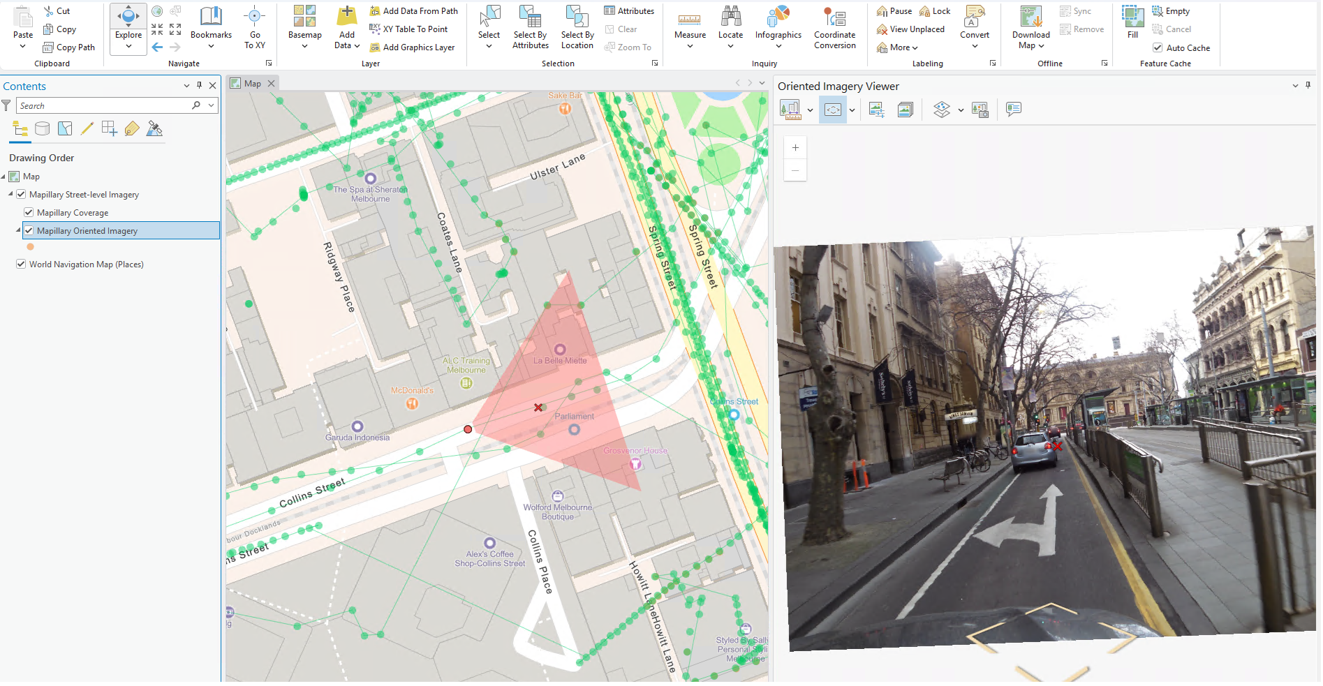
You can add a web map or a web scene with the imagery layer in the project. When selecting the Mapillary Oriented Imagery, open the Explore Imagery tool under the Oriented Imagery Layer ribbon.
Map Viewer
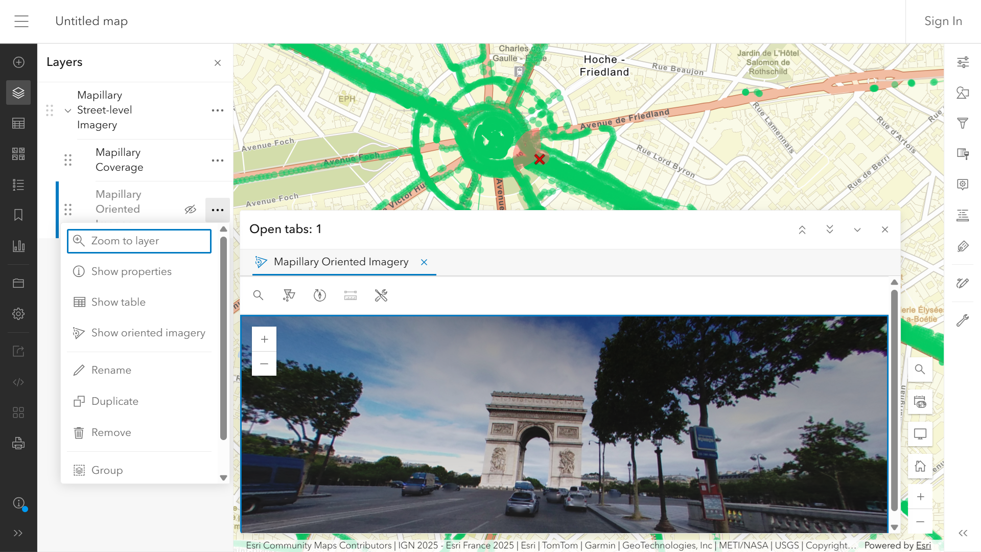
You can save a web map with the imagery layer. The oriented imagery viewer in Map Viewer is now launched directly from the oriented imagery layer.
Scene Viewer
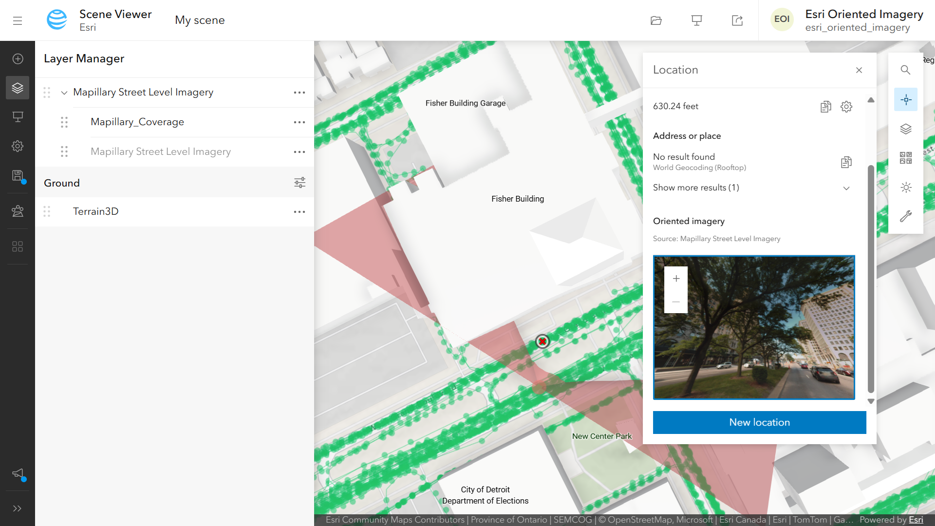
You can save a web scene with the imagery layer. To view the street-level images, please enable the visibility of oriented imagery layer within the imagery group layer, and open the Location Tool, new in ArcGIS Online June 2026 update. For more information, check out the section “See from above and on the ground with oriented imagery” in this What’s New in Scene Viewer blog article
ArcGIS Experience Builder
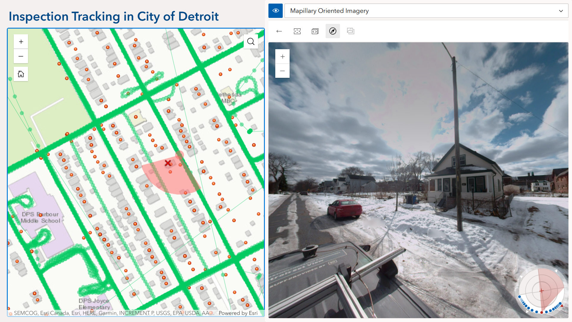
You can create web apps from a web map or a web scene with the imagery layer and your own data layer, and share with your audience. View the street-level images with the Oriented Imagery Viewer widget in the apps. To learn more, check out this blog post.
Below example is an Experience Builder app example tracking inspection issues in City of Detroit.
ArcGIS Instant Apps
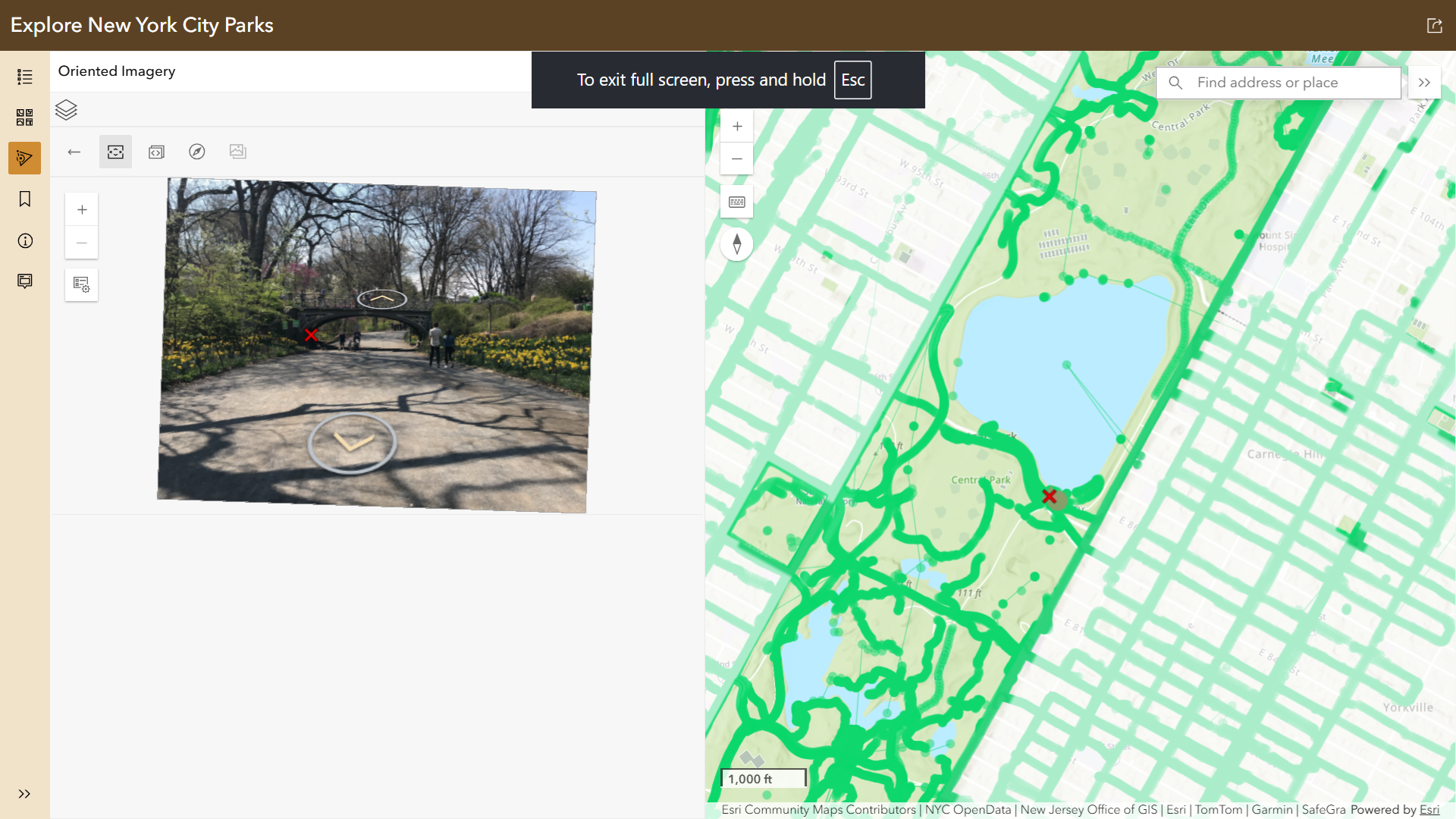
You can create web apps from a web map with the imagery layer and your own data layers using the Sidebar template, or from a web scene using 3D Viewer template. View the street-level images with the Oriented Imagery Viewer tool in the apps.
Below example is a Sidebar instant app example exploring New York City Parks.
How to share your feedback
We encourage you to try out this Mapillary global street-level imagery (beta) in ArcGIS ecosystem and explore the value of adding this imagery to your GIS workflow. Share your feedback with us in Esri community ArcGIS Living Atlas.
If you plan to attend the Esri User Conference next month, don’t forget to visit us at the Living Atlas showcase in the Expo Hall.


Cool, very useful.