Millions of scientists and naturalists around the world utilize the iNaturalist network to share detailed information about the biodiversity and species around them. The iNaturalist vision is described as a “a world where everyone can understand and sustain biodiversity through the practice of observing wild organisms and sharing information about them”. [1] The project allows you to record your observations, share with fellow naturalists, and discuss your findings with the community.
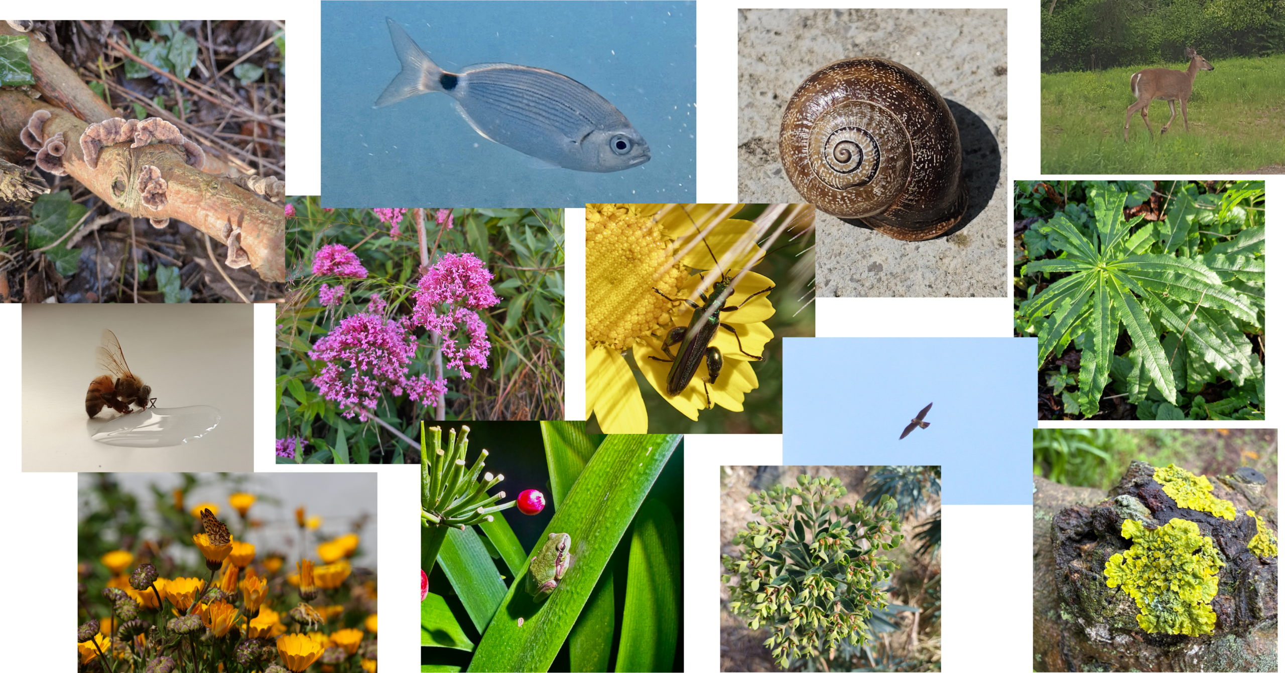
In 2024, a Beta iNaturalist service was released into ArcGIS Living Atlas to bring citizen science observations into ArcGIS for visualization and analysis. From the beta release, feedback has been collected from the user community, and we are pleased to announce that there is now a new updated iNaturalist layer, in general availability.
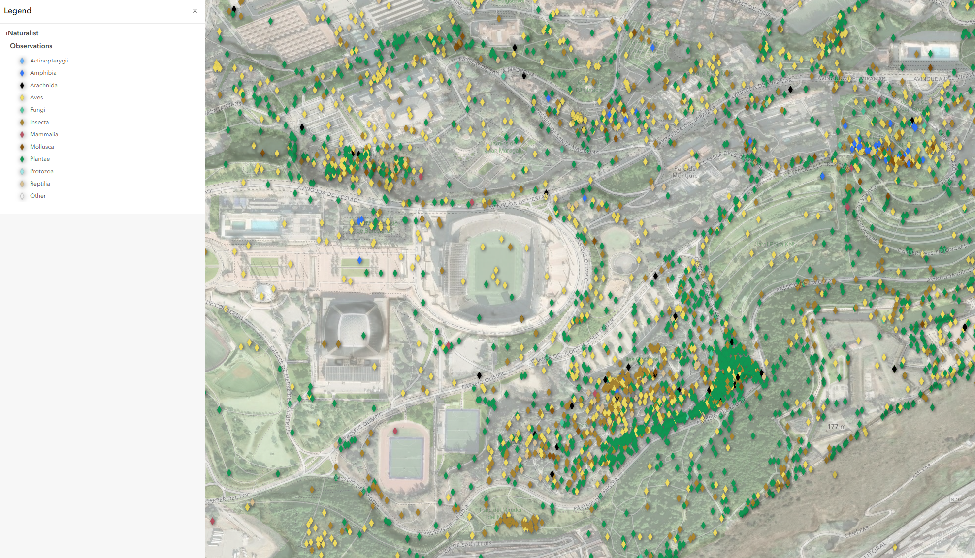
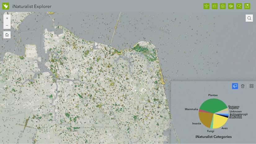
This new layer provides over 150 million observations from iNaturalist, which allows the public to share the plants, animals, and organisms around them. This impressive display of citizen science allows the broader GIS and scientific community to better understand and validate the natural patterns which surround them.
Enhancements
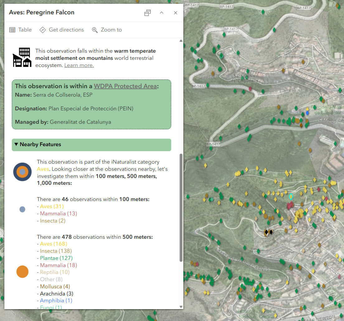
Based on the feedback from the beta service, we are excited to announce additional added data attributes, and an improved pop-up experience. These additions make the experience more closely align with what is available in iNaturalist. The pop-up has been designed to provide a comprehensive view of each observation and how it intersects with the world around it. The enhancements include:
- Access to all iNaturalist images and audio media from an observation (max=20 records)
- Direct link to the observation on the iNaturalist website
- Project ID names (if available)
- Location uncertainty in meters (due to user privacy settings or threatened/endangered species status)
- Infraspecific taxon names (e.g., subspecies, varieties, or forms, if specified)
- Observed on Date now uses the Timestamp Offset field type to capture the local date and time zone the observation was captured
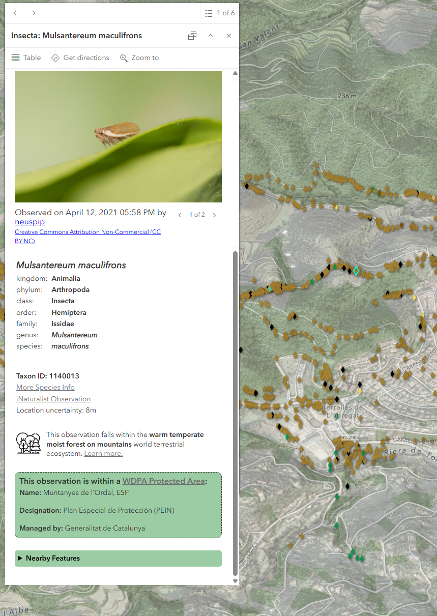
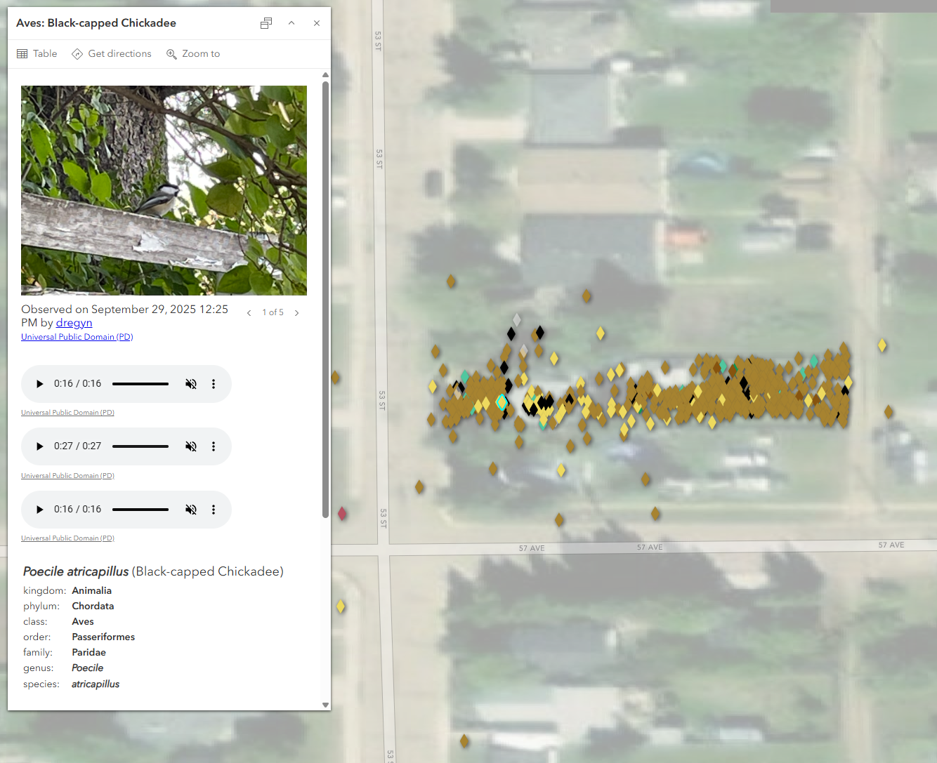
The pop-up also highlights two important geographic intersections: World Terrestrial Ecosystems, and protected areas (WDPA). If the iNaturalist observation falls within one of these areas, a summary will appear in the pop-up providing more information. There is also a dropdown block that showcases a local summary of nearby species observations.
Introducing a new way to access iNaturalist within ArcGIS
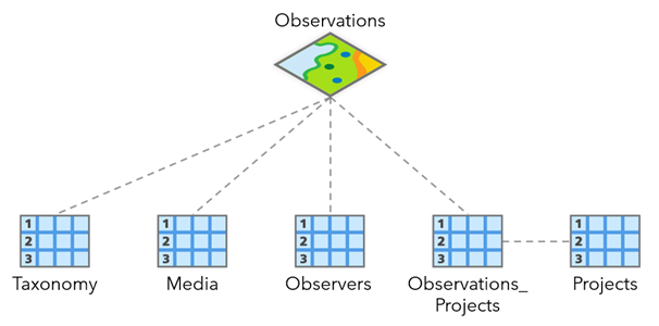
To accommodate such a rapidly growing dataset (over a million new observations a month!), there is also a new schema format for the iNaturalist service. Taxonomy, Media, and Projects are now available within related tables, allowing users to access all available images, observer details, audio files, and project information for each observation.
There are two ways to access the latest iNaturalist layer from ArcGIS Living Atlas:
If you are currently using the Beta iNaturalist layer or want to add iNaturalist to your maps:
- Open your map and add the new iNaturalist layer by searching Living Atlas for “iNaturalist” and adding the layer named “iNaturalist Species Observations”.
If you want to access a ready-to-use web map:
- Search Living Atlas for “iNaturalist” and find the web map item. This web map can be added into your apps and projects, and it already contains a custom basemap designed to work well with the cartography of the iNaturalist layer.
More about the Data and Layer
What can I do with iNaturalist observation data?
Citizen science observations from iNaturalist are used by conservation biologists, ecologists, and biodiversity researchers to better understand species distributions, as well as the environmental or policy threats to their habitats over time. Simply adding these observations to your existing apps can provide a lot of public interest and context on nearby biodiversity.
Individual species can also be filtered and copied from the service using the Scientific Name or Common Name attributes, and these points can be used in a variety of analytical workflows. For example, the Space Time Kernel Density tool can be used to understand the distribution of species observations over a defined time window, like the seasonal movement of morel mushroom observations in North America (example).
The Presence-only Prediction (MaxEnt) tool is also useful for determining the probability of presence of species, taking into account their spatial distribution in the context of environmental covariates, like climate, elevation, land cover, or distance to water. For example, black bear sightings near busy highways in Pennsylvania may be combined with the Locate Regions tool to find new candidate locations for wildlife crossings (example).
What is included in the Living Atlas layer?
Only Verifiable and Research-Grade observations are included in this service, which must meet the following requirements (see here for more information on how iNaturalist assesses data quality):
- Has an observation date/time
- Is georeferenced (has latitude/longitude coordinates)
- Has at least one photograph or sound recording
- Is not a captive or cultivated organism
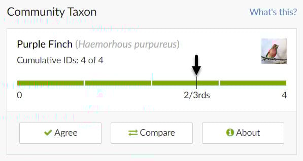
All citizen scientists can submit their species observations through the iNaturalist app on their phone, but in order to be deemed as “research grade”, the wider community of naturalists need to agree upon the taxon classification. Experts within the community are able to confirm or suggest species details to help promote an observation to research grade.
Location accuracy
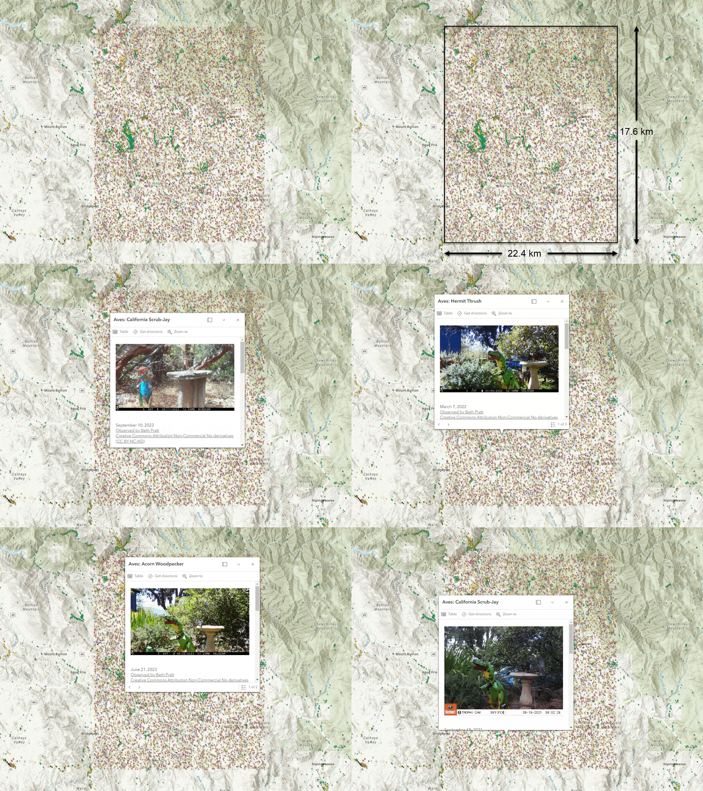
Privacy safeguards have been built in to the dataset in order to protect the participants as well as the natural environment. Threatened or endangered species are automatically tagged using their taxon identification, and the exact location is obscured to help protect the species. When viewing the observations on the map, you may see “blocks” of data as an artifact. For more information about the geoprivacy efforts put in place by iNaturalist, visit this resource.
Observation Bias
Because observations are collected via a social media experience, the observations are likely to correlate to various factors by those collecting them. A few of these observer behaviors are:
- Population – maps of observations mimic population maps. Where people are, people observe.
- Weekends – People tend to observe more on weekends in free time or holidays, so fewer observations are recorded on weekdays.
- Weather – People observe when weather is more comfortable, and where the vegetation is easier to navigate.
- Oddities – People take pictures of things that are unusual or less common because they find these things more interesting.
These are just a few considerations, but are worth noting when using the dataset. For more information and data considerations, visit this story.
Beta Service
The beta service will be updated for the coming months, but in late 2026 the service will no longer have the latest iNaturalist observations added to it. The beta service will eventually be retired and removed.
Update frequency
The iNaturalist layer in Living Atlas will be updated monthly. If you do not see an observation that was added recently, please revisit the service in the coming weeks to access the new observation.
Full Metadata
To learn more about the layer, release notes, the hexbin aggregated layers, or details about the data attributes, access the item details on the new layer for more information.
Contribute your Observations
Join the iNaturalist community to become part of the largest group of naturalists in the world! The observations are shared with the Global Biodiversity Information Facility where scientists can find and use the data for topics such as conservation, climate change, metagenomics, and more. Use the iNaturalist website to join, find tutorials, and learn more about the naturalist community.
From iNaturalist:
“Get connected with a community of millions scientists and naturalists who can help you learn more about nature! What’s more, by recording and sharing your observations, you’ll create research-quality data for scientists working to better understand and protect nature. So if you like recording your findings from the outdoors, or if you just like learning about life, join us!“
More iNaturalist Resources:

Article Discussion: