The ArcGIS Living Atlas provides foundational elevation layers and tools that support analysis and visualization throughout the ArcGIS system. These layers are updated quarterly with high-resolution elevation data from federal agencies, open data programs, and the Community Maps Program. Esri delivers these datasets as ready-to-use services that help organizations leverage authoritative elevation data for mapping, analysis, terrain visualization, and 3D workflows.
In this release, the World Elevation layers, Terrain and TopoBathy, have been updated with the following high-resolution digital terrain models (DTMs):
- Luxembourg: New 50-centimeter lidar-derived DTM coverage for the entire country. This dataset provides approximately 48 times more detail than the previously available Airbus WorldDEM4Ortho.
- Sweden: New 1-meter lidar-derived DTM coverage for the entire country, providing approximately 24 times more detail than the Airbus WorldDEM4Ortho.
- Japan: Expanded 5-meter elevation coverage is now available across much of Japan, adding extensive new high-resolution terrain data throughout the country’s main islands.
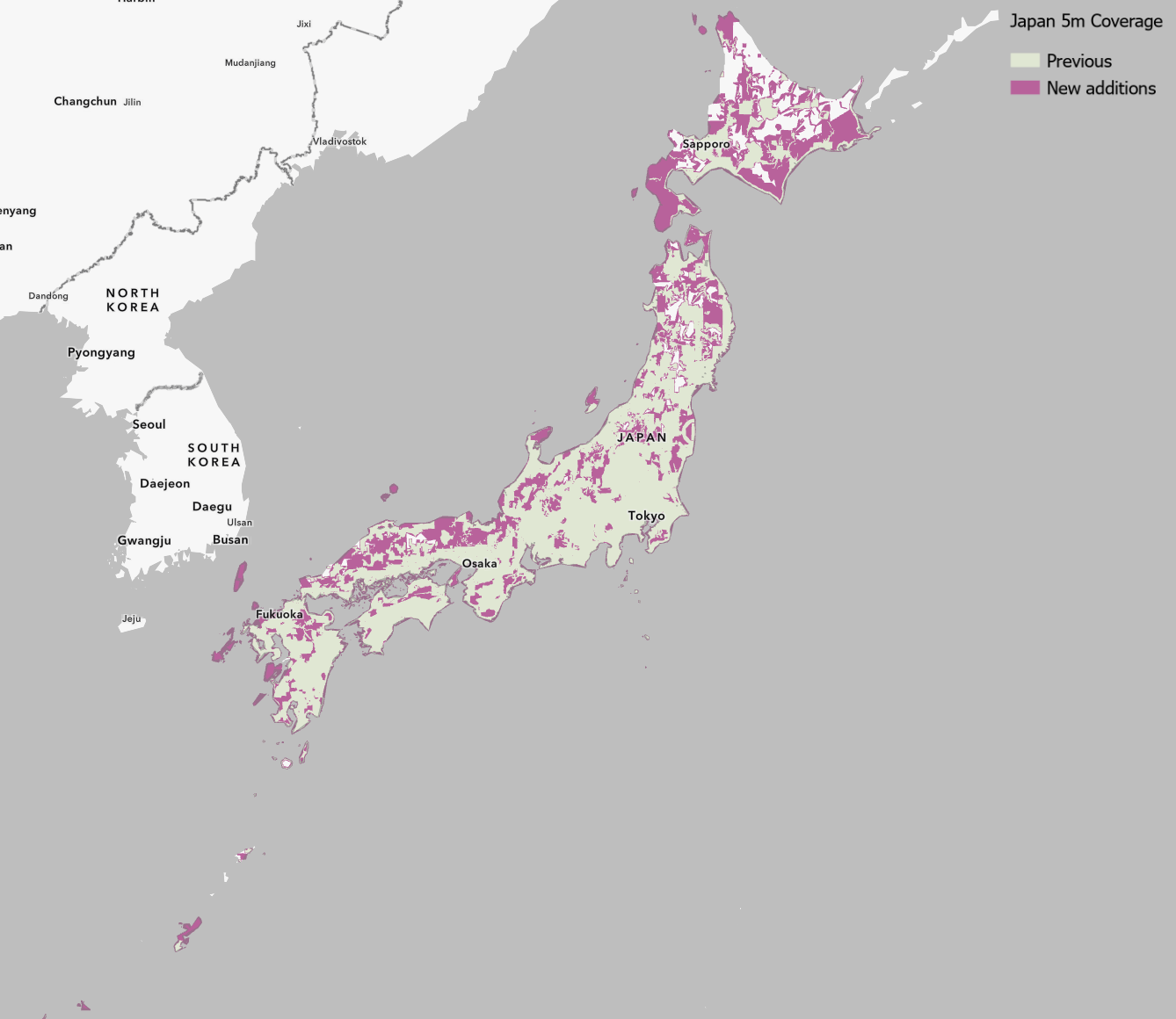
- Japan: Updated 10-meter elevation data replaces the previous version, providing improved elevation quality and consistency across Japan.
- Netherlands: New AHN5 and AHN6 50-centimeter lidar-derived DTMs have replaced the previous-generation AHN3 and AHN4 datasets.
- Canada: The new MRDEM 30-meter DEM provides nationwide elevation coverage across Canada.
- United States: Expanded USGS 3DEP 1-meter lidar-derived DTM coverage across the conterminous United States. Approximately 441,000 square kilometers of new coverage were added in this release.
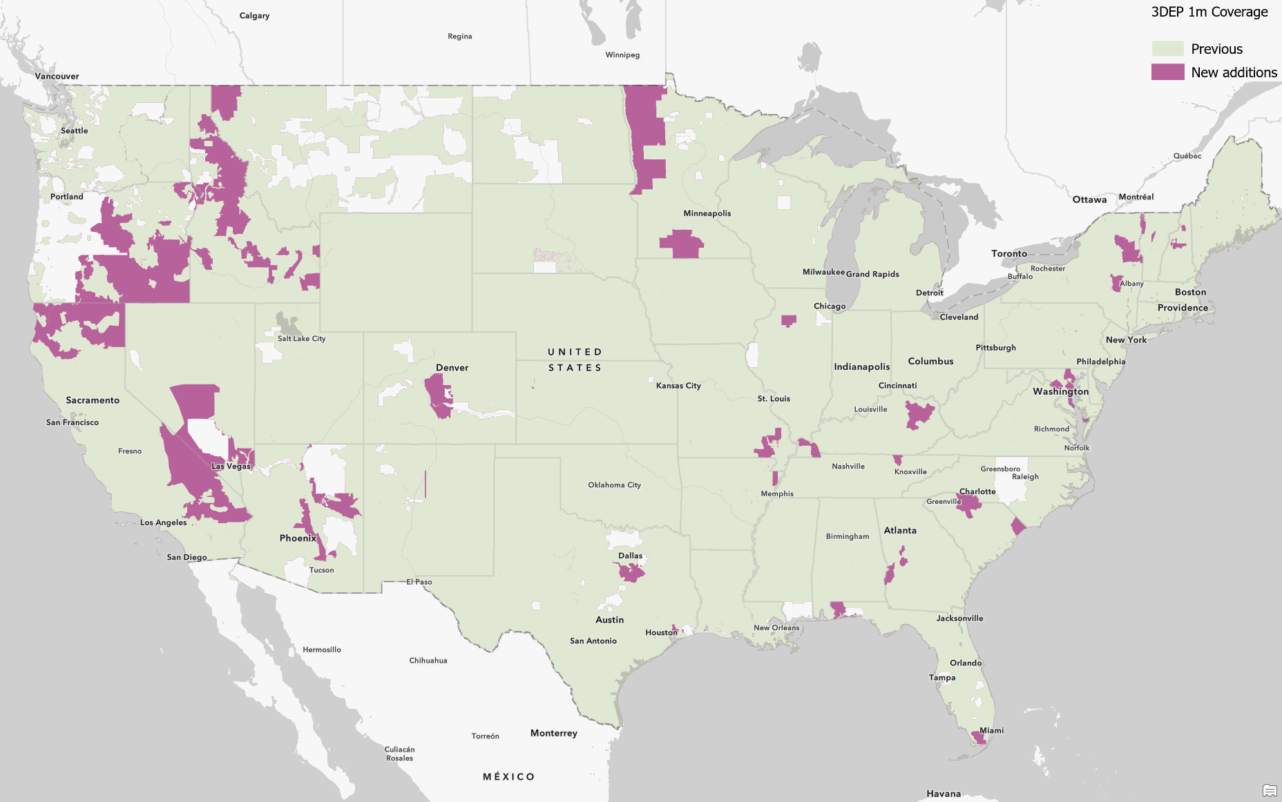
- United States: Updated USGS 1/3 arc-second (approximately 10-meter) seamless DEM providing complete coverage of the conterminous United States, Alaska, Hawaii, and U.S. territories.
- North America: Updated USGS 1 arc-second (approximately 30-meter) seamless DEM covering the conterminous United States, Alaska, Hawaii, Canada, and Mexico.
Ready-to-Use Elevation Tools
The ready-to-use elevation analysis tools, including Profile, Viewshed and Summarize Elevation, have also been updated with the latest Sweden 10-meter DTM, USGS 3DEP 1/3 arc-second DEM, and USGS 1 arc-second DEM datasets.
Examples of the Updates
The following examples highlight some of the improvements now available through the updated World Elevation services.
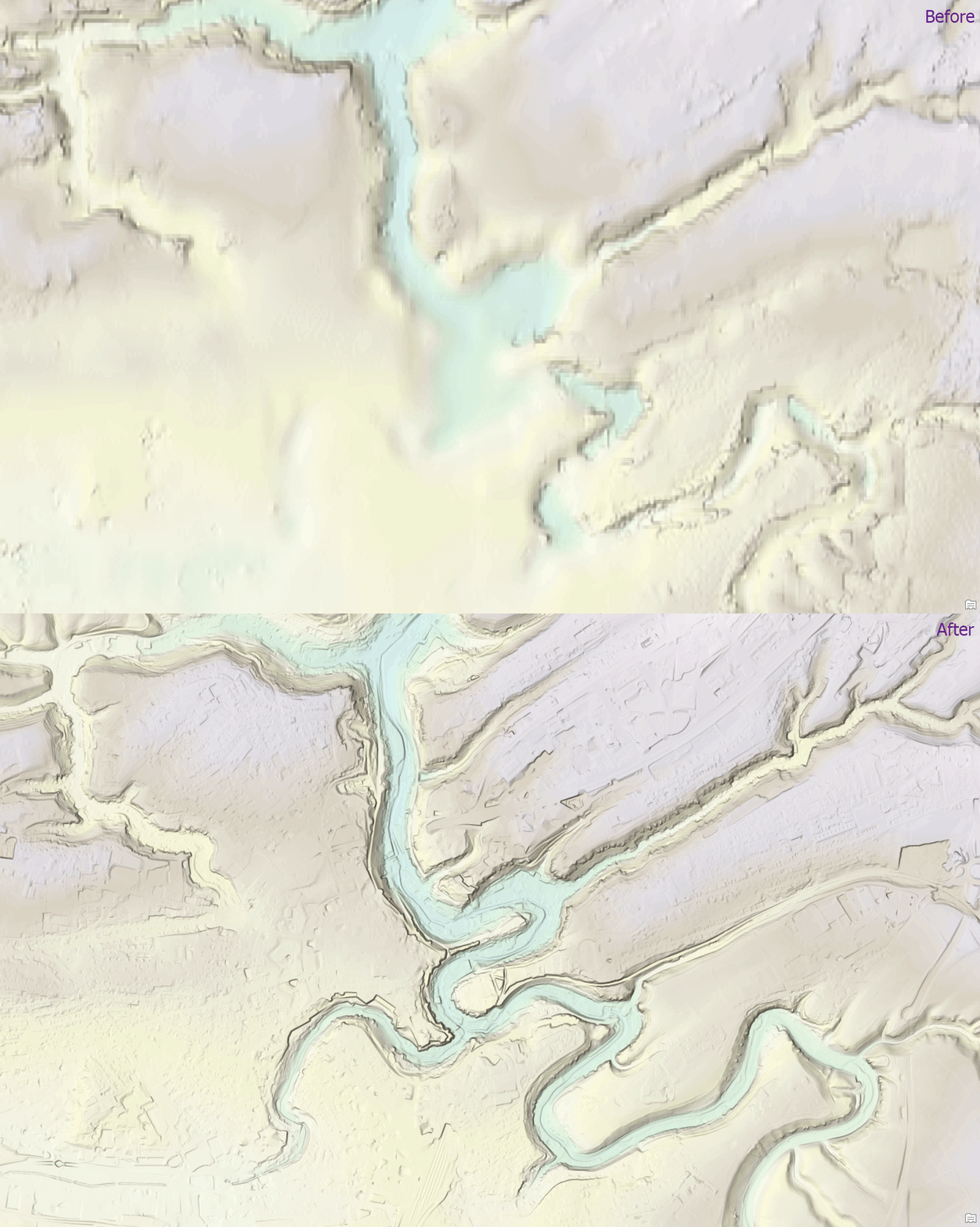
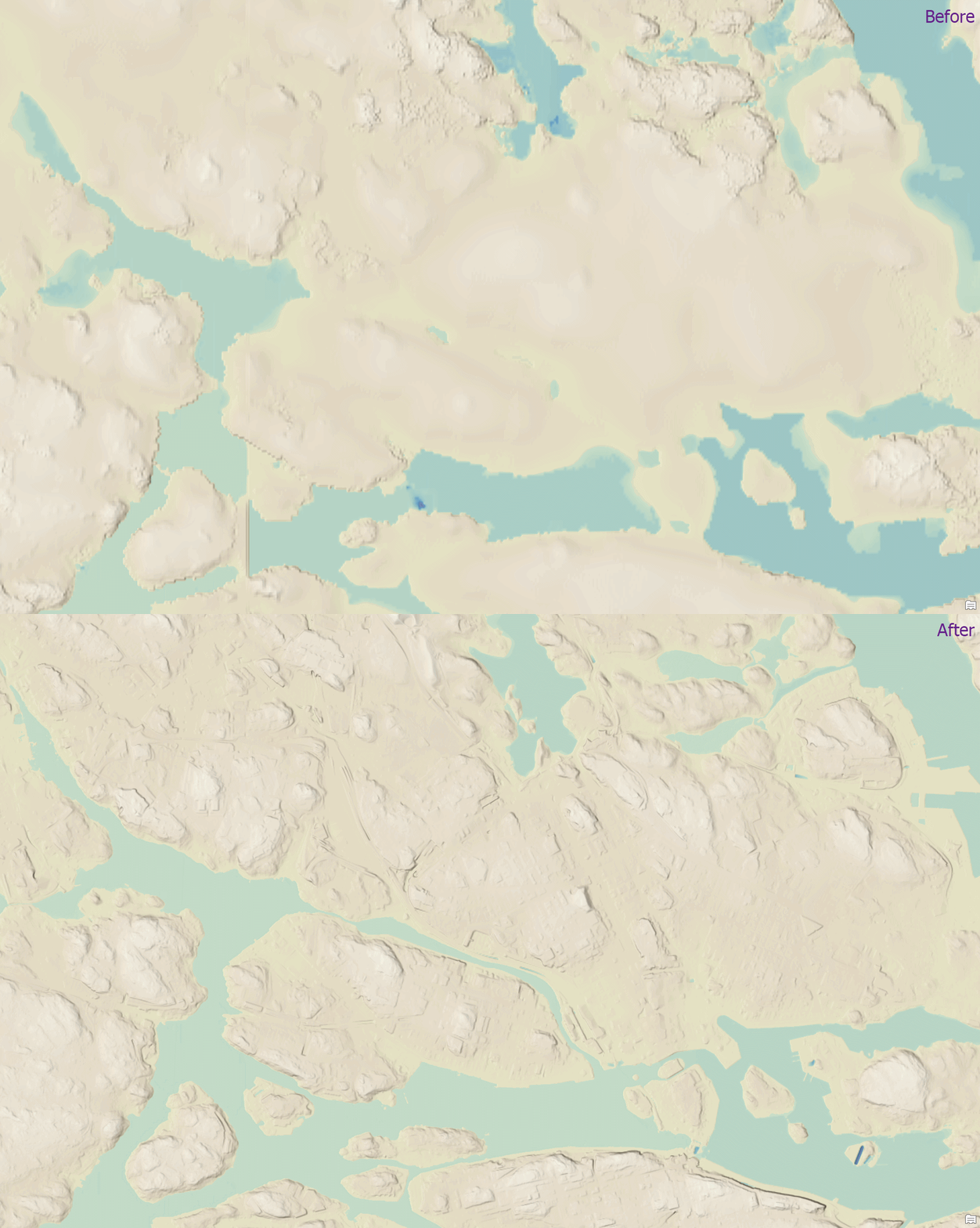
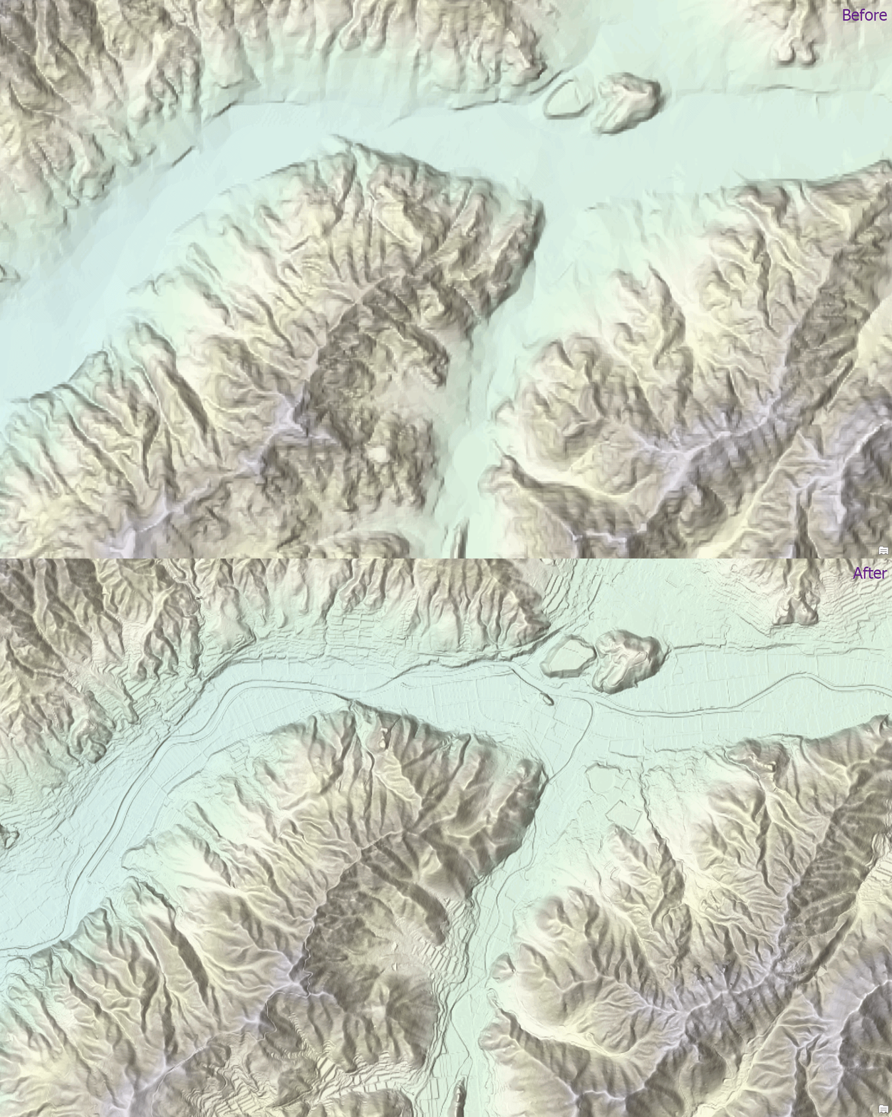
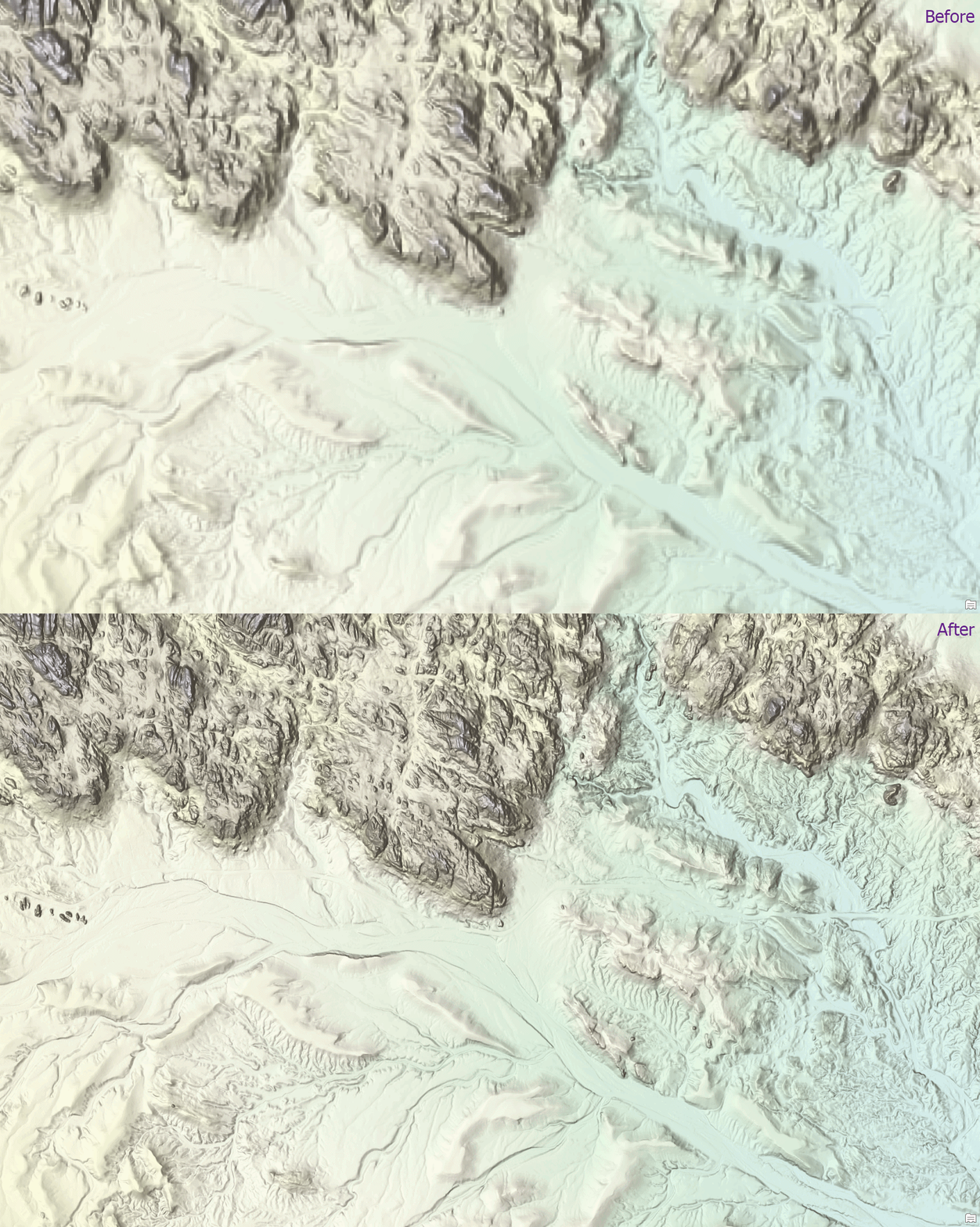
These updates are expected to be incorporated into the World Elevation tiled services, including the 3D elevation layers Terrain3D and TopoBathy3D, as well as World Hillshade and World Hillshade (Dark), during the first quarter of 2027.
To view the coverage extents and source datasets used in the World Elevation services, explore the World Elevation Coverage Map.
You can help improve these services by contributing high-resolution elevation data through the Esri Community Maps program. To learn more about participating, visit the Community Maps for Elevation program page.

Article Discussion: