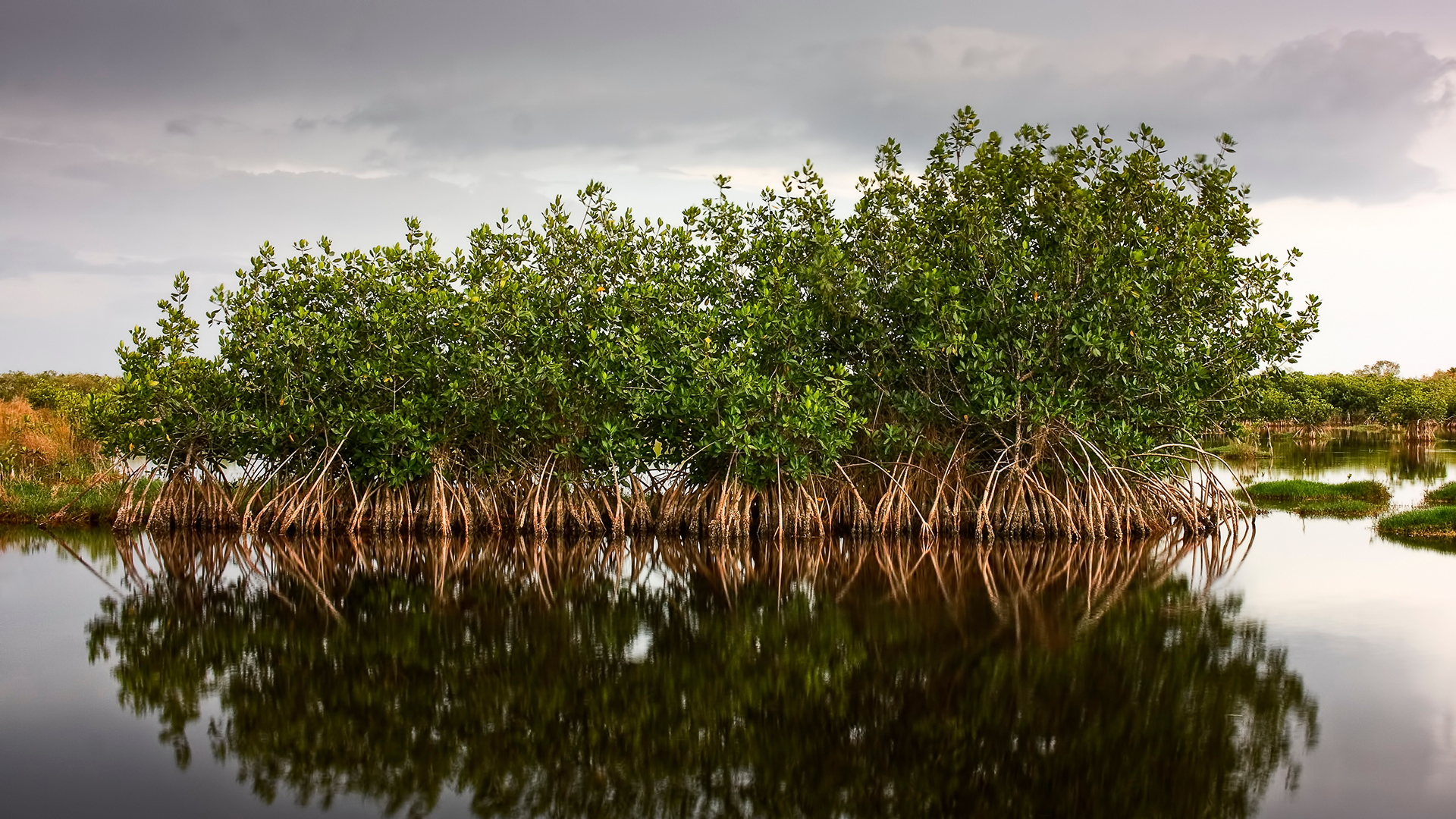
Mangrove forests are among the most vital and dynamic ecosystems on our planet, providing critical habitat for wildlife, protecting coastlines, and playing an essential role in carbon sequestration. Today, I’m thrilled to share the news of an exciting addition to the ArcGIS Living Atlas of the World: the Global Mangrove Layer, contributed by NASA’s Carbon Monitoring System.

A Unique Global Resource from NASA
This new layer represents a significant leap forward in our ability to map, monitor, and understand mangrove coverage on a planetary scale. Developed by the NASA Carbon Monitoring System, the Global Mangrove Layer offers a comprehensive, high-resolution view of mangroves worldwide, capturing details and patterns previously unavailable to the GIS community.
Unlike many existing datasets, this contribution stands out for its precision and completeness. The innovative methodologies and remote sensing technologies employed by NASA have resulted in a resource that is not only unique but also incredibly useful for researchers, conservationists, policymakers, and anyone interested in coastal environments.
High Resolution for Deeper Insights
One of the most exciting features of this layer is its high resolution. The fine spatial detail of 30 meters, enables users to discern the extent of mangrove forests with unprecedented clarity, supporting robust analysis at both global and local scales. Whether you’re tracking changes in mangrove extent, assessing ecosystem health, or planning restoration efforts, this dataset provides the granular information needed to drive effective decision-making.

Three Variables, One Layer: Comprehensive Mangrove Monitoring
The richness of this layer lies in its multidimensional approach. The dataset presents three distinct but interconnected variables:
- Aboveground Biomass: Accurately delineates the spatial extent of mangrove forests, offering a baseline for tracking change.
- Maximum Canopy Height: height of the tallest tree.
- Basal-area Weighted Height: individual tree heights weighted in proportion to their basal area.
These variables together create a holistic portrait of mangrove health, productivity, and climate impact—enabling a wide range of applications, from conservation planning to carbon accounting.

Applications for the GIS Community
With the Global Mangrove Layer now live in the ArcGIS Living Atlas of the World, the door is open for a wealth of new applications. Here are just a few potential uses:
- Conservation Planning: Identify critical mangrove habitats and prioritize areas for protection or restoration.
- Climate Research: Quantify carbon storage in mangrove ecosystems and support climate mitigation strategies.
- Disaster Risk Reduction: Map mangrove buffers to understand and enhance coastal resilience against storms and erosion.
- Community Engagement: Share compelling, data-driven maps and stories that raise awareness about the importance of mangroves.
Looking Ahead
The addition of NASA’s Global Mangrove Layer is a testament to the power of collaboration between science and geospatial technology. I’m eager to see how the GIS community will leverage this unique dataset to advance our understanding of mangrove dynamics, inform sustainable management, and inspire action for these critical coastal forests.
Explore the Global Mangrove Layer in the ArcGIS Living Atlas of the World, and join the conversation as we harness new data to protect and preserve our planet’s most valuable ecosystems.
Layer: https://arcg.is/15Om4u0
More information: https://doi.org/10.3334/ORNLDAAC/1665


Article Discussion: