How do you know when your layer, map, dashboard or app is ready to share with others? What if you could evaluate your items’ qualities before you share them to the public or to colleagues within your organization?
ArcGIS Living Atlas has a new tool that GIS teams can use to 1) evaluate their ArcGIS Online item against Living Atlas criteria and 2) nominate their item to Living Atlas.
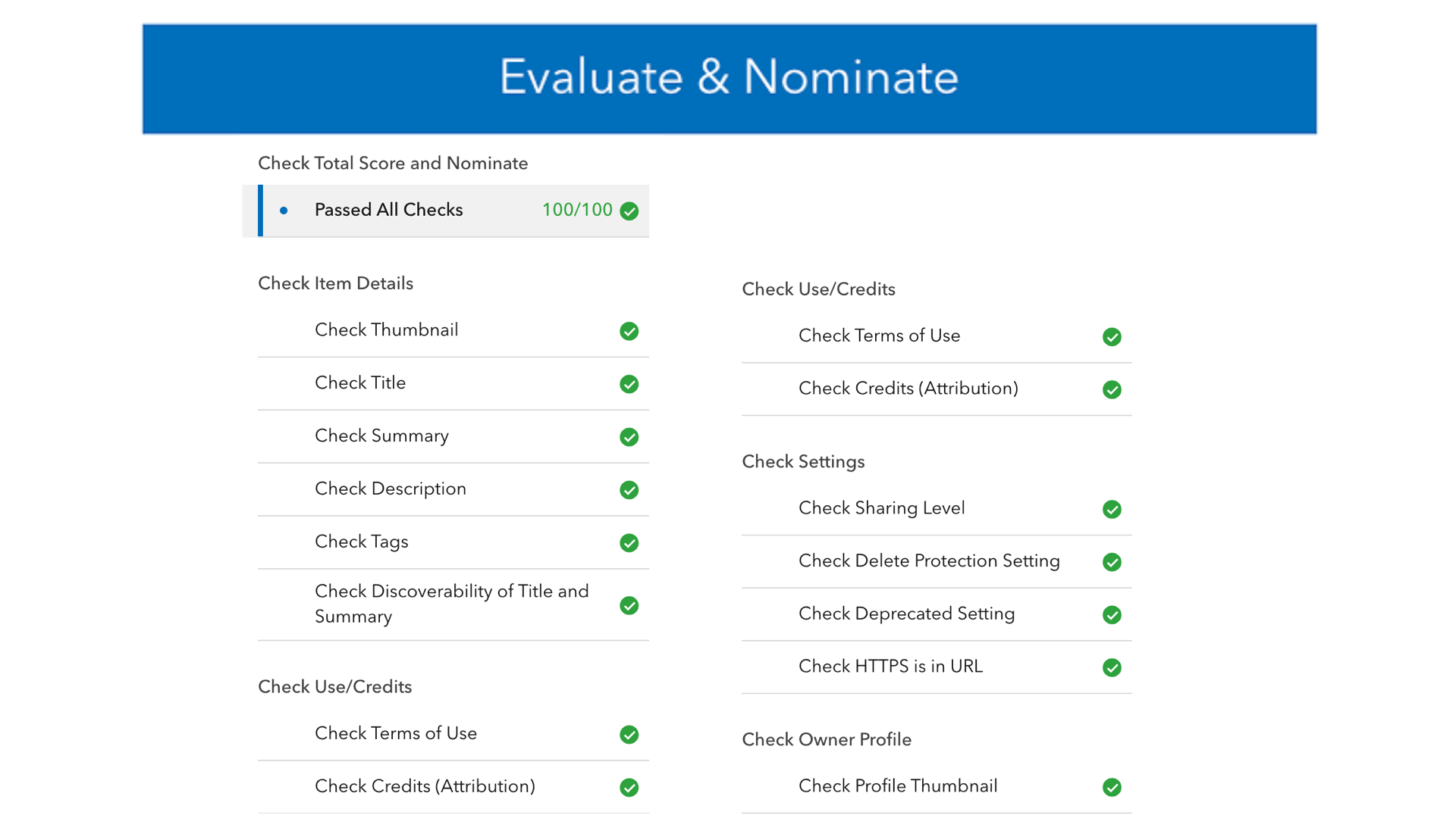
The new “Evaluate & Nominate” app lets you evaluate your item against the latest Living Atlas criteria. Whether you nominate your item to Living Atlas or not, the evaluation offers free, valuable best practices for sharing content to the GIS community. If your organization is a trusted source for layers, maps, dashboards, storymaps or tools, go ahead and nominate an item for inclusion in Living Atlas.
To try the app out, visit the “Contribute” page on the Living Atlas website to get started.

Why Evaluate your ArcGIS Online item?
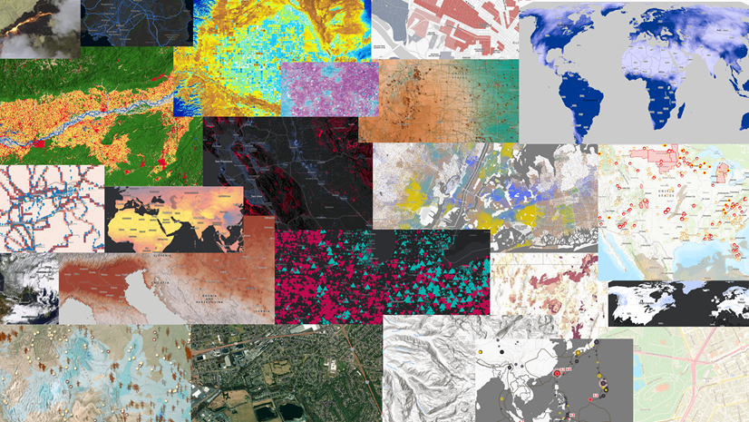
Since its launch a decade ago, ArcGIS Living Atlas has provided a curated collection of layers, maps, apps and other shareable GIS content. To be included in Living Atlas, an ArcGIS Online item must meet certain criteria as evaluated by a curator at Esri. By listening to the GIS community’s needs and questions every day, Living Atlas curators actively share their best practices for publishing layers and maps in meetings, phone conversations, emails and blogs (example).
Good news: many of the best practices and guidance you receive from a Living Atlas curator via an email are included within this new app, so that you can tap into that knowledge base simply by logging in and clicking on one of your ArcGIS Online items to get started.
Chances are good that your organization’s users can benefit from item improvements suggested by the evaluation. Many of the improvements this app recommends take just a few clicks to implement, such as turning on Delete Protection, and cleaning up Tags. Any organization which owns its data, layers, maps and apps is welcome to use this app to see what best practices are required/recommended for content nominated to Living Atlas. The evaluation is free, whether you are just curious or whether you intend to nominate the item to Living Atlas.


Why Nominate?
Living Atlas is the destination for ArcGIS users looking to find high quality, ready-to-use layers, maps, and apps to support their GIS workflows. Living Atlas includes content from the global GIS user community, Esri business partners, and Esri. Because Living Atlas is available throughout ArcGIS, contributing your best public content makes it easier for others to find and use your content in their work.
Help Others Find Your Items
Most apps like ArcGIS Pro and ArcGIS Online Map Viewer show the Title in search results, but the user often needs to click on an item to see its Summary. Some user interfaces also show the thumbnail. Fewer interfaces currently show the Title & Summary together, but in general the Summary information is one click away in most search results within ArcGIS.
The limited space in most search results displays puts a lot of pressure on a Title to make an item discoverable. The item Summary can help. Living Atlas “Evaluate & Nominate” app helps you evaluate your layer items’ Title and Summary content from a standpoint of discoverability.


For layer items (ArcGIS items like feature layers, imagery layers, group layers etc), this new app helps you evaluate this question: When a user is searching for your content, how well does your item’s Title and Summary support that search?
Users who search for layers consistently look for four pieces of information:
- Location or area of coverage, to understand which geographic area is included.
- Topic, to understand what this item is about.
- Year or Vintage, to understand how recently the data was collected or updated.
- Source organization/program, to understand where the item’s content originated
It is very rare that all four pieces of information can neatly fit in the Title of an item, so it is natural that the Summary section is the next best place to include key information that affects discoverability. Anything you cannot fit into the Title can certainly fit within the Summary section.
Title and Summary scoring is applied to layer items only at this time. If your layer item’s language is English, the words in your Title and Summary are evaluated. Full points are awarded if these four things are found in the item’s Title and/or Summary:
- Location or area of coverage (e.g., “London” or “England” or “Europe” or “Global” or “World” )
- Topic (e.g., “Parks” or “Population Density” or “Sea Surface Temperature” or “Basemap”)
- Year or Vintage (e.g., “2024” or “Current” or “Latest” or “1990-2020”)
- Source organization/program (e.g., “NASA” or “Sentinel” or “Produced by EcoVision Lab in the ETH Zurich Department of Civil, Environmental and Geomatic Engineering.”

The app evaluates your item’s Title and Summary to look for these four elements. If any are missing, you can edit your Title or Summary within the app, and the change is applied to your item immediately and the score updates. If the app is not giving your item the score it deserves for any of the four key elements, you can suggest the words or phrases that are already in your Title or Summary that you believe match a requirement. That suggestion is immediately given credit, since you know the subject matter, and the suggestion goes into a database for review and possible use by all users. That’s how the rule base grows over time, learning from the experts who know the content best.
Choose one of your top-tier content items to evaluate with this app by visiting the the Contribute tab on the Living Atlas web site.
For additional information about Living Atlas, see “Your Living Atlas Questions Answered“


Article Discussion: