ArcGIS Mission is Esri’s solution to organizational command and control when it is paramount to have everyone connected. ArcGIS Mission facilitates a constant flow of information between a command element and coordinating responders to include location relay, reporting of events, communications between Mission members, and dispatching capabilities. The power of Mission is that it brings your enterprise data to life.
At 11.5 we focused on enhancing the functionality of our overall product with some significant UI/UX enhancements to both the manager and responder applications.
Streamlining the Task Panel to Enhance Task Management
Building off of the Tasking Details panel introduced in a previous version, we expanded the experience to provide greater tasking capabilities. At 11.5 users can create new tasks from a csv which can be filled out with any number of tasks. Don’t worry, if you need a template, we include one for you. Once the tasks are loaded, we check them and provide guidance if there are any issues. Once verified, they will populate the task details panel and task panel in both manager and responder making the tasks available instantaneously.
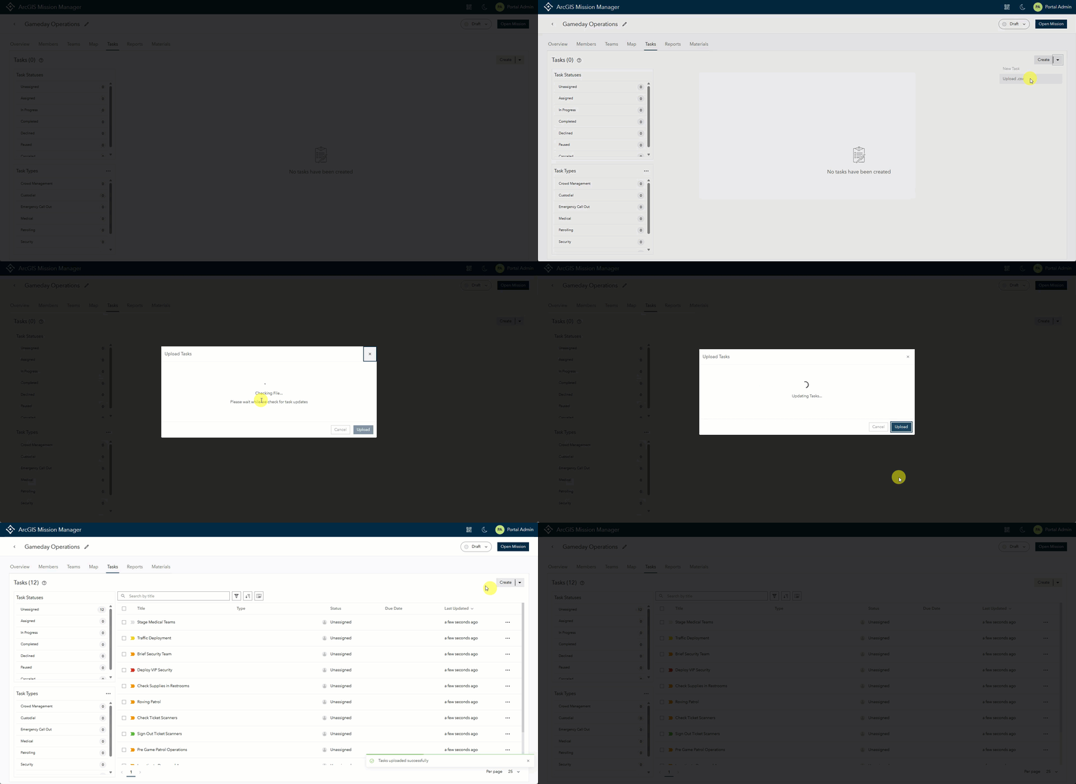
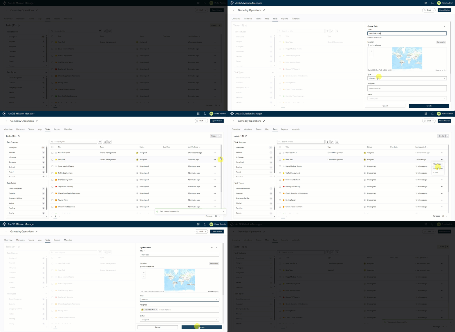
We also added the ability to fully edit any of the tasks in this panel with a full function task editor built into the interface. This same tool can be used to create an entirely new task if desired.
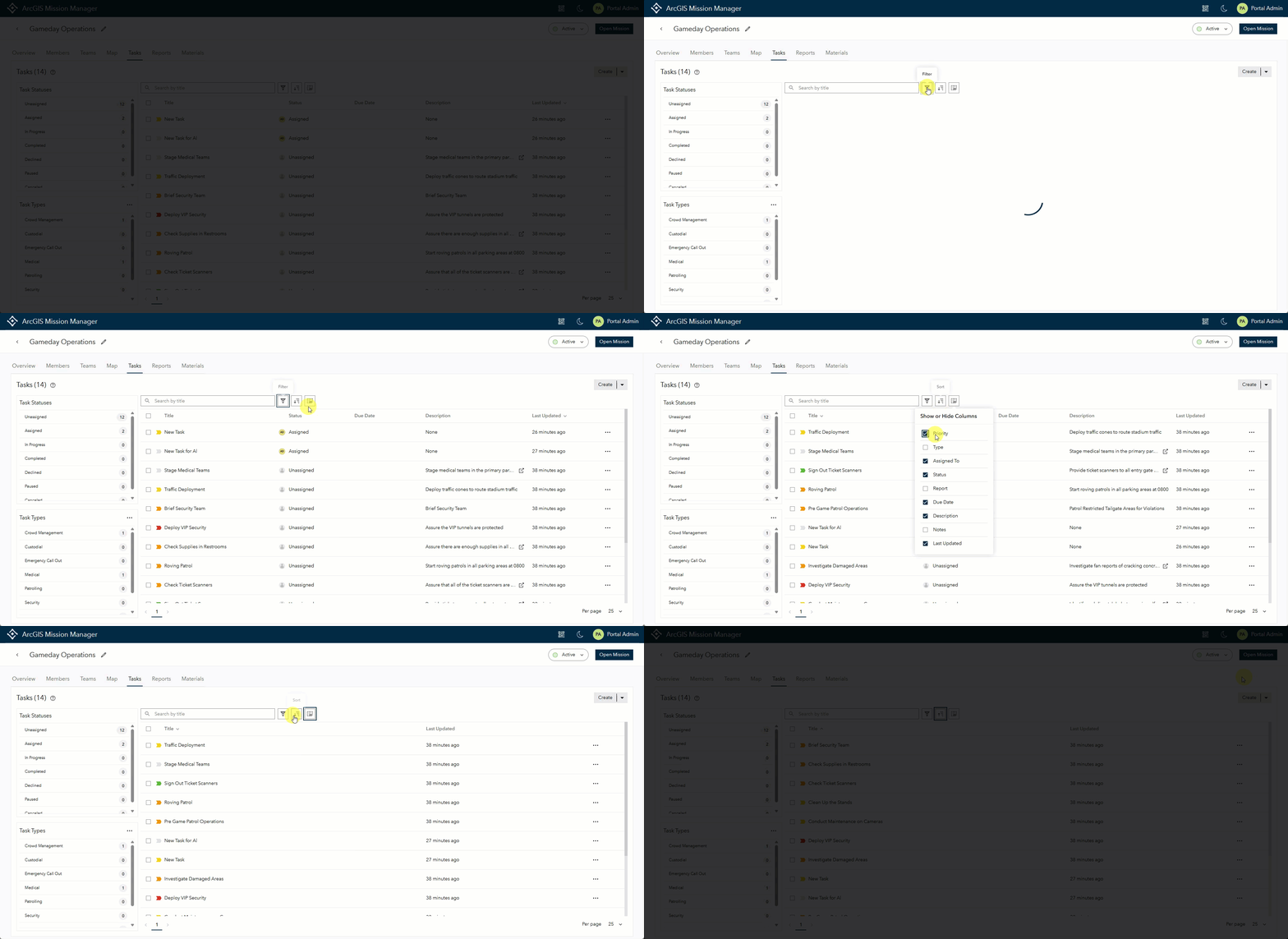
Finally, we expanded upon the filtering and sorting in the Task Details panel to handle any combination of data sorting that a user wishes to get answers. We also added the ability to configure visible columns in the task details panel to a users needs. Columns can be added or removed as needed.
Providing Context to Broadcast Messages
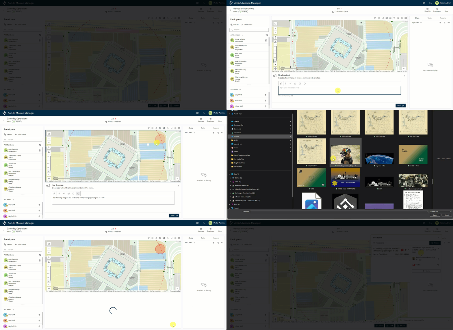
Broadcast Messages have become a very popular way for important group-wide information to be conveyed quickly. While they have been well received they always seemed to be missing something. At 11.5 we found that something and now allow users to add picture attachments as well as geo sketches to a broadcast. These additions help provide context to these messages and their audiences. Additionally, we expanded broadcasts to be sent from Responders in a mission lead role, extending the reach of front line information.
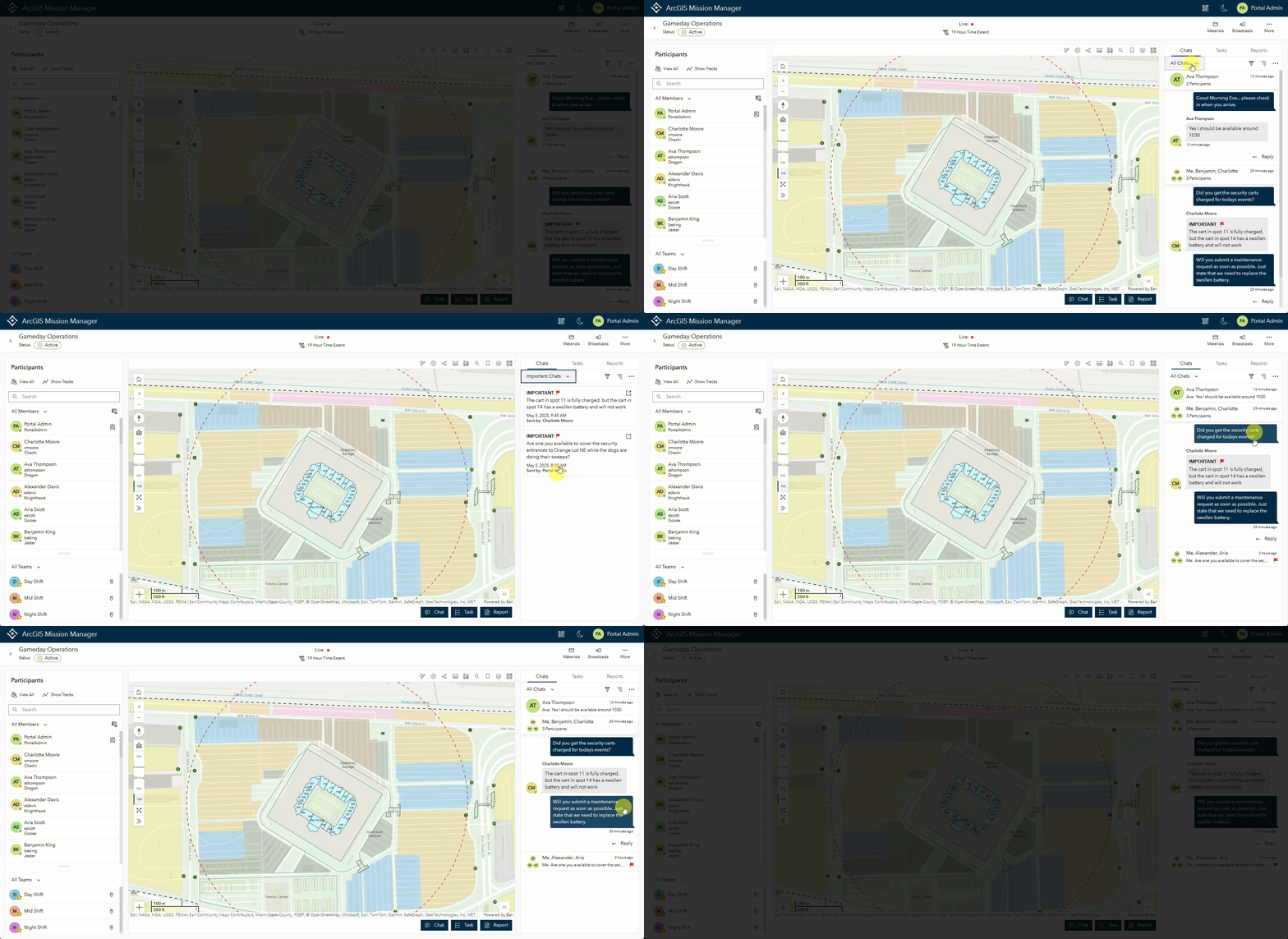
Filter Important Chats to Quickly Find and Update Status
At a previous version we introduced the notion of setting some chats as important to draw attention to information that has more weight than others. Extending upon this feature, at 11.5 we added a new filter to the Task Panel that allows a user to see all Important Chats in a single view when selected. The user can select the chat pop out navigating to the thread and specific area of that chat. Also, recognizing that messages may not maintain importance in eternity we now provide an option to “unflag” an important chat, reverting it back to a standard chat. This action can be changed as many times as necessary.
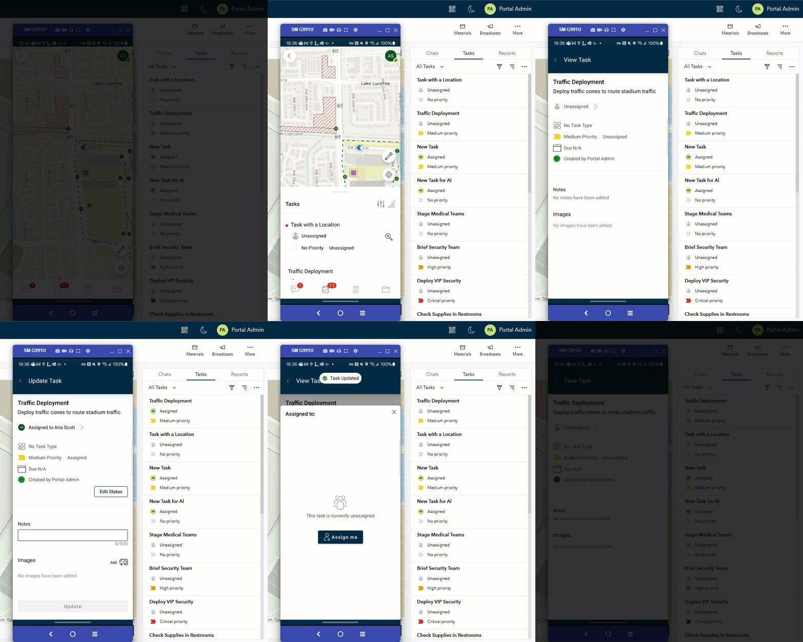
Responders can Manage Tasks by Assigning or Unassigning to Self
In ArcGIS Mission 11.5, responders can now assign or unassign themselves from tasks. This functionality enables tasks to be initially uploaded as unassigned, allowing Mission Responders to take ownership of tasks or remove themselves based on their current workload. This enhances task management significantly, empowering individuals with the necessary skills to determine what they can realistically achieve.
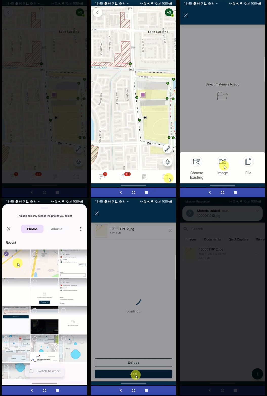
Responder Leads can Upload Materials from the Field
Enhancing the Mission Lead role in ArcGIS Mission Responder, field leads can now upload various materials directly from the field. This includes a wide range of items such as documents, PowerPoint presentations, and photos from both galleries and mobile devices. This feature enables quicker access to data compared to traditional email distribution. Once files are attached, they become accessible for all users to view.
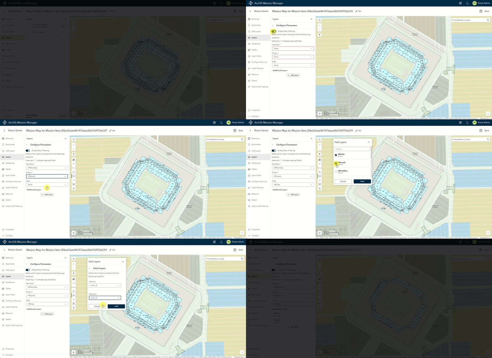
Expanding to the Great “Indoors”
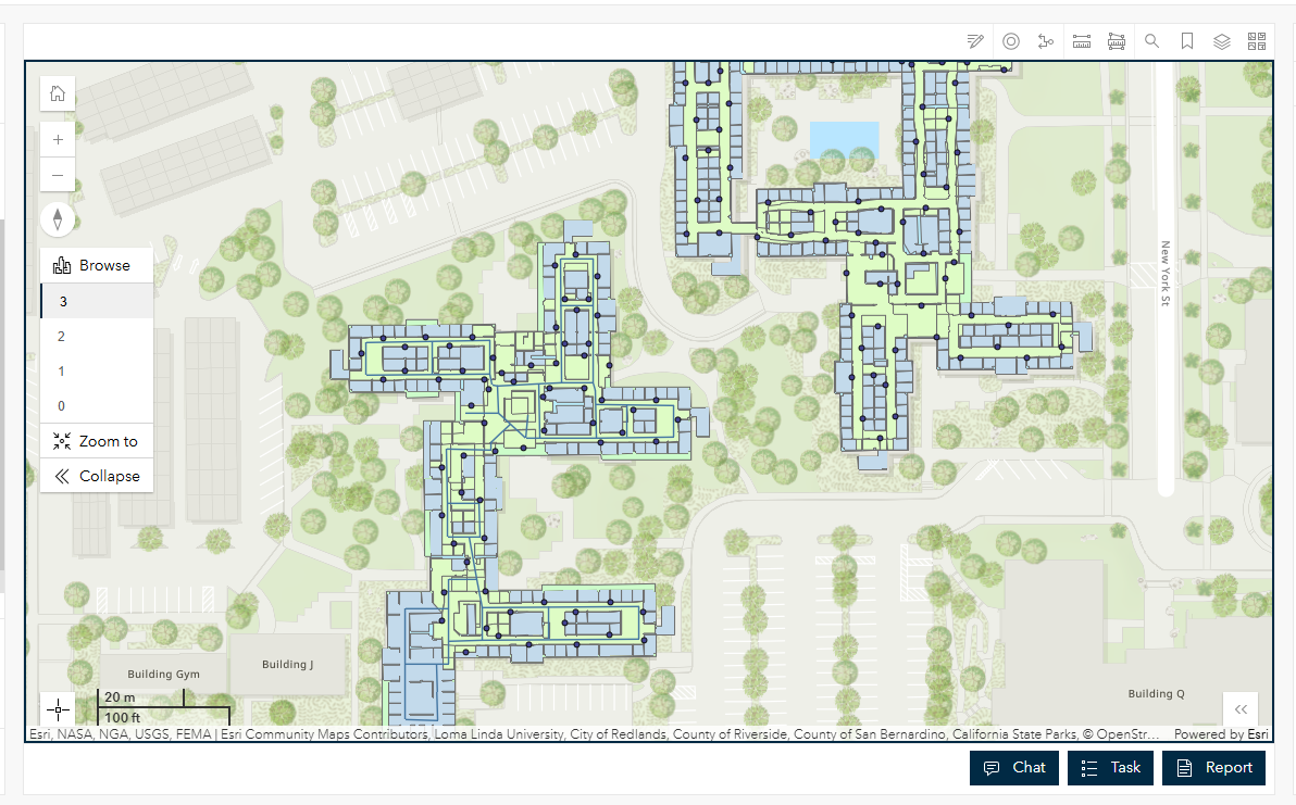
In a previous version, we introduced the ability to incorporate a published floor-aware enabled web map as the basemap into any mission. Building on this concept, Mission Owners or Administrators can now add any hosted feature service with underlying floor-aware configuration directly to the map in an edit map session. When these layers are added a message notifies users that the layers are ready for configuration. Selecting this option, users can make the necessary adjustments to enable floor awareness in their mission.
With Floor-aware enabled, it was only natural to take the next step and work with IPS configured networks. At 11.5 Mission Responder recognizes any web map that has an IPS network configured. When properly configured, ArcGIS Mission Responder can effectively navigate indoors using the available beacon system and IPS setup. This functionality ensures that the indoor locations of mission responders are accurately displayed within a building environment, free from interference caused by the building’s structural materials.
Manager and Responder Usability Enhancements
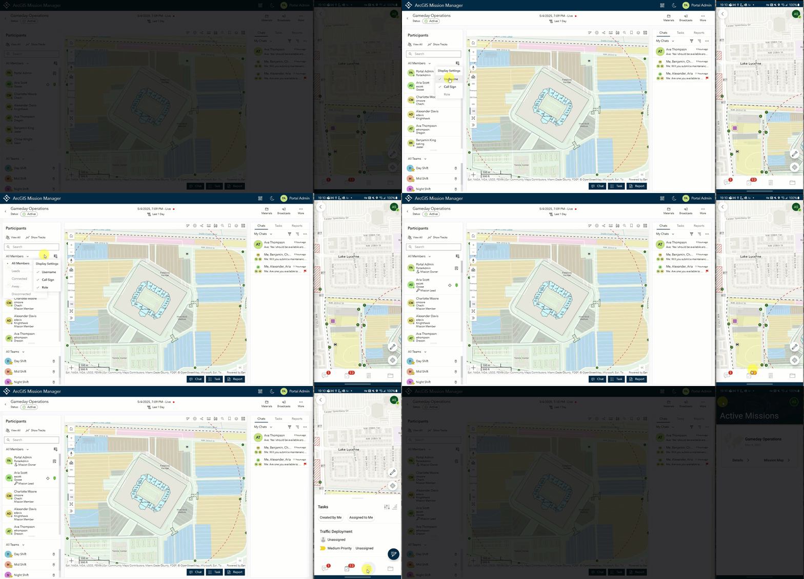
Finally we have focused in on some of the details to make the Mission Manager and Mission Responder apps more intuitive which ultimately will make mission participants more effective. Some of these enhancements include filters and toggles that can minimize or maximize display data in your mission participants panel. On the Mission Responder application, we have worked hard to make the interface smoother and more functional as a whole. These enhancements will continue to develop as the product evolves.
ArcGIS Mission has evolved and grown in a positive direction thanks to the requirements passed from our users. We look forward to evolving the product even further to the meet the needs of all that utilize Mission everyday to accomplish… the Mission.






Article Discussion: