The Reporter Instant App template continues to evolve with each release, guided by customer feedback and a focus on improving performance. The June 2025 update of ArcGIS Online introduces several enhancements designed to make the reporting experience more streamlined and responsive. Let’s take a closer look.
Restricting Report Submission Within a Boundary
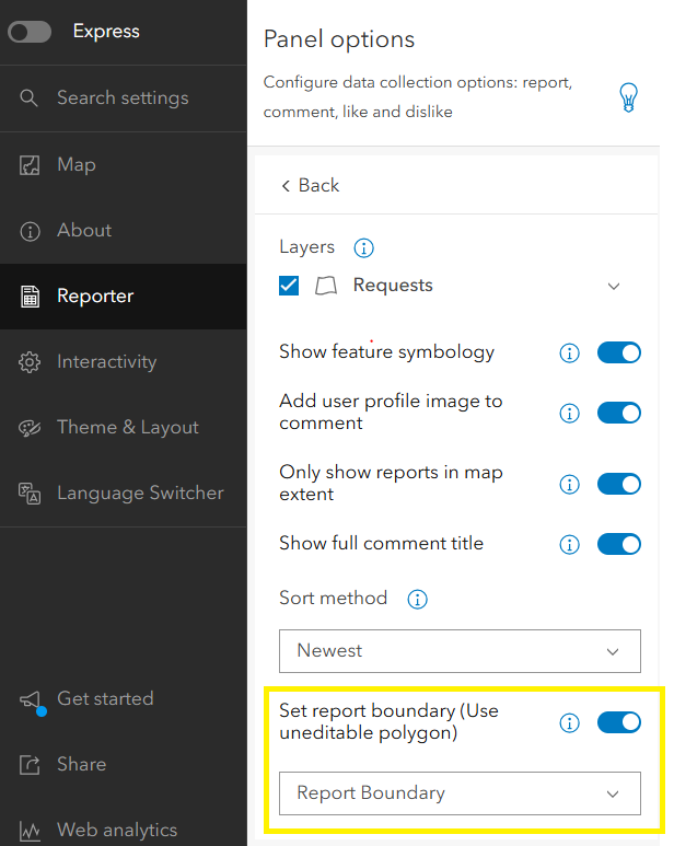
A new configuration option now allows app authors to restrict report submissions to a specific area. To use this feature, enable the parameter Set report boundary (Use uneditable polygon) in the configuration panel. This setting requires an uneditable polygon layer in the web map. This can either be a non-editable version of an existing layer, such as a city or county layer with editing turned off, or a new layer containing at least one polygon feature to act as the reporting boundary.
If a user creates a report outside the boundary, the app disables submission and displays a message (configurable by the app author) prompting the user to move the feature within the boundary.
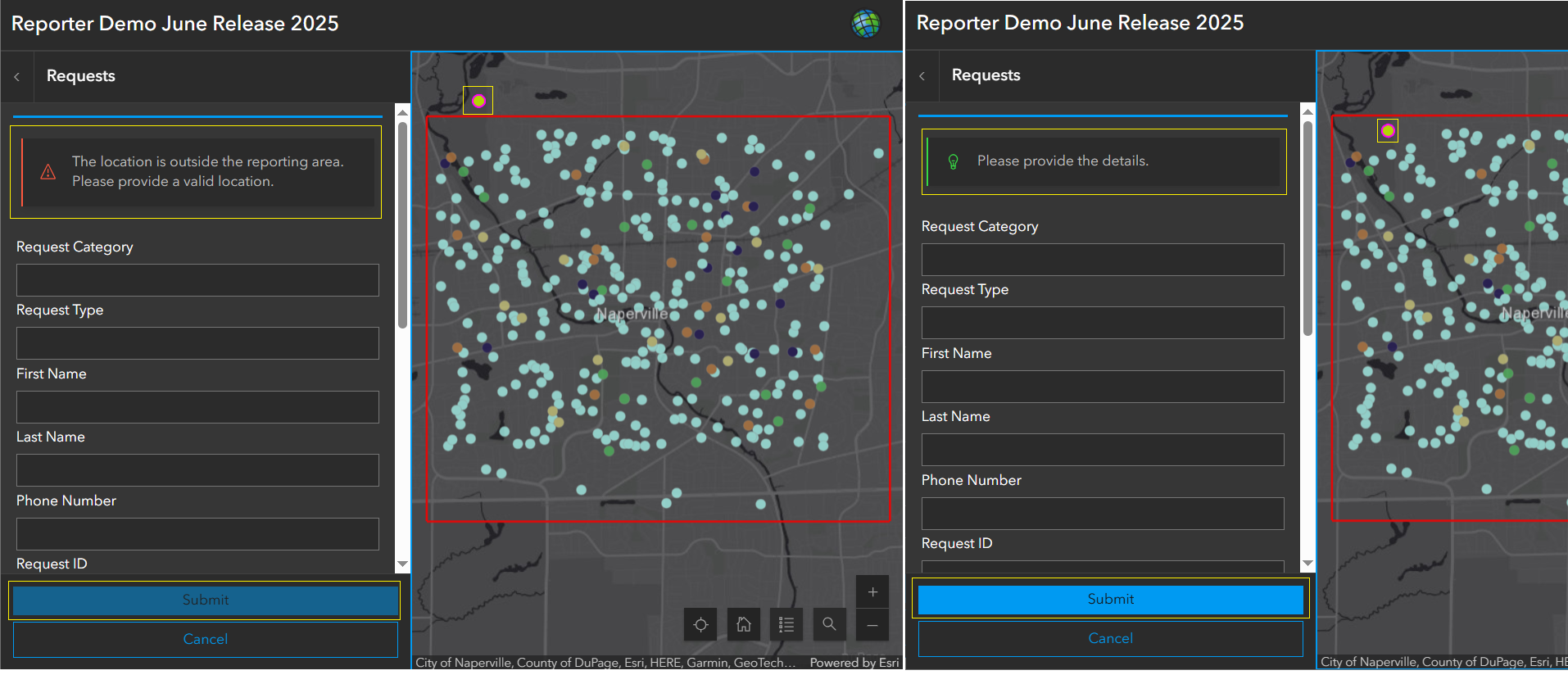
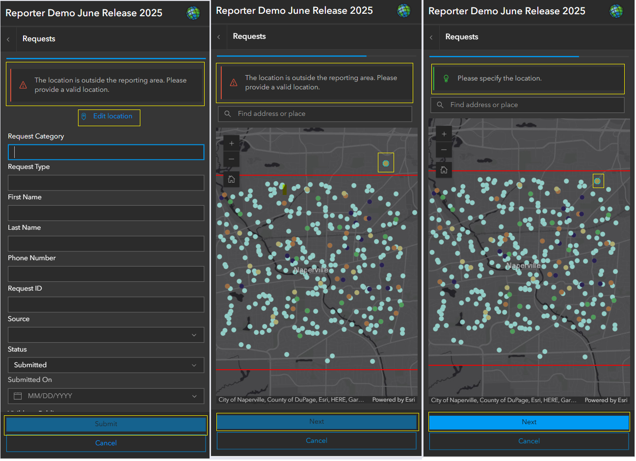
To move the feature inside the boundary, users must click the existing feature and move it on the map to update its location. On mobile devices, this is done using the Edit location button, which opens a map view for moving the feature into the valid area.
Users can cancel the workflow and restart at any time if needed.
Note: On mobile devices, the Edit location button is always visible, even when no boundary polygon is configured. This provides flexibility for updating feature locations as needed.
In the illustration below, the desktop view shows a feature (highlighted with a yellow rectangle) located outside the report boundary (red rectangle). In this case, a message appears on the panel, and the Submit button is disabled. Once the feature is moved within the boundary, the message updates and the Submit button becomes enabled, allowing the user to proceed with submitting the report.
In the mobile view illustration below, once a feature is dropped on the map, the app immediately opens the form. If the feature is placed outside the report boundary, a message appears on the panel. Tapping Edit location brings up the map view, where the feature (highlighted with a yellow rectangle) is shown outside the report boundary (red rectangle). In this case, the Next button is disabled. Once the feature is moved within the boundary, the Next button becomes active, allowing the user to proceed with submitting the report.
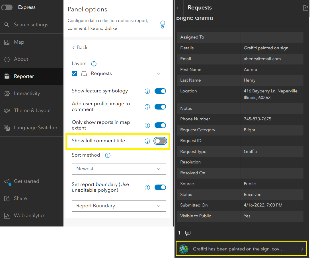
Full Pop-up Title Display in Comments List
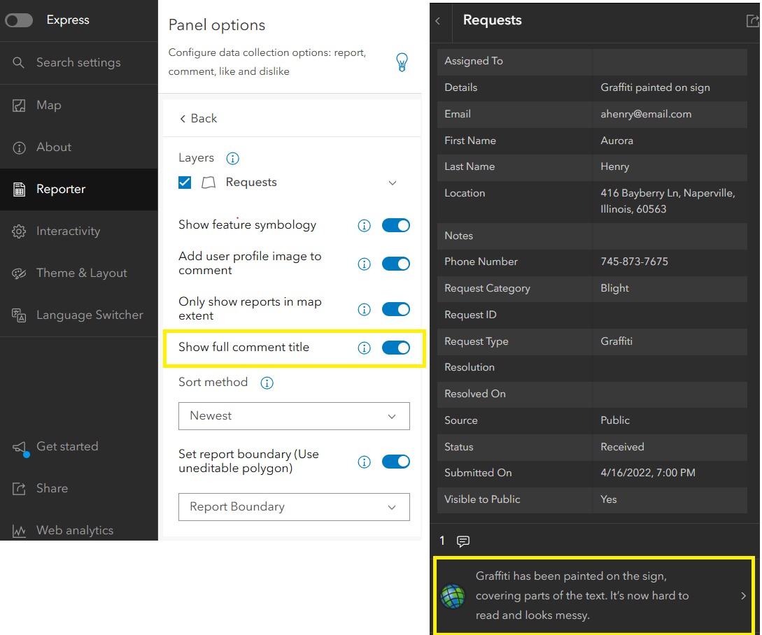
We’ve added a new configuration parameter — Show full comment title, which is enabled by default. When this setting is toggled on, the full text of each comment’s pop-up title is displayed in the comment list, making it easier for users to review comments without clicking each one to view its full details.
When the setting is disabled, only the first line of the comment’s pop-up title is visible in the list view, followed by an ellipsis.
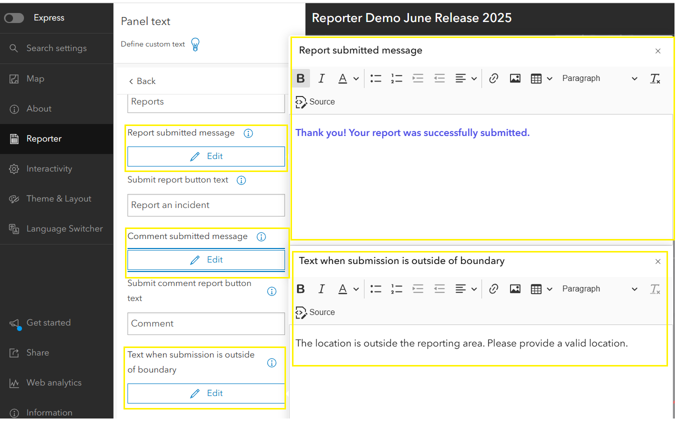
Rich Text Support for Submission Messages
The configuration options for customizing both report and comment submission messages now support rich text. This enhancement also extends to the new parameter Text when submission is outside of boundary, allowing app authors to provide styled, detailed guidance when users attempt to submit reports outside the designated area.
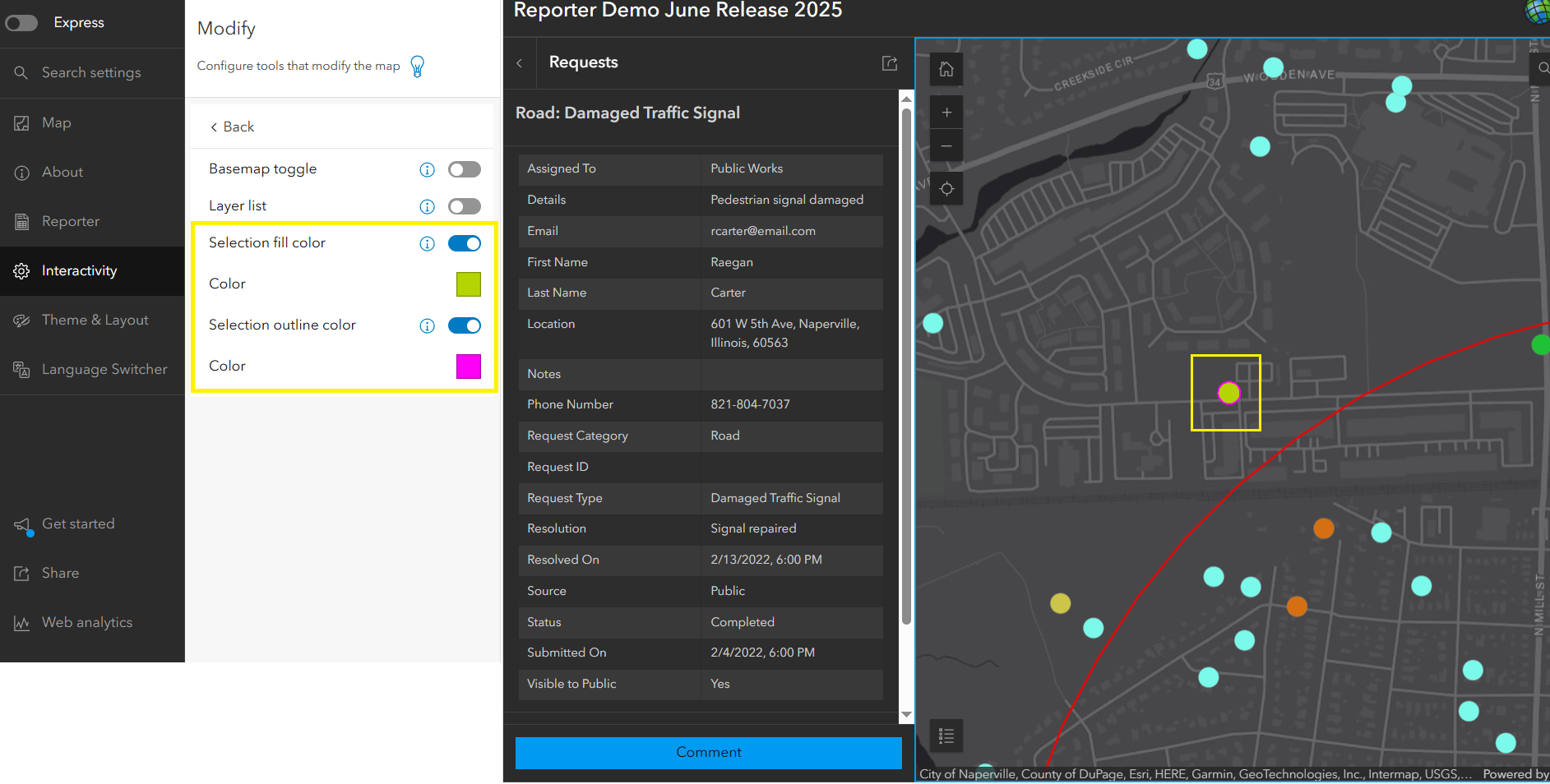
Customize Feature Selection Fill and Outline Color
In the Interactivity tab, under the Modify section, two new parameters have been added — Selection fill color and Selection outline color. App authors can enable each option and select preferred colors. The illustration below shows how these customized colors are applied when a feature is selected on the map.
Honoring Layer Capabilities
We’ve improved how the app handles the feature layer’s capabilities. If the layer’s Add capability is turned off, the existing app does not display the Report an Incident button—this behavior remains unchanged, and users can still interact with existing layers and features.
The enhancement is that when creating a new app from such a layer, the Reporting setting is now automatically turned off if the layer doesn’t support the Add capability. This logic now also applies to existing apps. By default, the setting remains enabled when the capability is supported.
Disable Pop-ups During Report and Comment Workflow
To streamline the report and comment experience, pop-up interactions are now disabled during the submission workflow. Previously, users could click features on reference (non-editable) layers to view pop-ups on the map, and interact with reportable layers to open pop-ups in the report panel—disrupting the submission flow. This improvement helps keep the workflow focused and minimizes distractions.
Try it out and feel free to reach out if you have any questions or feedback.

Article Discussion: