Map Viewer is used to create visually rich and informative maps. To achieve this, you need to know the data. For many, data exploration starts by viewing the data in tabular form. This makes the attribute table a valuable resource when curating layers for your maps. By default, the attribute table shows everything, but map consumers can quickly become overwhelmed by too much information.
We’re excited to announce that the 2024 fall update of ArcGIS Online brings new functionality enhancements that will help streamline the attribute table experience. This includes viewing and managing attachments and the ability to configure, save, and reuse the visibility, order, and sorting of columns in a feature layer’s or table layer’s attribute table.
Attachment management
Attachments are a key piece when contextualizing many datasets. They can include images that confirm the associated attributes or reports that detail procedures, among other options. Because attachments are important to so many of you, we’ve built an enriched experience that will improve attachment exploration and management.
Attachment viewing
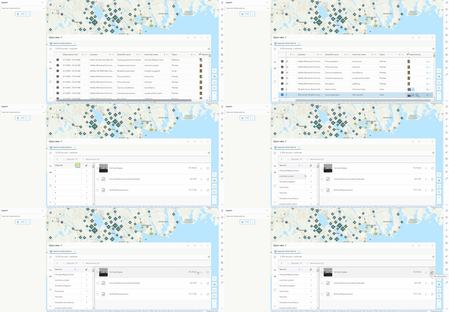
Previously, the attribute table in Map Viewer only displayed the number of attachments per record. That same attachment column now previews the first 8 attachments per record. Clicking on an attachment cell opens a complete list of attachment for the selected record. In the list you have access to the file size and the option to download or view the attachment.
Attachment management actions
If you’re the layer owner, organization administrator, or have the appropriate editing permissions you can manage attachments directly from the attribute table. The following management actions are available:
- Add an attachment by selecting or dragging and dropping a file
- Update an attachment to retain attachment order
- Delete an individual attachment or bulk delete selected attachments
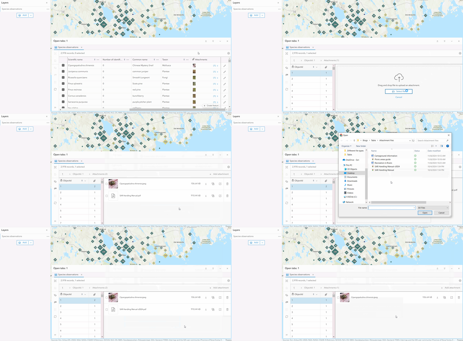
Table configuration
Map Viewer now allows you to save attribute table display settings. You can configure column visibility, order, and sorting for a feature layer or table layer. This is incredibly useful when curating a map to tell a specific story or to meet the data needs of a particular group of people. This new functionality is possible because of the new attributeTableInfo property in the web map specification. To learn more, check out the web map specification.
Let’s look at each configuration option in more detail.
Column visibility
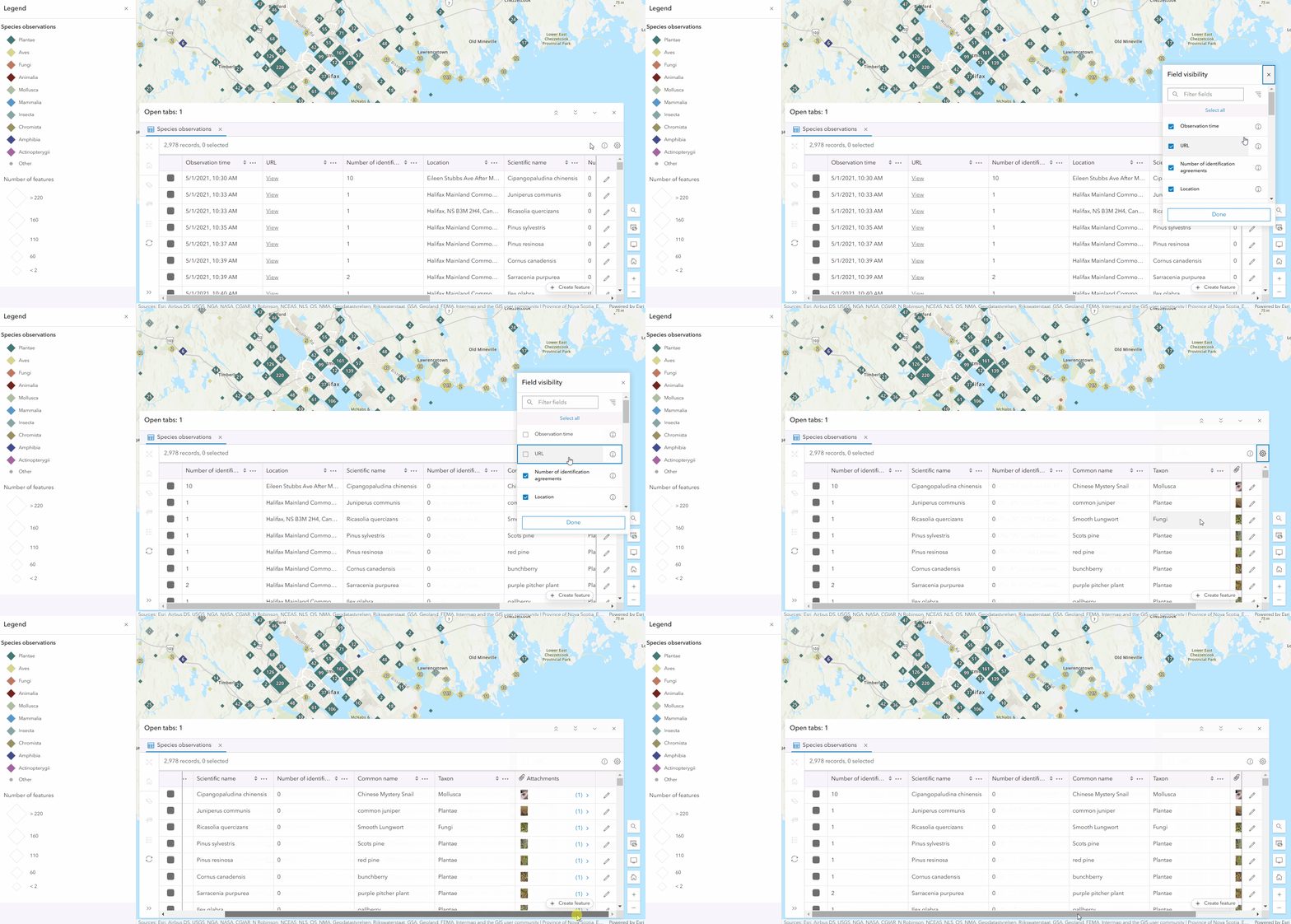
Configuring column visibility ensures that your audience has the information they need to understand the dataset and draw conclusions. Column visibility can be set on fields, attachment columns, and related record columns. In the species observations map below, I’m refining the attribute table to match the map theme by only including species identification information, like species names, identification agreement/disagreement votes, and attachments.
Column order
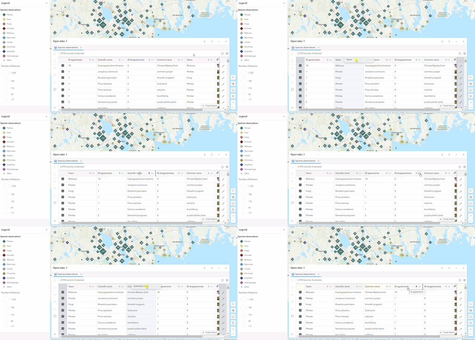
Setting column order allows you to prioritize important information and help your data flow. You can also improve readability by placing related fields together. For example, below I’m reordering the fields so that the number of identification agreements is beside the disagreements for easy comparison.
Data sorting
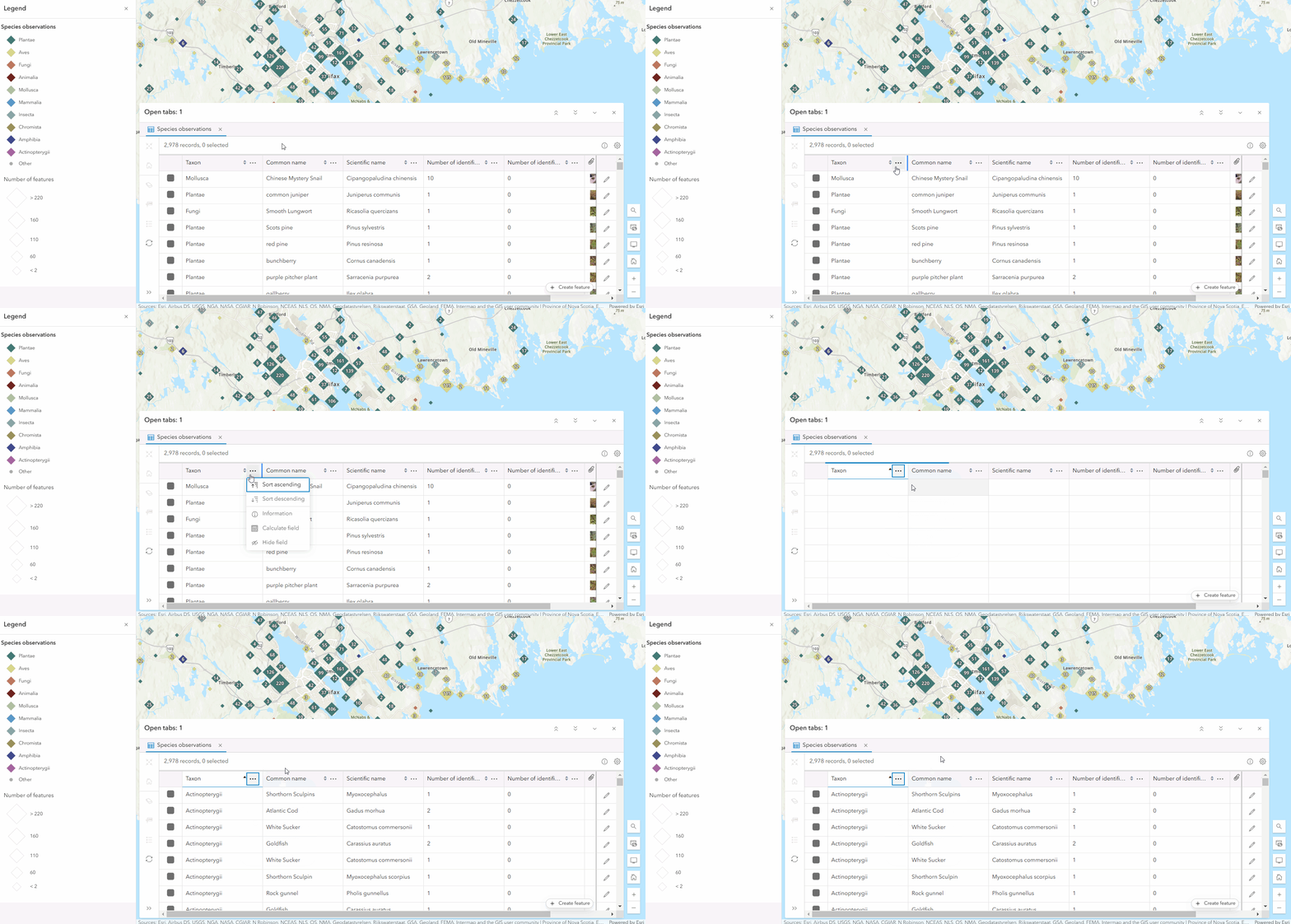
Sorting field data, in ascending or descending order, helps organize the data in a meaningful or intuitive way and can help highlight patterns. For instance, I can sort the taxon field so that the records are grouped by taxon like they are in the map.
Persisting table configuration
Save the web map once you’ve made the desired changes to the column visibility, order, and sorting. This will ensure that others viewing the map will see the attribute table as you configured it. If you want to reuse the attribute table configurations set on a layer in other maps, save the changes to the layer item through the properties panel. For more details, see the layer properties documentation.
Table functionality in ArcGIS Online
The attribute table of many ArcGIS Online applications, like Map Viewer, are built from the ArcGIS Maps SDK for JavaScript FeatureTable widget. We are putting an emphasis on building as much functionality as possible into the FeatureTable. This includes attachment management and table configuration. Building this into the FeatureTable ensures similar functionality and familiarity across applications, whether they’re custom or made with in-house apps like ArcGIS Instant Apps. In future ArcGIS Online updates, other areas like the Data tab of the items details page plan on incorporating the FeatureTable to further achieve functional harmony in the web.
What’s next
We’re excited to have brought more functionality and level of configuration to the attribute table, but we certainly aren’t done. We have big plans and look forward to delivering more key features. In future updates of Map Viewer, we plan to offer:
- Different options for displaying attachments within the attribute table, e.g. Gallery
- Persisting column width
- Defining column groups
- Control over which attachments show
- Export selected records to CSV

Commenting is not enabled for this article.