When you’re working on a Geographic Information System (GIS) project, there’s often a moment when you need to take a step back and get a clearer picture of the landscape – literally. Over the past two decades, imagery has become crucial for GIS applications across virtually every industry and discipline. That means imagery is no longer a nice-to-have; it’s a must-have because it provides a direct visual representation of reality, allowing for more accurate analysis, precise measurements, and a deeper understanding of complex phenomena. ArcGIS is a comprehensive system for imagery — integrated with GIS and enabling a geographic approach to data integration.
In your GIS projects, you can utilize many types of imagery, including satellite and aerial imagery. Satellite imagery provides broad coverage and frequent updates, while aerial imagery offers high-resolution data with visual detail that is crucial for specific applications.
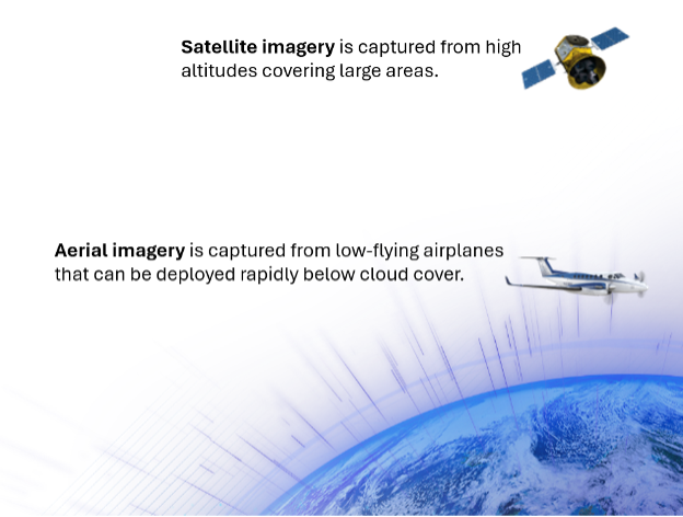
The question then becomes, which type of imagery is right for you? The answer is usually both. By combining satellite and aerial imagery, you can leverage their respective strengths to gain a more comprehensive understanding of your area of interest.
Enhancing Your GIS with Aerial Imagery
Content Store for ArcGIS is an ArcGIS Online app developed by Esri Partner Network partner SkyWatch. Released in February 2025, Content Store for ArcGIS enables you to find and purchase premium commercial imagery and easily integrate it into your projects. Now, in addition to satellite imagery, you can also purchase aerial imagery from leading providers EagleView and Vexcel. The archive library covers a wide geographic area, including the US (including Hawaii and Puerto Rico), Canada, Europe, the UK, Australia, Japan, New Zealand, and parts of India. Available products include wide-area ortho and True Ortho imagery at 7.5 cm, 10 cm, and 15 cm ground sampling distance (GSD). This expansion of available imagery types enhances your ability to tackle complex projects with precision and accuracy.
Why Aerial? Gaining Valuable Insights from Detailed Imagery.
Aerial imagery offers several key advantages for specific use cases. A significant benefit of aerial imagery is that aircraft can be deployed rapidly and mobilized when satellites can’t (e.g., when there is cloud cover or satellite revisit gaps):
- Higher resolution and detail: Provides images at 7.5 cm, 10 cm, and 15 cm ground sample distance (GSD), ideal for urban planning, construction monitoring, and detailed data capture tasks like counting solar panels.
- Increased accuracy: Offers higher positional accuracy, crucial for urban planning, asset management, and precision agriculture.
- Clear and unobstructed views: Captured below cloud cover, ensuring clear images, which are vital for disaster recovery and damage assessment.
By purchasing aerial imagery through ArcGIS’s Content Store, you can access high-quality images without the need for custom-commissioned flights, reducing costs and making it easier to integrate detailed imagery into your projects. This streamlined process empowers you to make more informed decisions and tackle a wider range of applications.
Streamlining Your Imagery in GIS Workflow.
Because ArcGIS Online now includes access to aerial imagery through Content Store, it’s now a snap to enhance your GIS project with high-quality imagery. Simply open Content Store from the app switcher, search the imagery archives for your area of interest, and purchase what you need. This streamlined process offers several key benefits that can significantly improve your workflow:
- No need for technical imagery expertise – the imagery is ArcGIS-ready and doesn’t require pre-processing.
- No technical integration needed on the IT side of your organization.
- A seamless purchase process without lengthy vendor approvals and contracts.
- The ability to enhance your GIS project with imagery quickly by finding and adding it on-demand.

Leading Providers to Support Your Needs.
Having access to imagery from multiple industry leaders through Content Store means you can choose the best data for your specific needs without having to interact with multiple vendors or manage separate contracts. This streamlined approach gives you the flexibility to select the most suitable imagery for your projects, saving you time and effort.
EagleView Technologies
EagleView brings a unique depth of coverage to the aerial imagery offerings in Content Store for ArcGIS, with an astounding library of over 3.5 billion ultra-high-resolution ortho and oblique images. This extensive collection covers 94% of the U.S. population, providing comprehensive visual data that enables accurate assessments and informed decision-making. What sets EagleView apart is the sheer scale and detail of their imagery library, making it an invaluable resource for projects that require broad coverage and high-resolution insights. With EagleView’s imagery in Content Store, you’re gaining access to a rich source of data that can enhance your GIS workflows and support a wide range of applications.
Vexcel
Vexcel enhances the aerial imagery offerings in Content Store for ArcGIS with its comprehensive library of high-resolution imagery products, including oblique, ortho, and 3D cities data. With coverage spanning 40+ countries and territories, Vexcel provides a broad and diverse dataset that supports a wide range of applications. Their imagery is captured using advanced airborne sensors, ensuring high-quality and accurate data. The variety of imagery products, such as oblique collections offering ultra-high-resolution views from multiple angles and TrueOrtho imagery providing clear, building-lean-free views, allows users to gain detailed insights into their areas of interest. With Vexcel’s imagery in Content Store, users can access a rich source of visual data that can enhance their GIS workflows and support informed decision-making.
You can expect to see more partners and providers added in the future, further enhancing the value of Content Store for ArcGIS for your projects.
Get Started with Aerial Imagery in Your Organization
Ask your ArcGIS Online administrator to download and provision the Content Store for ArcGIS app. Your admin can either input a credit card or your organization can prepay for Content Store data credits. We’re excited to see how you’ll use this new capability to take your work to the next level.
To learn more about what’s new in the latest update of ArcGIS Online, read the release blog.


Article Discussion: