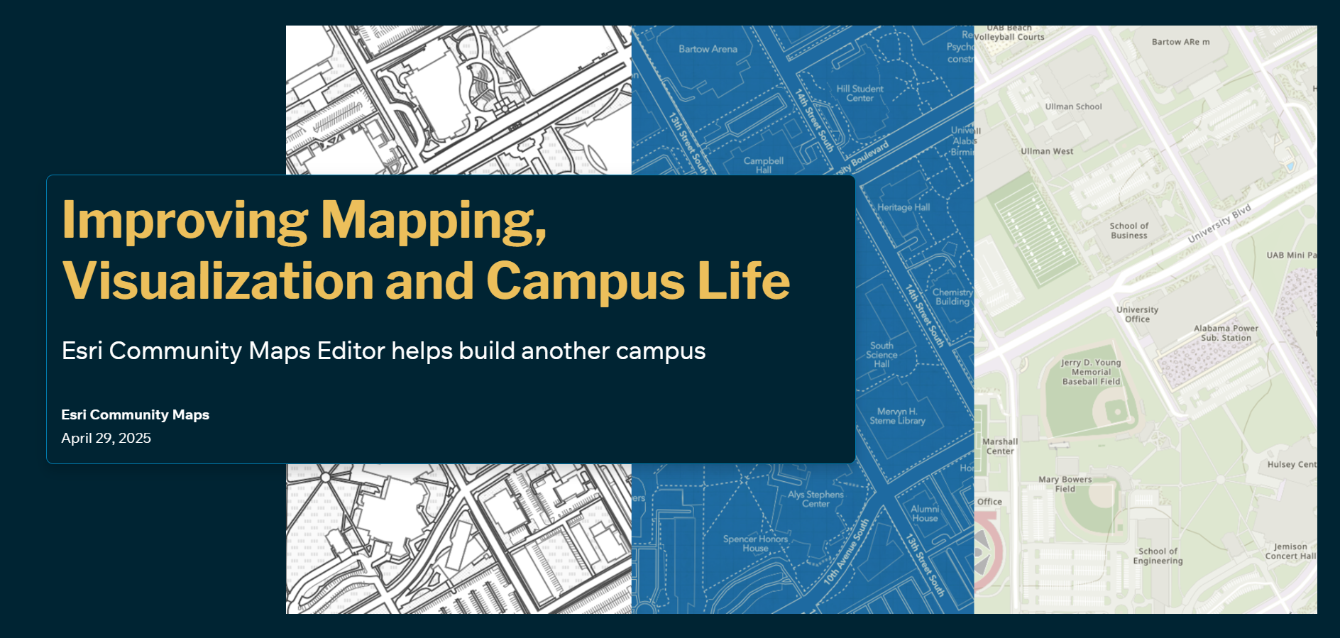
Esri’s Community Maps Editor has just helped build another campus basemap. A routinely updated and useful campus basemap for the University of Alabama at Birmingham (UAB) will bring several strategic, operational, and educational benefits.
Explore the University of Alabama Birmingham
These benefits include:
Improved Campus Navigation Easier wayfinding reduces confusion and enhances the experience for new students, visitors, and event attendees. Proper mapping of accessible routes helps individuals with disabilities navigate the campus more effectively.
Enhanced Emergency Planning and Response Emergency services can access precise building layouts, utility locations, and ingress/egress routes, enabling faster response in crises (e.g., fire, medical, or security incidents)
Efficient Facilities Management Facilities and maintenance teams can track utilities, infrastructure, and building systems accurately, allowing for better asset management and quicker repairs or upgrades.
Support for Planning and Development Campus planners can make informed decisions on new construction, renovations, and landscaping by understanding current land use and spatial relationships
Academic and Research Applications Geography, urban planning, and environmental science students and faculty can use the basemap for spatial analysis, real-world GIS training, and project planning.
Sustainability and Resource Management Helps track energy usage, water flow, green spaces, and other environmental factors to support sustainability initiatives and reduce the university’s carbon footprint.
Event Coordination and Logistics For large-scale events (e.g., graduation, football games, concerts), organizers can plan traffic flow, crowd control, and setup areas more efficiently.
Click on the StoryMap below for all the details!


Article Discussion: