Choosing the right symbol is one of the simplest ways to make a map easier to understand. A good symbol can help someone recognize a hospital, airport, park, roadway, or other feature before they even read the map.
With the latest update to Map Viewer, there are a lot more symbols to choose from. The default symbol galleries now include more than 2,700 ready-to-use symbols across points, lines, and polygons. Many of the additions come from the ArcGIS Pro 2D symbol gallery, providing a more consistent set of cartographic choices when moving between desktop and web mapping workflows.
But this update is about more than adding a large number of symbols. The expanded galleries introduce new categories, modern vector versions of familiar Esri symbols, better search and filtering, and symbols that you can continue to customize directly in Map Viewer.
Let’s take a look.
More of ArcGIS Pro’s symbol gallery, now in Map Viewer
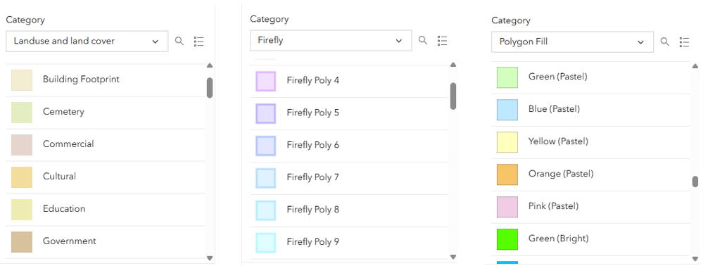
One of the goals of this update was to reduce the gap between the out-of-the-box symbols available in ArcGIS Pro and Map Viewer. Many of the new symbols come directly from the ArcGIS Pro 2D symbol gallery, preserving their names, tags, and categories while making them available through web styles in Map Viewer. That becomes especially noticeable with some of the more specialized symbols. For example, the expanded polygon galleries add more than 100 symbols, including land-use and land-cover symbols, additional filled polygons, and outline-based polygon designs. The point galleries also add more of the default shape configurations available in ArcGIS Pro. That means you can spend less time recreating common cartographic symbols and more time refining how they communicate your data.
More than 600 Calcite symbols
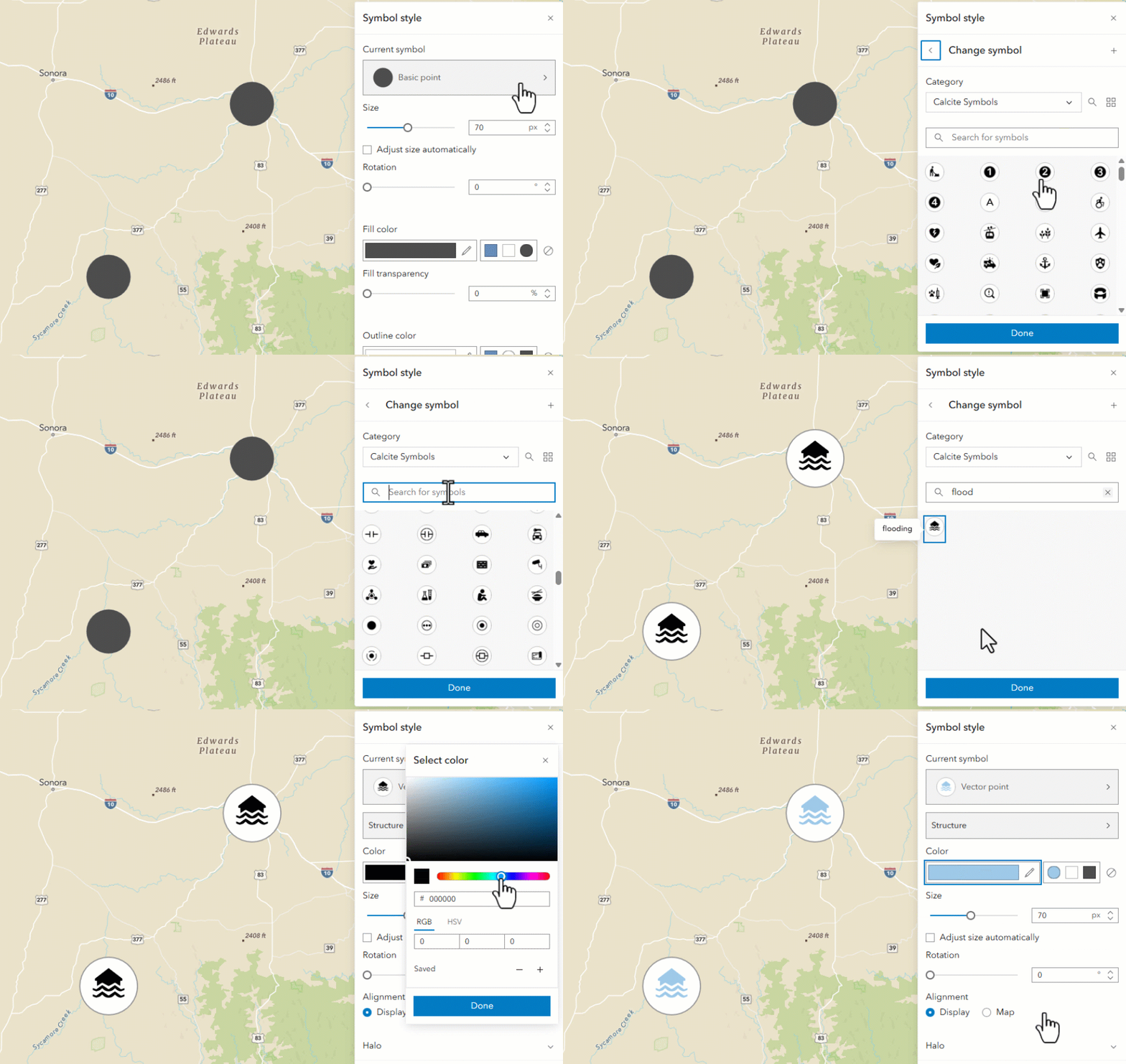
One of the largest individual additions is a collection of more than 600 Calcite mapping symbols. These provide a broad set of clean, modern symbols for representing features across many different subjects. They also significantly expand the vocabulary available when you need a recognizable symbol but don’t want to create or upload one yourself. With hundreds of symbols available, discovery becomes just as important as quantity. That’s why these symbols have been categorized and tagged for searching. In the development demo, for example, searching for a term such as health returned symbols associated with that concept. The symbols have roughly ten descriptive tags each to improve filtering and discovery. Instead of scrolling through hundreds of icons, you can start by describing what you’re mapping and narrow the gallery from there.
Firefly goes vector
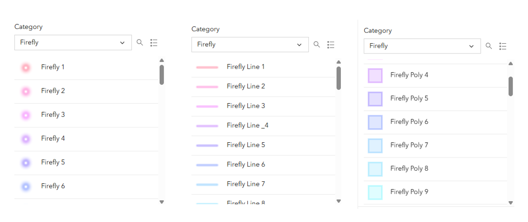
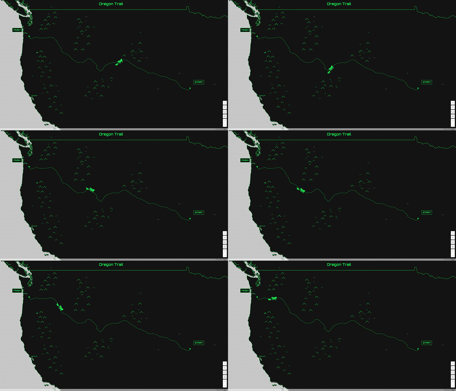
Firefly symbols have long provided an effective way to make features stand out against dark basemaps. This release brings vector Firefly symbols into the default galleries for points, lines, and polygons. That distinction matters. The older classic Firefly symbols were static and provided limited control over their appearance. The new symbols use editable vector symbol definitions, so they work much more naturally with the modern symbol-styling capabilities in Map Viewer. The result is the familiar Firefly aesthetic with considerably more flexibility.And Firefly is no longer primarily a point-symbol story. The same visual language can now be used across point, line, and polygon geometry.
New numeric points and pins
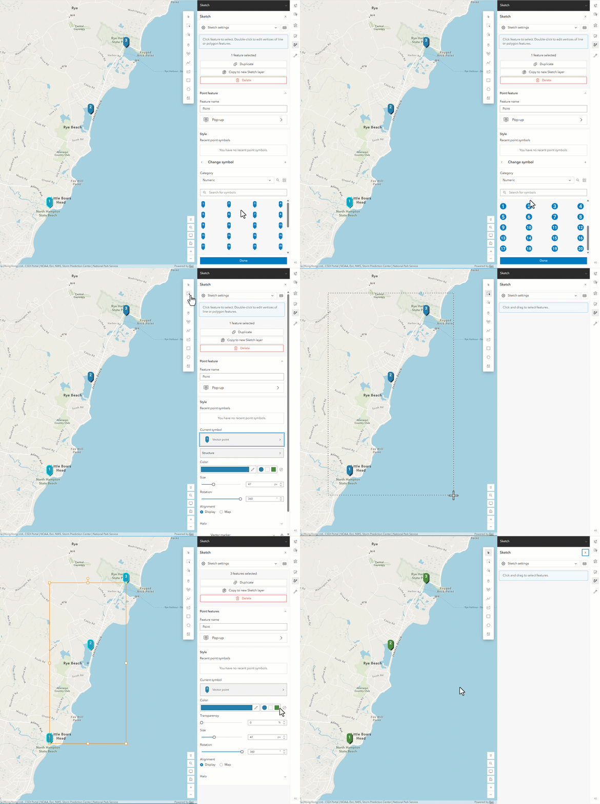
Sometimes the clearest symbol is simply a number. The new galleries include numeric circles and numeric pins, making them useful for ordered locations, stops, inspection sites, itinerary maps, sampling locations, or any map where the number itself carries meaning. These aren’t simply text placed over another marker. The numeric designs are built as vector marker symbols, which allows the individual components to behave together as a symbol. The configuration also works with color locking, so a map’s styling can update the appropriate background portion of the symbol while preserving the number itself. They are particularly handy in Sketch, where you might want to quickly add a sequence of numbered locations while building or annotating a map.
A much larger collection of shapes
Basic shapes sound simple, but they’re some of the most versatile symbols in a mapping application. Previously, Map Viewer exposed only a relatively small set of shape options. The expanded gallery brings in the additional shape configurations available in the ArcGIS Pro 2D gallery, including multilayer, outlined, hollow, and other variations. Because these are vector symbols, the new shape options also benefit from the styling controls within Symbol Styler. A basic shape can therefore be a starting point rather than a finished design.
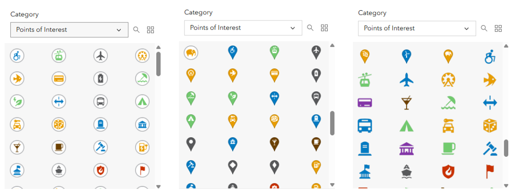
Expanded points of interest
The Point of Interest gallery has also been expanded to provide a broader representation of the options available in ArcGIS Pro. The updated collection includes familiar circular markers, pins, and symbols without a separate background marker, giving authors more options for balancing iconography against the rest of the map. This is particularly useful when building general-reference maps where recognizable locations need to coexist with thematic information.
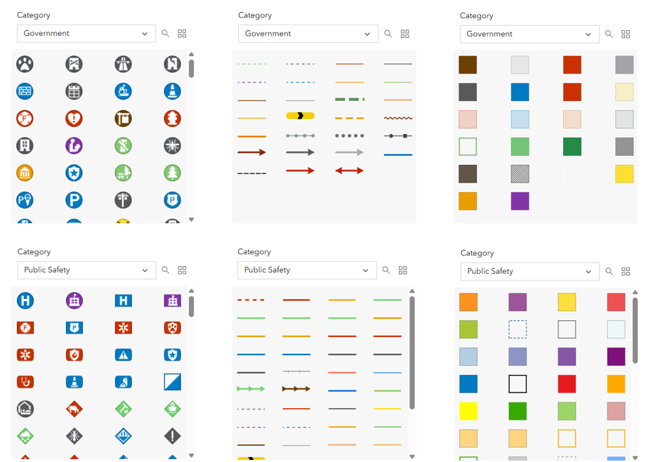
Government and public safety symbols
This release also brings vector symbol galleries from ArcGIS Solutions into the default experience, including government and public safety symbols. Older versions of some of these symbols were available as raster symbols in classic experiences. The new versions are vector based, making them a much better fit for modern Map Viewer styling. Another important change is geometry coverage. These galleries aren’t limited to points. Where appropriate, their symbols can also be represented in the line and polygon galleries. That gives organizations working with government and public-safety data a more consistent starting point for authoring maps without first assembling their own collection of custom symbols.
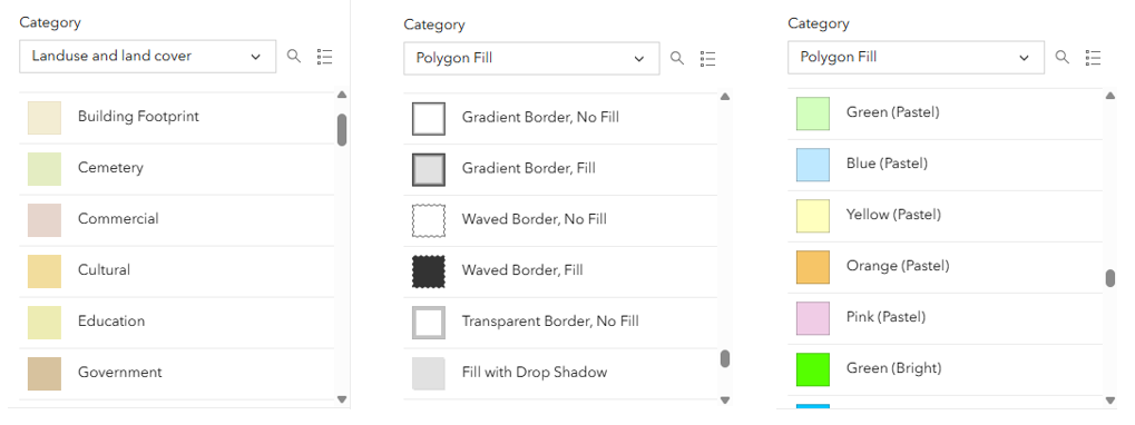
More line and polygon symbols
The expansion isn’t only about point icons. Polygon galleries now include additional symbols from ArcGIS Pro, including land-use and land-cover symbols, vector Firefly polygons, and specialized fills and outlines. Lines also benefit from the broader gallery work. Some line symbols use cartographic properties such as offsets, and because Map Viewer supports adjusting the offset effect in Symbol Styler, authors can bring one of these symbols into a map and refine its appearance rather than being locked into the preset configuration. This is an important difference between simply having a big symbol gallery and having symbols that are genuinely useful as starting points for cartographic authoring.
New animated symbols
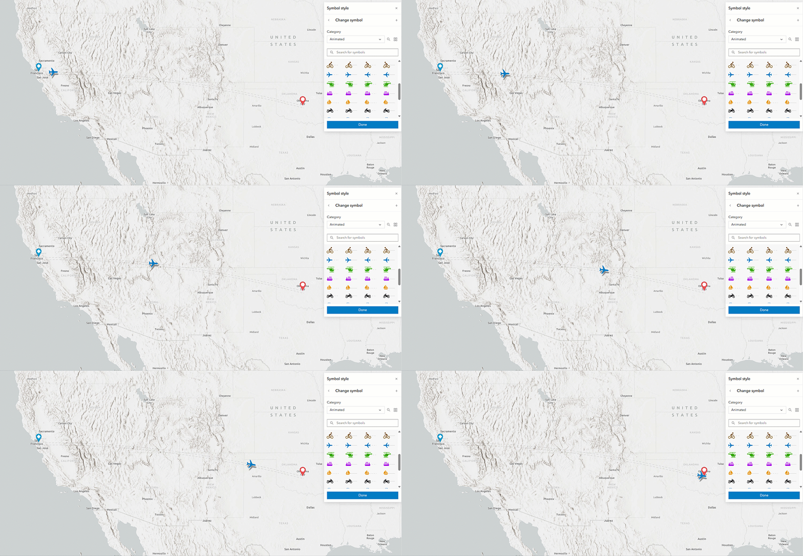
The animated symbol gallery has expanded as well. The June 2026 update introduced animation along a line in Map Viewer. The November release builds on that work with additional ready-to-use animated line symbols, including single-marker animations that can move along a line. The gallery contains directional variations for cases such as aircraft and other asymmetric markers. And the gallery is only the starting point. You can take one of these symbols and configure properties such as how quickly it moves or how far it travels along a line. Animation along a line can also now be added to compatible marker layers that weren’t originally created as animated symbols. That opens workflows ranging from transportation and migration to utilities, water flow, and other directional phenomena
Perhaps the most important aspect of the expanded galleries is that the new symbols aren’t intended to be static artwork.
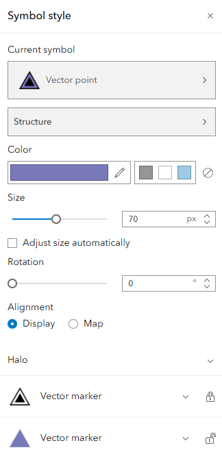
They are vector symbols.
That means you can start with a professionally designed symbol and then use the supported controls in Symbol Styler to adapt it to your map. Depending on the symbol, that can include color, symbol-layer properties, outlines, gradients, offsets, and other supported properties. Leveraging layer and feature effects also add another layer to the customization you can make in Map Viewer.
This release also introduces point-symbol halo authoring. A halo can be placed behind a point symbol and configured with its own size, fill, and outline. More complex halos authored in ArcGIS Pro, such as those using gradient fills, can also be displayed in Map Viewer, although authoring of those more sophisticated fills is planned for later.
The gallery can then become less about choosing a finished symbol and more about choosing the best starting point.
Keeping custom symbol galleries current
There’s one more enhancement that’s easy to overlook, but important for organizations that have configured their own symbol galleries.
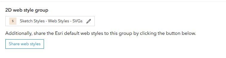
When an organization uses a custom web-style group, newly released Esri galleries historically did not automatically become part of that custom collection. With this release, administrators can bring newly added Esri default symbol galleries into their configured gallery instead of having to locate and add each style individually.
That makes the expanding default collection much easier to take advantage of without abandoning an organization’s existing custom symbol-gallery configuration.
A bigger cartographic toolbox for the web
Taken together, this is one of the largest expansions of Map Viewer’s out-of-the-box symbol collection.
With more than 2,700 symbols across points, lines, and polygons, including more than 600 Calcite symbols, vector Firefly symbols, numeric markers, government and public-safety symbols, expanded points of interest, ArcGIS Pro shapes, and additional land-use and land-cover symbols, there are substantially more places to start when designing a map.
Just as importantly, these symbols are increasingly built around the same vector and CIM-based cartographic capabilities used throughout ArcGIS. That means the goal isn’t simply more symbols.
It’s a more consistent workflow between ArcGIS Pro and Map Viewer, better symbol discovery, and a collection that authors can continue to customize for the story their map needs to tell.
So the next time you open the symbol gallery, try searching before reaching for the symbol you’ve always used.
You might find something new.

Article Discussion: