We’re excited to announce the launch of Road Centerlines as the newest addition to Esri’s Community Maps Program! Historically, part of the vector basemap community, Road Centerlines, now stands as an independent community—giving this critical dataset the attention it deserves. Contributors who previously delivered roads for basemaps will be automatically transitioned to this new program.
Why Road Centerlines Matter
Road Centerlines are the backbone of accurate mapping, routing, and analysis. By joining this community, you help ensure your region is represented with precision across ArcGIS products—from basemaps to routing services and spatial analysis tools.
What We’re Looking For
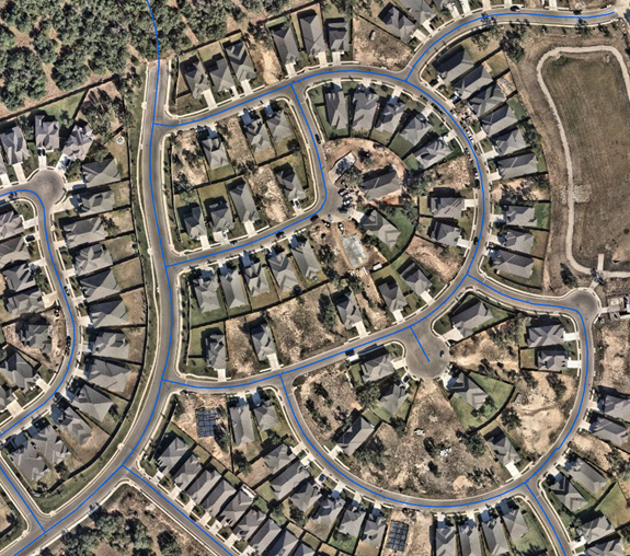
- Topologically complete datasets including all road classifications—freeways, toll roads, arterials, local streets, service roads, and alleys.
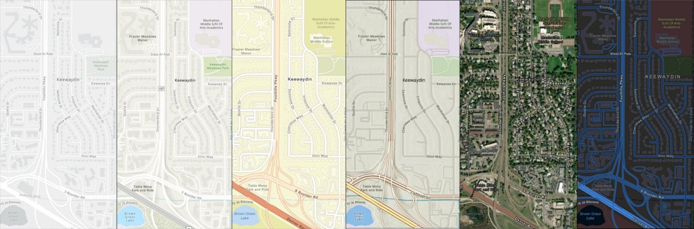
- Cartographically and spatially accurate geometries aligned with true roadway positions as seen in high-resolution imagery.
- Explicit modeling of complex configurations such as roundabouts, traffic circles, and divided roads.
- Authoritative road names matching official signage, including directional prefixes and suffixes.
- Actively maintained data reflecting recent changes and removing outdated segments.
- Ability to exclude planned roads scheduled for completion within six months.
Contribution Requirements
- Submit Road Centerline layers as a Feature Service (zipped File Geodatabases are not accepted).
- Configure Service Parameters in the Community Maps Contributor App for road types and names.
- Provide an Area of Interest (AOI) polygon as a Feature Service, kept current to reflect jurisdictional changes.
How Esri Uses Your Data
Your contributions won’t appear verbatim in Esri Vector Basemaps. Instead, they enhance and validate the commercial road network that powers ArcGIS basemaps, routing, and analysis tools. Through a spatial comparison algorithm, Esri identifies variances in geometry and naming, ensuring the commercial dataset evolves to reflect the most authoritative local data.
Why Join the Road Centerline Community?
- Improve accuracy across ArcGIS products.
- Ensure new roads and changes are reflected quickly.
- Reduce routing errors and improve travel-time analysis.
- Influence how the global road network evolves.
- Enhance trust in local authoritative data.
- Extend the reach of your road features.
Ready to Make an Impact?
Join the Road Centerline Community today and help shape the future of road data accuracy. Your contributions matter—not just for your community, but for millions of users worldwide.
Click on the StoryMap below for additional details…

Article Discussion: