Note: This blog covers the classic Esri Story Maps. Story authors are encouraged to use the new ArcGIS StoryMaps to create stories; however, Esri will continue to maintain the classic templates for your use. For more information, see the Product road map.
Story Maps let you combine authoritative maps with narrative text, images, and multimedia content, making it easy to harness the power of maps and geography to tell your story.
ArcGIS Online has been updated with the following enhancements to Esri Story Maps.
Story Map Shortlist
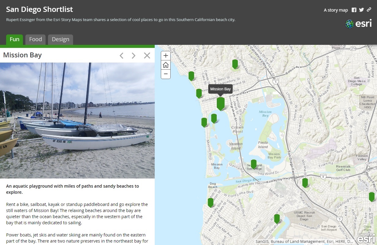
The Story Map Shortlist (beta) app lets you present places of interest organized into tabs, making it fun and easy for people to explore what’s in an area. Shortlist was previously only available as a code download that you needed to host on your own server. With this release Shortlist is available in ArcGIS Online and features an interactive builder that makes it easy to author. The app also has a refreshed look with support for larger images. You can see an example here.
In the Shortlist builder you can add places individually or import them in bulk. This beta release supports photos in Flickr, Picasa/Google+, and referenced via URLs. When you create a Shortlist, the builder creates a web map in which your places are stored (similar to Story Map Tour and Story Map Crowdsource).
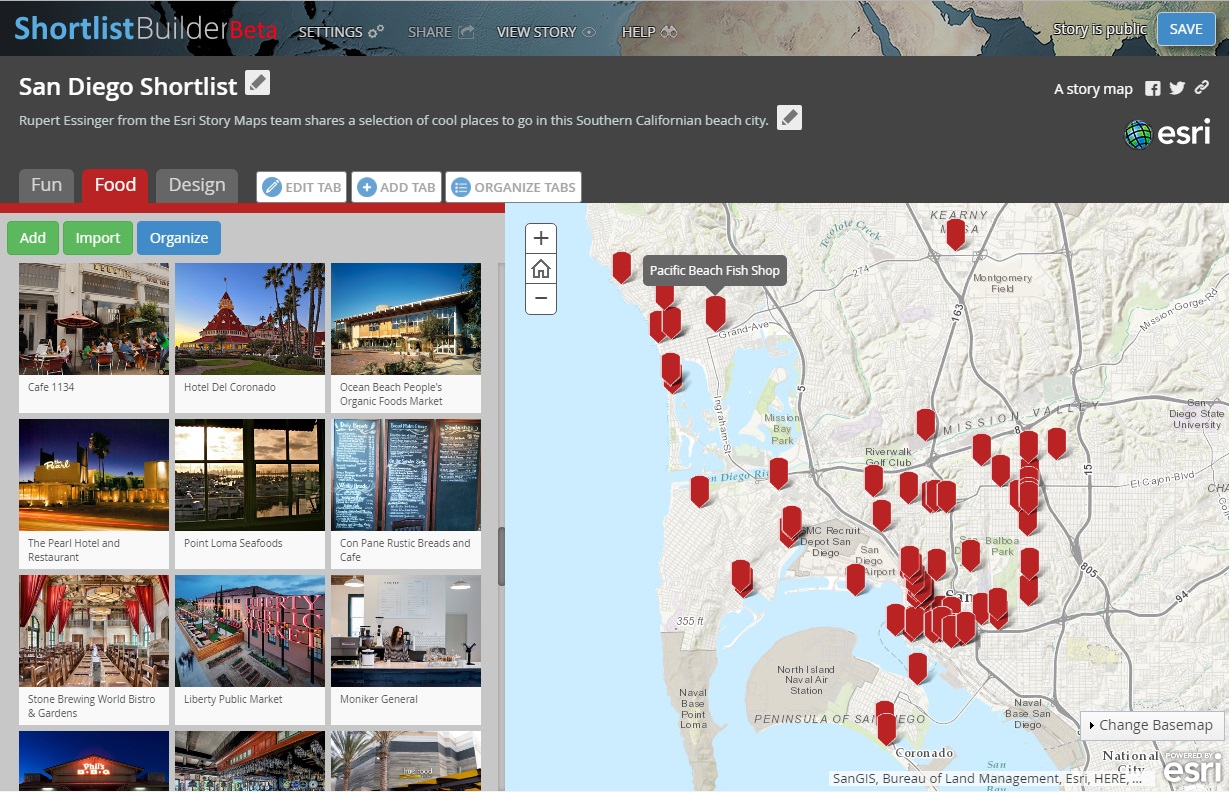
You can also use point data in an existing web map to create a Shortlist. For example, if you have a point layer containing places of interest you can use those as places in your Shortlist and optionally choose fields from the layer to appear as descriptive text. You can assign photos to your places in the Shortlist builder, or use photos referenced via URLs from existing fields in your layer.
If you have created a Shortlist using the previous, non-hosted version of the app, your existing Shortlist will continue to work unchanged. You can also migrate your existing Shortlist into the new hosted beta version so you can take advantage of easy interactive place editing and management and support for larger images. When you migrate a Shortlist, the builder automatically creates a copy of your web map so your existing Shortlist app is unaffected. While the new Shortlist does support the smaller photos typically used in existing Shortlists, after migrating you will most likely want to assign larger images to your places in the builder.
To create a Shortlist using existing point data in a web map, or to migrate a Shortlist, simply open the web map in ArcGIS Online and share it using the Shortlist app in the Web App gallery. A wizard will step you through the process.
We are eager to get your feedback about the new Shortlist! We welcome your comments and issues on the Story Maps forum on Geonet.
Story Map Cascade
Story Map Cascade (beta) has been updated with many fixes and enhancements. You can read more about what’s new with Cascade here.
Story Map Crowdsource
Story Map Crowdsource (beta) has been updated with many fixes and several key enhancements for contributors, readers, and authors.
Contributors have easier and better ways to specify a location. An exact location can now be specified by clicking on the map or by dragging the pin to a new place. Also, when a geotagged photo is uploaded its location will be added to the map.
Readers will enjoy Crowdsource stories even more since there is more interactivity between the photo collage and the map. Hovering over a photo thumbnail highlights that location on the map, and when viewing a single contribution readers can use the new arrow buttons to easily flip through contributions one by one.
To help authors create high quality stories contributors are notified if they try to upload an image that’s too small and they can use this advanced configuration to collect high-quality photos.
Other fixes and improvements to Story Map Crowdsource:
- The experience of choosing a location using coordinates has been improved.
- For advanced authors, crowdsource layers can now be viewed or edited (by members who have permission to do so) on ArcGIS.com or in ArcGIS Desktop.
Story Map Journal
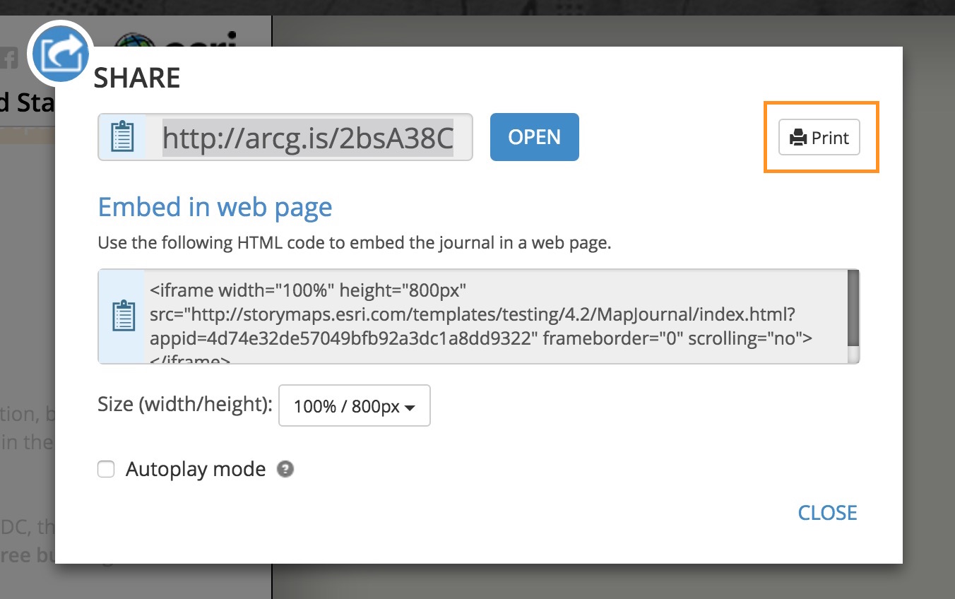
You can now print a Story Map Journal!
Printing is available from the Share panel. Note that content like videos and interactive web apps cannot be printed. This is a first release of this feature and we want to hear your feedback about how it works for you, so please share your reactions and suggestions about printing with us on GeoNet.
Story Map Journal has a white theme for the floating Panel layout.
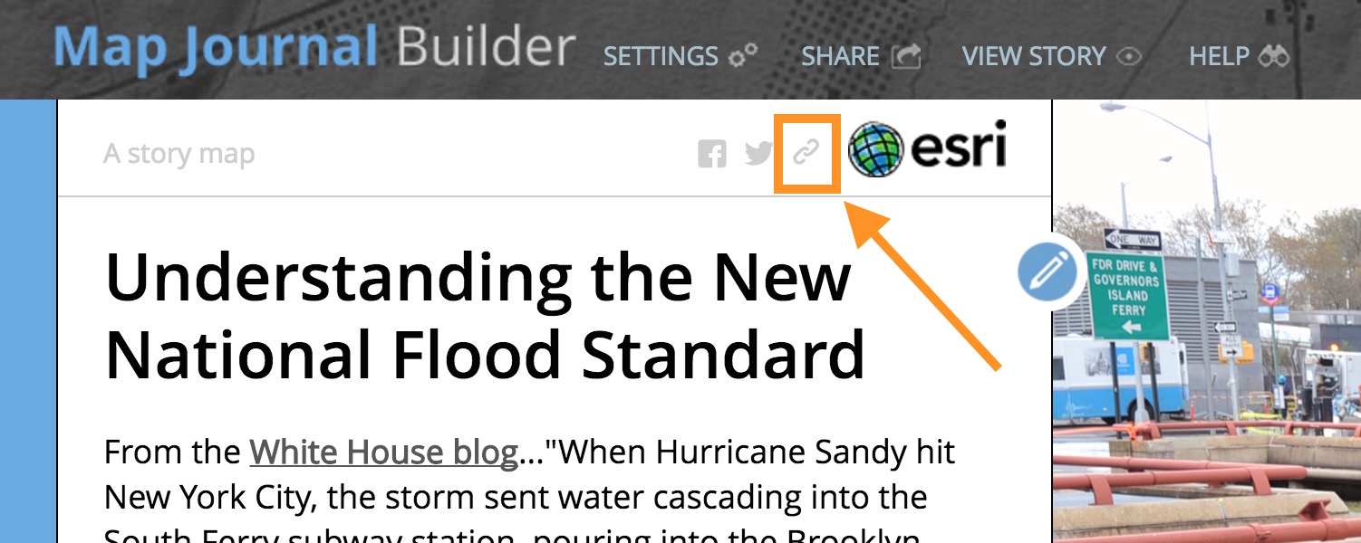
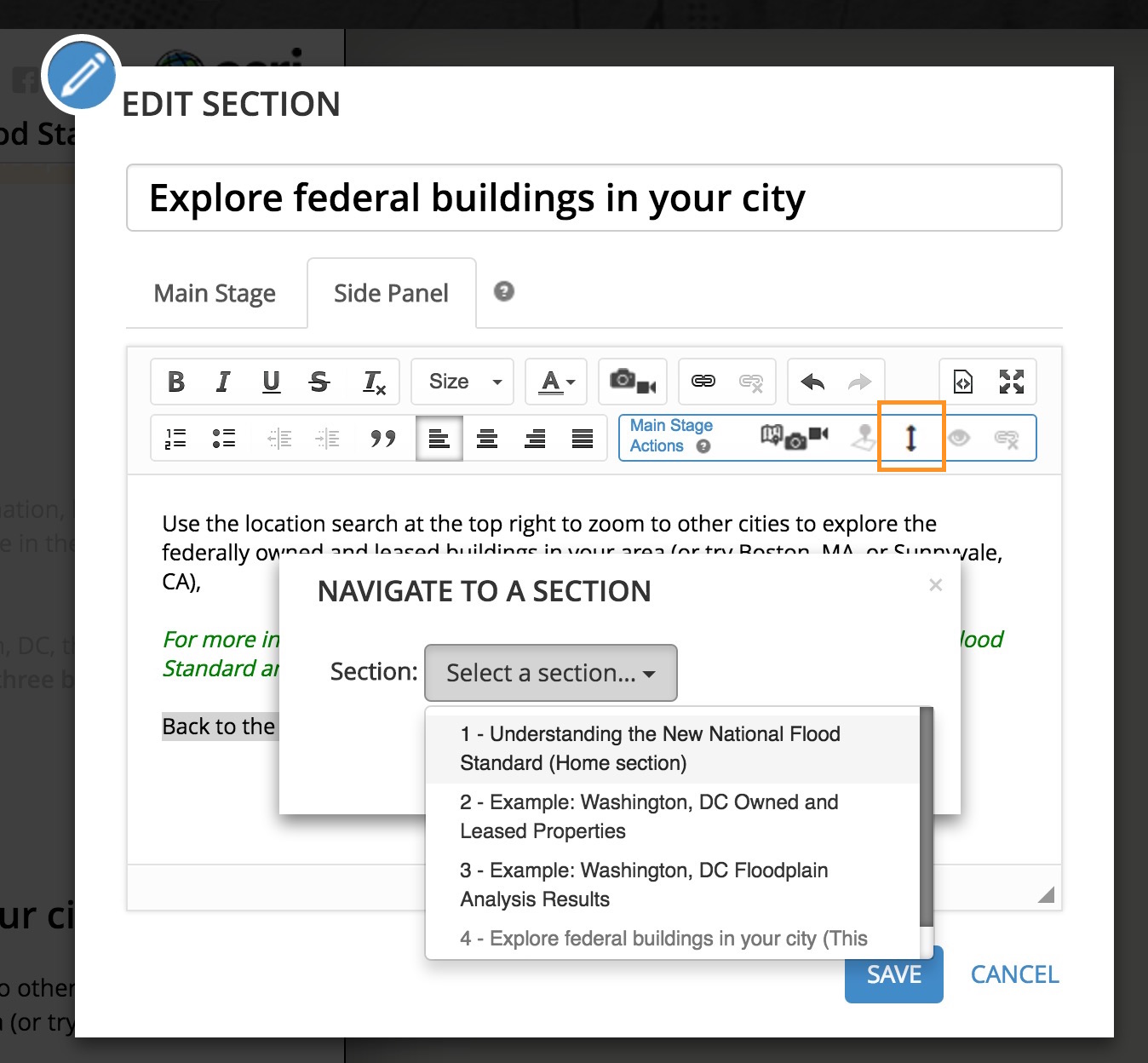
You can create a link to another section. To do this, 1) highlight the text that you want to convert to a link, 2) click the Navigate to a section button in the Actions menu (marked in the screenshot below), and finally 3) choose the section to navigate to.
My Stories
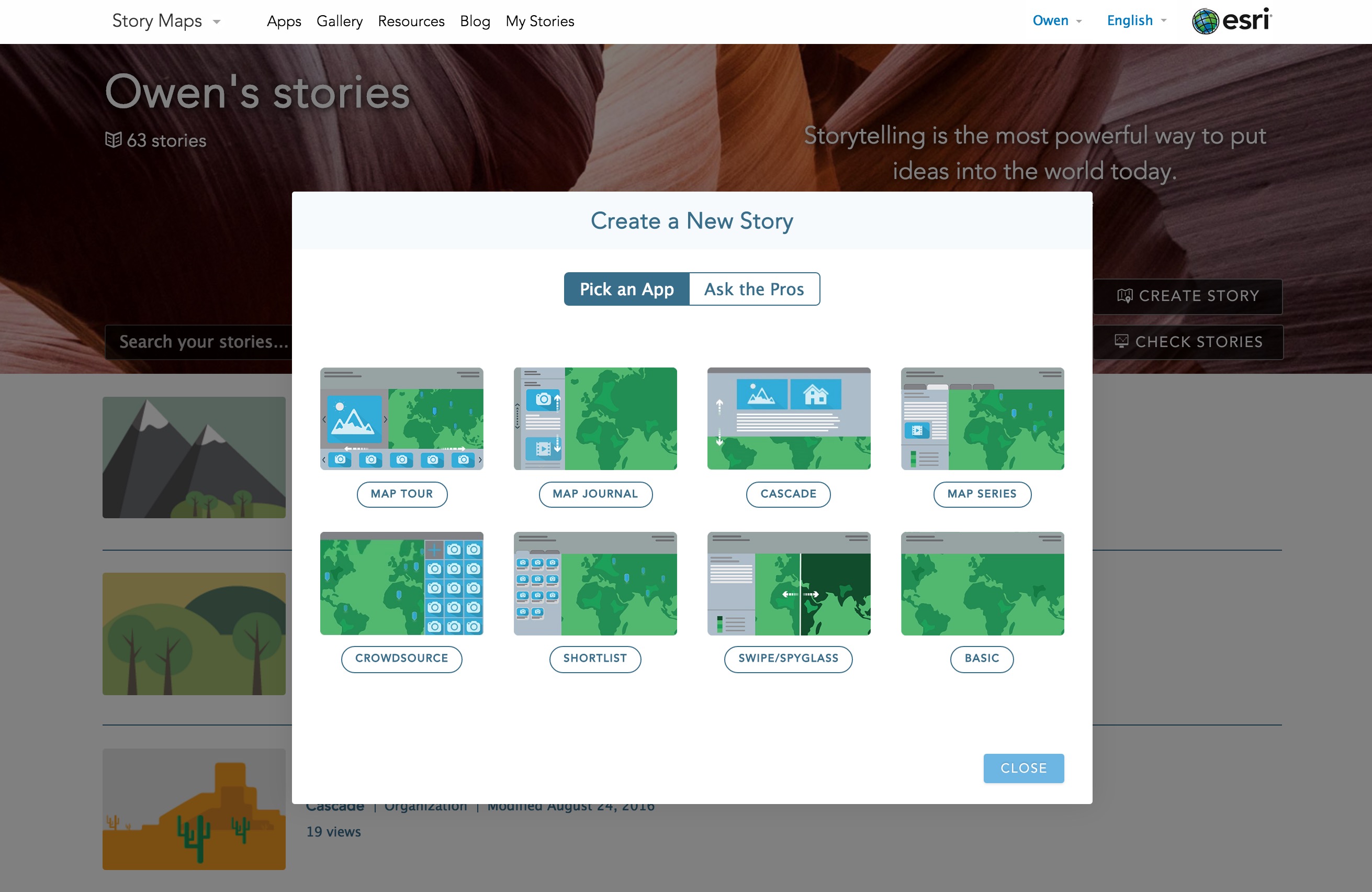
My Stories is a tool on the Story Maps website that checks your story maps for broken links and sharing issues and helps you fix them. All three beta Story Map apps (Cascade, Crowdsource, and Shortlist) are now included in My Stories.
The beta apps have also been added to the Create Story Wizard that can be launched from the My Stories page or from other places on the Story Maps website.
Other Enhancements and News
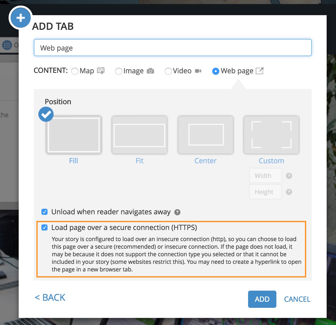
We’ve previously written about best practices for embedding story maps or websites in a story map to help authors avoid mixed content security issues, but in this release we’ve added a feature to Story Map Journal and Story Map Series to help authors avoid mixed content issues when embedding story maps or other web content in a story map. In most cases, the standard option will help you avoid issues where an embedded website won’t load due to a mixed content restriction.
Previewing a story no longer shows an Edit button in the header that could tempt you to open the builder in more than one browser tab leading to confusion and possibly lost work.
Support for using images from Facebook has been deprecated; see this FAQ for details. (This change does not affect sharing a story on Facebook; that feature has not been deprecated.)
As Google’s transition from Picasa to Google Photos continues this blog has been updated with the latest information on how to use photos from Google Photos or Google+ in story maps.
Thanks to Rupert Essinger for his contributions to this post.

Commenting is not enabled for this article.