Approximate reading time: 4 minutes
Geoprocessing tools in ArcGIS Pro 3.0 now display an information tip  that will let you know when your input layer has an active selection or filter.
Has this ever happened to you?
You run a geoprocessing tool, and a new layer appears in the contents pane; however, nothing appears or is obvious on your map. Where did the new output go?
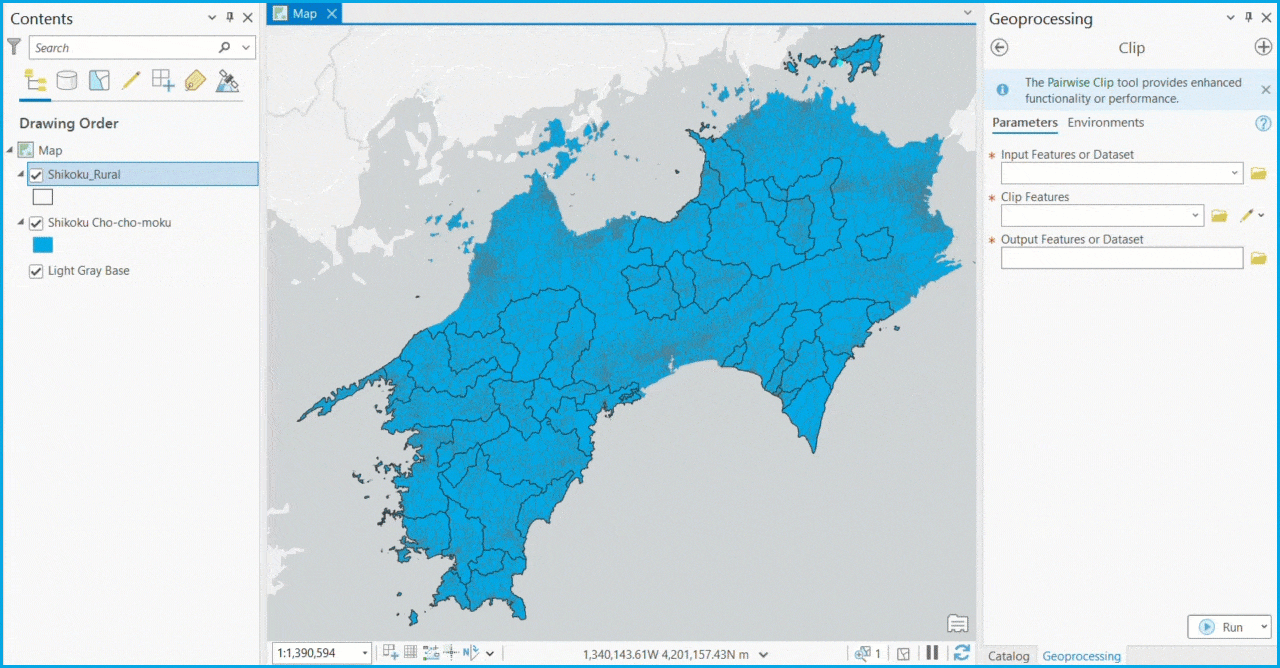
Here is an example using data from Shikoku Island, Japan.
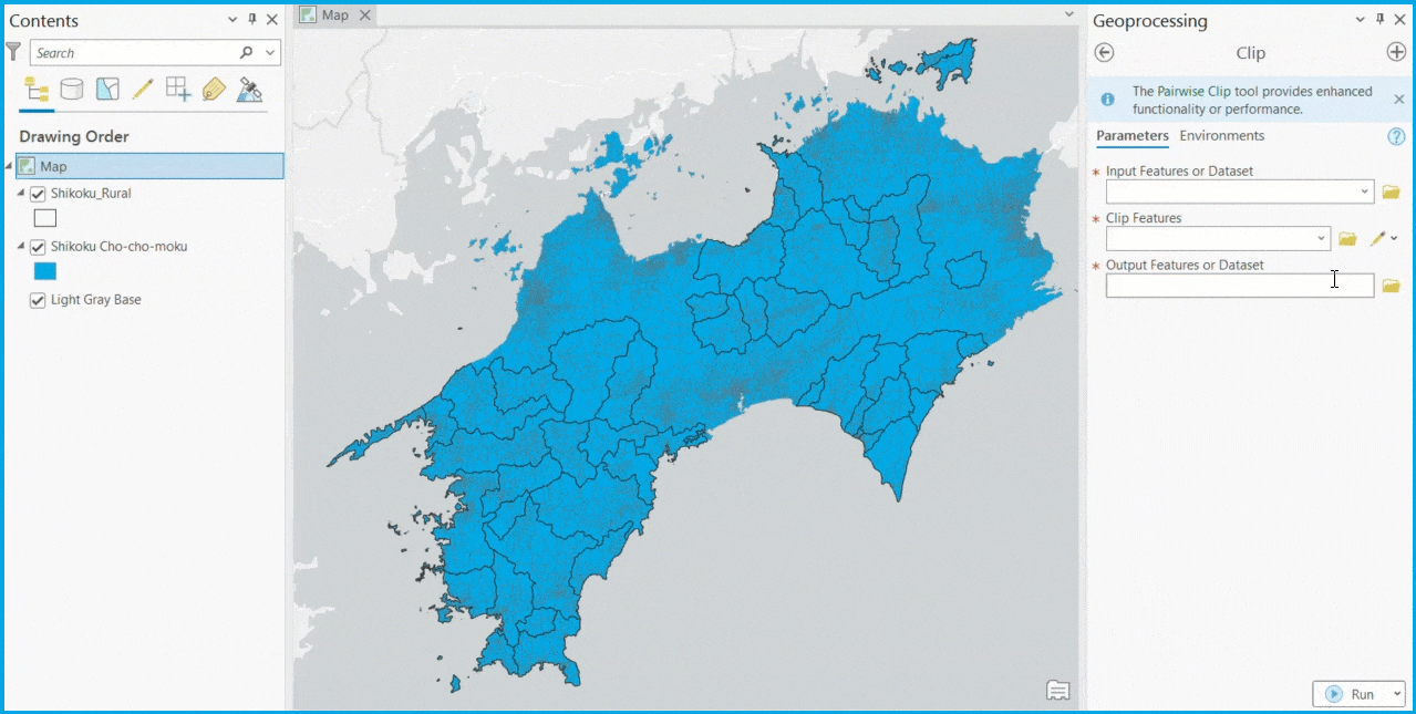
We are attempting to Clip the administrative regions (i.e., Cho-cho-moku) by rural areas to determine the portion of each administrative region that is rural. Unfortunately, the output does not display immediately on the map as expected.

What went wrong?
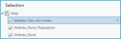
Using Zoom To Layer, we find that only one administrative region clipped to the rural areas. Upon further inspection, we notice a selection on the same administrative region. All administrative regions were not included in the output even if they contained rural areas because of the selection, meaning that only one administrative region was clipped.
Information about a selection is available at the bottom of the view or by selecting List By Selection  in the contents pane.
However, these elements may not be immediately obvious when running a geoprocessing tool, so it’s easy to make this mistake.
The Selection or Filter Tip
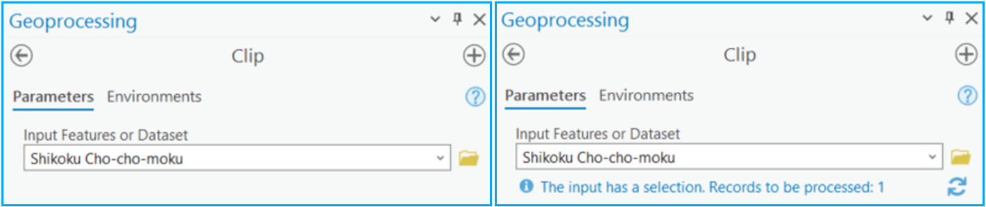
New in ArcGIS Pro 3.0, there is a selection or filter tip that informs you how many records will be processed when you run a tool. You will never feel more confident about the number of records you are about to process. But that’s just the tip of the iceberg!
A Deeper Look
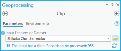
Selections and other filters (definition query, time filter, and range filter) are beneficial when you want to work with only a subset of records within your dataset. For instance, using our example above, you may only want to analyze administrative regions with populations greater than 1,000 people. In this case, you could apply a definition query to your dataset before running a tool.
If you would like to use the entire input, clear the selection or filter on your data prior to running a tool.
Note: The tip does not automatically update when you change or clear a selection or filter; to update the tip click the refresh button  .
.
Summary
The new selection or filter tip informs you when a tool’s input layer has a selection or filter impacting the data the tool will process. The message in the tip indicates whether there is a selection or filter and includes the number of records processed when the tool runs. You can also click on the tip to learn more about geoprocessing tools, selections, and filters.
The data and workflow used in this blog post can be accessed at Learn ArcGIS: Estimate access to infrastructure.


Article Discussion: