Creating balanced and meaningful zones is a common challenge across many planning and analytical workflows. For example, emergency response teams may need to define service areas based on the locations of existing fire stations, while urban planners may divide a city into planning zones based on population, risk, or social vulnerability. In these scenarios, zone design directly affects how resources are prioritized, allocated, and communicated.
The Build Balanced Zones (BBZ) tool in ArcGIS Pro is designed to support these decisions by intelligently grouping spatial features into contiguous zones that balance multiple criteria. In this blog, we walk through two practical, real‑world workflows that demonstrate how Build Balanced Zones can be applied in real-world scenarios. Along the way, we highlight several key enhancements introduced in ArcGIS Pro 3.7, showing how they improve both analytical flexibility and result accuracy.
Workflow 1: Balancing Risk and Equity — Creating Resilience Planning Zones with National Risk Index Data
Planning and policymaking analysis often begin with polygon data such as census tracts, neighborhoods, or administrative units. However, existing boundaries may vary significantly in population, risk exposure, or vulnerability, making them difficult to use directly for equitable planning or comparison.
In this workflow, we use the National Risk Index (NRI) dataset to create 10 balanced resilience planning zones for the city of Philadelphia. The NRI dataset is developed by FEMA. It provides baseline risk measurements for U.S. census tracts across multiple natural hazards, along with demographic and vulnerability indicators.
After preparing a subset of census tracts for Philadelphia, we first visualize several NRI variables—including expected annual loss, population, and social vulnerability—to understand how risk and burden are distributed spatially.
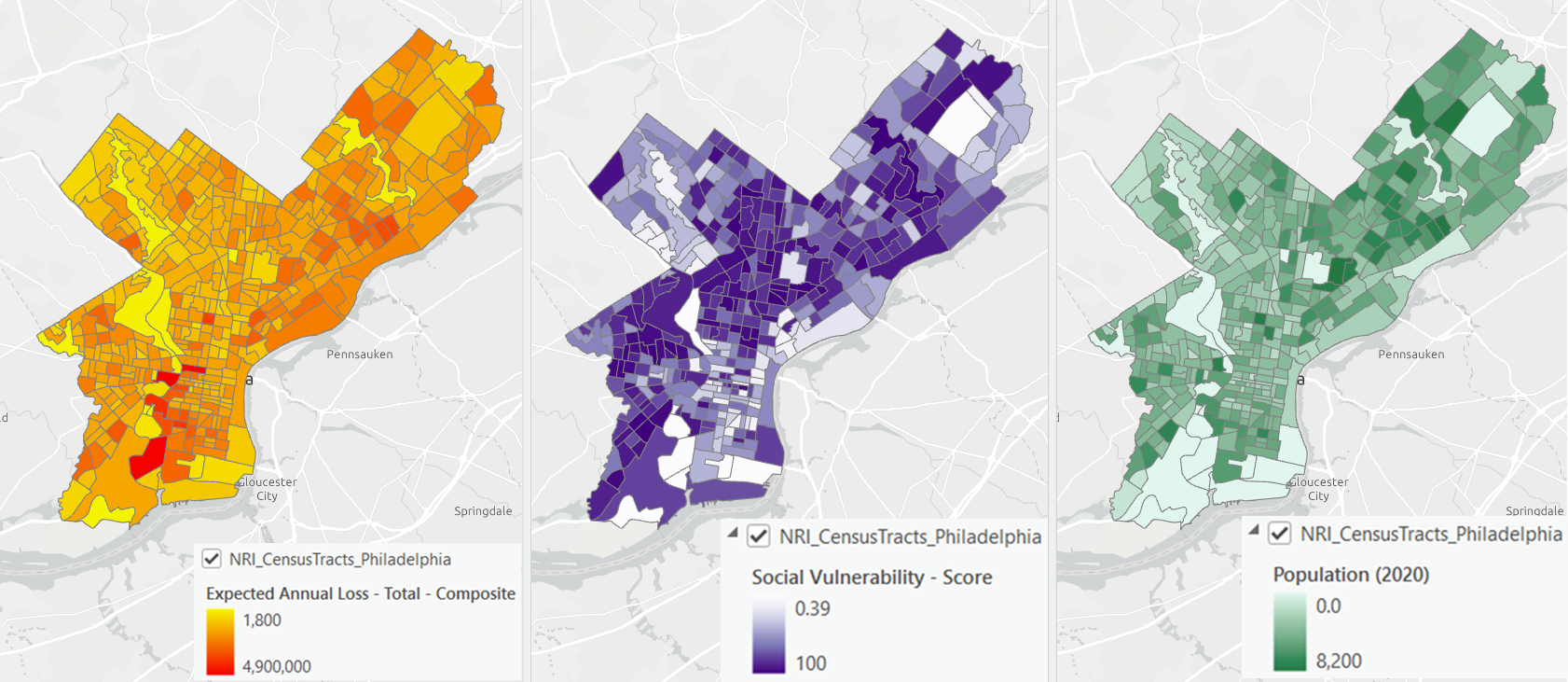
This exploratory step helps frame the analytical goal of our analysis:
We want 10 zones that carry comparable total expected annual loss and population, while keeping average social vulnerability levels as consistent as possible across zones.
To achieve this, we first input the census tracts in Philadelphia, and specify the output name.
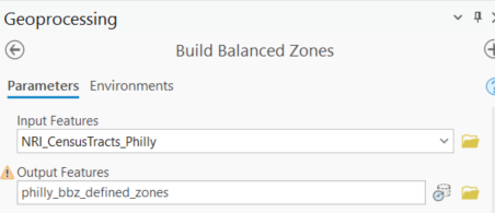
Then we configure the Build Balanced Zones tool using the Number of zones and attribute target method, specifying the Target Number of Zones as 10.

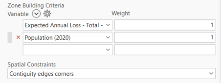
Next, we set expected annual loss and population as Zone Building Criteria, ensuring that each zone meets these balancing requirements during generation. If you give different weights to your Zone Building Criteria variables, the variables with higher weights will be prioritized during the zone selection process. In this workflow, we’ll just keep the default.
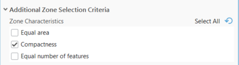
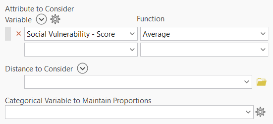
Additional preferences such as compactness and consistency in average social vulnerability are applied during the zone selection stage. Through these settings, the tool will prefer compact zones that have a similar average social vulnerability score.
The resulting output divides Philadelphia into ten contiguous zones with comparable overall risk and population profiles, making them easier to interpret, compare, and use in downstream planning. The tool also creates charts that help you understand the selected characteristics of each zone.
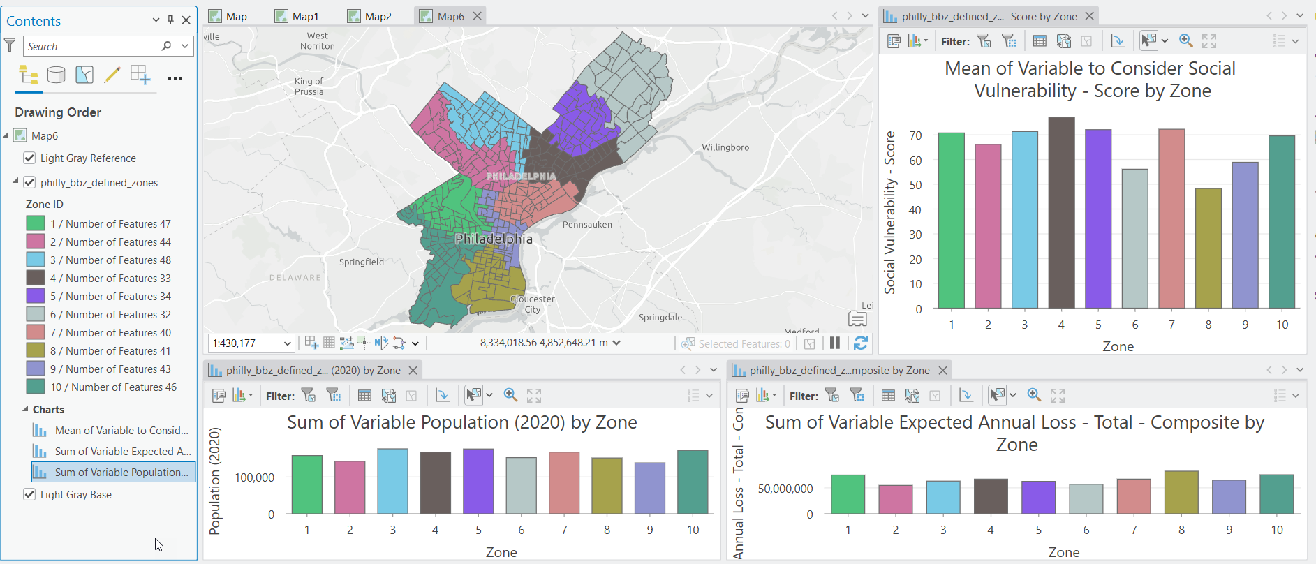
With these balanced planning zones in place, analysts and planners can move forward with resource allocation and policy design using zones that are both statistically comparable and spatially coherent.
Workflow2: Balancing Workload and Accessibility — Creating Maintenance Zones around Fixed Workstations
Generating zones and distributing workloads around existing facilities is a common use case in real-world settings. In ArcGIS Pro 3.7, we introduced the Custom seed locations feature to help build zones that are more reasonable in real-world settings.
In this workflow, we are going to help a national park create a maintenance plan to maintain all the trailheads and campground areas in the park. The goal is to divide the task locations into several service zones and allocate the workload equally. We need to develop zones around the existing ranger stations to make sure the plan is cost-efficient and manageable.
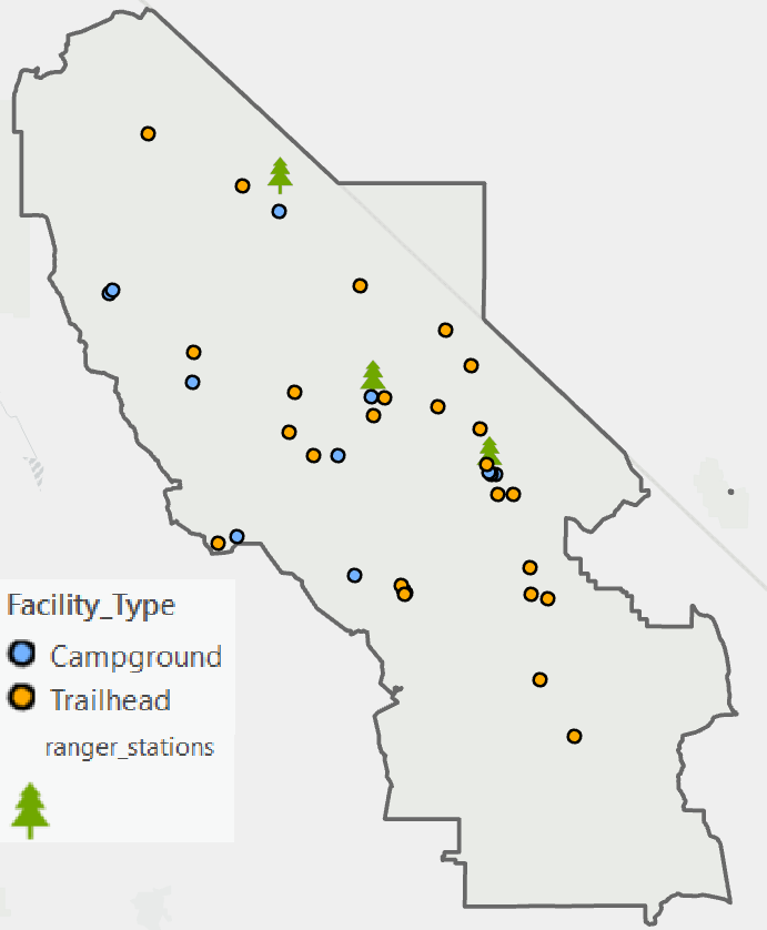
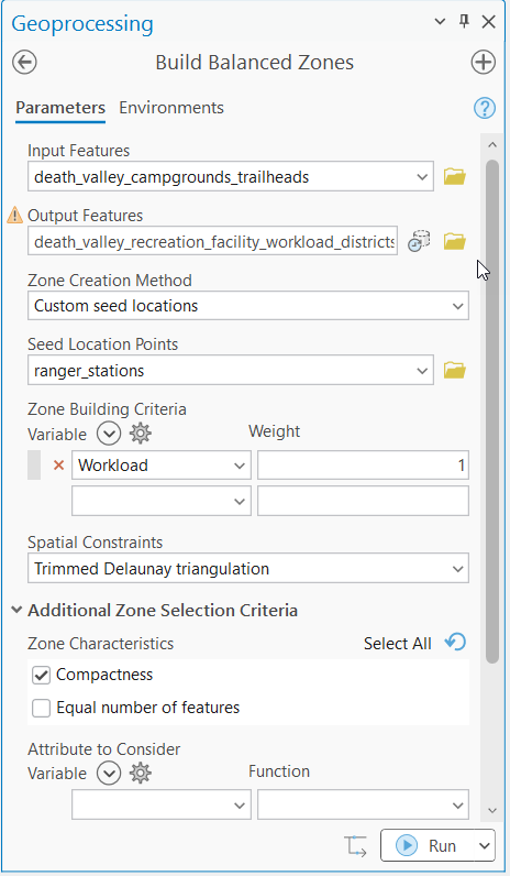
Within the Build Balanced Zones tool, we input the task locations as input features and select Custom seed locations as the Zone Creation Method. Next, we provide the ranger stations as Seed Location Points. This ensures that each zone grows outward from an existing ranger station, generating zones that are easy to manage.
Each task location carries a workload value based on estimated maintenance effort. And the workload values are supplied as the Zone Building criterion, while compactness is used as a zone characteristic to keep zones spatially efficient.
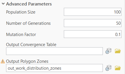
To support visualization, communication, and downstream analysis, it is often useful to convert these point‑based zones into explicit spatial boundaries. Build Balanced Zones can now optionally generate an Output Polygon Zones layer, representing the spatial extent of each zone. We will choose this option under the Advanced Parameters.
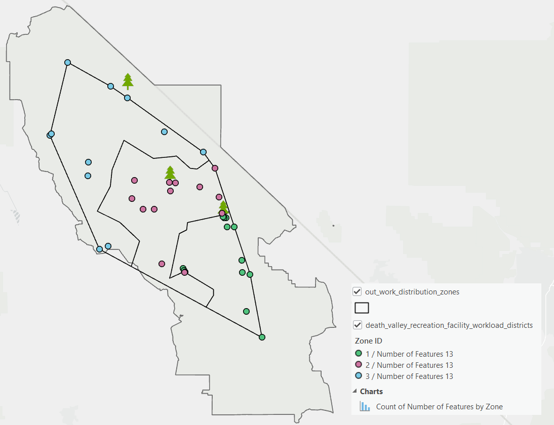
From the map, you can see that zones are generated around the custom seed locations, and the shapes of the zones are generally compact.
Beyond These Workflows: Additional Parameters to Explore
Beyond the parameters used in the workflows above, Build Balanced Zones provides a range of additional options that support more specialized analytical needs. These parameters are not required for every use case, but they allow analysts to adapt the tool to different real‑world constraints without complicating simpler workflows.
For example, the Get spatial weights from file option enables you to define spatial adjacency explicitly using a spatial weights matrix, rather than relying on geometry-based contiguity.
Distance to Consider parameter can be used to favor zones that are closer to specific facilities or points of interest, such as hospitals, service centers, or depots. This is useful when proximity or response time is an important consideration.
Categorical variables can be included to maintain proportions of categorical attributes—such as land‑use type—across or within zones. This helps preserve important categorical patterns while still balancing numeric criteria.
Advanced parameters expose additional controls over the genetic algorithm, including population size and mutation behavior. While the default settings work well for most workflows, these options can be useful when fine‑tuning performance or experimenting with alternative solutions.
Together, these parameters make Build Balanced Zones flexible enough to support a wide variety of planning and operational scenarios, while allowing analysts to keep individual workflows as simple or as advanced as needed.
Closing Thoughts
In this blog post, we introduced two workflows using Build Balanced Zones to develop resilience planning zones and create a maintenance plan. These workflows illustrate how Build Balanced Zones supports practical use cases using real‑world data. We also highlighted the enhancements to the tool in ArcGIS Pro 3.7 along the way. Whether starting from polygons or points, BBZ provides a flexible framework for creating zones that balance multiple criteria while remaining spatially meaningful. With this tool, analysts can build zones with greater confidence, clarity, and efficiency across a wide range of applications.

Article Discussion: